Road Trip to Ingham

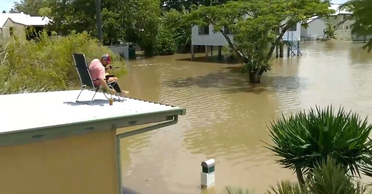
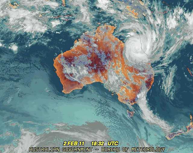
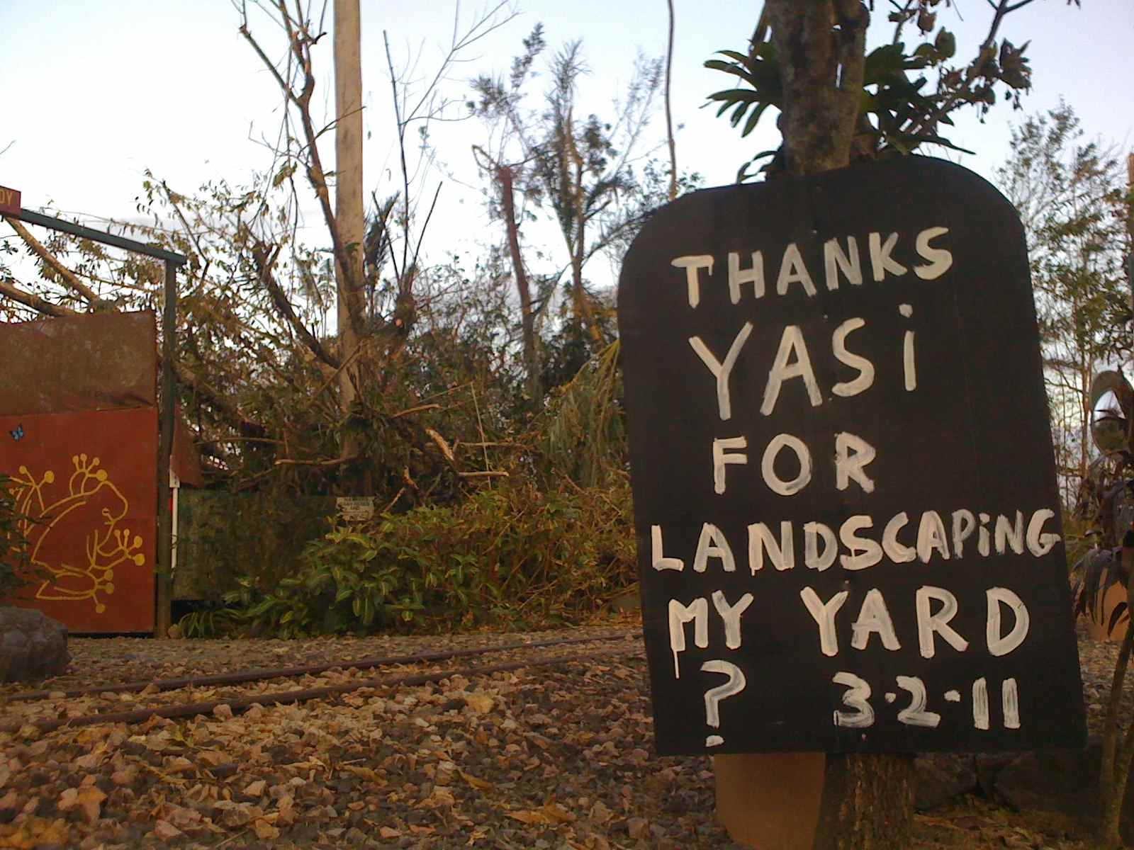
Wet season, Ingham, 2021. The Herbert River overflowed repeatedly, spreading across the flat country around the town, flooding houses and cane fields. Opened in January, a Facebook page, “Ingham floods 2021”, gained 3.7 thousand members and in April was still posting updates on floods.

Herbert River flooding the highway north of Ingham, 2009 versatel.ebc.net.au

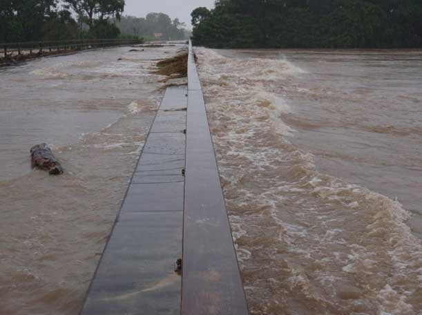
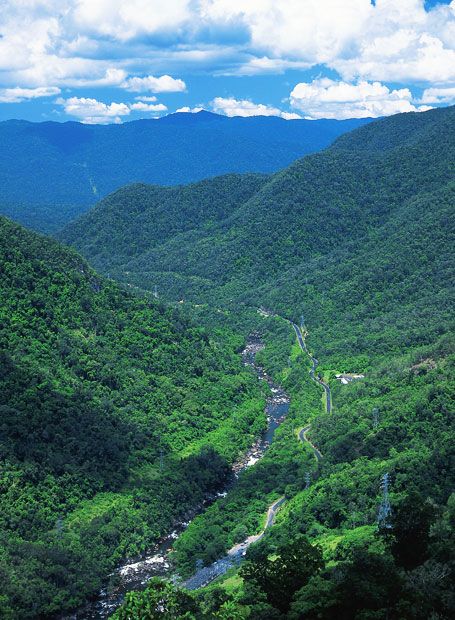
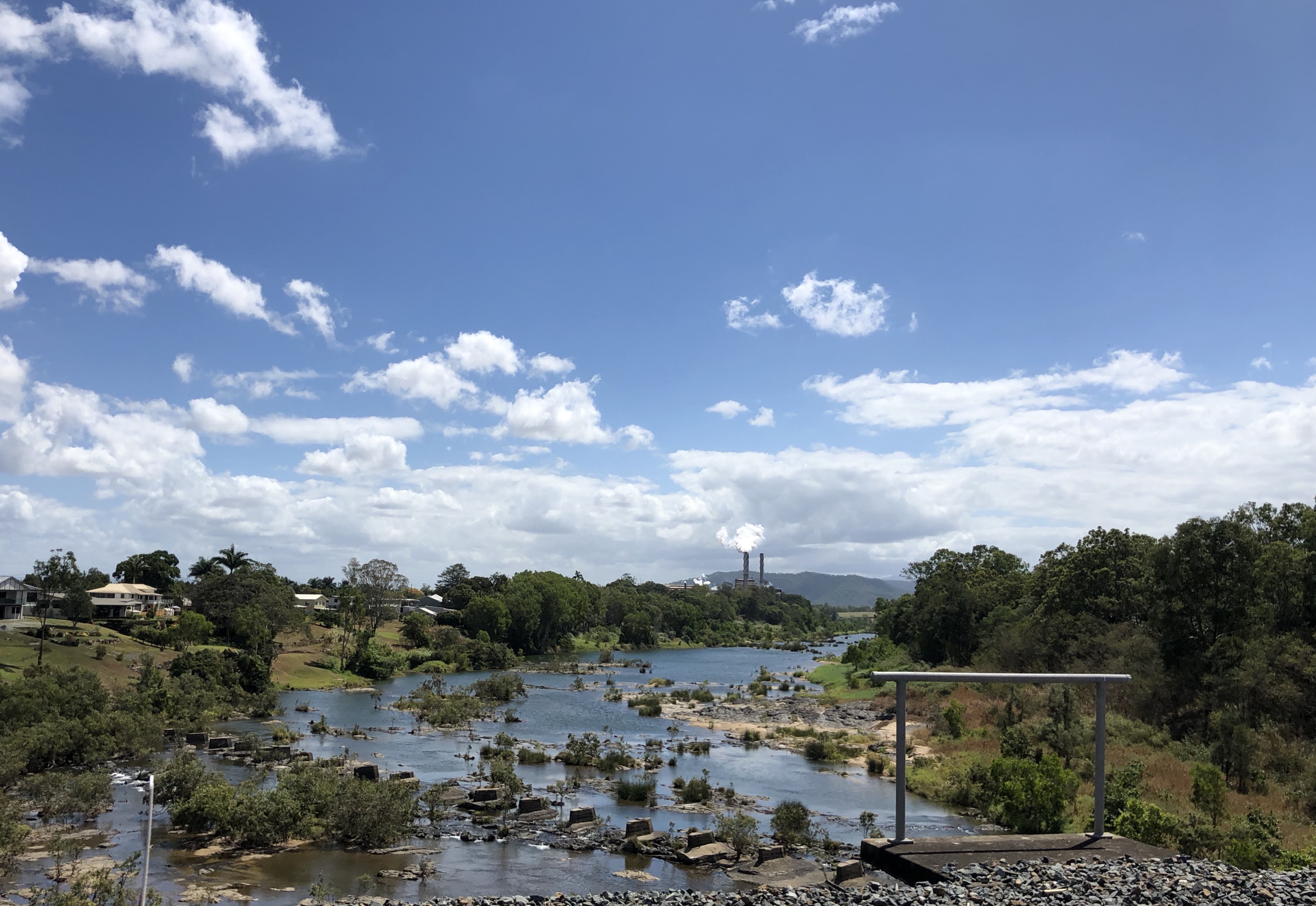
This was nothing new. Ingham, 112 kilometres north of Townsville and one of North Queensland’s most prosperous towns, has been flooded in seven of the last ten years. The Herbert River catchment runs off the southern Atherton Tablelands and its tributaries pick up water from 9,000 square kilometres of high rainfall country.

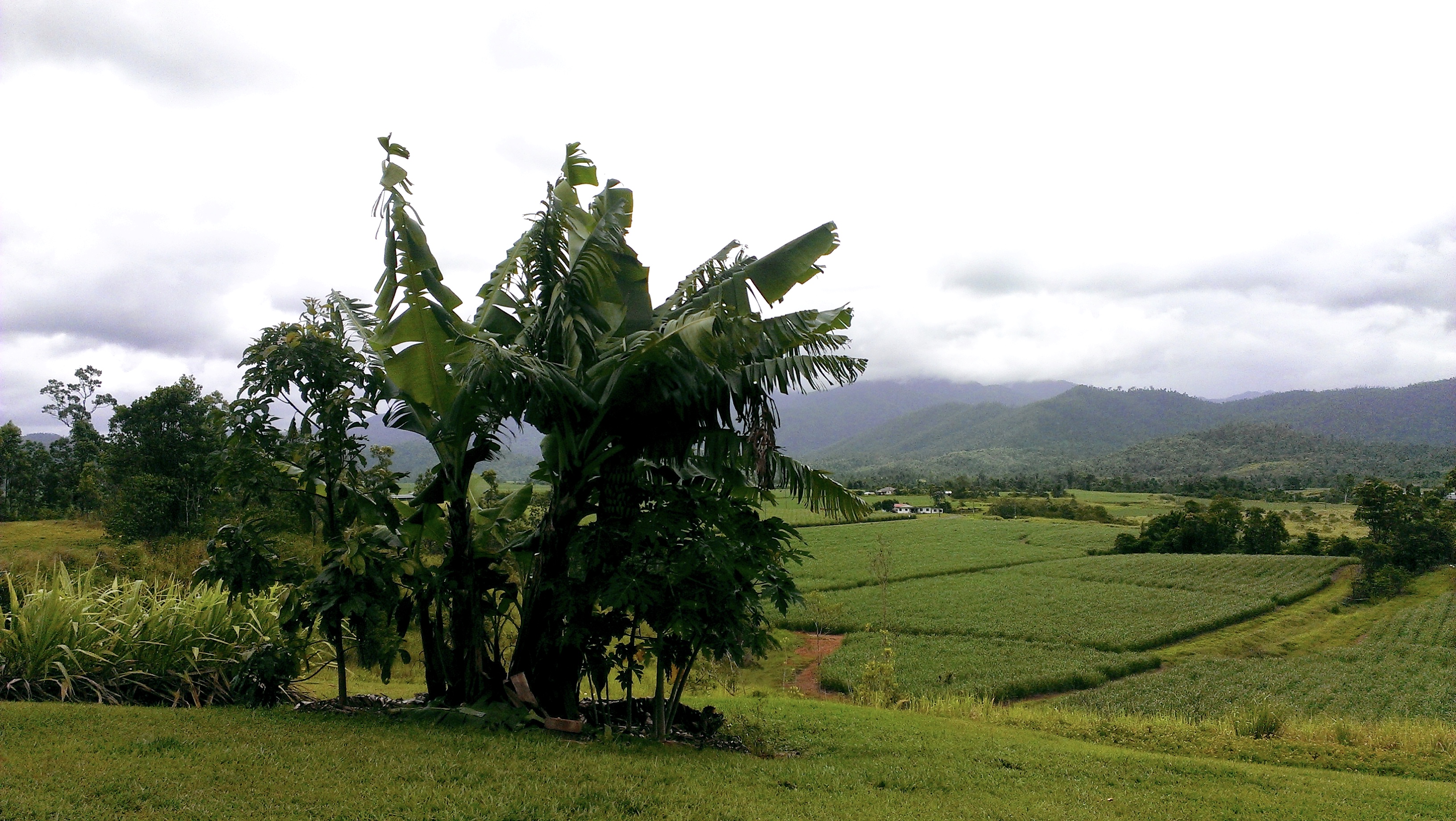
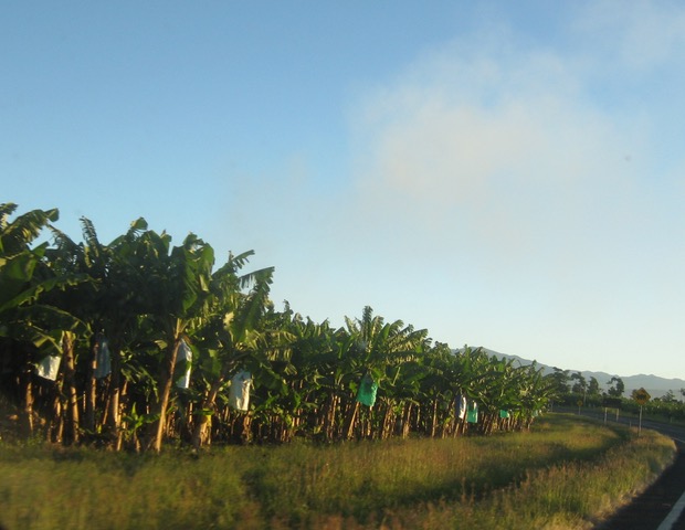
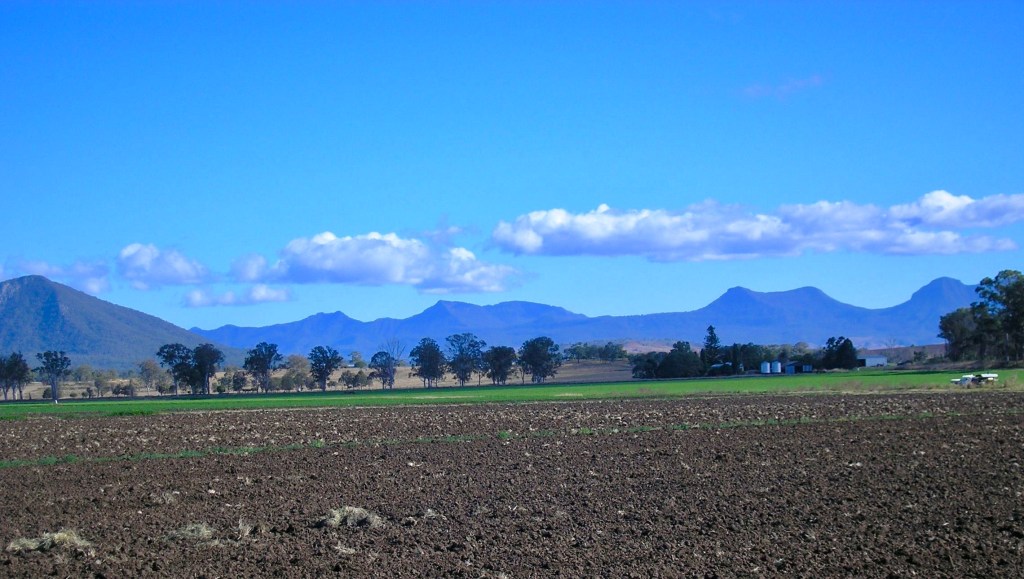
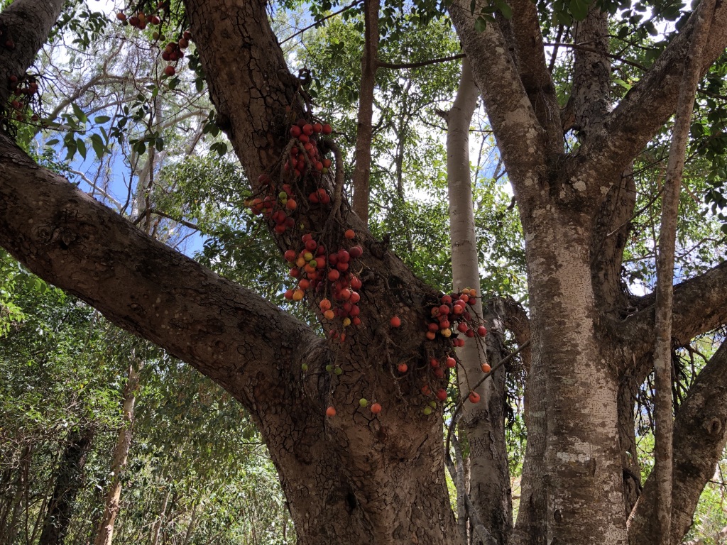
Ingham is where luxuriant tropical scenery begins, north of the drier country around Townsville: sugar cane, green hills, creeks. It’s always green here, on the edge of the Wet Tropics.
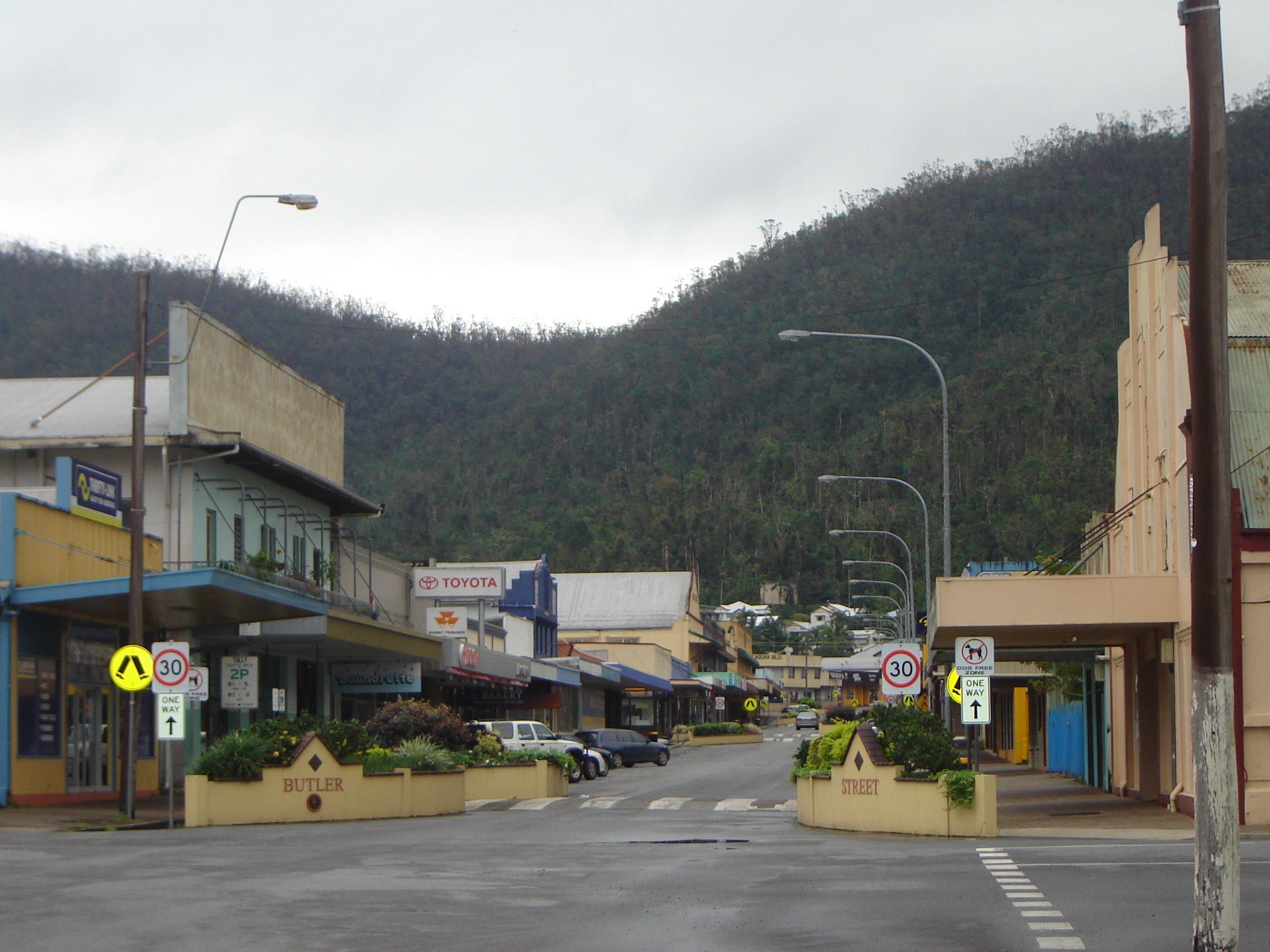
Rainforest fruits, Jourama, Paluma Range National Park

“Did I tell about my first visit to Ingham?” I ask Con as I clean the windscreen. He is filling up with fuel at the service station on Ingham’s main street, the one we’ve been stopping at for years on our journeys north.

“Don’t think so,” he says over the sound of the pump.

“I was sixteen, on a camping road trip from South Queensland with my family, and we stopped here for the night so Dad could visit an old army mate. Dad had old army mates all over the state. We got to Ingham in the middle of a downpour. The river was flooding. The caravan park was awash.”

Con goes to pay for the fuel, and I finish cleaning the back windscreen.

“Anyway,” I continue as we pull out into the traffic, “Dad’s army mate invited us to spend the night. It was great. A big, comfortable house, dry beds and tropical fruit for breakfast: that’s what Ingham means to me. It was such a relief to get out of the wet.”

For Con, growing up in Innisfail, torrential rain was part of life.

“Floods were fun for us kids,” he says. “Floods meant swimming in your own backyard and not having to wear shoes to school.”

We’re on the Bruce Highway, passing through cane fields on the flat country north of Ingham, and as we cross the Herbert River, Con tells me a story of driving to Ingham when he was young. I like his dramatic stories of growing up in FNQ.

Wallaman Falls, Ingham wettropics.gov.au

“Mum, Jim and I drove through here at Easter the year I turned fourteen, in Jim’s 1939 Ford, heading south from Innisfail to Townsville. My brother Jim was driving trucks when he was seventeen, delivering fuel to cane farmers around Innisfail on narrow, unsealed roads and through flooded creeks, so the fact that it was pouring rain when we set off didn’t worry us. We were Innisfailites – we had webbed feet.

“There was a minor concern, though: the car had a slow leaking radiator. Every few miles, we would have to refill it with water; but there were plenty of creeks along the way. At Moresby, only eight miles south of Innisfail, we stopped for the first time and I was sent over to the river with a bucket to bring back water for the radiator. Jim poured it in while the engine was running then screwed down the cap. We set out again. 

 “The rain kept up, and I kept scouting for water. The road was mainly bitumen, a bit patchy, and the car was high enough off the ground to manage the washouts and the water running across it.

 “Just out of Cardwell, on a stretch of road awash with sand and water, we met a tiny Triumph sports car. The driver was travelling alone, and he asked us what conditions were like further up the road. He didn’t like what we told him – torrential rain and creeks running across the roads – but he pointed the little car’s nose to the north and kept going.

“We filled the radiator again at the bottom of the Cardwell Range and made it to the top, and then Jim checked the temperature gauge. We needed water again, and soon.

 “On the way down the other side, we prayed for a creek. We came to one, all right – ten metres below the road, with scrub-covered cliffs leading down to it. No chance of getting water there. Going downhill was easier on the engine, though; and at the bottom of the range, we found another creek, and I did my job with the bucket again.

 “There were no more hills between there and Townsville, so we thought our troubles were over. But north of Ingham, and with still over 120 kilometres to travel, we came out on to the Herbert River flood plain. There were road works. It was chaos. 

“The bitumen had disappeared, leaving churned-up mud. Cars were buried up to their axles on the sides of the road, and farmers were trying to pull them out with tractors.”

“You know, people complain about the state of the Bruce Highway, and it’s true you can never drive the length of it, 1700 kilometres from Brisbane to Cairns, without being held up by road works. But what a lot of improvements we’ve seen over the years! I’ll always stick up for the Bruce.”

Con continues his story.

“I looked at Jim. He clenched his hands around the steering wheel and set the car on the safest course he could find through that madness of mud, bogs, cars and tractors, until we were once again on bitumen, and Ingham was only a few miles ahead.

“We made it through to Townsville a couple of hours later. They hadn’t had the heavy rain we’d come through, thank God. Townsville is a dry old dump.”

Country towns can have such disdain for one another. But of course, so can big cities. Sydney and Melbourne, for instance.

 “At a garage in Hermit Park, Jim bought a can of Radiator Cement. It plugged up the holes, and on the way home a few days later we didn’t need to fill it once. The sun shone, and the muddy stretch north of Ingham had hardened. The old Ford charged over the Range, and at Cardwell we bought fish and chips, as we always did, and ate them sitting in the car on the oceanfront. By mid-afternoon, in bright sunshine, we were home in Innisfail.

“The next day on my way to school I saw the Triumph sports car driving down Rankin Street. He’d made it through. A gutsy effort. But so was ours.”

“Good story! Let’s stop in Cardwell for fish and chips.”

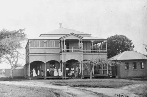
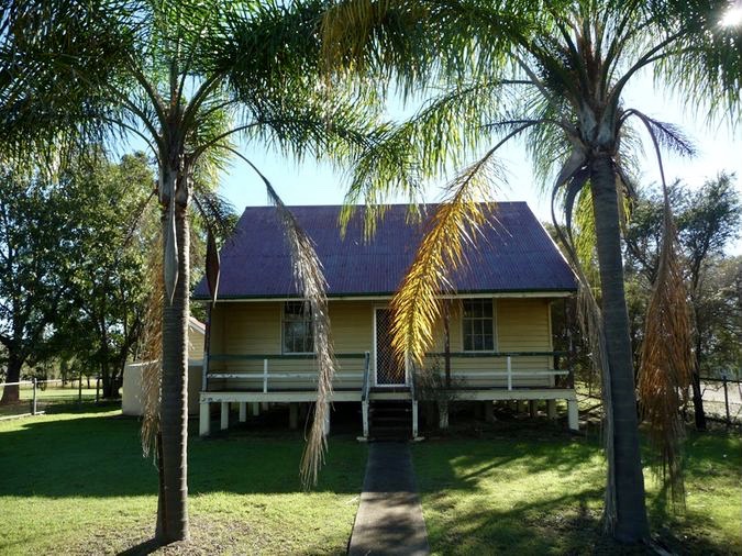
We’ve had lots of good Ingham experiences. Our Lizzie and Russ lived there for a time in the late 1990s, and we stayed with them in their typical North Queensland house.

Russ and Lizzie’s house in Ingham

Lizzie took me down to Lucinda, the nearby sugar port famous for its jetty, 5.76kms long. Near the beach is a large sign describing some of the creatures that can kill you if you go swimming there.

Sign by the water at Lucinda

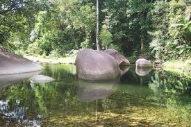
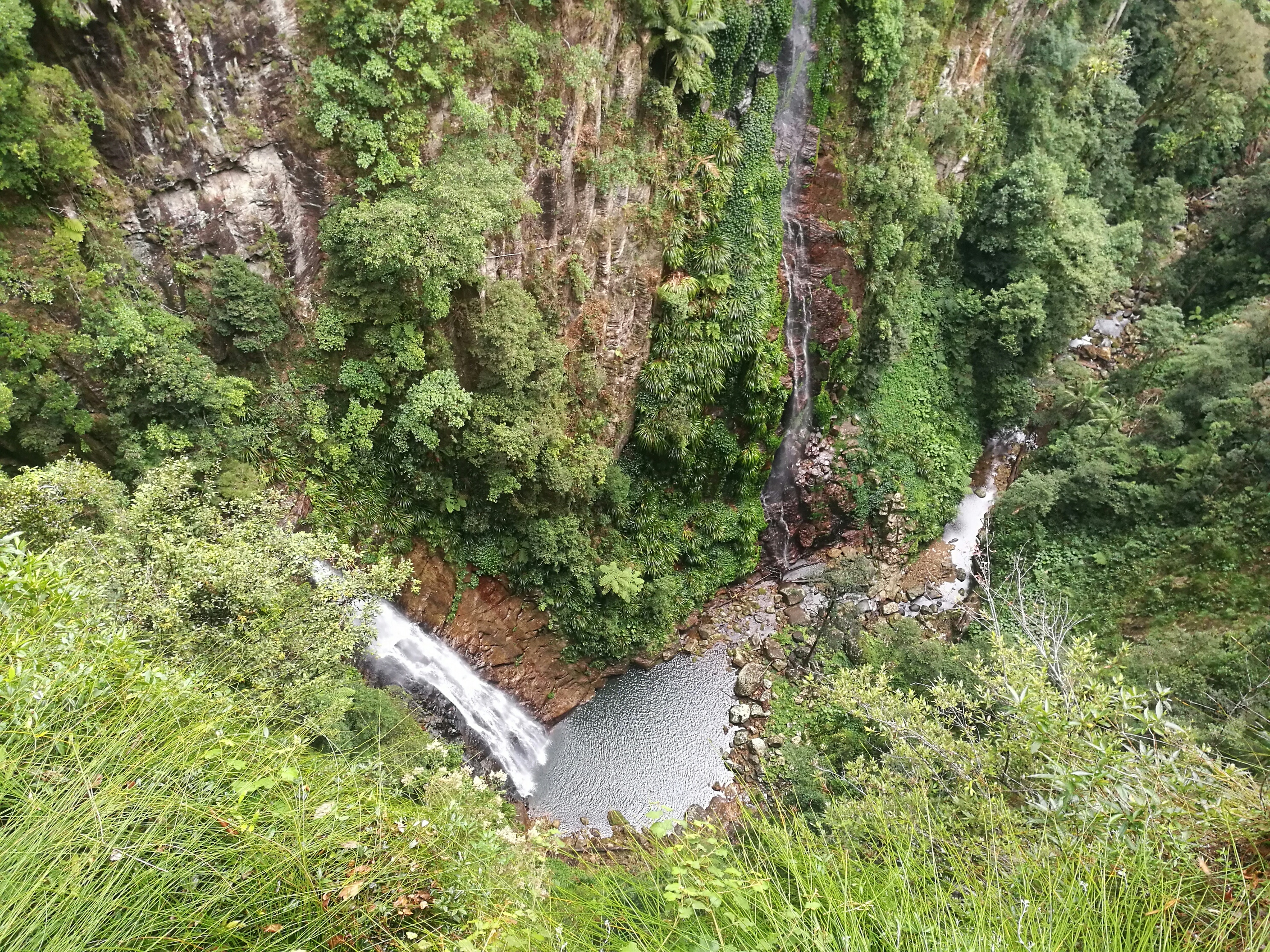
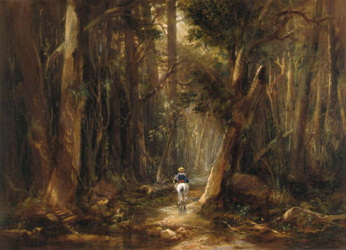
We went by boat across to rugged, mysterious Hinchinbrook Island for a walk along the beach and swim in Mulligan’s Falls.

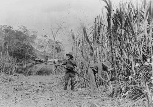
Descendants of the migrants that flocked to the cane fields in the twentieth century have given Ingham its distinctive Italian culture. Every year, the Australian Italian Festival is held here. Lou’s Italian Deli in the main street of Ingham is a wonder to behold.

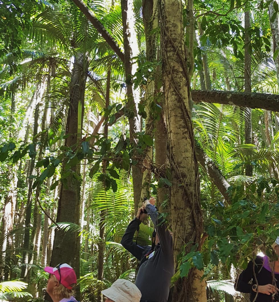
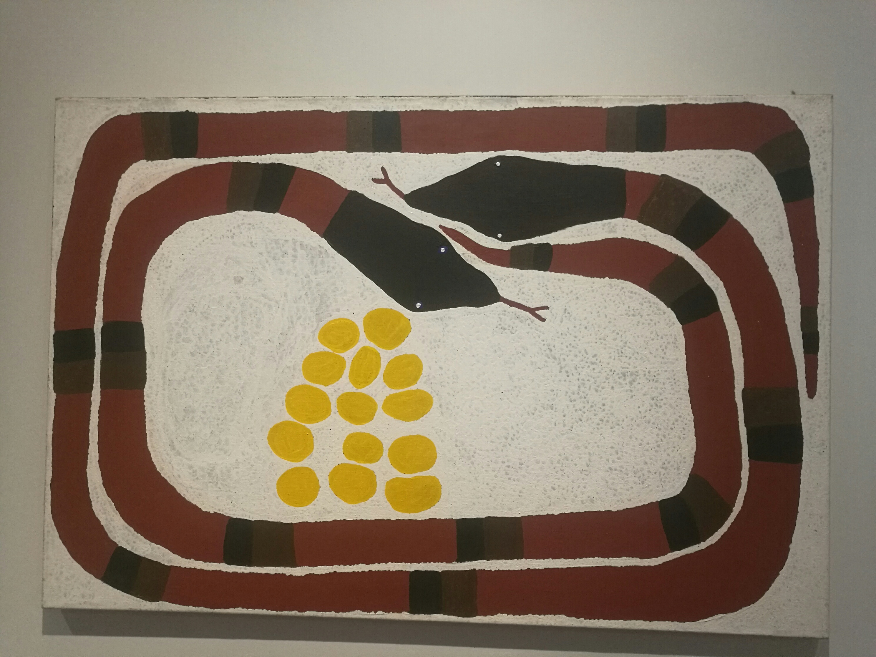
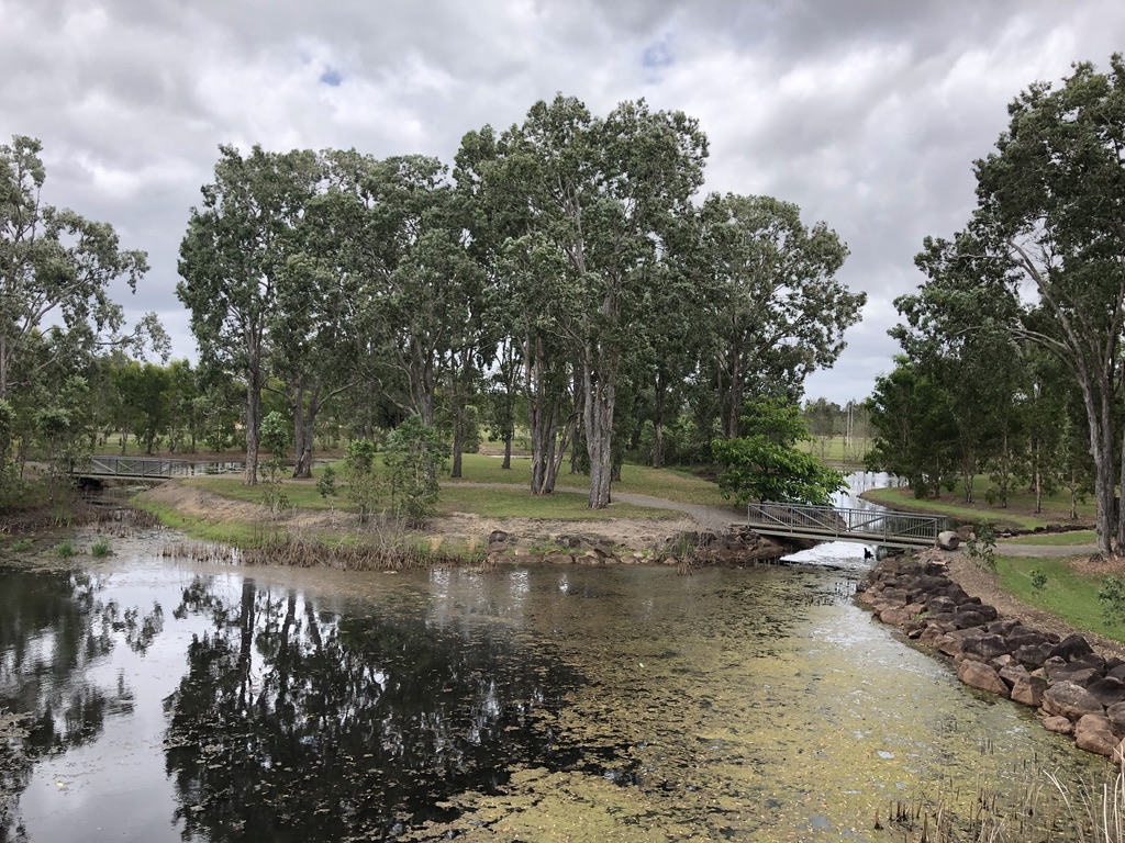
Just south of town is the TYTO Wetlands, with paths and walkways for birdwatching and the impressive Information Centre and Regional Art Gallery.

TYTO Wetlands, Ingham

Spectacular to see, in this richest of all sugar cane areas, is the vast Victoria Mill, with its kilometres of cane trains and lines of cane bins, its huge old rain trees and tall, steaming chimneys.

With Joe and Isabel, two years ago, we drove further south to visit Jourama, part of the lush and spectacular Paluma Range National Park, and swam with turtles and eels in beautiful Waterview Creek.

Swimming at Waterview Creek

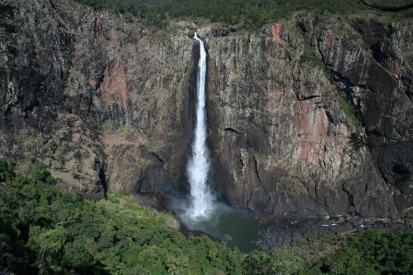
Instead of just stopping for petrol and hurrying on, I’d like to get to know Ingham better; to visit Wallaman Falls, Australia’s tallest single-drop waterfall, and maybe have a beer at Lees Hotel, which claims to be the original “Pub With No Beer”.

We’ll visit in the Dry Season, though, when the weather up here is perfect.

I don’t have webbed feet.

Ingham floods 2018 nine.com.au

Golden Gumboot

It’s December in the Wet Tropics of Queensland, and the chimneys of Tully Sugar Mill are quiet. Crushing has finished for the year. Behind the town, the rainforests of Mount Tyson are cloaked in rain.

06FF0145-4C62-4F82-A470-A090615A3B76_1_201_a
Wet Tropics

This is Golden Gumboot country. The Golden Gumboot is an unofficial, hotly contested yearly competition for the highest rainfall, between the Far North Queensland towns of Tully and Babinda.

Tully, 140 kilometres south of Cairns, has at the start of its main street a concrete gumboot 7.9 metres high with a frog crawling up it. Having survived two fierce cyclones, the boot was recently refurbished by means of a state government grant and given a spectacular coat of gold paint. There is a staircase to the top, and a viewing platform. 7.9 metres is the amount of rain that fell here in 1950: the highest annual rainfall ever recorded in a populated area of Australia. Tully’s average annual rainfall, according to the Bureau of Meteorology, is 4 metres.

golden gumboot new
Tully’s Golden Gumboot with renewed gold

Tully has a Golden Gumboot Festival each year whatever the totals are; but in recent decades Babinda, 80 kilometres further north, has had the higher rainfall, averaging 4.28 metres annually, compared to Tully’s 4.09 metres. It’s Babinda that has the Golden Gumboot bragging rights.

To give an idea of what these numbers signify, Brisbane has an average rainfall of just over one metre a year.

Babinda nestles close to the rainforest-covered slopes of Mount Bartle Frere, Queensland’s highest mountain. If you can see the top of Mount Bartle Frere, so locals say, it’s going to rain. If you can’t, it is raining.

FA23E2EE-F506-45C2-B4E3-089F01CB3ED6_1_201_a
Towards Mount Bartle Frere, Queensland’s highest

People in these northern towns and farms face a challenging climate, economic threats and agricultural tribulations. Bananas and papaws are major industries around here, but the focus of Tully’s economy is its sugar mill. Chinese-owned, it is the economic heart of this working town. Tully Mill crushes the second highest tonnage of any in the country.

Banana crops, papaw trees and sugar cane are vulnerable to disease, and all are at the mercy of the market – and the weather. Because the rainfall in this region is so reliable, farmers don’t irrigate.

The locals are down-to-earth and practical. They drive twin-cab utes, often with a pig dog cage on the back, and there are boats parked in many back yards. Men dress in boots, work shorts, polo shirts and hi-vis. Women favour denim shorts, black singlet tops and rubber thongs.

The locals relish an earthy form of humour. For instance, a visitor to Tully might talk about driving up the main street, Butler Street; but to a local, it’s “going up the Butt.”

golden gumboot butler st
Up Butler Street, Tully, towards Mount Tyson

Both Babinda and Tully have spectacular tourist draw cards nearby. The famous Tully Gorge, where white-water rafting tours ride the outpour of water from the Kareeya hydro-electricity plant, runs right up against the ranges of the Atherton Tableland and the three hundred metre drop of Tully Falls. The falls lie directly below Tully Falls Lookout on the map, but the distance between the two by road is over two hundred kilometres.

golden gumboot tully gorgr
Tully Gorge seen from Tully Falls Lookout, 200km away by road

Electric-blue Ulysses butterflies flit through the forests along the gorge.

Babinda has The Boulders, a famous swimming hole and granite boulder-strewn creek of matchless beauty. We called in there for a swim a few years ago, floating in that clear pool in the rain as if in a cool, green heaven.

“We used to come to The Boulders for picnics,” Con told me, kicking against the gentle flow of the water. Con grew up in Innisfail, which lies between Tully and Babinda, looking out towards Mount Bartle Frere. Innisfail, famous for its papaws, averages a mere 3.4 metres of rainfall annually.

golden gumboot bananas
Innisfail banana farm

“Downstream from the main swimming hole there’s a place we called the Chute, which was like a fast water slide. It was great. And the Devil’s Pool – you’d have to be crazy to jump in there, but people did.”

This is a dangerous place for people who venture too close to where the creek is sucked down among huge granite boulders. Adventurous young men have died here.

“When I played for Innisfail Brothers League team and we had a game in Babinda, we’d come to The Boulders afterwards for a swim. We played at the Babinda showgrounds, and there was no such luxury as showers there.”

I first visited The Boulders with my family during a road trip from the south. My dad climbed up on a large boulder and swung out on a rope swing before performing a cartwheeling belly flop into the creek. He swam ashore with his chest scarlet from hitting the water. We were laughing; he didn’t see the funny side.

golden gumboot boulders
The Boulders, Babinda

In 2011, Cyclone Yasi brought disaster to a thousand kilometres of  Queensland coast, its eye crossing the coast at Mission Beach, the closest coastal town to Tully.

golden gumboot yasi bom
Cyclone Yasi crossing the coast

Yasi’s devastation still shows in an occasional roofless building and in the thinned rainforest on the hillsides. Mission Beach people were isolated for days. A couple of years after Yasi I spoke to a young Frenchwoman living there. I asked her how she had fared.

“During the cyclone, I got a call from my family in Paris,” she told me. “My mother had died. I wanted to get out, to get to the airport in Cairns and fly home. The roads were blocked with debris. The army was clearing them with chainsaws, but no one was allowed in or out.

“I finally managed to get a ride out to the highway with the police, and a bus to Cairns, but the funeral was over long before I reached home.”

We visited friends at South Mission Beach in their beautiful timber house on the hill, and stood on their verandah looking down through greenery towards the tranquil beach where Yasi made landfall.

“Did you leave, when Yasi was coming?” I asked.

“No, we stayed here. We bunkered down in the bathroom, but it was scary. The noise was incredible. The glass doors at the back blew out, and the garden was a mess of shredded trees and debris. We couldn’t get down the road for smashed branches and tree trunks.”

golden gumboot yasi 2
A local’s comment on Cyclone Yasi

In the Tully branch of Cassowary Coast Libraries there is a display of local historical photographs. Looking at them and seeing the difficulties involved in land clearing, timber felling, road building and transport in the old days, and considering the difficulties they still face today from the weather and the markets, it’s easy to see why the locals need to be tough.

2019 has been drier than usual, even here in the Wet Tropics. The Cassowary Coast Council, which includes Tully and Innisfail, has announced Level 3 water restrictions. The beautiful creek at The Boulders is at its lowest level for years. Babinda and Tully have both recorded much less than their average rainfalls, and little rain is forecast for the rest of the year.

The Wet Tropics is still the greenest place in the state. Sugar, banana and pawpaw farmers are watching the forecasts, though. They must wonder what the future will bring.

golden gumboot Australian_Butterfly_Sanctuary_Ulysses-8-1024x685
Ulysses butterflies

Mackay Crocodiles

“Daily Mercury”, Mackay. 30 July 1913

The search for Mr George Noble, who wandered from his home near The Leap at the beginning of the month, has now been abandoned without the slightest trace of the missing man having been discovered. The missing man might have been taken by alligators, his farm being situated between Reliance and Constant Creeks, the waters of which are infested with these reptiles. Native dogs also frequent the neighbourhood and may have attacked the man once he became helpless through exposure. Mr Noble was a man of 78 years of age and in his declining years had become rather childish. He evidently lost his way through wandering off on a bye-track.

Reliance Creek National Park now protects one of the last patches of scrub along the creek, not far from its estuary between Mackay and Cape Hillsborough. A century ago, although already surrounded by farms and sugarcane fields, this area, dense with vines and palms, would have been a dangerous place to be lost.

mackay reliance creek nat park mackay conservation group Mackay Conservation Group explores Reliance Creek National Park

In 1883, George and Jane Noble had emigrated to Mackay from Newcastle on Tyne, England, with their children. They settled on the farm at The Leap, amongst the cane fields and wilderness north of Mackay. It was thirty years later, in his old age, that George disappeared. The search involved local people, police and a tracker, but nothing was ever found.

Perhaps somewhere out in the Reliance Creek estuary there is a pair of spectacles or set of false teeth lying hidden under the sand, lost by poor old George Noble, his Geordie accent stilled forever, far from the Tyne.

George and Jane Noble were the great-grandparents of my husband Con, and only a vague story of the old man wandering off and disappearing was passed down in the family.

Every year in Northern Australia, people are taken by crocodiles. North Queenslanders have lost access to many of their old favourite swimming holes because of them. Endlessly cynical about governments in the south, they say whenever an appeal for crocodile culling is turned down, “When the first croc appears in the Noosa River, they’ll change their minds!”

Or the beaches of the Gold Coast. Perhaps the Brisbane River, near the Tower of Power, home of state government administration, poised above the river at 1 William Street. A crocodile under the mangrove boardwalk there would cause a stir.

Queensland has a service called “Crocwatch” that people ring to report crocodile sightings. Every year there are many such calls, from Torres Strait to Rockhampton. This year, someone said they saw a crocodile at Tin Can Bay, which is scarily close to south Queensland waters.

mackay croc-country Qld Government’s “Crocwatch” map

This year there have been twenty-five recorded crocodile sightings in the Mackay region, near swimming enclosures along the coast, up the creeks and the Pioneer River, and one in Constant Creek, near where George disappeared.

On trips north to Cairns we’ve often spent a night in Mackay, where the cattle country to the south changes to the land of sugarcane, coconut palms and rainforest. It’s a fine old city, and a good place to break a journey. This is spectacular country, from the beautiful beaches, up the sprawling Pioneer Valley to the rainforest-covered ranges of Finch-Hatton and Eungella. The climate has extremes – from cyclones and floods to the occasional fall of snow on the ranges.

This year, just before reaching Mackay we turned west on the road to Walkerston, then right on to Mackay Eungella Road, and drove up the Pioneer River valley, through picturesque small towns – Marian, Mirani, Pinnacle, Finch Hatton.

581BB516-EEB8-4002-A387-BF2A77F5ED33_1_201_a The Pioneer River at Marian

Con’s mother Min grew up here. George Noble’s son Bill and his wife Mary became cane farmers in this valley, still one of Queensland’s richest sugarcane areas. Bill farmed at Alexandra, on the Palms Estate, a large area of farms located about ten kilometres south-west of Mackay, somewhere between Walkerston and the river.

In 1908 it was from this family farm that Bill and Mary drove away in a buggy to Mackay Hospital. Mary was to have an operation for a goitre in her neck. She died under the anaesthetic. She and Bill had six children under nine, and it was hard times for the bereaved family.

F46C1516-64C7-4F34-87DF-B8C1873CFE45_4_5005_c Mackay District Hospital, 1910 (Image: Mackay Regional Council Libraries)

Min was the second-eldest child, and she told us stories about life on the farm.

She spoke of the time her little brother, Jim, lost two fingers in a chaff cutter.

She spoke of city men, desperate for work as the Great Depression started to bite, who came here with soft hands and cut cane with blood running down their arms until their blisters turned into calluses.

9E6749DF-53E1-42A7-B261-B9DD605A9341_4_5005_c Cutting sugar cane (Image: Mackay Regional Council Libraries)

Min spoke of going to dances at nearby Walkerston or Marian. During the Wet, when the roads were cut, to get there they would travel along the cane train tracks on a pumper trolley.

This year it’s dry in the Pioneer Valley, like most of the state. Last December, for the first time, bushfires got into the iconic rainforest on the Eungella range. It was a shock to us all. Rainforest doesn’t burn, we thought.

CFE12488-DC2A-407A-AE05-7FBDFF5E4B4F Eungella Range: fire damage from December 2018

The barman in the Finch Hatton pub, where we enjoyed a beer and toasted sandwiches, looked up at the hillside across the road and said, “It was burning right to the top of that range. Up the Gorge as well. I’ve never seen anything like it.

“It’ll grow back, though. It always does.”

I hope he’s right, but rainforest trees, unlike eucalypts, are not adapted to burning. This September, South-east Queensland’s Binna Burra rainforest also burned, along with its heritage-listed lodge. Perhaps we’ll have to become accustomed to fires in ancient forests.

B7CBC891-E637-45A3-B20B-297C5AE3214C Coomera Falls, Binna Burra, 2018

When you take the winding Mackay Eungella Road up the range, the scars of last year’s fire are still visible, although green is emerging. Over the range and down to Broken River, the forest is untouched, with platypuses in the river and whip birds scratching among the leaf litter; but we’ve had a shocking taste of how things may be in the future.

Crocodile attacks might be the least of worries for the people of Queensland, both north and south.

Mackay, though, is beautiful, in all its faces; and one of the loveliest sights in Queensland is that of kangaroos on the spectacular beaches of Cape Hillsborough, only a few kilometres north of where old George Noble’s specs may still lie hidden in the sand.

mackay cape hills kanga(Queensland.com)
Cape Hillsborough (Image: Queensland.com)

Snake Stories

A red-bellied black snake was stretched along the pipe at the back of the laundry tubs, behind the taps. I could see its glossy colours.

I’d been washing up while little Matt played outside the back door. Hearing him bumping something down the three steps that led to the yard and the laundry shed of the old house, I dried my hands and went to see what he was up to.

Matt had dragged a chair over to the concrete laundry tubs and climbed up on it, and he was reaching out, laughing, to the snake.

snake red-bellied
Red-bellied black snake

We were living in the school residence at Rosevale, south-west of Ipswich. Local farmers had warned us that the Rosevale valley was notorious for snakes – both brown and red-bellied black.

Trying not to startle either Matt or the snake, I called out, softly, “Come here, Matt. I’ve got a bikkie for you.”

He turned and climbed down. I grabbed him and ran back up the stairs and watched the snake slither away out of sight into the long grass behind the shed.

fullsizeoutput_453d
The old school residence, Rosevale. Laundry shed on left.

Another day Matt was playing in the yard with the cats. Suddenly they stood frozen, ears forward, staring at a patch of long grass, and the two deadly brown snakes sunning themselves there. Con ran to get the hoe.

Snakes are protected by law, and snake catchers will come to your house and take the snake away for release into the bush; but there are many who still consider that the only good snake is a dead snake, and delight in going into battle with sticks, hoes and mattocks or whatever is handy.

As children, my brothers and I entertained ourselves by leaving a rubber snake on the back landing where our father would be bound to find it.

He did. He grabbed a big stick and killed it.

Rubber snakes bounce in a most lifelike manner when hit with a stick. Dad heroically beat that rubber snake to death, and carefully lifted it on the stick to examine it. He said, “It’s a young brown. Dangerous things, those.” That was before he noticed us laughing.

He didn’t think it was funny.

I’ve played that trick on Con. He didn’t think it was funny either.

Most encounters with snakes happen in the bush. Walking down the zigzag track in the rainforest of the Palmerston, west of Innisfail, I met a large brown snake crossing the track. I met the same snake again on the next leg of the path down the hill. You don’t know how high you can jump until you almost put your foot on a snake.

All Australians have snake stories. They are a favourite topic of conversation, and we particularly love to tell them to foreigners. The English are best, and Americans. They respond with such horror.

An American visiting Brisbane asked a local, “Why are so many Brisbane house on stilts?”

“It’s because of the snakes. They can just slither straight under the house instead of coming inside.”

To white farmers and squatters of the nineteenth century, often living in primitive conditions in what was to them hostile bush, snakes were a deadly enemy. Henry Lawson wrote about it in his spare, atmospheric story “The Drover’s Wife”. Living in isolated bushland, alone with her young children in a slab hut, protected only by her kangaroo-dog Alligator, a woman sits up all night with the dog, her children bedded down on the rough kitchen table, waiting for a snake to re-emerge through cracks in the wall.

Alligator and the drover’s wife kill the snake between them, after a fierce struggle; and she lifts it on the point of her stick and throws it on the fire.

We have a love-hate relationship with snakes. They eat chooks, they kill dogs, and sometimes they kill people; but they’re part of our environment, a feature of legends and stories, from ancient Aboriginal culture to the Bible and modern literature and painting.

snake ayr
Giant carpet snake “Gubulla Munda”, Ayr, North Queensland

Rainbow serpent legends exist all over the country, and snakes are a common theme in Aboriginal art.

IMG_20190204_115256_resized_20190204_011100777
“Bloody Big Snake”, Shepparton Art Gallery, Victoria

Some say the rainbow serpent is a carpet snake: the “Kabul” that gives its name to Caboolture.

A carpet snake once ate a litter of kittens under our house at Yarrabah, then coiled up on the front door mat to sleep off the feed. There are carpet snakes living in my Brisbane back yard, too. I know when there’s one about by the screeching of noisy miner birds, harassing a snake on a tree branch or curled up behind a staghorn fern. They’re beautiful creatures, and we like to have them around.

snakes carpet
Carpet snake

It’s best not to walk out on our verandah at night without shoes, though. Carpet snakes like to slither across the boards and into the wattle tree. Sometimes we see a long, patterned snakeskin hanging across its branches.

No wonder birds don’t visit the bird bath I hung there.

Not even a kookaburra can win against a carpet snake.

snake kookaburra

Artists’ Eyes

The Glasshouse Mountains are beautiful and mysterious. They’ve been sitting there since long before James Cook came past in his little ship and named them, and for many thousands of years they’ve had their own Indigenous names and their own stories.

Moreton Bay Regional Council has three art galleries that specialise in exhibitions of the way artists represent local places. One of these, the Caboolture Art Gallery, has shown a range of artists’ depictions of the Glasshouse Mountains, including Indigenous artists, such as Melinda Serico.

fullsizeoutput_3d71

Many artists try to capture the atmosphere of the Glasshouses, but Lawrence Daws is my favourite. He lived near the mountains for years, and his paintings show the quality of the light, the glimmer of creeks and farm dams, the familiar shapes of Tibrogargan, Beerwah, Coonowrin and the other peaks.

fullsizeoutput_324c
Golden Summer, Lawrence Daws

I can see the beauties of landscape for myself, as I did when from the slopes of Ngun Ngun I took this photo of Tibrogargan; but seeing them through the eyes of an artist gives me an extra layer of appreciation.

fullsizeoutput_3d6e
Tibrogargan II, Lawrence Daws

fullsizeoutput_3d6c

It’s difficult to paint rainforests effectively: the trees are so tall, the undergrowth so thick. Queensland artist William Robinson found ways to paint the forests of Beechmont, in the beautiful hills near Lamington National Park, which puts us above and below the forest, looking up at towering trees and down at the valleys below, all on the same canvas. He painted the birds and animals, magnificent skies, and the stars and moon reflected in mountain pools.

fullsizeoutput_398a
Sunset and Misty Morn, Beechmont, William Robinson

Mount Barney, on the New South Wales border, is iconic to bushwalkers.

IMG_20180402_092753_resized_20180403_101159671
Mount Barney under cloud

Hulking and multi-peaked, with hidden valleys and forested slopes, it is a challenge to climb, and to paint. John Rigby painted a colourful image of Mount Barney in all its jagged beauty.

fullsizeoutput_3d6f
Mount Barney, John Rigby

My artist mother, Pat Fox, spent time on Cape York in the 1970s, and she took a photo, now faded, of a well-known waterhole near Weipa.

fullsizeoutput_3d6d

Back home, she painted the scene, showing the reflection of saplings and trees in the still water. Comparing the two images shows how she heightened the impact through her choice of  colour and composition.

fullsizeoutput_39c5

It was a road trip through New South Wales, not Queensland, that taught me to appreciate how interesting it is to see landscape paintings and also visit the landscapes they represent. It was between Cowra and Bathurst, where the Mid-western Highway of New South Wales curves through rolling hills near Carcoar, and a river winds past the distinctive shapes of weeping willows and poplars.

Con was driving while I sat musing on the passing landscape, brown now at the end of a long summer. The land seemed familiar, but couldn’t be: I’d never been this way before.

Then I realised. Brett Whiteley painted this country. We’ve got a print of it on the wall at home.

summer-at-carcoar-1977
Summer at Carcoar, Brett Whiteley

The painting is called “Summer at Carcoar”. As well as characteristic lush curves of road and river, there are magpies and a wren, a burrowing mouse, and a fox with head and tail above the tall, gold-brown grass. It’s a beautiful picture, the pride of the Newcastle Art Gallery. I’ve since found out that Brett Whiteley often painted the country round Bathurst.

That day, for the first time, it occurred to me that there is delight in seeing the actual country painted by artists, and that it doesn’t need to be Monet’s Garden at Giverny, or Van Gogh’s Arles.

The same pleasures are to be found here at home.

Walking to Warwick


The steamer left Brisbane for Ipswich on a Monday morning in September. The “Ipswich” was a side-wheeler with a rudder at each end, and a shallow draft for navigating difficult areas such as Seventeen Mile Rocks and the shoals of the Bremer River.

fullsizeoutput_3327
The “Ipswich”. Photo from the John Oxley Library collection, SLQ


Paddlewheels splashing rhythmically and smoke pouring from the tall funnel, the steamer made its way upstream, following the slow bends of the Brisbane River, past thickly-wooded, vine-draped banks that would one day become the suburbs of St Lucia, Chelmer and Fig Tree Pocket.

James Matthews probably stood on deck with a mug of coffee, watching the passing scenery and talking to his new boss, Benjamin Glennie.

It was 1861, and the newly-independent state of Queensland was actively seeking English migrants. James, my great-great-grandfather, was one of them. Aged twenty-three and ordained only yesterday, he had come to Queensland to work in Warwick as a curate.

young james matthews
James Matthews

For years Archdeacon Benjamin Glennie, now the rector of Warwick, had been the only Church of England clergyman on the Darling Downs. The eccentric Glennie loathed riding, so his travels around his huge parish were mostly done on foot, and this is how he and James would be travelling from Ipswich to Warwick. On foot.

Forty years later, in memory of Archdeacon Glennie, James described the trip in detail.[1]

On Monday morning, we started on our journey to Warwick, travelling to Ipswich in the steamer of the same name. The voyage occupied five hours.

The next morning the real work of our journey began. The Archdeacon’s old black horse was brought round and packed with a couple of valises and a pair of large saddle bags, consisting largely of my belongings, and off we trudged, the Archdeacon leading his horse.

That day they walked south for twenty kilometres, down the present-day Ipswich-Boonah Road. The two men would have encountered bullock teams dragging wool from the sheep stations, travellers on horseback and on foot, and the occasional buggy. Many would have recognised Benjamin Glennie. Perhaps they offered them a ride.

They spent that night with squatter William Watkins at Peak Mountain Station, near present-day Peak Crossing, its homestead set on a rise with a spectacular view towards Flinders Peak.

OLYMPUS DIGITAL CAMERA
Peak Station today

The following day we walked as far as Balbi’s, an accommodation house at the foot of the Range. 

All that Wednesday, covering over thirty kilometres over flat land and gentle hills, they would have seen ahead of them, through the trees, glimpses of blue mountain ranges.

In 1861 there were Aboriginal people living in this area – probably Ugarapul people. The two men must have met them on the road, but James left no mention of it.

Ironically, most of the roads walked by Benjamin Glennie and James Matthews would have been based on ancient trails of the Indigenous people who had been walking this country side for many thousands of years.

OLYMPUS DIGITAL CAMERA
Towards Cunninghams Gap


The two travellers spent that night in Balbi’s Inn, at the bottom of the range, beside the road to Spicer’s Gap. I’ve driven up that rough, gravel road myself, to sit at Governor’s Chair Lookout and enjoy its fine views east towards Brisbane and the coast.

On Thursday we crossed the Range, going through Cunningham’s Gap. There had been a heavy thunderstorm, the mountain streams were swollen, and we had to “double-bank” to get over. The Archdeacon got into the saddle and I jumped up behind.   

Wheeled traffic went over Spicer’s Gap, but riders and foot-travellers often took the bridle trail through Cunningham’s Gap. It would have been a tough journey up hill, but Benjamin Glennie was fit – according to James’s account he would vault a fence rather than stoop to go under it – and James was young. Looming cliffs and tall trees, the sound of bellbirds and whipbirds, cool air smelling of the rainforest: today they are still exhilarating, even though the way up the range is now a harsh slash through the forest, made noisy by semitrailers.

martens_cunninggap
“Forest, Cunningham’s Gap” Conrad Martens, 1856. Watercolour. QAG collection

From the top of the Range, they followed Gap Creek west to William Jubb’s Inn, a low building overlooking the stream. These days, a farmhouse occupies the old inn site beside the Cunningham Highway.

On crossing the last creek, I fell off into the water. Fortunately I had not far to walk to the inn, where Jubb rigged me out in a suit of his clothes while mine were being dried. He was a much bigger man than me. There was no one near with a camera, I am thankful to say.

OLYMPUS DIGITAL CAMERA
The site of Jubb’s Inn, above Gap Creek. Cunninghams Gap in the background

On Friday we lunched with Arnold Wienholt at his station Maryvale, in the afternoon proceeding onward to Glengallan, where we were put up for the night by that prince of squatters, John Deuchar.

All the land between Ipswich and Warwick was held by just six or seven squatters, members of the colony’s aristocracy. The Deuchars of Glengallan Station were famous for lavish hospitality in the sprawling cedar house where the two travellers spent that night. A few years later a new homestead was built, the elegant, now restored mansion visible from the highway.

After breakfast on Saturday morning we wended our way to Warwick, where we arrived in time for midday dinner, taking care to walk through the principal streets of the town so as to announce that the parsons had arrived and there would be church tomorrow.

Perhaps one day that walk to Warwick by Benjamin Glennie and James Matthews will be recreated. They were walking for a spiritual purpose, so it would be a kind of Queensland “Camino”, like the pilgrims’ pathways through Europe and Spain that are now so hugely popular. Great walks exist in Queensland, too, along ancient Indigenous pathways. We should pay more attention to them. Although they don’t pass through quaint medieval towns, they are just as old. The bridle trail through the forests of Cunningham’s Gap was probably one of them.

James Matthews married a Warwick girl named Mary Margetts. According to a family story he met her on the Spicers Gap road, a year or so after his long walk, when Mary’s hat blew away, and James caught it.

People journey, and people love. Some things will never change.

OLYMPUS DIGITAL CAMERA
Rose on the old trail along Gap Creek


[1]Excerpts from “A Few Personal Reminiscences of the Late Archdeacon Glennie” printed in “The Church Chronicle”, June 1, 1900.

Blog at WordPress.com.

Up ↑