
Years ago, when we were driving back from Cairns on the inland roads, I saw off to the east, across flat plains, a row of interesting mountain peaks.
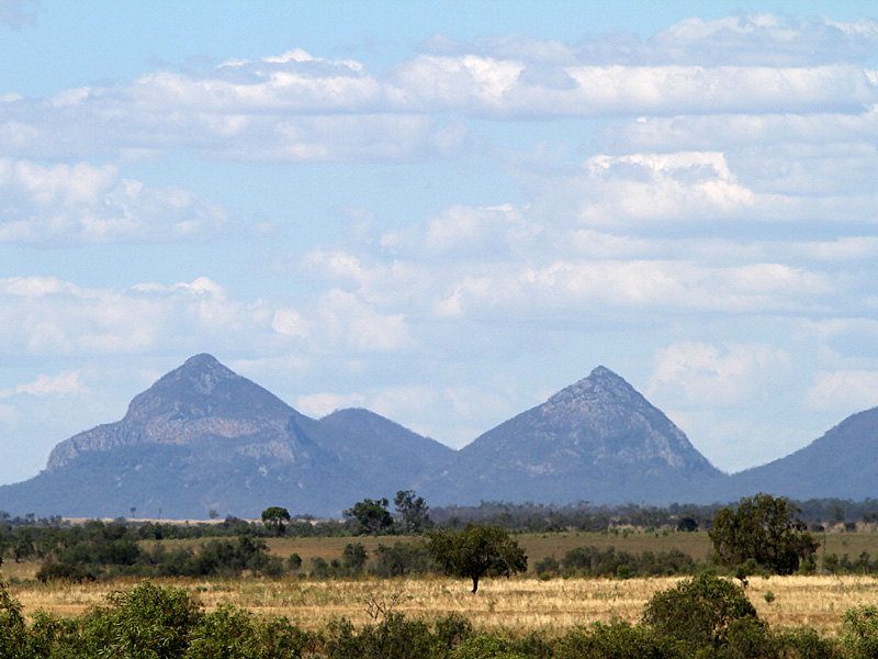
They reminded me of the volcanic plugs that make up the Glasshouse Mountains that I’ve known all my life, and I thought how interesting it would be to get a closer look at them.
We drove on, heading for the Carnarvon Ranges, and by the time we’d arrived home in Brisbane I’d forgotten where I’d seen those distant peaks.
That is why last year, driving home to Brisbane once again and wanting to get off the busy Bruce Highway, we headed inland down the Boyne River Valley, through Many Peaks, on a short cut to meet the Burnett Highway at Monto. Over the years I’d heard of Many Peaks. This must be where I could get close to those mysterious mountains.
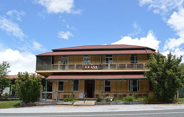
We’d discovered that Many Peaks, a tiny town with a population of less than one hundred, has an old pub, and we planned to stop there for lunch.
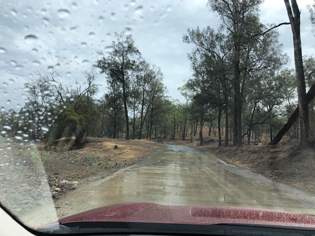
We left the Bruce Highway at Calliope, south of Rockhampton, for the Dawson Highway heading west to Biloela, then paused at the turn-off to Many Peaks and Monto and had a think. It was raining, and we knew the road was partly gravel.
Going via Biloela would be 195 kilometres and boring. Via Many Peaks, 137 kilometres and interesting. We turned off.
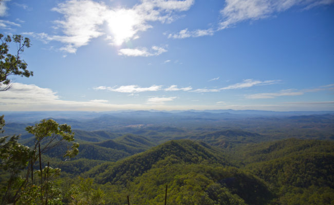
This turned out to be mountainous, forested country, with the road following the Boyne River Valley: no plains, and no volcanic plugs to be seen. The paddocks were wet, and brown from drought, and there had been fires through,
And the pub was shut that day.
There were loaded timber trucks on the muddy road, and they gave no ground for our Subaru.
One section of the road, sealed but narrow, goes up the side of a mountain. If we’d met a semi-trailer on its way down, loaded with timber, we would have had nowhere to go but over the edge. When we reached the top and a section of wider road, there was just such a truck lurking around the corner.
In bed that night in a Monto Caravan Park cabin, still thinking about that frightening mountain road, I suddenly realised that the timber trucks would have been in contact by UHF radio. That semi-trailer was waiting, probably impatiently, for our Subaru to make it up the hill before it started down the narrow stretch. We hadn’t been in danger at all.
We never did get to have a counter lunch at the Many Peaks Hotel; and I believe it has since closed down for good.
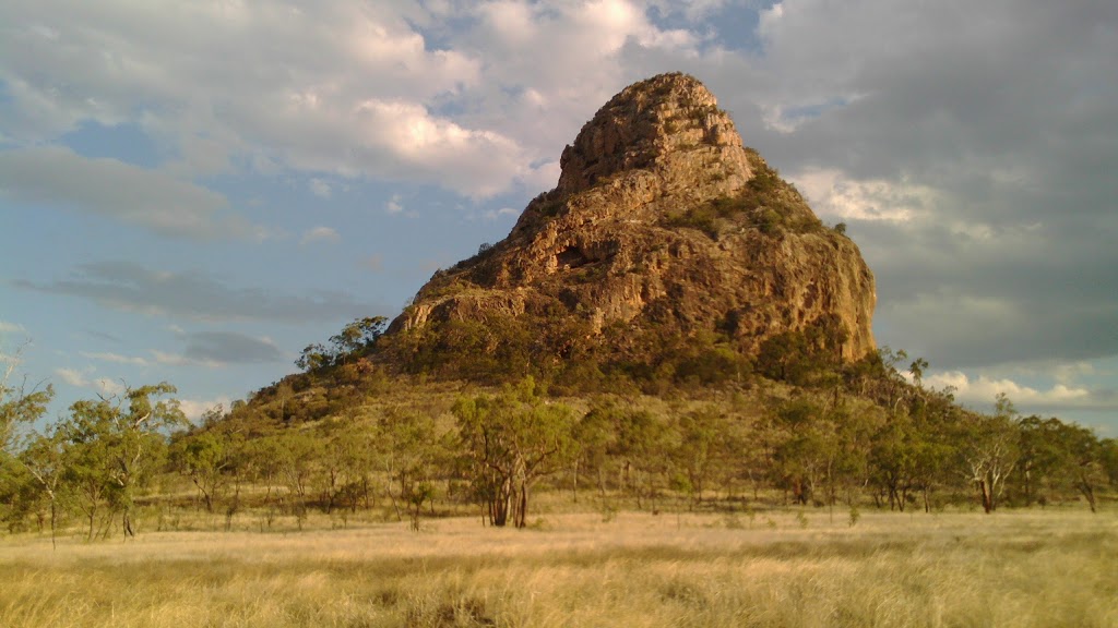
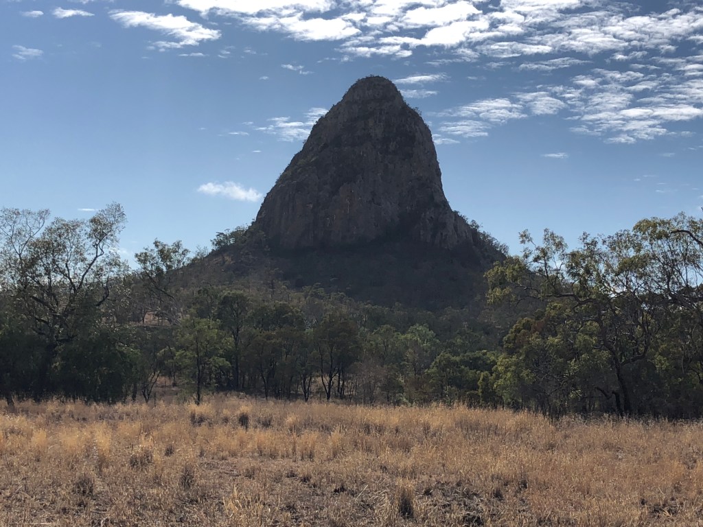
I’ve since discovered that the intriguing volcanic peaks I was looking for are actually part of the Peak Range National Park, off the Peak Downs Highway, deep in coal mining country south-west of Mackay – a long way north of the Boyne Valley. Next week I’m finally going to take a closer look at them.
We’ve booked an apartment in Palm Cove, north of Cairns, to spend time with the family. With recent COVID-19 cases popping up in South East Queensland, nobody can predict what the next couple of weeks will bring; but we’re planning to go anyway.
We’ll take face masks, but I doubt if we’ll wear them. Considering that fewer than one person in a hundred is wearing a mask in Brisbane, they won’t be a feature in the regions, so far almost untouched by the virus. Locals may well regard face masks as a typical southerners’ fad.
We won’t be in a hurry, not like those driving for work. In the regions, it’s all about work, and on the western roads tradies’ utes and mining company vehicles will fly past us at 120kms per hour.
Peak Range National Park is 280 kilometres south-west of Mackay via the Peak Downs Highway, and 944 kilometres north-west of Brisbane. We’ll travel via Gympie, Kilkivan, and the Burnett Highway, then west to Emerald on the Capricorn Highway and north to Clermont, deep into coal mining country.
Next day, driving up the Peak Downs Highway towards Mackay, we’ll pass the Peaks I’ve been looking for.
Closest to the road, I’ve read, is Wolfgang Peak – notorious for bats in its caves and many large spiders.
There are Mounts Castor and Pollux and half a dozen others, including the flat-topped Lord’s Table. In 1845, Ludwig Leichhardt’s expedition passed through here and gave them names – although I’m sure they already had names, and stories, many thousands of years old.
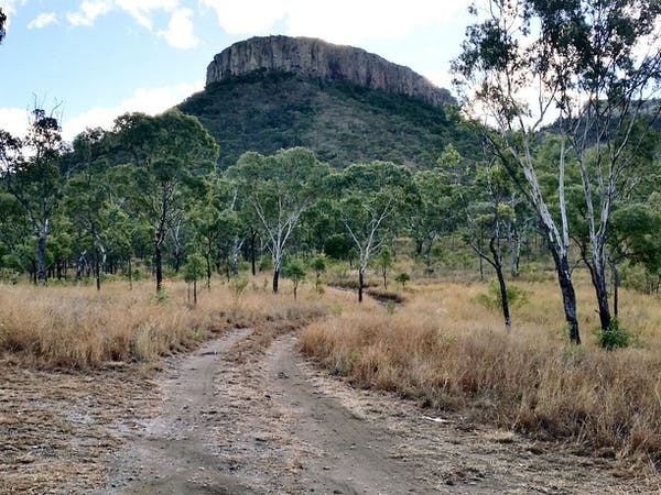
This national park is undeveloped, and only keen climbers attempt the peaks. I won’t get to meet the spiders and the bats; but I’m looking forward to walking in from the highway and getting as close as I can to Wolfgang Peak.
They say there are big, scary mining trucks on these roads, but after run-ins with those big, scary timber trucks on our last trip, we’ll know how to stay out of their way. I hope.
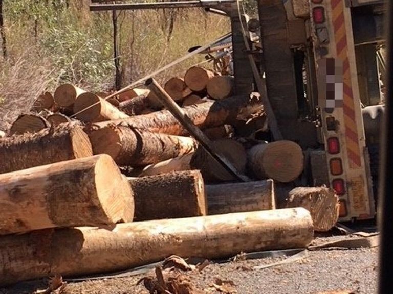
Timber truck rolled on the Calliope Monto Road qt.com.au
P.S. We took our road trip north, and had a great trip, with no confrontation with heavy vehicles.
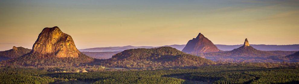
I found the Peak Range, a spectacular sight from both the Dawson and Peak Downs Highways. According to an information board, the peak closest to the road is not in fact Wolfgang Peak, at least not to locals. It’s Wolfang Peak. That’s a better name for it, because a wolf’s fang is what it looks like.

Leave a comment