Mangrove Pencils

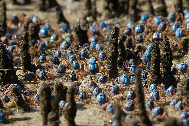
At the Cod Hole, where Eudlo Creek joins the Maroochy River, I watched the soldier crabs. Scuttling across the mudflats in their hundreds, dressed in smart blue-grey uniforms, the little round crabs would feel the vibrations of my footsteps and quickly screw themselves down into the mud and disappear. If I stood still for a few minutes they would start to twist themselves back into the daylight.

“Soldier crabs marching through mangrove aerial roots” commons.wikipedia.org

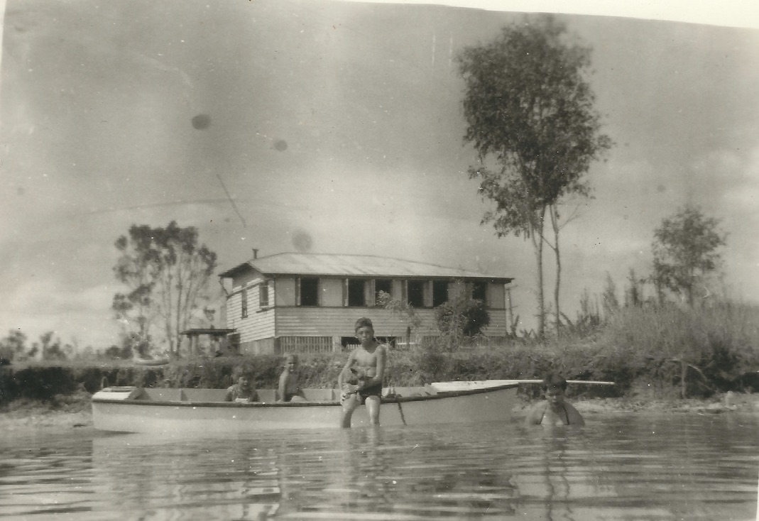
My dad had bought an old weatherboard beach house on the dead-end dirt road that has since become busy Bradman Avenue. We named the house Toad Hall.

“Toad Hall”, on the Maroochy River. I’m in the boat, on the left

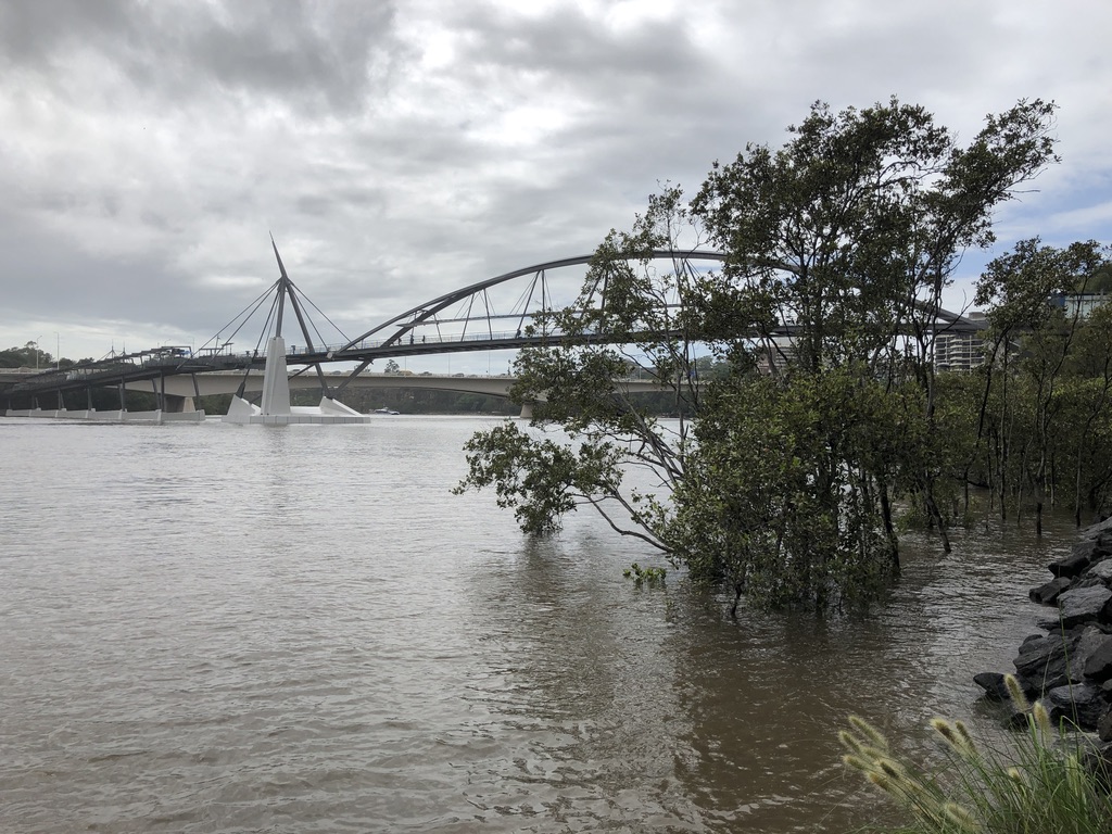
It was just upstream from where the Sunshine Motorway now crosses Maroochy River. Bradman Avenue runs upstream from Picnic Point, along the south bank of the river and over the creek, past a dragon boat club and a tavern.

The old house held out against development for years, but it’s gone now, replaced by holiday apartments. There are still some mud flats along the creek, though. You can still scoop up a soldier crab to feel it tickling your palm, trying to dig its way out of sight.

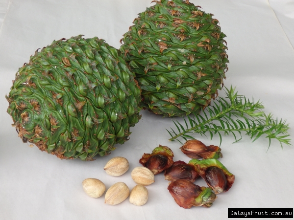
Also on the mud flats and along the banks of the river were mangroves. I collected the mangrove seedling “pencils” and used them to draw in the wet sand at the river’s edge.

Mangrove seedlings – “pencils” wettropics.gov.au

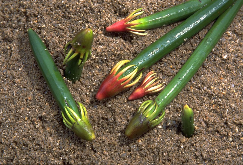
I made patterns with the flower husks, like little octopuses, from which the pencils grew. Little green mangrove “books”, actually seed pods, washed up on the river’s edge too, along with sea grass fronds and scraps of pumice from ancient local volcanoes.

Mangrove seed pods – “books”

Only a few mangroves survive along this stretch of the river, but further upstream they still thrive across the sand and mud flats. Mangroves grow from New South Wales, right up the Queensland coast, round the Gulf of Carpentaria, across the top of Australia and throughout the tropics and sub-tropics globally, thriving in warm tidal rivers, estuaries and bays.

 In many parts of the state, like Raby Bay in Cleveland and Pelican Waters at Caloundra, mangrove forests have been destroyed to make way for canal developments; but if the people, cars, concrete and bitumen disappeared, they would soon come back and resume their ancient job of filtering the mud, protecting the shoreline and pouring oxygen into the atmosphere.

Mangroves in the Brisbane River, Southbank

Except for climate change.

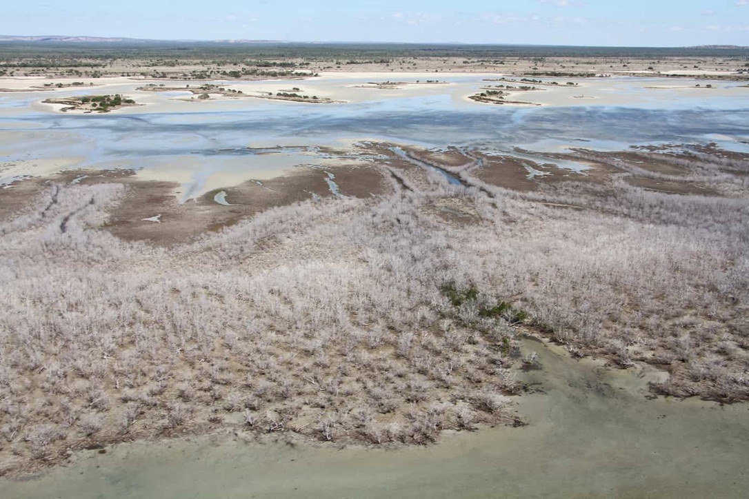
Mangrove dieback in the Gulf of Carpentaria
by Lyndal Scobell, Cape York NRM

Over 7,000 hectares of coastal mangroves have died along 1000 km of coastline in the Gulf of Carpentaria. James Cook University’s Dr Norman Duke said the dieback was unprecedented, and followed a prolonged period of high temperatures and unseasonally dry conditions in the region.

Dr Duke, a world expert on mangroves, said the dieback was severe and widespread, affecting 9% of mangrove vegetation from just south of the Roper River in the Northern Territory to near Karumba in Queensland. https://cafnec.org.au/wildlife-issues/mangroves-wetlands/mangrove-dieback-in-the-gulf-of-carpentaria/

I was shocked to read about this environmental disaster in the Gulf.

It will have a huge impact on fish breeding and the birds and animals of the area; the prawns, hermit crabs, and millions of humble, vital creatures of the tidal mud. The land itself will be left unprotected from erosion and inundation. It’s difficult to comprehend the scale of the dieback – 1000kms of coastline altered, perhaps permanently. In this harsh environment, mangroves have been the stalwart protectors of the coastline forever. Back in 1861, they defeated the utmost efforts of Burke and Wills, who’d travelled all the way from Melbourne to reach the Gulf, but never made it through the mangroves to the sea. Now 7,000 hectares of them have succumbed to the effects of heat and drought.

There are still mangrove forests around Moreton Bay – seven species of them, reportedly, along the coast and the islands, and up the rivers, in spite of development and climate change.

Moreton Bay mangroves, Victoria Point

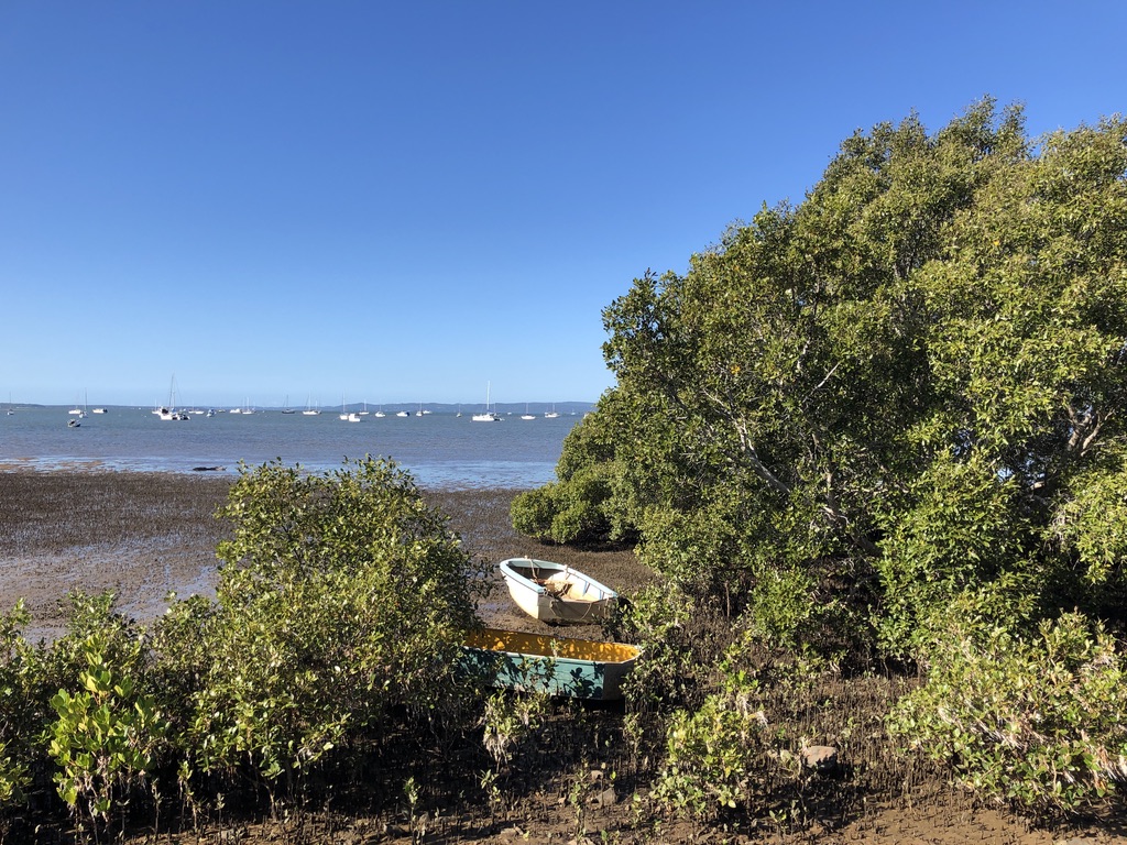
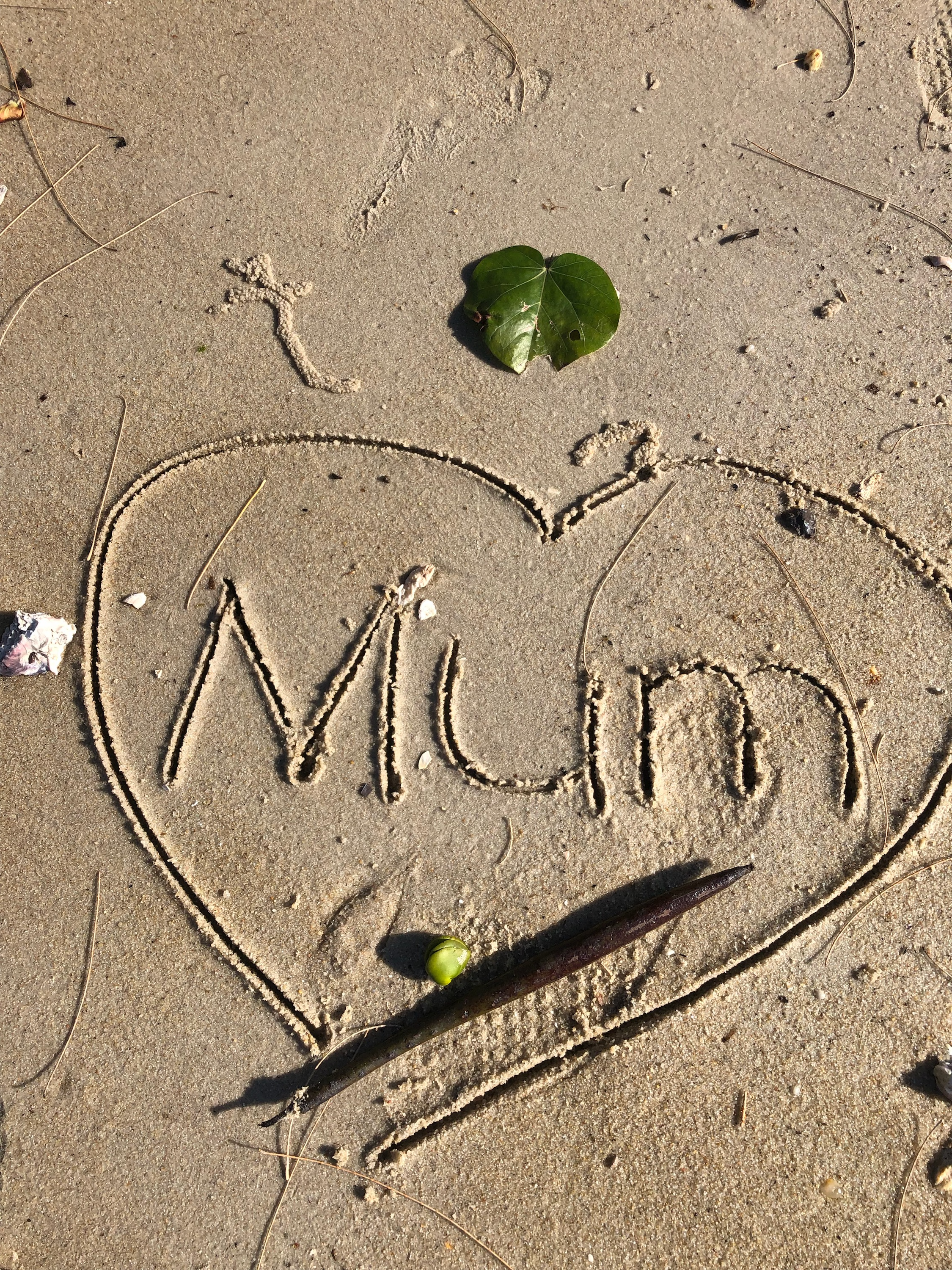
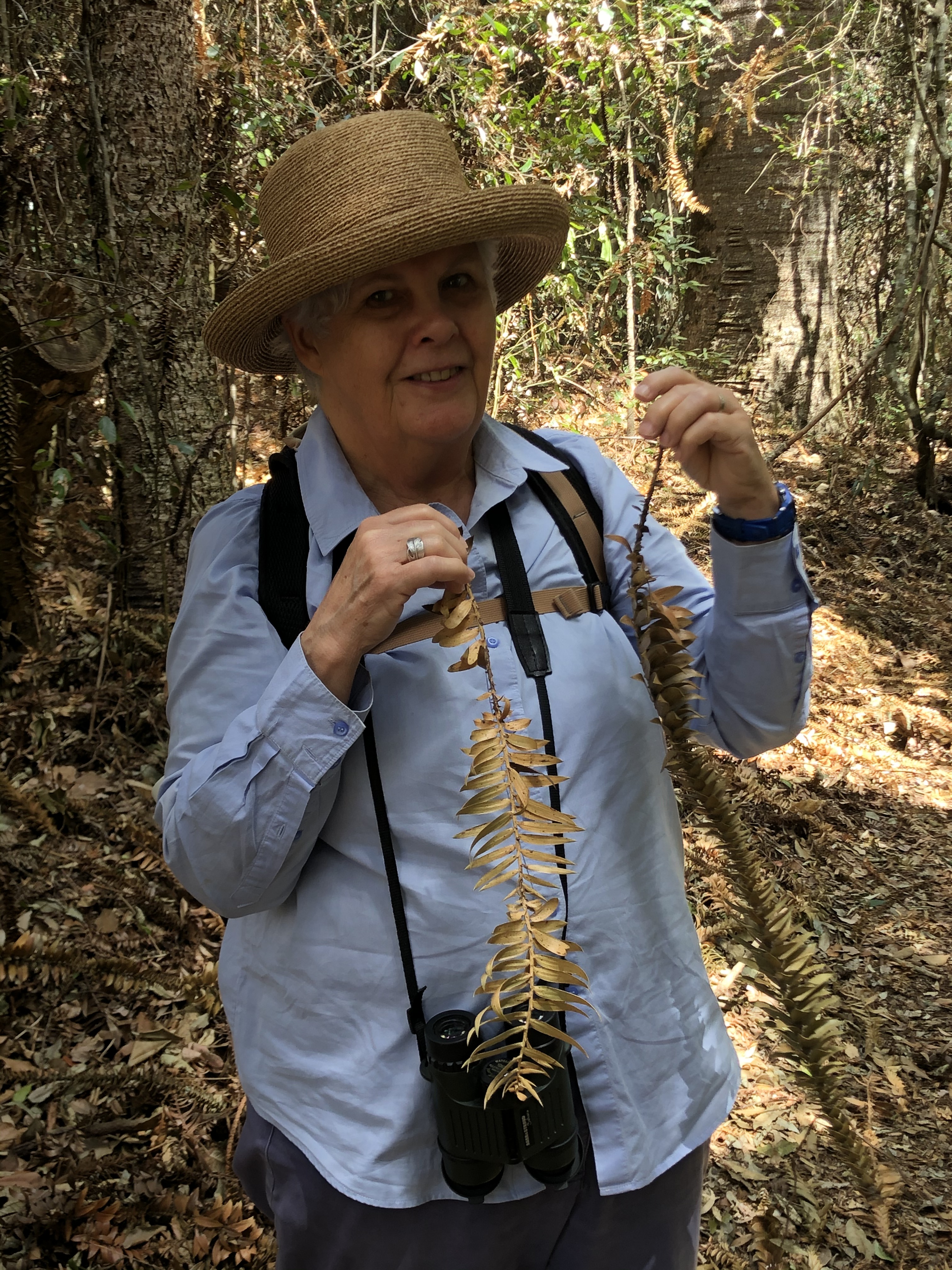
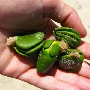
Our Lizzie has been a beach lover all her life. When she was little, we’d often visit the beaches of Maroochydore, or Townsville, or Etty Bay, making sandcastles and decorating them with shells and seaweed and pumice. We’d draw in the sand with mangrove pencils and make patterns with mangrove flowers. Lizzie is now an environmental engineer, and last month, during one of her regular scientific field trips to Stradbroke Island, she found a mangrove pencil on the sand.

She drew me a picture, and sent me the photo. That’s one to keep.

Peaks

Years ago, when we were driving back from Cairns on the inland roads, I saw off to the east, across flat plains, a row of interesting mountain peaks.

Peak Range aussietowns.com.au

They reminded me of the volcanic plugs that make up the Glasshouse Mountains that I’ve known all my life, and I thought how interesting it would be to get a closer look at them.

Glasshouse Mountains sunshinecoastpoint.com.au

We drove on, heading for the Carnarvon Ranges, and by the time we’d arrived home in Brisbane I’d forgotten where I’d seen those distant peaks.

That is why last year, driving home to Brisbane once again and wanting to get off the busy Bruce Highway, we headed inland down the Boyne River Valley, through Many Peaks, on a short cut to meet the Burnett Highway at Monto. Over the years I’d heard of Many Peaks. This must be where I could get close to those mysterious mountains.

We’d discovered that Many Peaks, a tiny town with a population of less than one hundred, has an old pub, and we planned to stop there for lunch.

Grand Hotel, Many Peaks boyneburnettinlandrailtrail.org.au

We left the Bruce Highway at Calliope, south of Rockhampton, for the Dawson Highway heading west to Biloela, then paused at the turn-off to Many Peaks and Monto and had a think. It was raining, and we knew the road was partly gravel.

Going via Biloela would be 195 kilometres and boring. Via Many Peaks, 137 kilometres and interesting. We turned off.

This turned out to be mountainous, forested country, with the road following the Boyne River Valley: no plains, and no volcanic plugs to be seen. The paddocks were wet, and brown from drought, and there had been fires through,

The Boyne Valley southerngreatbarrierreef.com.au

And the pub was shut that day.

There were loaded timber trucks on the muddy road, and they gave no ground for our Subaru.

Driving the Boyne Valley road in the rain

One section of the road, sealed but narrow, goes up the side of a mountain. If we’d met a semi-trailer on its way down, loaded with timber, we would have had nowhere to go but over the edge. When we reached the top and a section of wider road, there was just such a truck lurking around the corner.

In bed that night in a Monto Caravan Park cabin, still thinking about that frightening mountain road, I suddenly realised that the timber trucks would have been in contact by UHF radio. That semi-trailer was waiting, probably impatiently, for our Subaru to make it up the hill before it started down the narrow stretch. We hadn’t been in danger at all.

We never did get to have a counter lunch at the Many Peaks Hotel; and I believe it has since closed down for good.

I’ve since discovered that the intriguing volcanic peaks I was looking for are actually part of the Peak Range National Park, off the Peak Downs Highway, deep in coal mining country south-west of Mackay – a long way north of  the Boyne Valley. Next week I’m finally going to take a closer look at them.

We’ve booked an apartment in Palm Cove, north of Cairns, to spend time with the family. With recent COVID-19 cases popping up in South East Queensland, nobody can predict what the next couple of weeks will bring; but we’re planning to go anyway.

We’ll take face masks, but I doubt if we’ll wear them. Considering that fewer than one person in a hundred is wearing a mask in Brisbane, they won’t be a feature in the regions, so far almost untouched by the virus. Locals may well regard face masks as a typical southerners’ fad.

We won’t be in a hurry, not like those driving for work. In the regions, it’s all about work, and on the western roads tradies’ utes and mining company vehicles will fly past us at 120kms per hour.

Peak Range National Park is 280 kilometres south-west of Mackay via the Peak Downs Highway, and 944 kilometres north-west of Brisbane. We’ll travel via Gympie, Kilkivan, and the Burnett Highway, then west to Emerald on the Capricorn Highway and north to Clermont, deep into coal mining country.

Next day, driving up the Peak Downs Highway towards Mackay, we’ll pass the Peaks I’ve been looking for.

Closest to the road, I’ve read, is Wolfgang Peak – notorious for bats in its caves and many large spiders.

Wolfgang Peak australia246.info

There are Mounts Castor and Pollux and half a dozen others, including the flat-topped Lord’s Table. In 1845, Ludwig Leichhardt’s expedition passed through here and gave them names – although I’m sure they already had names, and stories, many thousands of years old.

Lord’s Table Mountain queensland.com

This national park is undeveloped, and only keen climbers attempt the peaks. I won’t get to meet the spiders and the bats; but I’m looking forward to walking in from the highway and getting as close as I can to Wolfgang Peak.

 They say there are big, scary mining trucks on these roads, but after run-ins with those big, scary timber trucks on our last trip, we’ll know how to stay out of their way. I hope.

Timber truck rolled on the Calliope Monto Road qt.com.au

P.S. We took our road trip north, and had a great trip, with no confrontation with heavy vehicles.

I found the Peak Range, a spectacular sight from both the Dawson and Peak Downs Highways. According to an information board, the peak closest to the road is not in fact Wolfgang Peak, at least not to locals. It’s Wolfang Peak. That’s a better name for it, because a wolf’s fang is what it looks like.

Wolfang Peak

Romancing the Bunya

A king parrot is standing on my battered old Simpson and Day bird book. Not on the parrot page, either. He looks as if he’s researching the rufous fantails we’ve been watching in the forest.

68064807-6927-4AFB-9C9B-9D34996E7B99 King parrot

“I remember the day Mum put the bunya pine down her bra,” says my brother Rick. He and my other brother Mike and I are in the Bunyas Mountains together, on a nostalgic visit, sitting on the verandah of a small but comfortable cottage and reminiscing. King parrots and crimson rosellas cluster round us, pecking at bird seed.

I can’t imagine putting anything as prickly as a bunya pine down my bra.

We’re discussing a trip to the Bunyas we went on years ago, camping with our parents. Dad had pitched the old canvas tent on what was then known as the Lucerne Patch, a camping field running down to the edge of the rainforest. That evening there was a sudden storm, with heavy rain threatening to swamp the tent. Mum and we three kids held on to the tent poles while Dad frantically dug a trench along the uphill side to divert the flood.

Dad’s trench saved us from a night spent in wet bedding, and next day the sun was out. We walked along the forest tracks, under majestic pines and enormous fig trees laden with ferns and orchids.

Along the way, our mother spotted a baby bunya pine. The ground was soft after the rainstorm, and so in spite of signs that said not to interfere with vegetation or wildlife in a National Park she carefully dug it out. Because she didn’t want to be caught doing the wrong thing, so the family story goes, she hid it in her bra.

The iconic bunya pines, Araucaria bidwilli, endemic to the Blackall Range and Bunya Mountains National Park, command respect. Straight and rough-barked, bunya pines can grow close to fifty metres tall and a metre in diameter.

3CA28F0E-E113-476C-8BCC-0E5DBD82E71E Bunya pines

For thousands of years, great bunya festivals were held here. This was a meeting place for local Aboriginal groups and those from further away, travelling here every three years for ritual and ceremony, resolving of disputes, feasting, dance, song, trading, socialising and above all harvesting the bunya nuts.

bunya 4 daleys fruitAraucaria-bidwilli-Bunya-Nut-146 Bunya leaves, cones and fruit


Development of surrounding lands by white farmers, and the relocation of Indigenous people to reserves, tragically put a stop to the bunya festivals by 1902.

According to Tom Petrie, his father Andrew Petrie “discovered” the bunya pine and “gave some specimens to a Mr. Bidwill, who forwarded them to the old country, and hence the tree was named after him, not after the true discoverer.”[1]

These trees had been known and celebrated in this place for centuries before the Petries came along.

In the mid-1800s, Tom Petrie himself as a boy was the first free (i.e. not an escaped convict) white person to attend a bunya festival. As an old man, he described it in detail to his daughter, who wrote out his memoirs. Many of the bunya pines have what seem to be notches in them and some believe that they were cut to help the young men who, with the aid of a loop of strong vine around the tree, would climb up to get the big cones that hold the nuts; but according to Tom Petrie they would never cut a bunya because it would hurt the tree. They would climb using just the vine, aided by the roughness of the bark. It would take great skill and courage to climb so high that way.

By the 1850s, an avenue of bunya pines had been planted in the Brisbane City Botanic Gardens, where they’re still standing today, along the path above the river.

bunya bris bot g Avenue of bunya pines in the Brisbane City Botanic Gardens  Image: Monuments Australia

My brothers and I have been walking those same soft forest tracks again today, and we worked out which leaves belong to the bunya pines, and which to the equally mighty hoop pines, Araucaria cunninghamii, that grow here too. They were first collected by Alan Cunningham, botanist and explorer, in the 1820s.

bunya hoop Araucaria-cunninghamii-MF-13333-large Hoop pine

It’s easy to tell the trees apart, if you crane your neck upwards. The mature bunyas have a dome-shaped top, while the hoops have a pointed top. The leaves are different too. Hoop pine leaves are smooth and closely woven, and bunya leaves are twisted and prickly. Maybe Mum wrapped that little bunya tree in a hanky.

“She put the tree in a pot, and it grew,” says Rick. “For years we used it as a Christmas tree.”

“That’s right – I’d forgotten the Christmas tree! Didn’t she eventually plant it behind the house at Ashgrove, down by the creek?”

“Yes, she did. I wonder if it’s still there.”

This year, the forest is in drought, like most of Queensland. Dry leaves are lying thick on the ground. Many trees are suffering, and some of the tracks are closed. As we sit on the cottage verandah that evening, we hear a menacing cracking sound in the distance, then a deep, booming thump. The sound of a forest giant falling.

20B8EC51-12F1-48BE-9E11-6F689326DBC0 Bunya leaves

“When we get back to Brisbane, let’s go and look for Mum’s bunya pine,” said Mike.

That’s what we do. We drive out to the old house in Joffre Street, Ashgrove, and there it is, towering over the houses, down near the creek.

Only it doesn’t have a dome shape. It has a point. After all these years of family legend, is it actually a bunya pine at all? It’s not a full-grown tree yet – too young to have a dome, perhaps.

Maybe it’s a hoop pine. Much less prickly to put in a bra. We knock on the door to ask if we can go out in the back yard and check the leaves, but there’s no one home.

Hoop pines are beautiful too, with their rough bark and hoop-like stripes. They’re everywhere in Brisbane, standing like sentinels on hilltops, in parks and suburban gardens and motorway plantings.

The bunya pine, though, is the iconic one; and its home forest, now suffering from drought, is an ancient and spiritual place. This year, Paris’s Notre Dame Cathedral burned down and the world mourned. The Cathedral will be rebuilt – just as it was. It won’t be so easy to rebuild the old, old forests of the Bunya Mountains.

[1] “Tom Petrie’s Reminiscences of Early Queensland”, Constance Campbell Petrie. First published 1904. This edition 2014: Watson Ferguson and Company, Brisbane. Page 9

Blog at WordPress.com.

Up ↑