Ipswich

In 1972 we were living at Rosevale, 50 kilometres southwest of the city of Ipswich. We went to Ipswich to shop, but our nearest town was Rosewood. As in all regional areas, sport is strong around Ipswich, and Con played cricket on the Rosewood United team, in an Ipswich competition. One team member that he got to know, named Daryl, was a coal mine rescue worker. Daryl’s father was a miner, too.

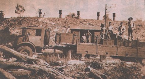
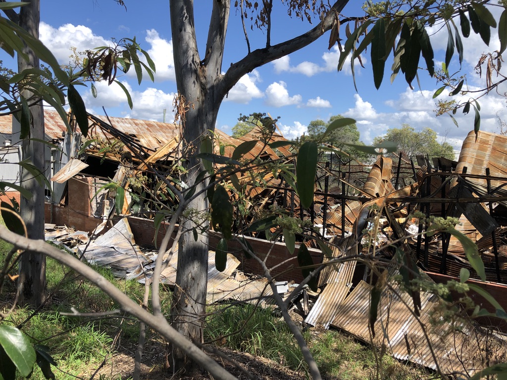
At 2.47 a.m. on 31 July 1972, a mining disaster occurred in the Box Flat coal mine, a few kilometres southeast of the city. When a huge explosion occurred, seventeen miners and rescue workers were killed, with another dying later of his injuries. Daryl was one of the men killed; and so was his father.

No one underground at the time could have survived; the bodies could not be retrieved, and the difficult decision was made to permanently seal the mine.

The whole region grieved. Mining communities are close-knit, and it was said that everyone in the district knew someone who died that night.

A video from the Mine Safety institute of Australia covers the story of the disaster. https://youtu.be/m-dXzS5KanI

Ipswich Historical Society President Hugh Taylor points to the location of the fire in the 1972 Box Flat mine about 100 metres beneath the surface of the ground at Swanbank” Report brisbane times.com.au on the 50th anniversary. Photo Tony Moore

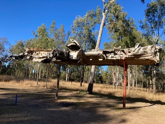
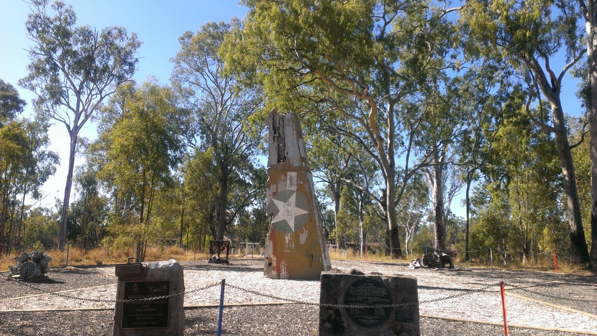
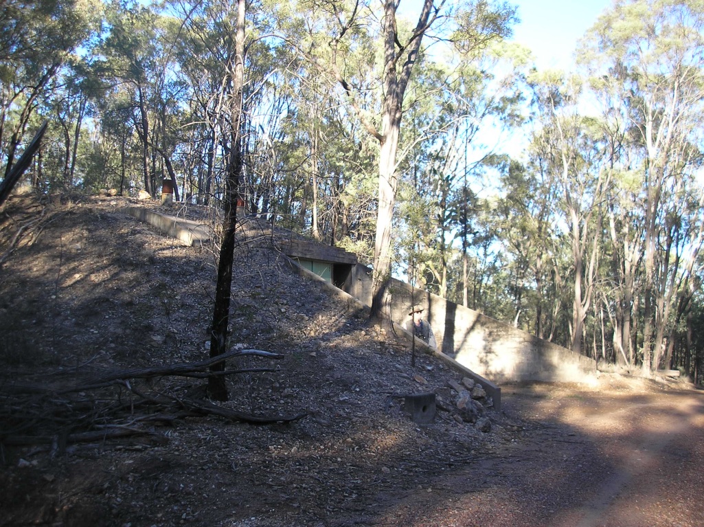
The sombre Box Flat Memorial was constructed at Swanbank, near the scene of the disaster.

The Box Flat Memorial, Swanbank Road, Swanbank

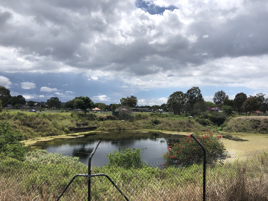
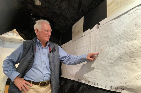
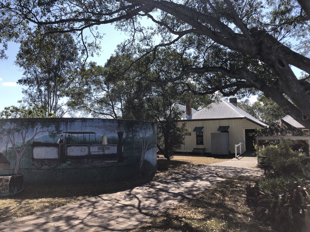
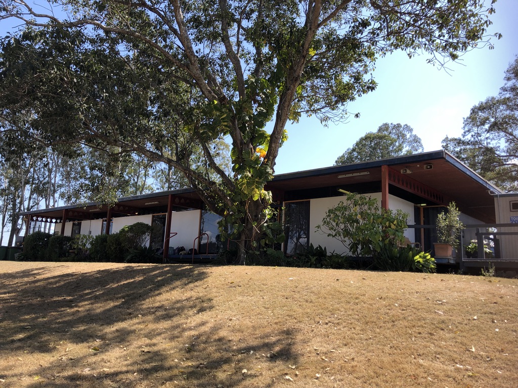
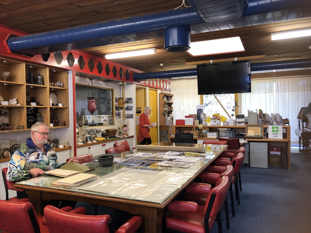
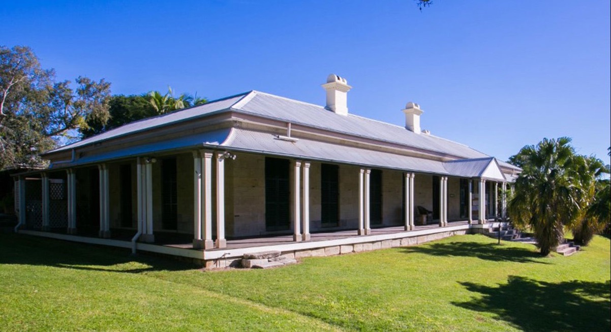
Last week I visited the Memorial, then drove to the site of the Cooneana Heritage Centre a few kilometres away for more information. This is the home of Ipswich Historical Society and of the original Cooneana Homestead, built in 1868 and lovingly preserved.

Water tank and Old Cooneana Homestead, Cooneana Heritage Centre, Redbank Plains Rd, New Chum

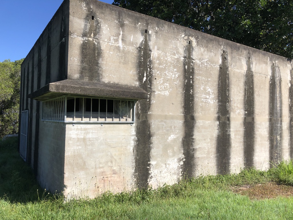
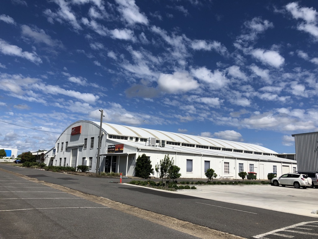
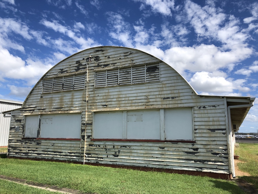
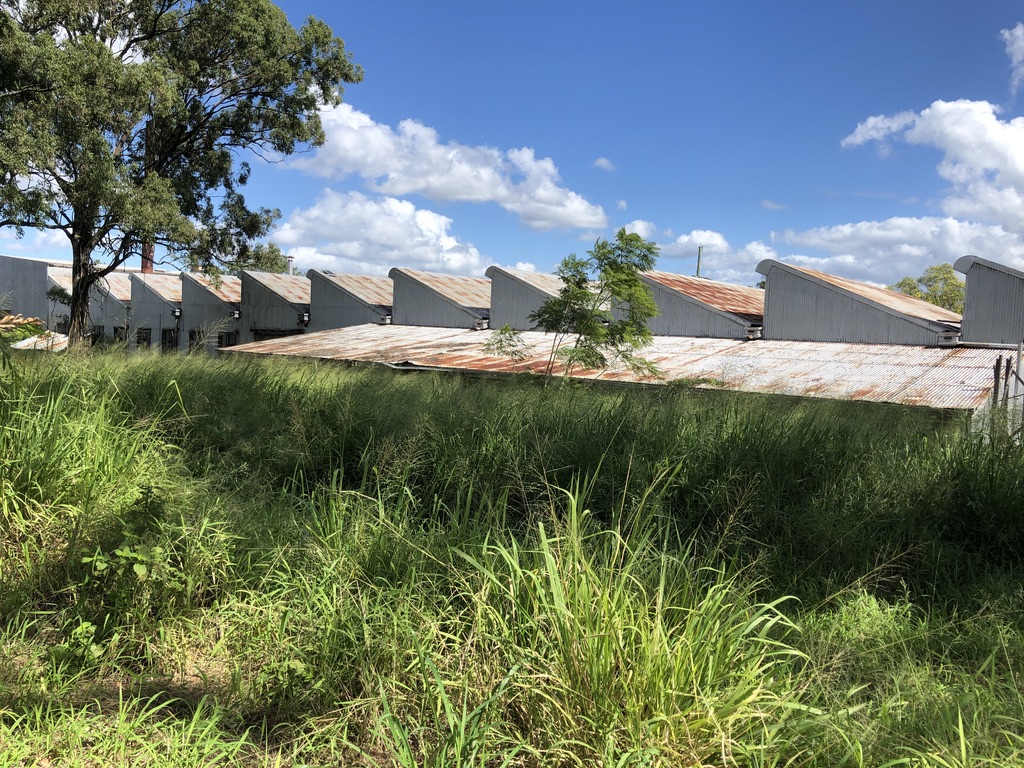
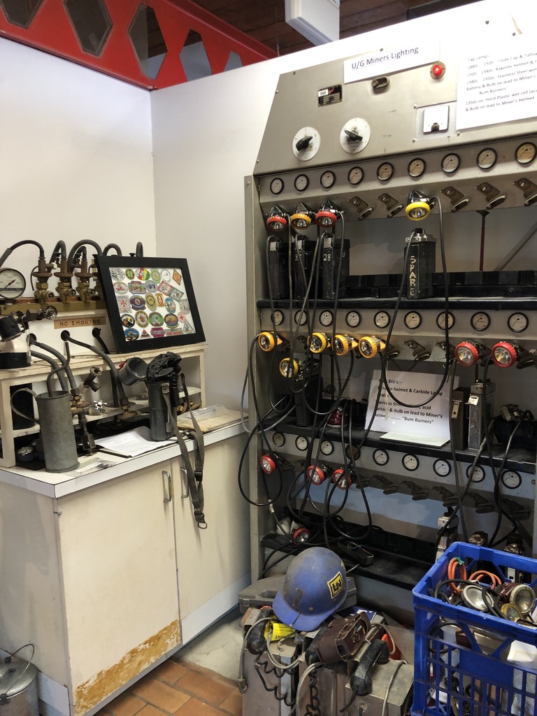
The Society’s headquarters and museum are housed in an attractive, award-winning Modernist building, constructed in 1976 as the offices of Rhondda Collieries and still in its original condition.[1]

Award-winning headquarters of the Ipswich Historical Society
Interior of the IHS Museum
Displays of miners’ lamps in the IHS museum, most of them part of the original equipment of the building

Coal is why ipswich is where it is. Coal and limestone.

In the early, convict days of Brisbane when building was progressing, lime was needed for mortar. In 1827, Commandant Patrick Logan, energetic explorer of the Moreton Bay area, discovered limestone deposits on a hill above the Bremer River in what is now Ipswich. A small convict outpost called the Limestone Station was set up, with George Thorn as overseer, and lime burning kilns were constructed.

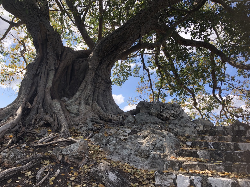
Cunningham’s Knoll on Limestone Hill is a spectacular pyramid of limestone terraces built in the 1930s as a Great Depression employment project. On top of the Knoll, old fig trees grasp blocks of raw limestone in their buttress roots.

Old fig tree on top of Cunningham’s Knoll

Little remains of the old kilns now except for a small mound of kiln residue behind the Knoll.

Mound of limestone burning residue as seen from the top of Cunningham’s Knoll

Patrick Logan also discovered coal reserves near Limestone Hill, and over time coal mines were opened all around the area, with miners coming from as far away as Wales. The suburb of Blackstone is still known locally as Welsh Town, and Rhondda Colliery and the suburb of Ebbw Vale were named after coal mining areas in Wales.

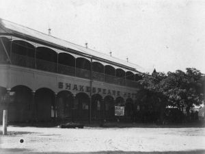
My own connections with Ipswich go back to 1861, when my great-great-grandfather James Matthews, fresh from England, spent a night there, enjoying the hospitality of the same George Thorn, probably in his hotel, the Queen’s Arms (soon to be re-named the Clarendon), on the corner of Brisbane and East Streets: Ipswich’s first licensed hotel.

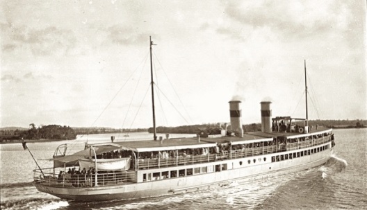
James had come up the Bremer River by paddle steamer, with Archdeacon Benjamin Glennie, and the next morning they set off together to walk to Warwick. (See my story “Walking to Warwick” https://roseobrienwriter.blog/2018/07/27/walking-to-warwick/ )

George Thorn, like many colonial officials, businessmen and squatters, was an English ex-military man who did well out of being in the right place at the right time. He became a major landholder and a Parliamentarian, influential in the colony of Queensland, and regarded as the Father of Ipswich. “Claremont”, the house George Thorn bought at the river end of what is now Milford Street, is sometimes opened to the public for the Great Houses of Ipswich weekend. “Claremont” is just one example of Ipswich’s many magnificent old homes and its fine civic buildings.

“Claremont”, Ipswich. Designed 1857 nationaltrust.org.au

Ipswich became a steam railway centre, and in 1865 the first railway line in Queensland was opened, running to Bigge’s Camp/Grandchester, about thirty-four kilometres away; the first stage of a line to Toowoomba. The railway workshop established in North Ipswich, now home of the Workshops Railway Museum, became the state’s biggest employer, constructing over 200 steam locomotives in its time.

In the 1850s, as statehood for Queensland approached, there was an unsuccessful movement for Ipswich to be chosen as the new state Capital. The owners of the Ipswich paper, The Queensland Times, pushed for it. This fine old masthead continues today. However, once News Corp bought it, its print days were numbered, like so many of Queensland’s regional newspapers; and now The Queensland Times is only available online.

Losing a local print newspaper is a bad thing for communities. Local news is no longer covered in detail; and people without online access might not find out until a year after the funeral that someone they knew has died.

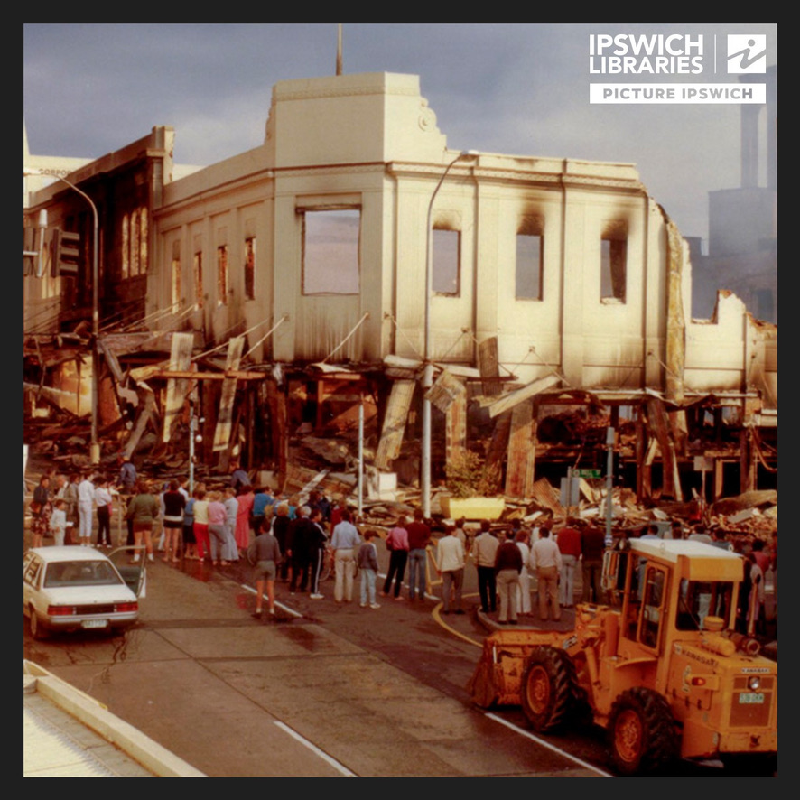
In the early 1980s, Con and I returned to the area, to the farming town of Lowood, 35 kms to the northwest. Again, Ipswich was our shopping town, and again I shopped at the iconic old department store of Cribb & Foote, then Reid’s, on Brisbane Street, just a block up the street from the site of George Thorn’s hotel.

Thorn’s hotel had eventually been destroyed by fire. Shockingly, in 1985 Cribb & Foote also burned down, leaving a massive gap in the CBD.

Cribb & Foote after the fire

Ipswich is to Brisbane as Newcastle is to Sydney, or Geelong is to Melbourne: the tough industrial neighbour with a slightly grimy reputation. Each of these old cities has had to reinvent itself as local industry changed. The Ford car factory in Geelong has been closed for years. Newcastle no longer builds ships; and the last coal mine in Ipswich closed in 2019. In each case, the city has moved to meet the challenges.

New communities have grown up in the ex-mining and scrubland country of the western growth corridor between Brisbane and Ipswich. Ripley, with ambitions to become Australia’s largest planned community, is currently under development only a couple of kilometres from Swanbank, the site of the Box Flat disaster.

Highways are expanding to meet the challenge of increasing population, and busways and extensions of the railway network are under consideration.

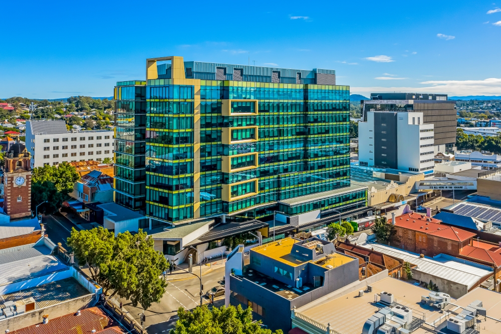
In 2013, an initiative to reverse some of the peak hour commuter traffic on the Ipswich Motorway to Brisbane and revitalise the CBD was completed. On the site where Cribb and Foote once stood, the Icon Tower was constructed, an office building occupied almost entirely by Queensland State Government departments, including, appropriately, the Department of Resources.

Icon Tower, Ipswich ipswichfirst.com.au

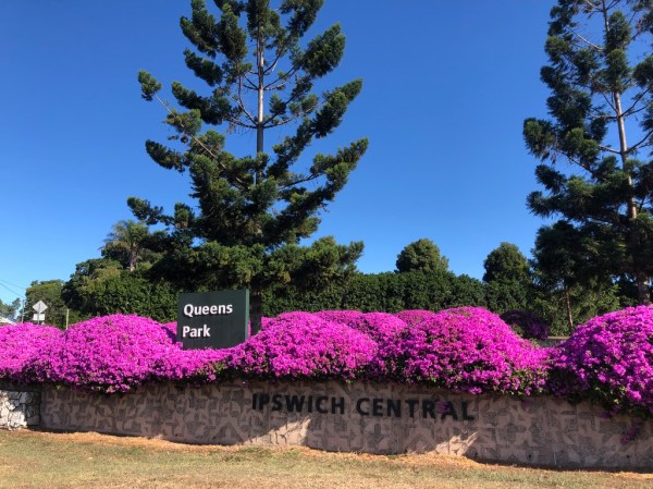
We live in Brisbane now, but we often take our grandchildren to the playground and Nature Centre in Queen’s Park, on the slopes of Limestone Hill; we visit Nerima Japanese Gardens, and the Ipswich Art Gallery, with its wall of coal. We visit cafes and the river walkways, restored after recent Bremer River floods. It’s a quiet river when we visit, and it’s hard to imagine the devastation it regularly causes through the low-lying areas of the city.

Below the old railway bridge, now a pedestrian bridge, is a commemoration of the resilience of Ipswich and its people in flood times

This is not soft country. The Ipswich area is hotter in summer and colder in winter than Brisbane. Living at Lowood, we sometimes scraped frost off the car windscreen at eight in the morning. At Rosevale in 1972, we suffered the hottest Christmas of our lives, with all-time record temperatures.

For the sad coal-mining families in the area, there would have been empty places at the table that Christmas.


[1] Thank you to Ipswich Historical Society President Hugh Taylor and other well-informed staff who generously helped with information and access to files when we visited Cooneana Heritage Centre.

Relics of War

Beside the road to Carnarvon Gorge is a damaged aircraft wing mounted on steel pylons, next to a wing tip set into the ground.

D-C47 Air Crash Memorial, Carnarvon Gorge Road Photo: tripadvisor.com.au

Nearby, on 16 November 1943, this USAAF Dakota C-47 broke up in a severe storm and crashed. Five Americans and fourteen Australian soldiers died. This is their memorial.

There were many plane crashes across Queensland during the years of World War Two. Traces of crash sites, wartime airstrips, military bases and hospitals, radar stations, fortifications and ammunition dumps are located across the state, from Torres Strait to the New South Wales border. A Queensland government website lists the wartime sites: https://www.ww2places.qld.gov.au/place?id=1686  Some, like the memorial beside Carnarvon Gorge Road, have been cared for by dedicated locals. Others have become tourist attractions. Many are lost in the scrub.

1942 was a year of great anxiety for Australians, especially in the northern states.

The British fortress city of Singapore fell on 15 February 1942, a terrible shock to Australians. My father became a Prisoner of War. Two weeks later in Brisbane, my mother, in great distress, gave birth to her first baby, two months premature.

Now Russia has invaded Ukraine, and civilians and the military are preparing valiantly for what must come. Many have become refugees, and many have died. Unlike in Ukraine, tanks can’t drive across our borders. Troops can’t just march in. Nevertheless, in 1942, Queenslanders were frightened.

Trenches were dug in parks, school yards and house yards. There were air raid sirens and drills, and saltwater pipelines were laid through city streets for fire-fighting, and black-out warnings were put by in place.

Con’s father, a sergeant, spent his wartime years driving army trucks across Cape York Peninsula, delivering fuel to military airfields and outposts.

Con as a wartime baby, with his father in uniform, in Innisfail

“There are old wartime airfields all over the Cape,” a pilot once told me, and as I was in a small plane over the Peninsula at the time, this gave me comfort. If we got into trouble, we would always find somewhere to land. We might have to chase cattle and kangaroos off the strip first.

Relics of Brisbane’s preparations for war can still be found across the city.

With my grandson Gus, I recently visited the remains of World War 2 Naval installation RAN No. 9 in the old suburb of Myrtletown, Pinkenba.

In 1943, from here near the mouth of the Brisbane River, an indicator loop was laid under the river and a Photo Electric beam installed to shine over it, to detect enemy craft. The concrete block house, once vital to the defence of Brisbane, still stands in long grass in the Myrtletown Reserve. Nearby information boards give details.

Control Building for the indicator loop (nearer window) and Photo Electric beam, Myrtletown Reserve

Among the mangroves on the riverbank nearby lie the remains of the SS Koopa, which also played its part. A small section of the hull tipped sideways above the mud at the mouth of Boggy Creek; a few sad, rusted steel parts.

Gus looks at the sad remains of SS Koopa

After Pearl Harbour was bombed, on 7 December 1941, the US “Pensacola” Convoy on its way to the Philippines was abruptly diverted to Brisbane, and on 23 December, nine large warships quietly dropped anchor in Moreton Bay.

No one knew, until the Koopa came down the river.

The SS Koopa was a much-loved excursion steamer that took passengers down the Bay to Redcliffe and Bribie Island, both before and after the War. My family took a trip on it when I was four. All I remember is a band playing on the wharf, an on-board kiosk down steep steps, and going to sleep under a seat.

SS Koopa in peacetime Photo: Yvonne Darcy peterlud.wordpress.com

To quote the book “The Battle of Brisbane”: The first Australian civilians to greet the Americans were in the SS Koopa… Joan Staines, an 18-year-old secretary, said: ‘We came out of the river and suddenly saw all these huge ships at anchor. My father said, “Cripes, it’s the bloody Yanks.”’[1]

Up to one million US servicemen would be stationed in Queensland during the next four years. In 1941 the population of the entire state was not much more than that. As Prime Minister John Curtin made clear at the time, it was the Americans, not the British, that we would be looking to for help in the Pacific War.

The SS Koopa was requisitioned from 1942 to 1945, stationed at Toorbul and in the Milne Bay area of PNG, before becoming a Moreton Bay excursion boat again. Eventually, she was brought here to Myrtletown and broken up. Those rusting scraps of steel are all that is left.

Brisbane’s Archerfield Airport was an important RAAF base, also used by the Dutch and British air forces and the USAAF.

Archerfield Airport “igloo” building today

Many of its WW2 buildings have been redeveloped for business, those fine old sheds and the “igloo” hangars with their curved roofs.

Wartime sheds and “igloo”, Archerfield Airport

One smaller igloo, now used by a mechanic, was a mess hall during the War. Another one nearby, almost derelict and used for storage, was once perhaps a dance hall or the Officers’ Club.

Just down the road from Archerfield Airport is an old quarry now filled with water. On one side, partly submerged, are concrete air raid shelters built during the war in case of air raids on the airfield. In 1992, some military aircraft and equipment, dumped here after the War, were salvaged from the water.

Partly-submerged air raid shelters, Beatty Rd, Archerfield

In 1942, bomb shelters were rapidly constructed in Brisbane, Townsville, Mackay, Cairns and coastal towns.

Air raid shelters in Ann St, Brisbane, 1942 Photo: State Library of Qld
Air raid shelter in a park in Babinda, FNQ. Now a public toilet

Many are still in use, converted to bus shelters, park shelters and public toilets. They are Queensland’s most common and visible relics of WW2.

Bomb shelter in Nundah, Brisbane, now a public toilet plus bus shelter

There was concern that Mount Isa might be a target, and in 1942 miners carved out a fully functioning underground hospital in the hills near the Base Hospital, complete with electricity, operating theatre, delivery room and wards.

Photo: Mt Isa Underground Hospital and Museum

Now, interested people can visit the Mount Isa Underground Hospital and Museum. https://undergroundhospital.com.au/hospital/

Photo: WW2 Secret Base

Charleville has a “WW2 Secret Base”, where over 3000 US soldiers were stationed, with B-17 bombers and P-40 fighters. A tag-along car tour takes visitors around the sights. https://book.bookeasy.com/agent/wwii-secret-base–tour/8305037/tours/wwii-secret-base/140066#/tours/140066

Newstead, Brisbane, is now gentrifying, but in the 1940s it was a place of warehouses and industry. In Stratton Street, Newstead, old wartime igloos have been redeveloped for entertainment purposes: The Triffid, a much-loved music venue https://thetriffid.com.au, and the upmarket Stratton Bar and Kitchen https://www.stratton.bar.

The iconic curved igloo roof is celebrated in The Triffid’s logo:

A few years ago, Con and I spent a night in a railway carriage at Possum Park, twenty kilometres north of Miles. During the War this was a top-secret RAAF munitions dump, situated, so it’s said, on the notorious Brisbane Line from which Australia would have been defended in the event of a Japanese invasion. 3CR RAAF Kowguran had its own railway branch line and a system of twenty underground concrete bunkers dug into a hill, reportedly storing up to 2500 tons of bombs and ammunition.

“Soldiers storing explosives at 3CR RAAF Kowguran during WW2. Note the ventilation shafts” Photo: ozatwar.com

Now surrounded by gardens, some of the bunkers and the troop train carriages have become tourist accommodation.

Con at the entrance to a WW2 explosives storage bunker, Possum Park

Much of Queensland’s wartime industry was located in the suburb of Rocklea, and many of the old sheds and factory buildings are still there, some derelict and some repurposed, many heritage listed. There were large munitions factories here, and at least one of them remains.

WW2 Munitions Factory, Assembly St, Rocklea

Recently it caught fire, and one end of the enormous building was burnt out. Gus and I, always curious about these things, went to have a look. We walked the 100-metre length of the old factory, past an overgrown bomb shelter, and stared, fascinated, through the chain-link fences and locked gates.

Overgrown bomb shelter, Rocklea

Huge steel beams had been twisted in the heat of the fire, and the roof had collapsed.

After the Munitions factory fire, Rocklea

“It would be great to fly a drone right through there,” said Gus. “We could get a look at what it was like inside.”

WW2 fort, Bribie Island Photo: visitbrisbane.com.au (Main photo: Fort complex, Magnetic Island – en.wikipedia.org)

WW2 coastal fortifications still stand on Bribie Island and Magnetic Island, attracting visitors.

As Gus and I have found, these old sites are fascinating. For amateur researchers there are plenty to explore.

In Queensland and Australia there were bombings, but the threatened invasions didn’t happen. These places were never the scenes of such appalling tragedies as are taking place right now in Ukraine, where the enemy can walk across the border at will.

We were lucky.


[1] “The Battle of Brisbane”, Peter A Thompson and Robert Macklin. 2000. ABC Books, Sydney. Page 31

Barcaldine

fullsizeoutput_3d7b
Oak Street Barcaldine 2015. Tree of Knowledge Memorial in the background

January 2000. Blazing heat and a bright blue sky. Oak Street was still strung with Christmas lights, but nothing much was happening in Barcaldine. The tourist season had not yet begun.

You forget, on the Coast, what it is like to drive in the West: on-coming drivers lift a finger off the wheel in laconic greeting, emus and kangaroos lurk in the roadside scrub; trees in the paddocks are levelled off along the bottom where sheep and cattle have reached up to pull at the leaves.

Con and I had driven two days from Brisbane and arrived on what would have been my mother’s eightieth birthday. She was born here in Barcie. The town is important in my family history. I’d driven through in previous years, but now I wanted to spend a bit more time here.

That Sunday evening, we asked the motel manager where we could eat.

“The pub,” she said. “Or the servo.”

In the Central West, Barcaldine, population eleven hundred, is a classic country town, a flat grid of streets with a row of pubs looking out across the railway line: Globe, Commercial, Shakespeare, Artesian, Railway, and Union Hotels. The streets are named after trees. Barcaldine was the first town to provide town water from an artesian bore, and it still calls itself the Garden City of the West.

This is an important town on the tourist route, situated on the junction of the Capricorn and Landsborough Highways. Barcaldine is also important in the history of politics and industrial relations in Australia. Troops were based here during the great shearers’ strike of 1891, and this was where Australian soldiers first wore emu feathers on their slouch hats.

Meetings of the striking shearers famously took place outside the railway station, under an old eucalyptus tree, a ghost gum, that came to be known as the Tree of Knowledge. By 2000 the tree was showing its age.

Image 13-8-18 at 10.36 pm
The Tree of Knowledge and railway station, Barcaldine, Qld, 1987. Image from collection of State Library of Queensland

Six years after our visit, causing distress locally and nationally, the Tree of Knowledge was poisoned.

If anyone knows who the poisoner was, they’re not telling.

Then, in 2009, the astonishing Tree of Knowledge Memorial was opened on the site where the old tree had stood, outside the station, across the road from the Artesian Hotel. Built with Commonwealth funds, the Memorial consists of a high cube of timber, startling in that flat country with its traditional roof-lines. Inside, above the dead trunk and branches, old railway sleepers hang suspended, outlining a ghostly image of flourishing foliage. At night the tree is lit up in green, a moving and spectacular sight.

Tree of knowledge 2
Inside the Tree of Knowledge Memorial

Eucalypts propagated from the old Tree of Knowledge in Barcaldine are flourishing next to the State Library of Queensland, in Brisbane. Don’t tell the poisoner from Barcie that they’re there.

Back in 2000, a publican gave me a local perspective on the political significance of Barcaldine’s hotels.

“The Shakespeare was the pub for the squatters, and the Globe was the workers’ pub. During the Shearers’ Strike there were heated meetings on both sides. They say the Australian Workers Party, later to become the Labor party, grew out of a meeting at the back of the Globe, and the Country Party began in the lounge of the Shakespeare.”

shakespeare hotel
The New Shakespeare Hotel, 1920 Image from the collection of the State Library of Qld

Six hotels are a lot for a small town to support. By 2011 the Globe was up for sale, possibly to be demolished. Huge old timber hotels with deep verandahs are the architectural treasures of Queensland country towns. So many of them have been lost through fire; I was sad to think that such a building, with so much history, could be pulled down.

I paid another visit to Barcie in 2015, with my cousin Nadine, searching for family history. To my delight, I discovered that the Globe has been preserved. It was bought by the local Council, and the designers of the Tree of Knowledge Memorial were commissioned to renovate it. It now stands in its original form, preserved and enclosed by elegant metal screening. What used to be the bar is now the Information Centre. Upstairs is an art gallery.

IMAG4082
The renewed Globe Hotel, 2015, from the rear

This exciting renovation is currently being showcased at the 2018 Venice Architecture Biennale as part of the Australian exhibit titled “Repair”.

During our 2000 visit, Con and I saw in the bar of the original Globe some large Hugh Sawrey paintings, based on Banjo Paterson poems. Con, loving horse racing as he does, especially liked “Old Pardon, the son of Reprieve”.

In 2015, over dinner in the motel restaurant, Nadine and I talked to the waitress about our family history trip, and I mentioned the spectacular preservation job on the Globe.

“My husband and I used to own the Globe,” she says. “We sold it to the Council.”

“What happened to the Hugh Sawrey paintings? Did the Council buy them, too? Will they go into the new art gallery?”

“We’ve got them packed away. Still deciding what to do with them.”

I hope those paintings make it back to the Globe.

Blog at WordPress.com.

Up ↑