Wallumbilla Station

It’s 1876, and a travelling photographer has set up his equipment at Wallumbilla Station homestead.

Janet and David Turbayne with family and staff, Wallumbilla Station, 1876

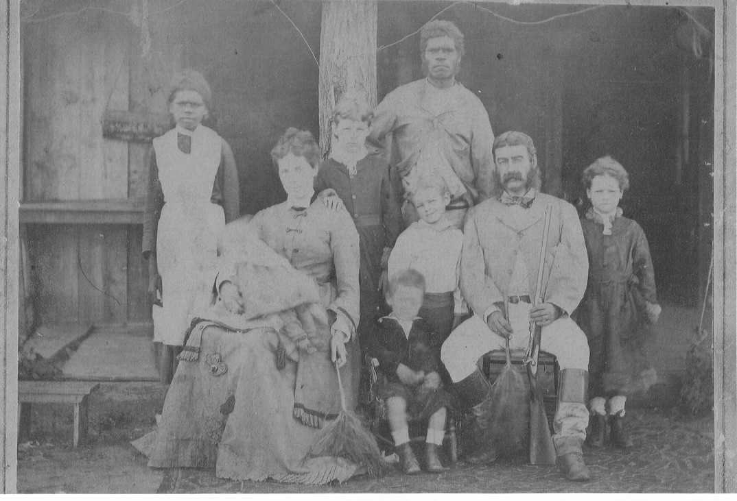
The house is a rough dwelling of wide, unpainted wooden boards.  Untreated tree trunks support the verandah roof. For this important occasion the best carpet has been brought outside, and three chairs – two for the parents and a child’s chair for the second youngest child, Charles, aged two. The youngest, a baby, is lying on her mother’s lap. That’s Maude Isabella, known as Isabel: my great-grandmother. (See my story “Isabel’s Death”.)

I’ve seen many photographs of my ancestors, going back five generations, but this photo, of David and Janet Turbayne is the most interesting. There’s so much to see.

The parents are holding feather dusters discreetly by their sides. That’s to whisk away the small, sticky, annoying western flies that will be bound to settle on faces during the long process of posing and keeping still for the photograph. People in these old photos always look solemn, because it’s hard to keep a smile in place for the twenty seconds or longer the camera shutter needs to be open.

Isabel’s face is blurry. No one can keep a baby still. Little Charles is blurry, too. Wilfred, aged five, has his head on a cheeky angle. Ellen is seven, and she’s mastered the art of standing straight and still. The eldest child, Jessica, has her hand on her mother’s shoulder. All her life, Jessie will be the responsible one helping raise her brothers and sisters and nieces and nephews, and their children too.

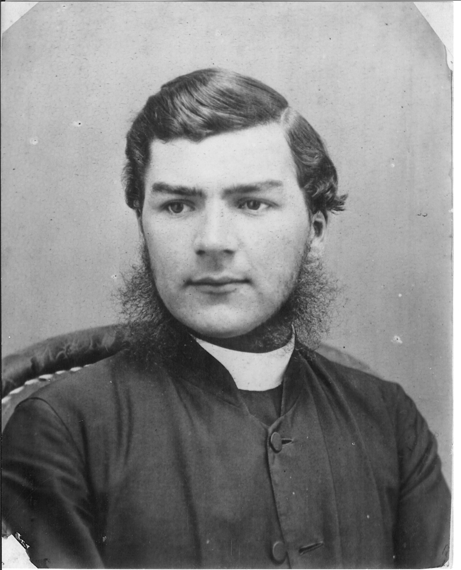
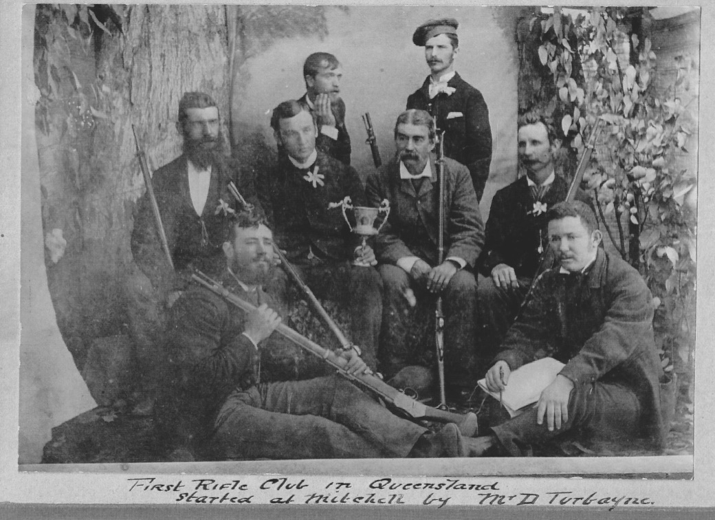
Look at David, forty-two years old and dapper, with fine whiskers, and holding his prized rifle. The following year, he was to begin one of Queensland’s earliest rifle clubs, the Maranoa Rifle Club.

Maranoa Rifle Club. David Turbayne is in middle row, third from the left

Janet is eight years younger than David, thirty-four when this photo was taken. She has already given birth to five children and will have four more by the time she is forty. Her expression, as far as we can see it, is enigmatic. She is dressed nicely in a skirt and jacket with a pleated flounce.

Standing behind the family are an Aboriginal man and young girl, the girl dressed as a domestic servant and the man in outdoor clothing. I hope that including the servants in the photo is an indication that, in spite of the all-pervasive racism among white people in this time and place, there is affection here, or at least respect. David Turbayne was interested enough in local Indigenous matters to make a collection of words in the local Bigambul language, which has now largely disappeared. That list is now housed in Canberra, as part of the collection of the Australian Institute of Aboriginal and Torres Strait Islander Studies (AIATSIS).

A plaque marks the site of Wallumbilla Station Photo: Nadine Schofield

Several years ago, my cousin Nadine Schofield, also a descendant of Janet and David and their daughter Isabel, created a Turbayne Family Facebook page (now closed). It was through this page that another Isabelle made contact.

This Isabelle is descended from a William (Billy) Turbane, born in Wallumbilla around 1871. Billy’s mother, Nellie, was Aboriginal, and his death certificate states that his father was Dick Tobane (Bank Manager).

David Turbayne later became a bank manager.

Was my great-great-grandfather David having relations with a local woman, who gave birth to a son? Or was Billy given the name of the station manager, a common practice at the time?

Isabelle, Nadine and I have all had DNA tests to follow up this interesting, typically Queensland story, and the results have proved that we’re not related. I’m disappointed. Many more of us Queenslanders, of all backgrounds, are linked by blood than we’ll ever know.

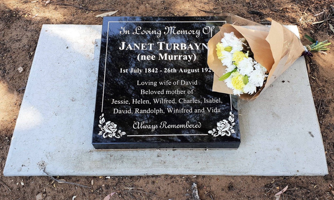
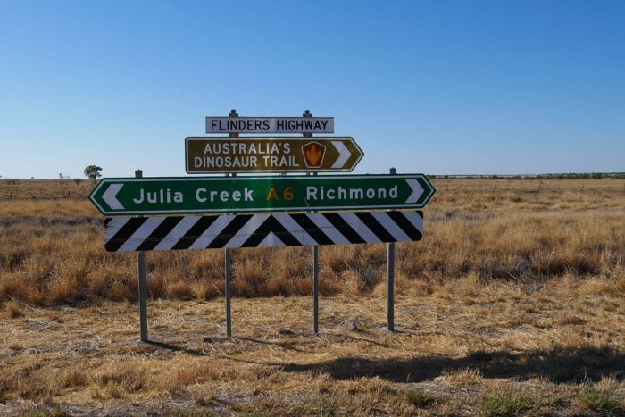
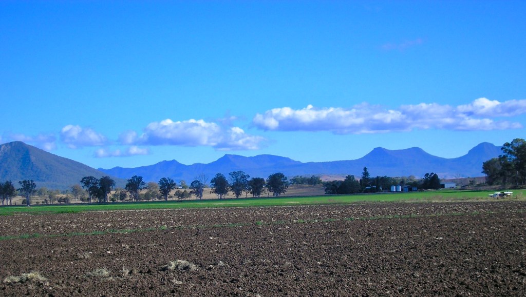
Janet and David Turbayne were both born in Scotland, a long way from Wallumbilla Station, forty-five kilometres east of Roma. They lived in many parts of Queensland, from Cardwell in the north to Sandgate in the south. David succumbed to cancer aged just fifty-six, but Janet lived to a grand age, dying in 1929. Perhaps all her life she missed the mists and snows and romantic highlands of Scotland; but she was buried in the flat, hard, dry soil of Roma.

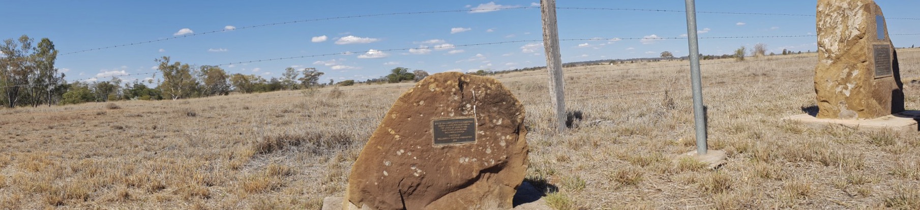
Nadine, a great sleuth of family history, discovered through her research that Janet’s grave had no headstone. Why she, mother of nine, was buried in an unmarked grave we’ll never know. But it is unmarked no longer.

In 2019, ninety years after Janet’s death, Nadine arranged for a headstone to be installed on our great-great-grandmother’s grave. We went out to Roma, a small group of her descendants, to that barren, drought-stricken cemetery, to honour her there with a quiet family ceremony, and flowers.

At Roma Cemetery, 2019

History on the Map

There was a young maid from Dungowrin

Who fondly recalled her deflowerin’.

“Gee it was beaut, in the back of Bob’s ute!”

But her sister preferred it while showerin’.

A few years ago, The West Australian ran a competition for limericks using local place names. This was Con’s favourite, and the competition winner.

Western Australia has lots of place names that end in “in” and “up”: Balingup, Dwellingup; Mukinbudin, Burracoppin. I think Dungowrin was a made-up one, though. Poetic license.

Queensland has wonderful Indigenous place names, too: Pimpimbudgie, Eubenangee, Dirranbandi, Bli Bli. The only place names unique to Australia are Indigenous names. They are both beautiful and inspirational.

fullsizeoutput_34b3
Eubenangee Swamp, north of Innisfail

Perhaps Henry Lawson’s poetic use of language was influenced by a childhood spent near Wattamondara and the Weddin Mountains. Dorothea McKellar was inspired by the country around Gunnedah, Narrabri and Coonabarabran when, homesick in England, she wrote the iconic poem, “My Country”.

English names like Cambridge and Oxford have literal roots, both being river crossing places. Aboriginal place names do too, of course. Sometimes their meaning has been lost, at least to people with non-Indigenous backgrounds like me, and they are just beautiful-sounding words; but I learned as a child on the Sunshine Coast that Nambour referred to the red-flowering bottlebrush that grows along local creeks, and Maroochydore means place of black swans.

cof
Bottlebrush Callistemon

As Europeans spread across the country, ancient names from Indigenous mythology were sometimes replaced with names from European mythologies, like Lethe Brook, south of Proserpine, where Con and I were held up by floodwaters in 1974.  The creek was named after a river in Hades, the town after Persephone, abducted by Hades and taken to live in the Underworld.

Many Queensland sheep stations and towns were given English, Scottish or Irish names: Stonehenge, Hyde Park, Lochiel, Doncaster. Killarney, Connemara. These names seem totally inappropriate when you look at the countryside. Like the town of Richmond, west of Townsville.

Wherever the British colonized, they established places called Richmond: New Zealand, Canada, Jamaica; at least six places in the United States, and six in Australia. Of all of them, Richmond in Queensland is perhaps least like the town of Richmond in England, the treasured ancient town on the Thames, home of Plantagenet kings, with a Green that once held jousting competitions. Soft green grass, a sprawling park with deer and ancient oak trees. An oak can be measured by how many people it takes to reach around its trunk: one hundred years per person.

fullsizeoutput_3556
Measuring an oak tree in Richmond Park, U.K.

England’s Richmond is about as far as the imagination can stretch from the dinosaur bones, galahs and donga motels of Queensland’s Richmond. But our Richmond has sprawling plains and vast, starry skies. Its population has to be tough, to cope with droughts, isolation, and appalling floods.


names richmond road sign
Plains west of Richmond, Qld


The British themselves had a history of invasion. They had been conquered by the Romans, and then Angles, Saxons and Jutes from northern Europe. Next, the Vikings. In 1066, the invading Normans under William the Conqueror defeated the Saxon/English King Harold. The Normans took over the country, stripped land from the locals and distributed it to their own people, and imposed their own language, social systems and government.

The English in turn invaded Ireland, allotting estates to their own people, renaming the landscape and imposing their religion. In battle after bloody battle, they also forced their government on the Scots.

I wonder if all this bloody history entered the thoughts of the English, Irish and Scots who invaded Aboriginal lands, took the country for their flocks, killed Indigenous people almost at will, and put their names on the landscape of Australia. They must surely have been aware of the irony.

Occupation of the land by Europeans was often accompanied by violence. The Aboriginal inhabitants suffered by far the greatest losses, and across Australia there are place names indicating this: Skeleton Creek, Murdering Gully, Battle Mountain, and The Leap, just north of Mackay, where it is said an Aboriginal woman, chased by the Native Mounted Police, jumped to her death with her child in her arms.

names the leap mackay
The Leap, Mackay

You can see our history written on the map, in place names; but some of those names need changing, and gradually that’s happening.

Two mountains near Rockhampton have been renamed. Mount Wheeler, probably named after the notorious, murderous Lieutenant Wheeler who ran the Native Police when white people were moving into this area, has been officially renamed Gai-i (pronounced guy-ee), its name in the local Darumbal language. And Mount Jim Crow, with a name loaded with over a century of racist connotations here and overseas, is now officially known as Baga.

South of Home Hill, Yellow Gin Creek, according to the Northern Land Council’s website, runs through a region of creeks, wetlands and coastline, traditionally an important food-gathering area for the local Juru people. Its road sign has always always a reminder to me of bad days not so very long ago when talking about Indigenous Australians in racist terms was a social norm.

Now, that place name has been reclaimed and adapted by the Juru people. When a new bridge over the creek was completed, it was given a new sign. Youngoorah, which means ‘women” in the local language. Beautiful.

names yellow gin creek
Image: from the Northern Land Council website

Our history is written in the place names on the map, for those who want to see it.

It is a history both good and bad.

It goes back a lot further than two hundred years.

And there could be lots of limericks from Queensland place names, even if they don’t end in “in” or “up”.

There once was a young man from Bli Bli…

Major Mitchelling

IMAG4045
Wisteria arbour, Mitchell

St George to Mitchell is 210 kilometres. My cousin Nadine is driving, and she stays close to the 110kph speed limit, eating up the distance.

It’s a lonely road. At the service station in St George they’d warned us to keep an eye out for animals: kangaroos and cattle, emus and wild pigs. A big kangaroo leaps across the road ahead of us, but Nadine is alert, and feathers her foot on the brake. They say you should never swerve to miss a kangaroo, or brake violently, because you’ll lose control of the car and roll or hit a tree. Hitting a kangaroo is less likely to injure you than swerving, although it won’t be much good for the kangaroo.

“Dad used to call this kind of trip Major Mitchelling,” I tell Nadine. My family spent a lot of time on country roads, and Dad especially loved travelling through unknown territory.

I remember Major-General Sir Thomas Mitchell from primary school social studies lessons. In the 1840s, he led an exploration party up this way – hence the name of the town we’re heading for. At school we used to trace maps of Australia, marking with dotted lines the journeys of the European explorers. Major Mitchell was one of the big ones. He was a rugged and determined traveller, notoriously bad-tempered, and a great mapmaker.

A soldier and draughtsman, Thomas Mitchell was involved in fighting in Spain, fought at the battle of Waterloo, then after the defeat of Napoleon worked at doing sketches of the European battlefields. In 1827 he came to Australia to succeed John Oxley as Surveyor-General.

The colonial government was keen to discover grazing lands and rivers, and to “open up” the country. Between 1831 and 1835 Major Mitchell and the men who went with him, including convicts and Aboriginal guides, ranged from the Barwon River in what is now northern New South Wales to the southern Victorian coast.

Mitchell_(Thomas)_exploration_map.svg
Mitchell’s expeditions (Wikipedia)

Mitchell’s exploration parties were resented by the Aboriginal people whose land he was intent on opening up. They knew what happened once white people came to stay: streams polluted by cattle hooves and wool washing; sacred places destroyed; women raped and abused; disease and alcohol, and mass shooting if anyone fought back.

It wasn’t until recent times that such events were even mentioned; but Mitchell wrote in his journal about “treacherous savages”. Treachery depends on who writes the history. The resistance fighters of Nazi-occupied Europe, who did whatever they could to trick, ambush and destroy the invader, are not described in our histories as treacherous.

Mitchell was exploring for the government, to map and survey the land and make it available for grazing and white settlement. Wealthy and powerful pastoral companies were keen to exploit the vast inland plains; and strong in the colonial mind after Captain Cook’s voyage of discovery in 1770 was the idea that Australia was a land that belonged to no one. Terra Nulius.

They were tough, those explorers. Nadine and I are driving this mildly-lonely stretch in a modern, air-conditioned car, on a sealed road, in spring. Those men were travelling through dry, hostile territory, in extremes of weather and distance, eating miserable food and drinking dodgy water, dependent on the health of their horses if they were to return to civilization, and always watched and often harried by angry locals. No wonder Mitchell was bad-tempered.

In late 1846, Mitchell led an expedition into what is now Queensland, looking for rivers. He named the Balonne River after a local indigenous word, and followed it northwards, naming the site of St George. The Balonne meets the Maranoa River, and Mitchell’s party followed it further north.

IMAG4061
Maranoa River at Mitchell

We’re following the Maranoa today, over to our right, not far away. All we see, though, is flat, monotonous eucalypt bushland along the road verges, with cleared, grassy paddocks beyond. The grass is mainly what became known as Mitchell grass, astrebla pectinate, one of the premier grazing grasses of inland Australia.

 Occasionally a dirt track, flanked by a mailbox and a station name, leads off through the trees.

“Look!” says Nadine, pointing off to the right. “I don’t believe it!”

There, alongside a track leading off into the trees, is a sign saying “Coffee Shop”.

There is a story to be found there. But it’s getting late.

By five o’clock, we’ve checked in to a motel. The receptionist suggests the Mitchell Hotel for dinner.

“We thought we’d go across the road to the Courthouse Hotel. I liked it last time I was here.”

“You’d be better off at the Mitchell. I’ve had bad reports of the Courthouse.”

One of the features of Mitchell is the Great Artesian Spa, and that’s where I go, for a swim before dark. Sheltered from the road by coloured glass and greenery are two pools. I dip into the cold pool and soak in the hot one, where warm bore water gushes from a pipe and steam rises from the water.

IMG_3022
Family enjoying the Great Artesian Spa, Mitchell

“Where do you suggest we go to eat?” I ask the ladies in the spa shop. “I thought we might go to the Mitchell Hotel.”

“Go to the Courthouse. Better atmosphere there.”

fullsizeoutput_4356
Courthouse Hotel, morning, Mitchell

Dinner, at the Courthouse, is a friendly, cosy affair, and afterwards we cross the Main Street to the Mitchell Hotel for a drink. Nadine orders Kahlua and milk, which causes a bit of a stir, with milk having to be fetched from the kitchen. We strike up a conversation with a couple of blokes in the bar, and before we leave, we each put ten dollars through the pokies.

Mitchell is a quaint country town, with attractive old timber buildings, art works, bottle trees and a wisteria arbour.

Major Mitchell camped by the river near here, then continued far to the north, eventually turning back only when he reached the Belyando River, a tributary of the Burdekin.

Tomorrow Nadine and I will head west, across the Mitchell grass plains.

fullsizeoutput_4357
West of Mitchell

Walking to Warwick


The steamer left Brisbane for Ipswich on a Monday morning in September. The “Ipswich” was a side-wheeler with a rudder at each end, and a shallow draft for navigating difficult areas such as Seventeen Mile Rocks and the shoals of the Bremer River.

fullsizeoutput_3327
The “Ipswich”. Photo from the John Oxley Library collection, SLQ


Paddlewheels splashing rhythmically and smoke pouring from the tall funnel, the steamer made its way upstream, following the slow bends of the Brisbane River, past thickly-wooded, vine-draped banks that would one day become the suburbs of St Lucia, Chelmer and Fig Tree Pocket.

James Matthews probably stood on deck with a mug of coffee, watching the passing scenery and talking to his new boss, Benjamin Glennie.

It was 1861, and the newly-independent state of Queensland was actively seeking English migrants. James, my great-great-grandfather, was one of them. Aged twenty-three and ordained only yesterday, he had come to Queensland to work in Warwick as a curate.

young james matthews
James Matthews

For years Archdeacon Benjamin Glennie, now the rector of Warwick, had been the only Church of England clergyman on the Darling Downs. The eccentric Glennie loathed riding, so his travels around his huge parish were mostly done on foot, and this is how he and James would be travelling from Ipswich to Warwick. On foot.

Forty years later, in memory of Archdeacon Glennie, James described the trip in detail.[1]

On Monday morning, we started on our journey to Warwick, travelling to Ipswich in the steamer of the same name. The voyage occupied five hours.

The next morning the real work of our journey began. The Archdeacon’s old black horse was brought round and packed with a couple of valises and a pair of large saddle bags, consisting largely of my belongings, and off we trudged, the Archdeacon leading his horse.

That day they walked south for twenty kilometres, down the present-day Ipswich-Boonah Road. The two men would have encountered bullock teams dragging wool from the sheep stations, travellers on horseback and on foot, and the occasional buggy. Many would have recognised Benjamin Glennie. Perhaps they offered them a ride.

They spent that night with squatter William Watkins at Peak Mountain Station, near present-day Peak Crossing, its homestead set on a rise with a spectacular view towards Flinders Peak.

OLYMPUS DIGITAL CAMERA
Peak Station today

The following day we walked as far as Balbi’s, an accommodation house at the foot of the Range. 

All that Wednesday, covering over thirty kilometres over flat land and gentle hills, they would have seen ahead of them, through the trees, glimpses of blue mountain ranges.

In 1861 there were Aboriginal people living in this area – probably Ugarapul people. The two men must have met them on the road, but James left no mention of it.

Ironically, most of the roads walked by Benjamin Glennie and James Matthews would have been based on ancient trails of the Indigenous people who had been walking this country side for many thousands of years.

OLYMPUS DIGITAL CAMERA
Towards Cunninghams Gap


The two travellers spent that night in Balbi’s Inn, at the bottom of the range, beside the road to Spicer’s Gap. I’ve driven up that rough, gravel road myself, to sit at Governor’s Chair Lookout and enjoy its fine views east towards Brisbane and the coast.

On Thursday we crossed the Range, going through Cunningham’s Gap. There had been a heavy thunderstorm, the mountain streams were swollen, and we had to “double-bank” to get over. The Archdeacon got into the saddle and I jumped up behind.   

Wheeled traffic went over Spicer’s Gap, but riders and foot-travellers often took the bridle trail through Cunningham’s Gap. It would have been a tough journey up hill, but Benjamin Glennie was fit – according to James’s account he would vault a fence rather than stoop to go under it – and James was young. Looming cliffs and tall trees, the sound of bellbirds and whipbirds, cool air smelling of the rainforest: today they are still exhilarating, even though the way up the range is now a harsh slash through the forest, made noisy by semitrailers.

martens_cunninggap
“Forest, Cunningham’s Gap” Conrad Martens, 1856. Watercolour. QAG collection

From the top of the Range, they followed Gap Creek west to William Jubb’s Inn, a low building overlooking the stream. These days, a farmhouse occupies the old inn site beside the Cunningham Highway.

On crossing the last creek, I fell off into the water. Fortunately I had not far to walk to the inn, where Jubb rigged me out in a suit of his clothes while mine were being dried. He was a much bigger man than me. There was no one near with a camera, I am thankful to say.

OLYMPUS DIGITAL CAMERA
The site of Jubb’s Inn, above Gap Creek. Cunninghams Gap in the background

On Friday we lunched with Arnold Wienholt at his station Maryvale, in the afternoon proceeding onward to Glengallan, where we were put up for the night by that prince of squatters, John Deuchar.

All the land between Ipswich and Warwick was held by just six or seven squatters, members of the colony’s aristocracy. The Deuchars of Glengallan Station were famous for lavish hospitality in the sprawling cedar house where the two travellers spent that night. A few years later a new homestead was built, the elegant, now restored mansion visible from the highway.

After breakfast on Saturday morning we wended our way to Warwick, where we arrived in time for midday dinner, taking care to walk through the principal streets of the town so as to announce that the parsons had arrived and there would be church tomorrow.

Perhaps one day that walk to Warwick by Benjamin Glennie and James Matthews will be recreated. They were walking for a spiritual purpose, so it would be a kind of Queensland “Camino”, like the pilgrims’ pathways through Europe and Spain that are now so hugely popular. Great walks exist in Queensland, too, along ancient Indigenous pathways. We should pay more attention to them. Although they don’t pass through quaint medieval towns, they are just as old. The bridle trail through the forests of Cunningham’s Gap was probably one of them.

James Matthews married a Warwick girl named Mary Margetts. According to a family story he met her on the Spicers Gap road, a year or so after his long walk, when Mary’s hat blew away, and James caught it.

People journey, and people love. Some things will never change.

OLYMPUS DIGITAL CAMERA
Rose on the old trail along Gap Creek


[1]Excerpts from “A Few Personal Reminiscences of the Late Archdeacon Glennie” printed in “The Church Chronicle”, June 1, 1900.

Blog at WordPress.com.

Up ↑