Want to Buy a Country Pub?

O’Mahony’s Hotel, Warwick

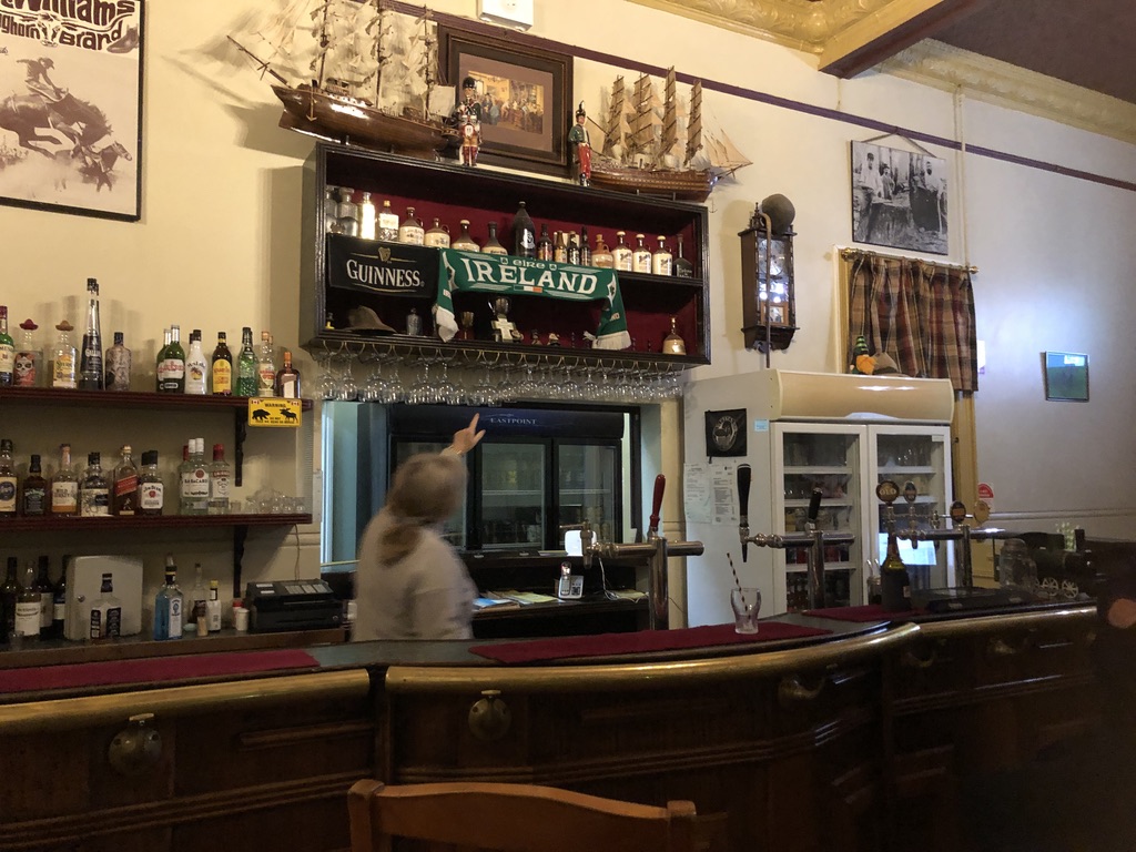
‘There was an Irish tradition that if you were building a hotel, you had to bury under it a hat, a cat and a bottle. Well, when we were renovating we found a hat and a bottle, and there they are.”

Joan pours me a gin and tonic and points to a battered felt hat on a shelf above the bar. Next to it is an old bottle.

“We never found the cat, though. I hope we don’t.

“Along there you can see my father’s walking stick, and the cap he wore when he was racing trotters.”

Joan Wallace in the bar of O’Mahony’s

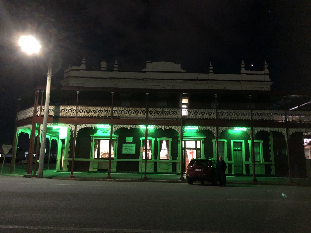
I’d driven years ago past this attractive old Warwick hotel with its red brick and iron lace and been sorry to see it in a rundown condition. Originally the National Hotel, built in 1907 and Heritage Listed, O’Mahony’s is located at the eastern end of Grafton Street, Warwick, opposite the railway station. It had in the past been patronised by train travellers and railway workers, but those days are almost gone.

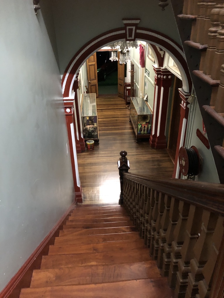
Joan Wallace is the licensee and current owner of O’Mahony’s, with her brother Kevin. She tells me that they bought it in 2001 and they’ve been renovating it ever since, sourcing material and furnishings from near and far. The handsome timber bar came from the Ship Inn in South Brisbane, and the comfortable-looking lounge suite in the lounge originated in a monastery, she tells me. There are high pressed metal ceilings throughout, chandeliers, and a magnificent cedar staircase.

Looking down the main staircase at O’Mahony’s

“We have thirty-four bedrooms, and sometimes we fill them all,” Joan says. “And we’re listed on Airbnb.”

When I was young, living in a large country town, hotels were smelly places to walk past, with a bad reputation. My father, a temperate drinker, didn’t go into public bars except on ANZAC Day. The rest of the year he would buy the occasional bottle of wine or beer at the side door.  Now, after many years living and travelling through rural Queensland, I’ve learned to appreciate country pubs, whether magnificent buildings like O’Mahony’s or small, single-storied structures that have been the social centres of isolated communities for well over a century. They are places for travellers to stay and rest, places for locals to gather and relax and do business. I’ve often thought that for a family, perhaps with two or three generations together, a country pub would be a fine business to run, even providing a home.

When you stay in a country hotel it feels like home. It might be slightly daggy, but you have the run of the place: lounge and verandahs, breakfast room, bar. These old places all have stories; but as they age, and demographics shift, and times change, some of them become neglected and no longer viable.

Then, sometimes, the right people come along, people who are prepared to take them on and keep that tradition of hospitality going in the face of changing times; and not only magnificent places like O’Mahony’s.

Across Queensland there are many humbler hotels in tiny, isolated towns that provide the only meeting place for kilometres around. Road trippers love old country pubs, with their quirky bush décor of bush hats and branding irons and an atmosphere of yarns and larrikins; but they’re tricky businesses to run, what with pandemics and decreasing local populations, with insurance and regulations, transport costs and staff shortages, maintenance of old buildings and the eternal issues involved with dealing with customers and alcohol.

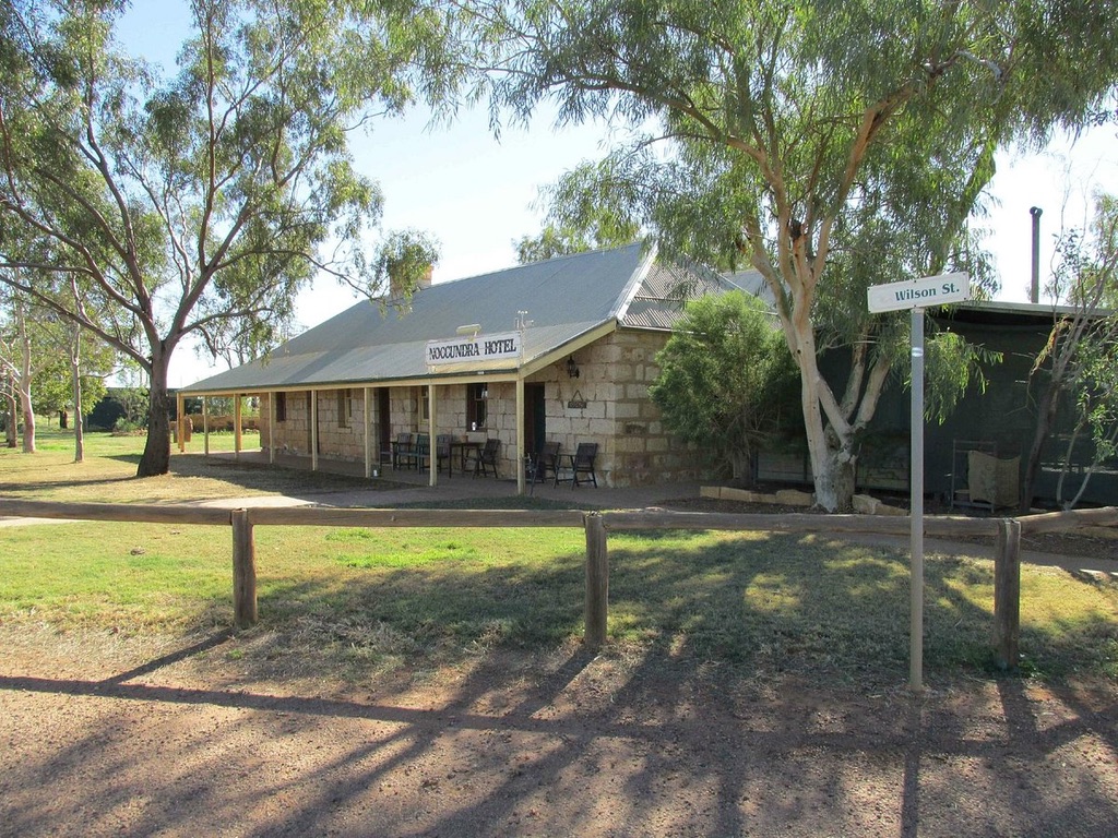
Hotels in tiny towns might sell groceries and fuel, provide campgrounds, run the local Post Office, maintain the local public toilets and run a Centrelink Agency. It sometimes seems as if liquor sales are incidental to everything else that goes on. The Heritage Listed Noccundra Hotel, along a gravel road in the Channel Country , 13 hours’ drive west of Brisbane, is like that.

Noccundra Hotel Photo: tripadvisor.com.au

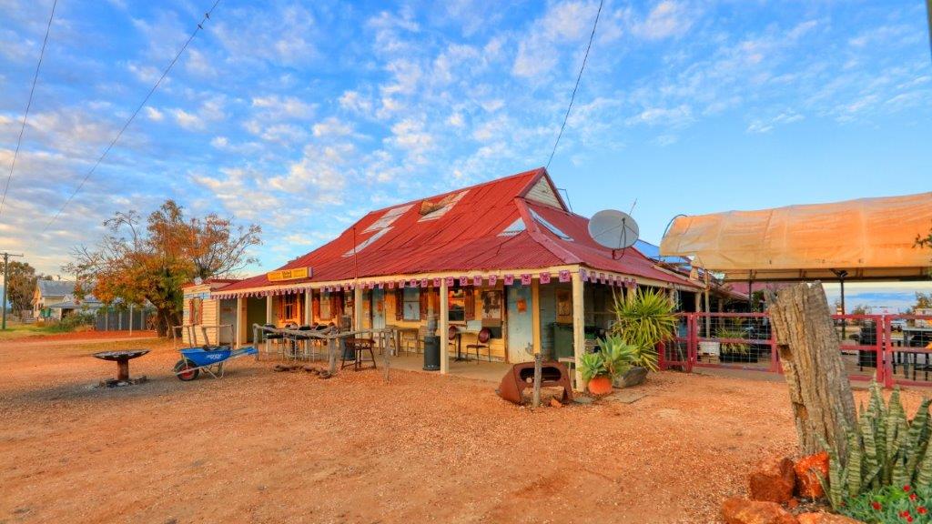
In Hebel, a local rescued the pub for the sake of the community. Hebel is a tiny town in south-western Queensland, on the Castlereagh Highway just north of the NSW border. When it looked as if the Hebel Hotel was going to close, because of drought, floods, farm closures, isolation and COVID, a local businessman farmer named Frank Deshon and his family bought it, along with the General Store, because they knew the community needed it.

Hebel Hotel Photo: hebelhotel.com.au

Heather Ewart on ABC’s Backroads went there: https://www.youtube.com/watch?v=rb5p3wtKPC4

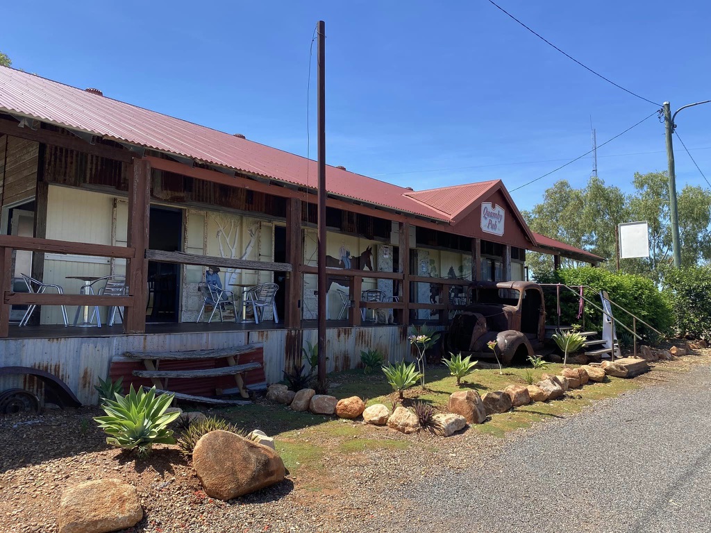
It’s not only locals who come to the rescue of dying bush hotels. Take the Quamby Pub.  Around fifty kilometres north of Cloncurry on the long and lonely road to Normanton, there’s not much happening in Quamby, except once a year for the rodeo. The small town died as roads improved and the local cattle and mining industries changed.

Ten years ago the old hotel was abandoned to the white ants, but in 2021 it was spotted by travelling Gold Coast friends. It was for sale, and they bought it, and rebuilt it for present day customers.

The photos on the Quamby Pub Facebook page document the arduous restoration process they went through, with the help of friends, locals, and even passing travellers. https://www.facebook.com/quambypub

Now the Quamby Pub is open once more, with food and drink, a big new covered deck out the back, camp sites, and even a pool.

Judging by the response of locals and travellers it’s hard to imagine that the Quamby Pub will be closing down again. https://www.abc.net.au/news/2023-04-19/historic-quamby-pub-restored-by-gold-coast-tourists/102235284

Now, after all their devoted work, Joan and Kevin Wallace’s fine old Warwick hotel is on the market too. O’Mahony’s is up for auction, Joan tells me, and because of its iconic status locally, the sale has been the subject of news reports:  https://www.facebook.com/watch/?v=1635605283142106

The auction will take place on 19 July, 2023: just a couple of weeks from now. Want to buy a pub?

Captain Logan and Queen’s Wharf

“The settlement,” Cowper had told Clunie on the Isabella, “is mostly on one point of land. Penis-shaped, we shall say, backed by a high ridge we shall call the Line of Bollocks.”[1]

Jessica Anderson wrote a wise and interesting novel of convict Brisbane, “The Commandant”, published in 1975. It includes this pungent description of the site of the Moreton Bay Convict Station, in the words of the notoriously bitter, badly-behaved drunk, Henry Cowper, the convict station’s first medical officer. The site of the Moreton Bay Convict Settlement, established in 1826, runs along the ridge where William and George Streets run now.

Queensland’s government buildings still occupy this “penis-shaped” piece of high ground along the river.  

Henry Cowper was the medical officer for the Settlement from 1826 to 1832. He worked in primitive conditions in this isolated, under-funded and under-supplied outpost of the British Empire. Captain Patrick Logan was the commandant.

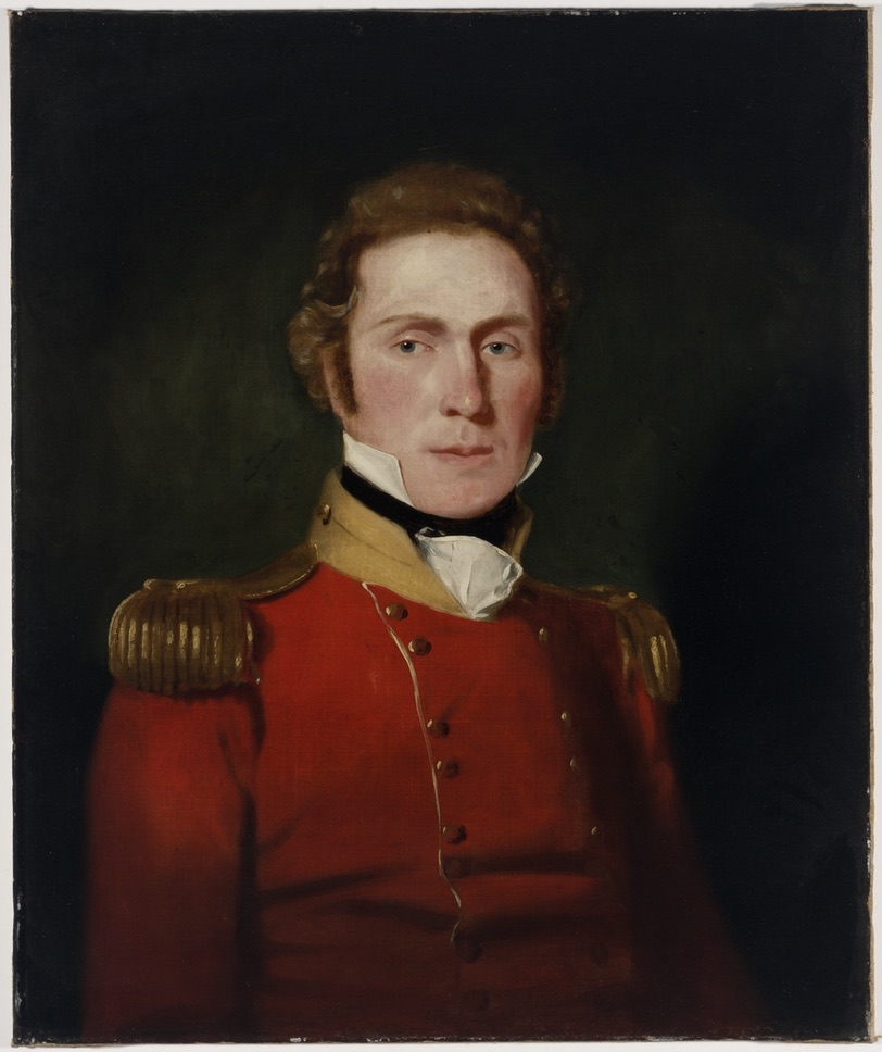
Captain Patrick Logan, 57th Foot Regiment, Commandant of Moreton Bay Convict Station 1826-1830 State Library of New South Wales

Jessica Anderson’s excellent novel was thoroughly researched, and conditions in the settlement, and many of the characters, are based on records of the time. The novel culminates in the sombre discovery and retrieval of the body of Captain Logan.
Captain Patrick Logan of the 57th Foot Regiment, a veteran of the Peninsula War against Napoleon, was commandant of the settlement from 1826 until his murder in 1830 at the age of just thirty-nine.

Many men who came to Australia in the early years of European occupation, to supervise convict stations and run governments, were veterans of the European wars of the early nineteenth century. Violence and flogging were not new to them. Logan was a notoriously harsh disciplinarian who followed the rules without mercy. The floggings Logan ordered for convicts would have provided Cowper with a stream of grievously injured patients.

Constant complaints about the treatment of Moreton Bay convicts were made to the government in Sydney. The famous old song “Moreton Bay” has a convict describe it:  

For three long years I was beastly treated 
And heavy irons on my legs I wore
My back from flogging was lacerated
And oft times painted with my crimson gore
And many a man from downright starvation
Lies mouldering now underneath the clay
And Captain Logan he had us mangled
All at the triangles of Moreton Bay

Like the Egyptians and ancient Hebrews
We were oppressed under Logan’s yoke
Till a native black lying there in ambush
Did deal this tyrant his mortal stroke
My fellow prisoners be exhilarated
That all such monsters such a death may find
And when from bondage we are liberated
Our former sufferings will fade from mind[2]

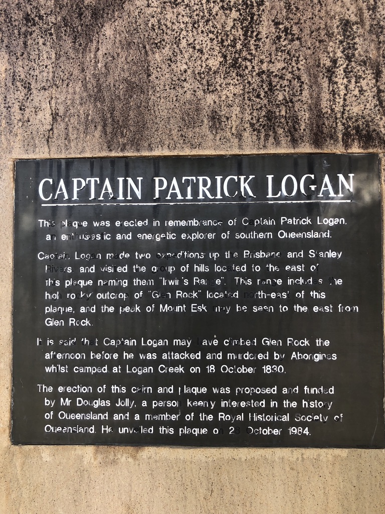
In Esk, in the Brisbane Valley, the Memorial Park has shady trees and picnic tables. We stopped there for lunch one day. Sandwich in hand, I wandered around the park, and found a rock with a plaque attached. The plaque describes Patrick Logan as “an enthusiastic and energetic explorer of Southern Queensland’, and provides the information that it was near here, on 18 October 1830, on his last exploratory trip before his term as commandant was over, that he was killed by an Aboriginal group.

Plaque on the monument in Esk Memorial Park

It may be true that escaped convicts were also involved in Logan’s murder; but there is always going to be violence when one group invades another’s traditional homelands and takes them for their own.

Patrick Logan made frequent exploratory expeditions and is credited with many “discoveries” in south-east Queensland. His name is on lookouts at Rathdowney and Mount French in the Scenic Rim. He is credited with discovering the Logan River, Dugulumbah to Yugumbeh people who had known it for thousands of years. Logan Road, the City of Logan, and many other plaques, streets and suburbs carry his name.

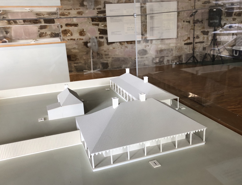
During Logan’s time as commandant, the first permanent buildings in what was to become Brisbane were erected. Two of them still stand: the windmill up on Wickham Terrace (on Cowper’s “Line of Bollocks”, in fact) and the Commissariat Store in William Street, the oldest inhabited building in Brisbane. The Commissariat Store building is now the Convict Museum and the headquarters of the Royal Historical Society of Queensland, and on its lower floor can be seen models of the Convict Station the way it looked at the time of Logan’s death.

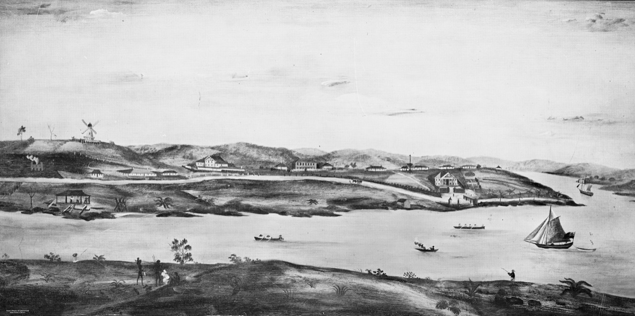
The Commissariat Store, in its original two story form, can be seen above the wharf towards the end of the point of land. The Commandant’s house is the last one on the right above the Store. The wharf was not called “Queen’s Wharf” in those days. George IV had recently died, and William IV was king. Queen Victoria did not gain the English throne until 1837. “Image of early Brisbane Town in convict days, ca. 1831. From a painting by Cedric Fowler.” collections.slq.gov.au

These include a model of the Commandant’s house, with a verandah in front.

Model of the Commandant’s house, in the Convict Museum, William Street, Brisbane

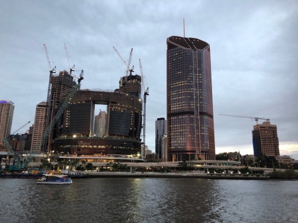
A museum volunteer tells me that the house, which features in Jessica Anderson’s novel, looked across William Street to the river, near the site where huge casino and hotel buildings are currently rising: the Queen’s Wharf Development Project.

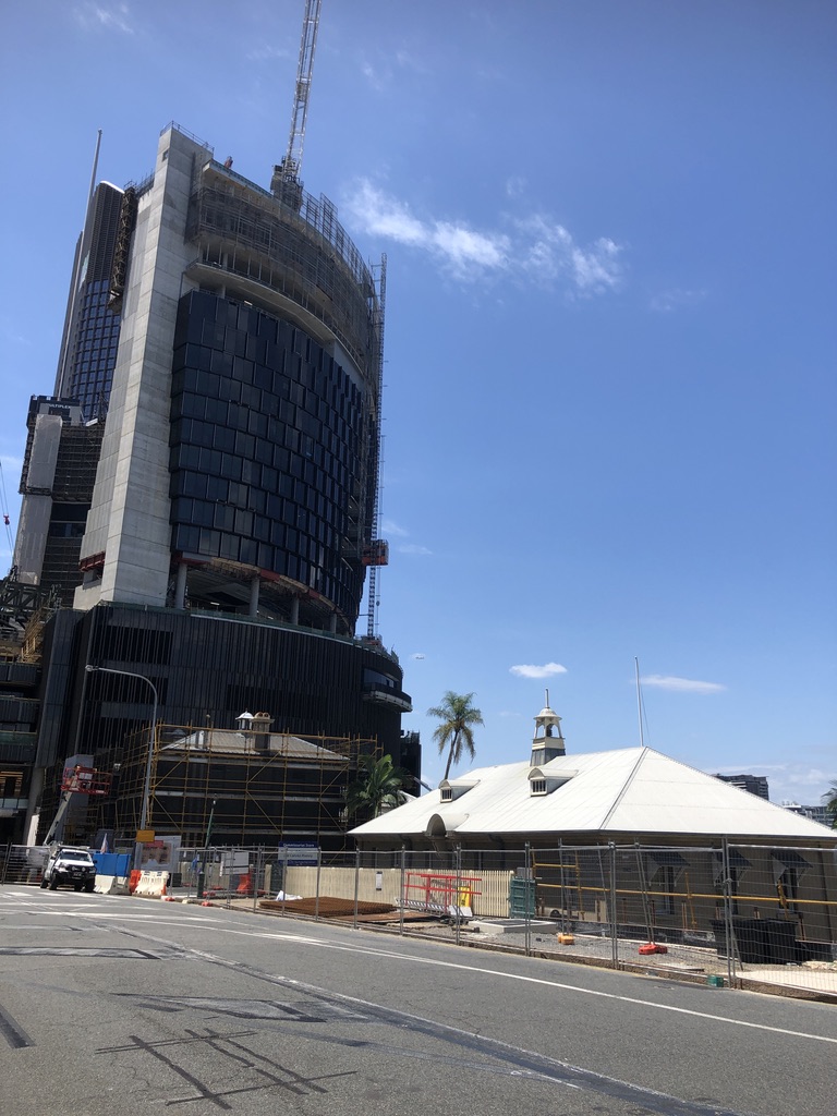
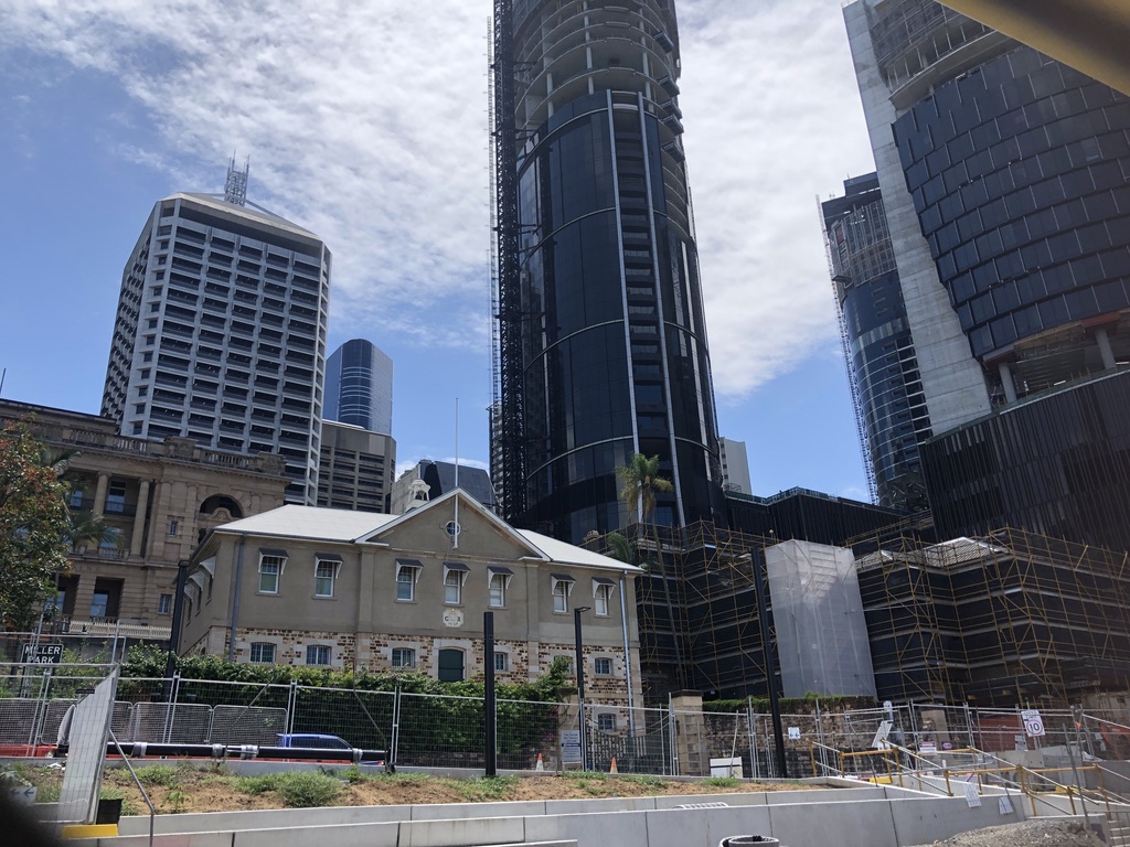
The roof and top floor of the Commissariat Store, now headquarters of the Royal Historical Society of Queensland, William Street. Queen’s Wharf Development site in the background

According to the website, the finished Queen’s Wharf development will include a Sky Deck 100 metres above William Street, and fifty restaurants, bars and cafes.

This whole area is a massive construction site; and in the midst of it sits, incongruously, the Commissariat Store.

Commissariat Store in the midst of construction site

I’m told the developers wanted to take over the convict-built Commissariat Store. It would have made a fine site for a restaurant and bar, this old stone building opening out on to the riverbank. But somehow the RHSQ managed to keep it.

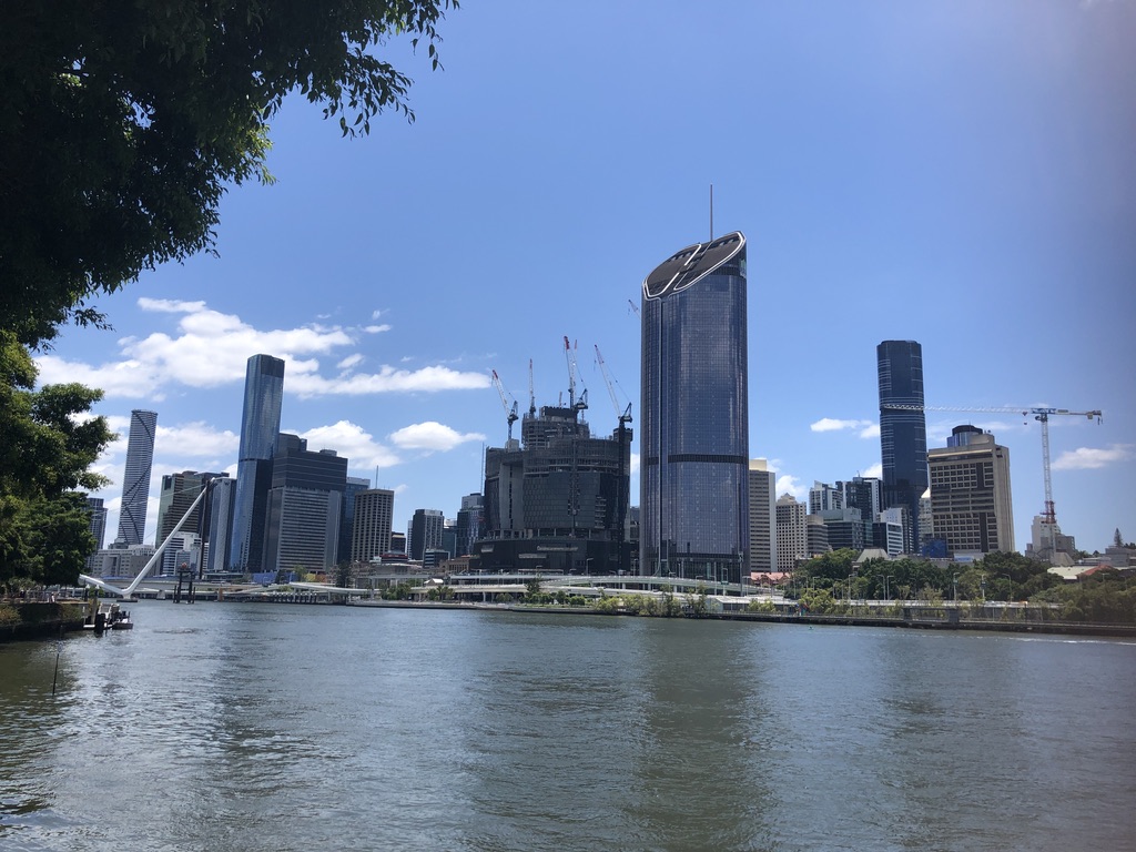
The white peaked roof of the Commissariat Store can just be seen behind the freeway overpass. The Commandant’s house would have been behind the building with the cranes

Other historical buildings within the William and George Street precinct are being protected and preserved, but it’s difficult now to imagine the environment of simple wooden buildings, dirt pathways and gardens that occupied this stretch of land two hundred years ago.

Today there’s a huge, powerful white snake rearing out of the Brisbane River, looking as if it’s about to strike.

Neville Bonner Bridge under construction

It’s the new Neville Bonner Bridge, startling in its design but destined to become a Brisbane icon. The last sections have been craned into place, and soon pedestrians will be able to cross from Southbank Parklands to take part in the promised glories of the new development.

The ridge above the river will never be the same again. Patrick Logan would not recognise it.

It’s to be hoped that enough well-off tourists come to spend their money there to pay for it all.


[1] “The Commandant”, Jessica Anderson. First published 1975. This edition: The Text Publishing Company, Australia. 2012. P. 74.

[2] folkstream.com

Josh Arnold’s Queensland Songs

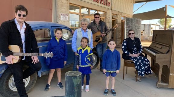
I love stories about Queensland, especially the regions and small towns; and so I was delighted when Josh Arnold was featured in this week’s episode of the ABC’s “Backroads” with Heather Hewitt. They visited Birdsville, Dajarra and Camooweal, little towns in the far west of the state. For each town, Josh has written a song for the local school and filmed the kids singing it.

I’ve been aware of Josh’s school songs for a while now. An award-winning country music singer, songwriter and guitarist, Josh grew up at the small town of Tara, west of Dalby.

Josh Arnold

For over a decade, in collaboration with the University of Southern Queensland in Toowoomba and local councils and groups, Josh has been running a project called Small Town Culture. He visits schools in country towns across Queensland and makes songs with the students.

Josh, a family man and school worker himself, has a gift for getting kids to relax with him and have fun. The children tell him what’s special about their area and the things they like to do. He makes up a song, including their ideas; they learn to sing it, with Josh on guitar. Adults and local musicians get involved, too – especially in a place like Birdsville, where at the time of filming for “Backroads” the school had just three pupils.

At Birdsville, with Heather Ewart and the three pupils enrolled at the school, with the school principal at the piano

A video is filmed, with the kids singing, running, playing, riding dirt bikes, swinging on playgrounds, sliding down sand dunes, cracking whips, on horseback, splashing in creeks; from the green of South East Queensland’s Scenic Rim to the red dirt of Dajarra and Camooweal.

With the Camooweal kids


Josh travels with a camera operator, and the production values of the resulting videos are impressive.

Shared on Youtube and elsewhere, they are beautiful, full of sunset shots and happy people, and always the song. The whole process must be an unforgettable delight to all involved, and a source of pride in tiny, isolated places where people rarely see themselves on film.

Blackall, Wallumbilla, Lowood, the Boyne Valley; Miriam Vale to the Gold Coast, Quinalow to Cunnamulla; Charleville, Warwick, Miles, Rockhampton and more. Josh Arnold has been to some places I’ve never visited myself, such as Cooyar, or Darlington. At Ewan, in the dry country back of Townsville, Josh filmed a song at the Outreach Centre of the Charters Towers School of Distance Education.

Along with his school songs project, Josh records his own music, as you can hear and see for yourself on Youtube or his Facebook page.

Josh Arnold is a musician with a great appreciation of people, places and stories. He has a gift.

NB Photos with this story are taken from Josh Arnold’s Facebook page and abc.net.au

Bundaberg

I’d meant to book a motel in Bundaberg.

Driving from Brisbane and heading for Cairns a year or so ago we turned off the Bruce Highway at Childers to visit some relations in Bundaberg, planning to spend the night in a motel in the centre of the city. After waving goodbye to Con’s cousin I tapped the motel’s name into my phone. The sat nav directed us through the suburbs as I expected it to; but then it sent us north across the Burnett River.

I know the Bundaberg CBD is on the south bank of the river. Just as the CBDs are in those other two major Queensland river cities, Rockhampton and Mackay.

Putting on my glasses I had a closer look at the phone. Distance to the motel: 620 kilometres.

I’d accidentally booked a motel in Mackay.

All the Bundaberg motels had No Vacancy signs, and we ended up driving back to Childers for the night.

On another trip I booked a place in Gayndah when I meant to book one in Gin Gin. There are so many Colonial Motels, Country Comfort Motels, Seaview and Ocean View, Heritage and Midtown Motels across the country, it’s easy to get confused.

That Bundaberg motel mistake happened a few years ago, and last year we took a more leisurely trip north and decided to visit Bundaberg to stay for a few days. I booked a room in the Matilda Motel, making sure it was the one in Bundaberg, not the Matilda Motel in Winton or the one in Dubbo…

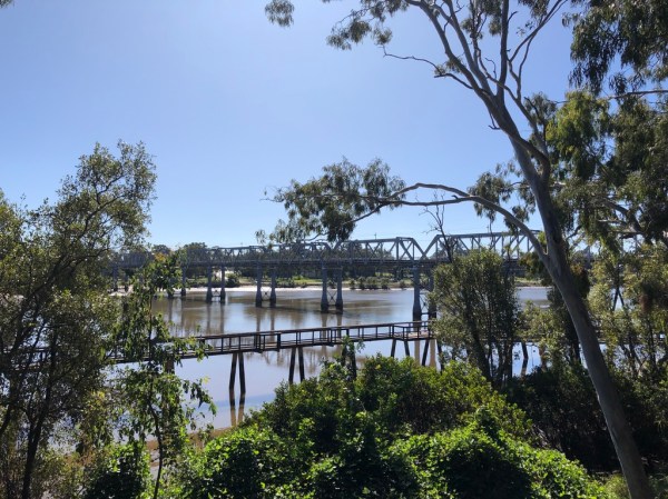
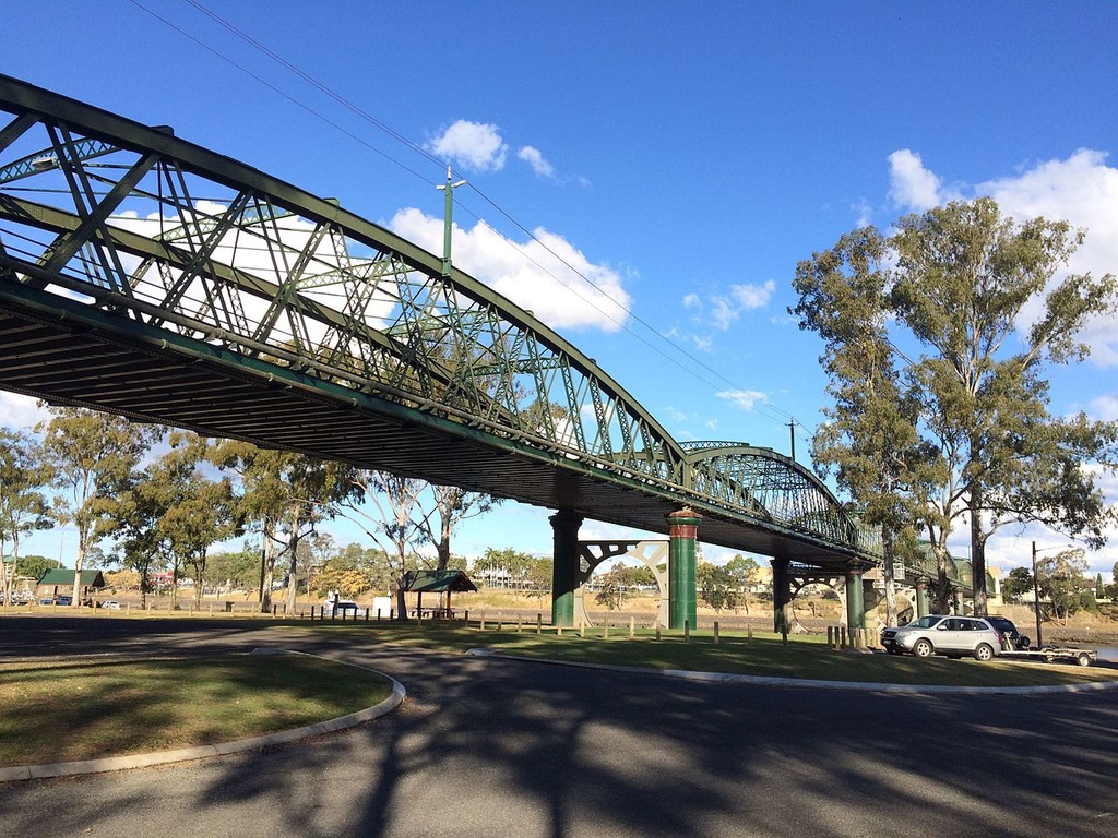
The fine old sugar town of Bundaberg is known for its ginger beer, but it’s Bundaberg Rum the town promotes itself by. Once a thriving port, it has some beautiful civic buildings, banks and hotels, and heritage listed bridges.

Burnett Bridge, Bundaberg, built in 1900, heritage listed Photo: en.wikipedia.org

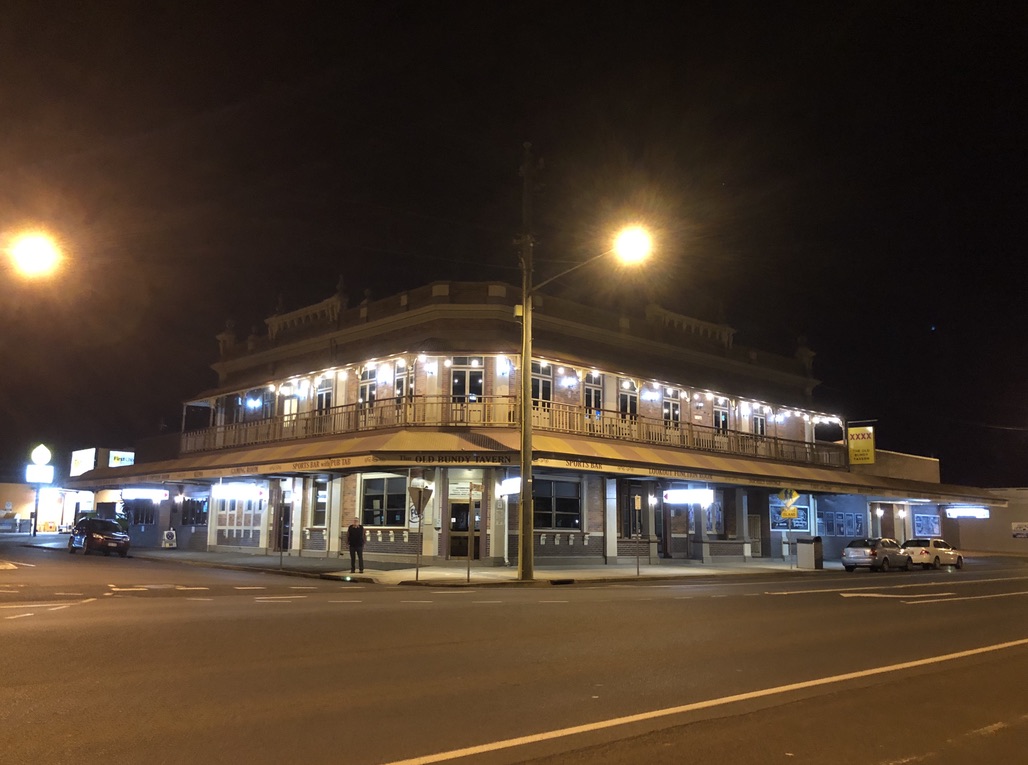
We took in dinner and the Trivia Night at the Old Bundy Tavern, overlooking the river. This elegant brick hotel with its verandahs and stained glass windows was built in 1917 as the Hotel Bundaberg.

The Old Bundy Tavern, previously The Hotel Bundaberg

Best of all for me, as a fan of old infrastructure, is a wonderful 1902 brick water tower in East Bundaberg, heritage listed and still in use.

East Bundaberg water tower, still in use

Across the river in North Bundaberg are the Bundaberg Botanic Gardens, with the striking-looking Hinkler Museum celebrating Bert Hinkler, aviator, one of Bundy’s most famous sons.

Hinkler Museum, Bundaberg Botanic Gardens Photo: queensland.com

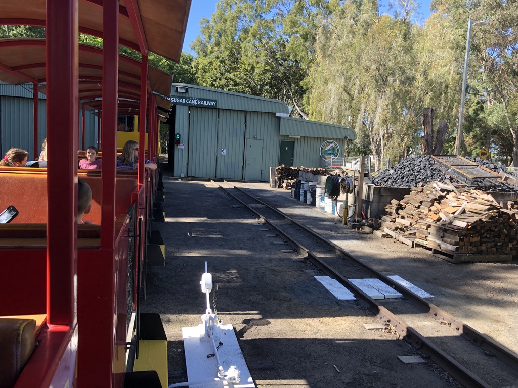
There’s a sugar industry museum in beautiful old Fairymead House; and you can take a ride on a cane train. I love a train ride.

All of Queensland’s old river port cities, Mackay, Rockhampton, Bundaberg, Maryborough and Brisbane itself, are built on flood plains. The Burnett River has a catchment area of some 33,000 square kilometres, including Gayndah and Monto, and it all flows down to Bundaberg. The city has been flooded many times. The worst happened in January 2013, and it was apocalyptic. The CBD flooded and an estimated 600 businesses were inundated, as well as many houses.

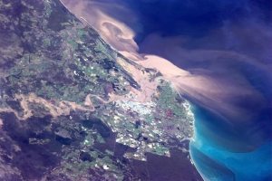
Bundaberg with the Burnett River in flood, January 29, 2013, as seen from space Photo: Canadian astronaut Chris Hadfield

People living in North Bundaberg were told to leave their homes. Evacuation was mandatory, but many people said, “They don’t know what they’re talking about. North Bundaberg never floods.”

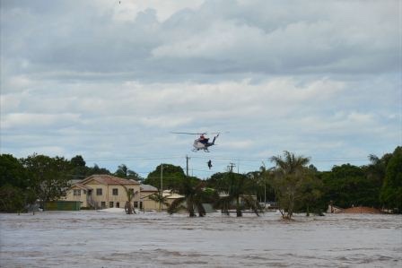
This flood was different, and higher, and in the end hundreds had to be rescued by helicopter.

Helicopter evacuation, Bundaberg 2013 Photo Fiona Sweetman, couriermail.com.au

In 2014, the year after the flood, we drove through Gayndah and visited the small museum there and heard how that same Burnett River flood ripped trees out of the riverbanks, filled the museum with mud and flowed through the shed full of prized old agricultural machinery. “Backpackers helped us clean up. We couldn’t have done it without them,” the museum staff told us.

Burnett River, Gayndah, in normal times. Height of bridge is an indication of flood heights here

Last year it was Maryborough’s turn to go under. Twice, within six weeks. These old regional river cities are beautiful, but beware the floods.

Mary River flood, Maryborough, 2022: second flood within six weeks Photo: good-news-fraser-coast.com

And take care when booking your motel.

Where the Bruce meets the Sea

The first glimpse of the sea is always exciting. Suddenly there it is, spread out blue in the sun, with light glinting off the wave crests.

I feel calmer and happier near the sea. Perhaps it’s the clean, salty breeze. Coastal air seems more charged with oxygen than inland air. Perhaps it’s the peaceful sleep that comes with the sound of the waves all night long.

We think of Queensland’s Bruce Highway, in its magnificent 1679 kilometres from Brisbane to Cairns, as a coastal highway. The irony of it is that in all that length there are only four spots where can you actually see the sea. And you have to earn those views.

First sight of the sea comes 840 kms up the Bruce from Brisbane: well into the Tropics, passing the beaches of Noosa and Rainbow Beach, of Hervey Bay and Yeppoon, without a glimpse.

After eight hours or so of hinterland driving to Rockhampton and another couple of hours through the beautiful but dry cattle country further north, suddenly, below a curving hillside, across the railway line that skirts the highway, the sea appears. On a narrow strip of land beside the water is the tiny fishing village of Clairview.

Less than a minute’s drive later, it’s gone, and the dry forested hills are back.

“That looked beautiful,” you say. “We must stop there some time!”

A few weeks ago when driving to Cairns, we did stop at Clairview, spending the night in a cabin at the peaceful BarraCrab Caravan Park.

BarraCrab Caravan Park Clairview Photo: thetimes.com.au

We ate fish and chips (neither barramundi nor crab was on the menu) with a beer at the casual licensed restaurant, looking across the coconut palm lined beach to the peaceful evening sky and sea, where people were strolling or fishing.

Evening at Clairview

Workers commute up and down the Bruce Highway all year round, often spending the night in motels and caravan parks, and here at Clairview a tradie was standing relaxed on the beach, looking at the water, work done for the day, in hi-vis and thongs with a Fourex Gold beer can in his pocket.

At Clairview, after work

We weren’t tempted to swim. Stingers and crocodiles are always a threat in these waters, and like all northern beaches in the shelter of the Great Barrier Reef, the waves are little more than ripples.

Onwards up the Bruce.

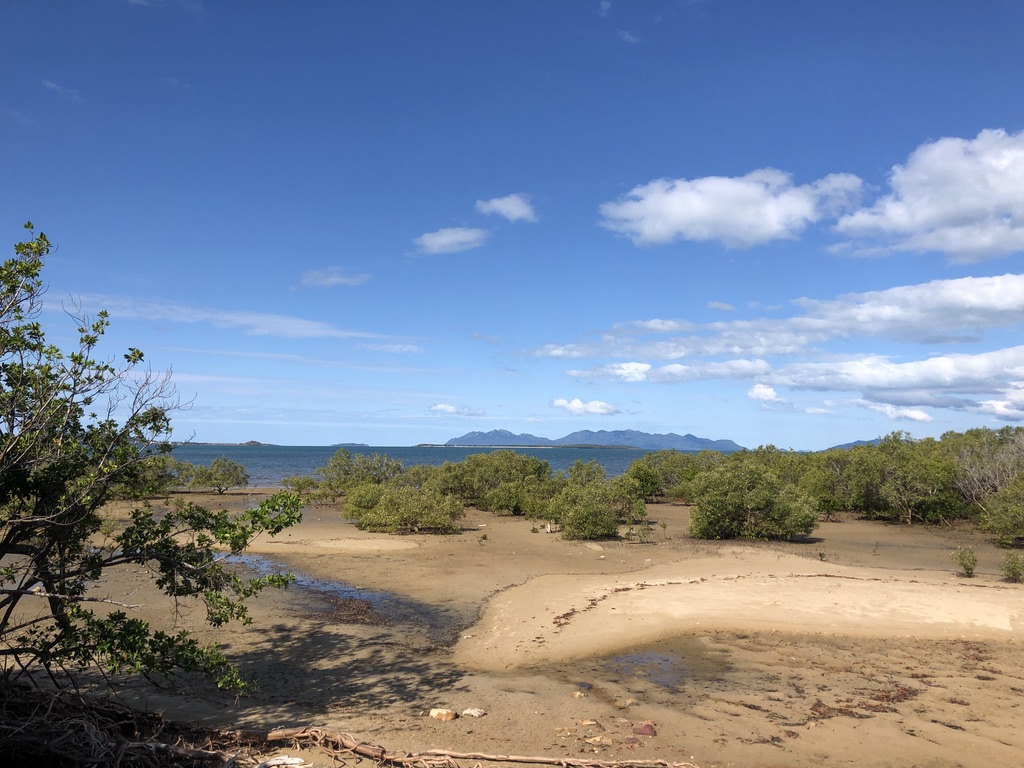
Three and a half hours north of Clairview, just south of Bowen and across the road from the Big Mango, you glimpse the sea again. The tide is out, revealing the roots of mangroves and millions of tiny mud dwelling creatures; but beyond them the water is bright blue. Looming to the east are the hazy purple hills of Gloucester Island and the Whitsundays.

Low tide, south of Bowen

Nearby, above the highway and looking out across Nelly Bay, is the Ocean View Motel, and it’s a pleasure to sit outside a unit there, under the frangipanis, and enjoy the evening view across the water to the lights of Bowen.

Bruce Highway where it meets the sea, south of Bowen, near the Big Mango Photo: petfriendly.com.au

This is one of the rare Bruce Highway motels with a view of the sea. You’ll need to drive north for another four hundred kilometres or so to find another.

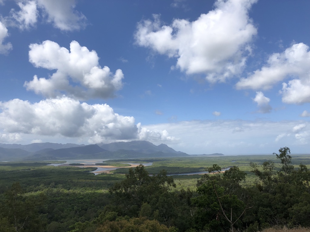
An hour and a half north of Townsville comes the next ocean view. On a stretch of the these-days divided highway that crosses the Cardwell Range nineteen kilometres north of Ingham, you can glimpse the sea through roadside vegetation. For the full sea view, away from the fast-moving traffic, take the slip road at the top of the range and walk five minutes to Panjoo Hinchinbrook Lookout for a breathtaking outlook over the channel and Hinchinbrook Island (Munamudanamy) to the ocean.

View from Panjoo Lookout across Hinchinbrook Passage and Island (Munamudanamy)

The Banjin People are traditional owners of this large, undeveloped, beautiful island, which is part of the Girringun Indigenous Protected Area.

At Cardwell, thirty-eight kilometres north of Panjoo Lookout, the Bruce Highway at last spends time near the sea – the Coral Sea. Here, for over a kilometre, the highway follows the shoreline. A walkway leads past big old calophyllum inophyllum trees, otherwise known as ballnut trees, on the edge of the beach.

Protected since 1865, a Calyphyllum inophyllum at Cardwell

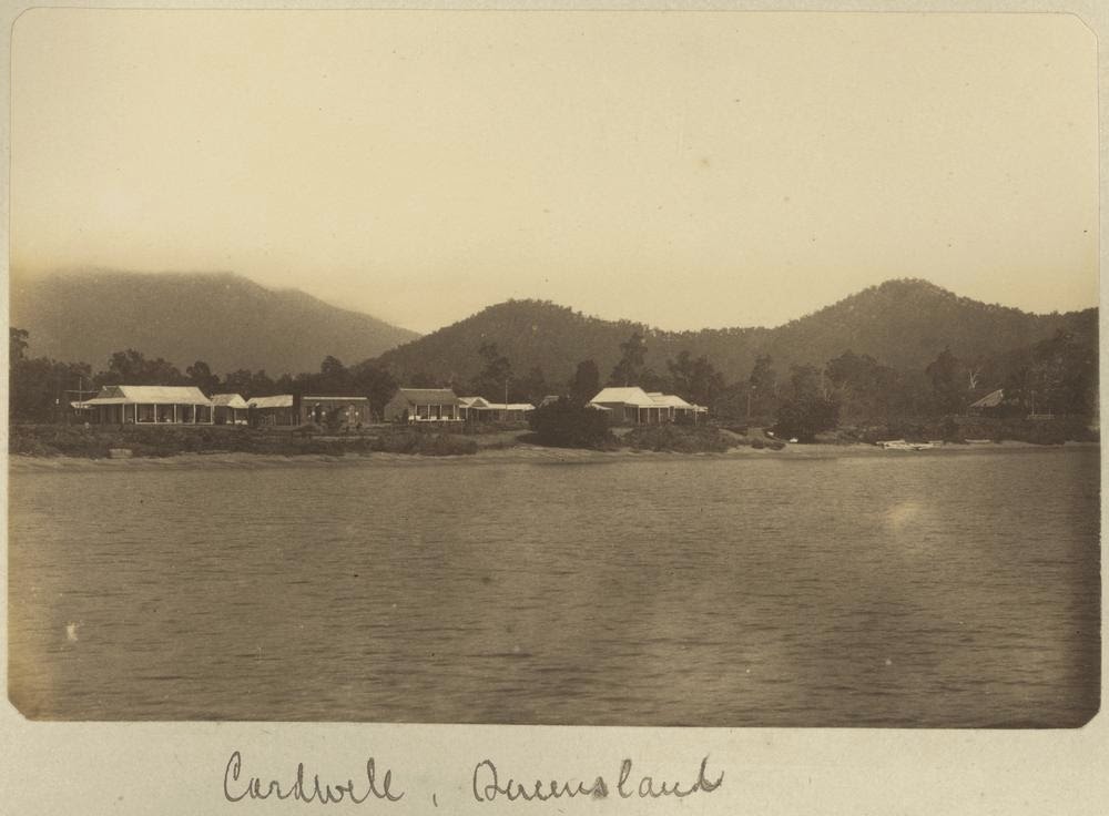
Governor Bowen, travelling in the ship “Platypus”, visited this area in 1865, only a year after the town was formed and the local Girringun people had been violently “dispersed” from their ancient lands. The Queensland Government wanted Cardwell for a port.

Governor Bowen was impressed by the calophyllum trees, hundreds of years old even then. Since 1866 they’ve been protected by law; and they weathered Cyclone Yasi better than most.

A postcard from c.1885 shows the dark-leaved calyphyllum trees, old even then, on the shoreline of Cardwell Photo: northqueenslandhistory.blogspot.com

In 2011, Cardwell was devastated by Yasi, with sand and water blown across the highway, the bitumen ripped up and houses destroyed; but now, eleven years, later, it has never looked better.

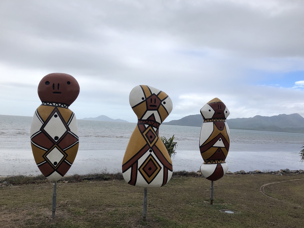
Girringun Bagu sculptures, based on the design of firesticks, by local artists Eileen Tep and Charlotte Beeron, stand enigmatically on the shoreline. They watch the tourists who stop here for the scenery, the information centre, playground, petrol and food.

Bagu sculptures at Cardwell

There are motels and pubs, the popular Yasi Bar, and a charging station for electric vehicles. And the calophyllum trees.

Best not go for a swim, though. Crocodiles and stingers are common here, so close to the mangroves and muddy water of Hinchinbrook Channel.

That’s it for sea views from the Bruce Highway.

Named in the 1940s after a North Queensland Labor politician and Minister for Works, Harry Bruce, this highway deserves a more romantic, evocative title. Many travellers have called it derogatory names over the years, one favourite being Goat Track. That’s unfair. This is a long road, covering difficult terrain in an extreme climate, with a comparatively small population to pay for it.

I’ve been travelling the Bruce for over fifty years, in drought and in flood. I’ve crossed the old Marlborough Stretch, been stopped at its one-way bridges, experienced flat tyres and breakdowns and dodgy motels. I’ve crawled around the hills south of Gympie, stuck behind caravans on the old narrow, curving road that has now been replaced by a motorway. I’ve suffered the bumps and potholes in the flood-prone roads around Bowen and Proserpine. But to me the Bruce Highway is a beautiful road, and I’ve seen great improvements to it over the years, making it far safer and more pleasant to drive on; and upgrades are happening all the time.

However, if it’s sea views you want, you’d be better to take the Captain Cook Highway from Cairns to Port Douglas.

Captain Cook Highway Photo: australiangeographic.com.au

There are many spectacular sea views to enjoy in Queensland; but you’ll have to leave the Bruce to find them.


[1] https://www.theguardian.com/lifeandstyle/2019/nov/03/blue-space-living-near-water-good-secret-of-happiness

Battling and building with nature: Alexandra Bridge, Rockhampton

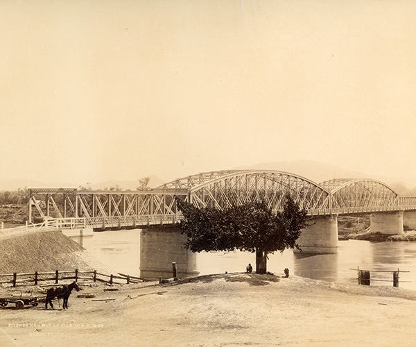
We take things like bridges for granted, especially in the regions, but I find them interesting, especially the old ones. I took a photo of this railway bridge in Rockhampton, a month or so ago. Until I saw this blog post from Queensland Museum I didn’t know its name, and I’d never though of the engineering and effort that went into building it strong enough to withstand those terrifying Fitzroy River floods.

Alexandra Bridge, Rockhampton, July 2022

qldmuseum's avatarBlog

By Phil Manning, Senior Curator, Cultures & Histories

Needed to cross the river. Designed to survive the river. Built using the river. The rail bridge over the Fitzroy River reveals how the forces of nature were used to overcome the challenges of the environment itself.

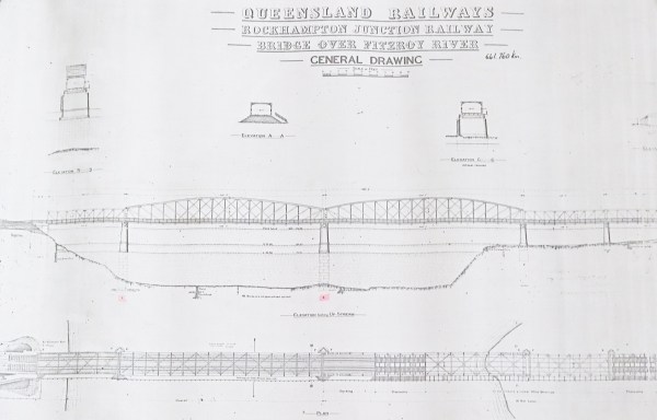
The Alexandra Bridge was part of the Rockhampton Junction Railway. George Willcocks was the contractor for its construction.

The Alexandra Bridge consists of five spans. Three 100 feet (30.5m) spans, one on the south bank and two on the north bank. And two central spans, each 250 feet (76m) long. At the time of its construction, the Fitzroy Bridge comprised the fourth longest span used for an Australian bridge. Photographer: Henry Goode. Queensland Museum Network Collection

Designed for floods

Since its official opening on 6 November 1899 the Alexandra Bridge has withstood the forces of seven major flood events. This is a tribute to the…

View original post 1,338 more words

Mangrove Pencils

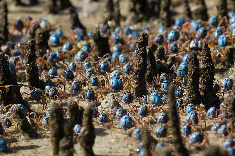
At the Cod Hole, where Eudlo Creek joins the Maroochy River, I watched the soldier crabs. Scuttling across the mudflats in their hundreds, dressed in smart blue-grey uniforms, the little round crabs would feel the vibrations of my footsteps and quickly screw themselves down into the mud and disappear. If I stood still for a few minutes they would start to twist themselves back into the daylight.

“Soldier crabs marching through mangrove aerial roots” commons.wikipedia.org

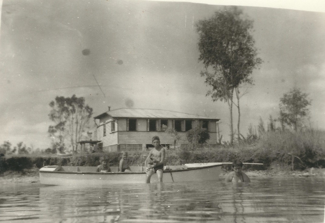
My dad had bought an old weatherboard beach house on the dead-end dirt road that has since become busy Bradman Avenue. We named the house Toad Hall.

“Toad Hall”, on the Maroochy River. I’m in the boat, on the left

It was just upstream from where the Sunshine Motorway now crosses Maroochy River. Bradman Avenue runs upstream from Picnic Point, along the south bank of the river and over the creek, past a dragon boat club and a tavern.

The old house held out against development for years, but it’s gone now, replaced by holiday apartments. There are still some mud flats along the creek, though. You can still scoop up a soldier crab to feel it tickling your palm, trying to dig its way out of sight.

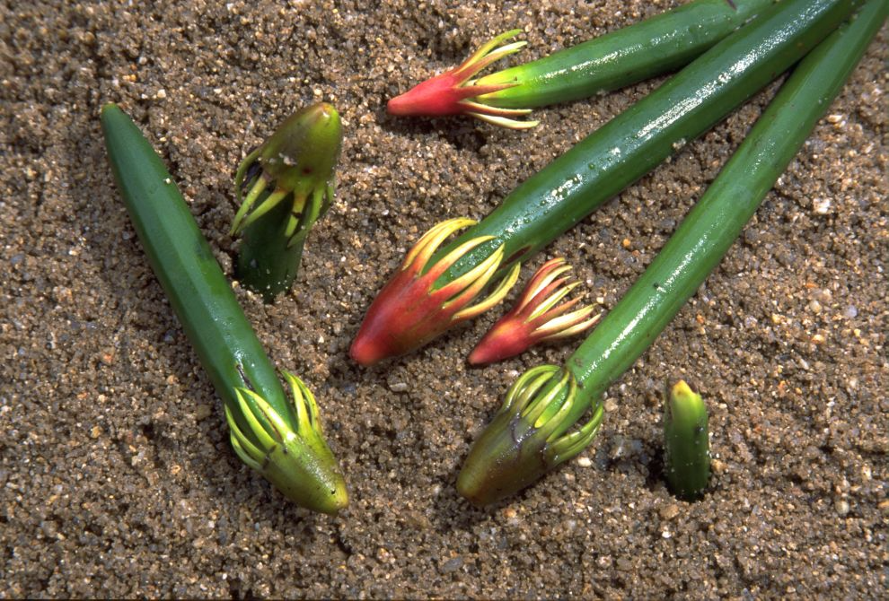
Also on the mud flats and along the banks of the river were mangroves. I collected the mangrove seedling “pencils” and used them to draw in the wet sand at the river’s edge.

Mangrove seedlings – “pencils” wettropics.gov.au

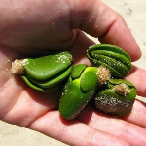
I made patterns with the flower husks, like little octopuses, from which the pencils grew. Little green mangrove “books”, actually seed pods, washed up on the river’s edge too, along with sea grass fronds and scraps of pumice from ancient local volcanoes.

Mangrove seed pods – “books”

Only a few mangroves survive along this stretch of the river, but further upstream they still thrive across the sand and mud flats. Mangroves grow from New South Wales, right up the Queensland coast, round the Gulf of Carpentaria, across the top of Australia and throughout the tropics and sub-tropics globally, thriving in warm tidal rivers, estuaries and bays.

 In many parts of the state, like Raby Bay in Cleveland and Pelican Waters at Caloundra, mangrove forests have been destroyed to make way for canal developments; but if the people, cars, concrete and bitumen disappeared, they would soon come back and resume their ancient job of filtering the mud, protecting the shoreline and pouring oxygen into the atmosphere.

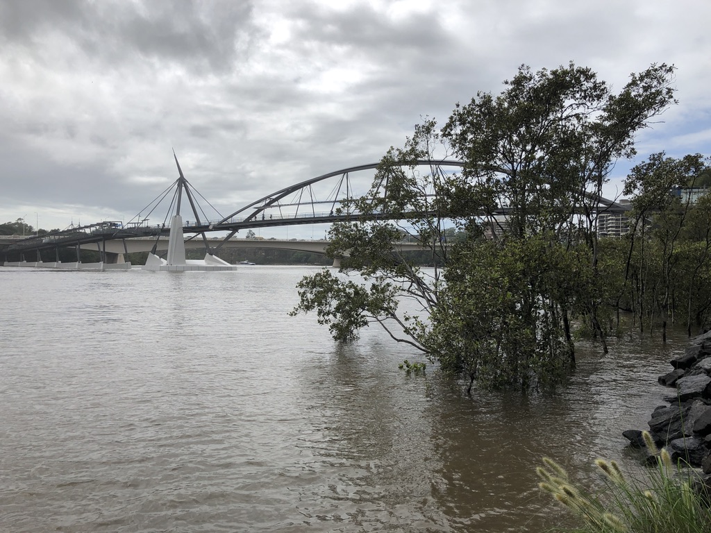
Mangroves in the Brisbane River, Southbank

Except for climate change.

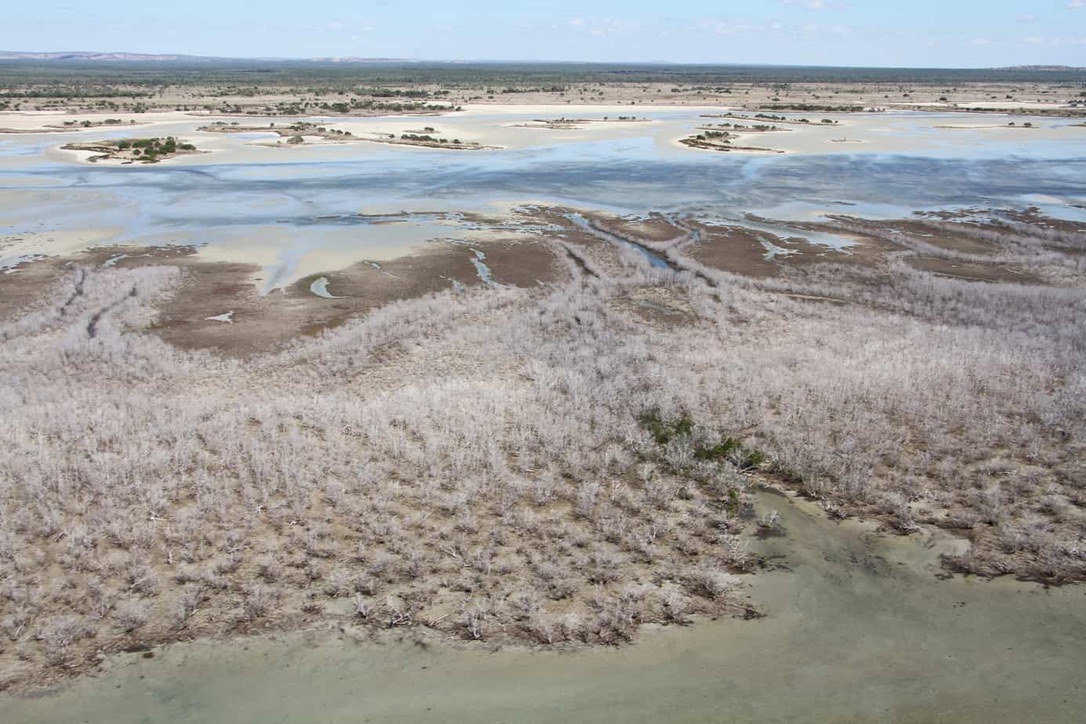
Mangrove dieback in the Gulf of Carpentaria
by Lyndal Scobell, Cape York NRM

Over 7,000 hectares of coastal mangroves have died along 1000 km of coastline in the Gulf of Carpentaria. James Cook University’s Dr Norman Duke said the dieback was unprecedented, and followed a prolonged period of high temperatures and unseasonally dry conditions in the region.

Dr Duke, a world expert on mangroves, said the dieback was severe and widespread, affecting 9% of mangrove vegetation from just south of the Roper River in the Northern Territory to near Karumba in Queensland. https://cafnec.org.au/wildlife-issues/mangroves-wetlands/mangrove-dieback-in-the-gulf-of-carpentaria/

I was shocked to read about this environmental disaster in the Gulf.

It will have a huge impact on fish breeding and the birds and animals of the area; the prawns, hermit crabs, and millions of humble, vital creatures of the tidal mud. The land itself will be left unprotected from erosion and inundation. It’s difficult to comprehend the scale of the dieback – 1000kms of coastline altered, perhaps permanently. In this harsh environment, mangroves have been the stalwart protectors of the coastline forever. Back in 1861, they defeated the utmost efforts of Burke and Wills, who’d travelled all the way from Melbourne to reach the Gulf, but never made it through the mangroves to the sea. Now 7,000 hectares of them have succumbed to the effects of heat and drought.

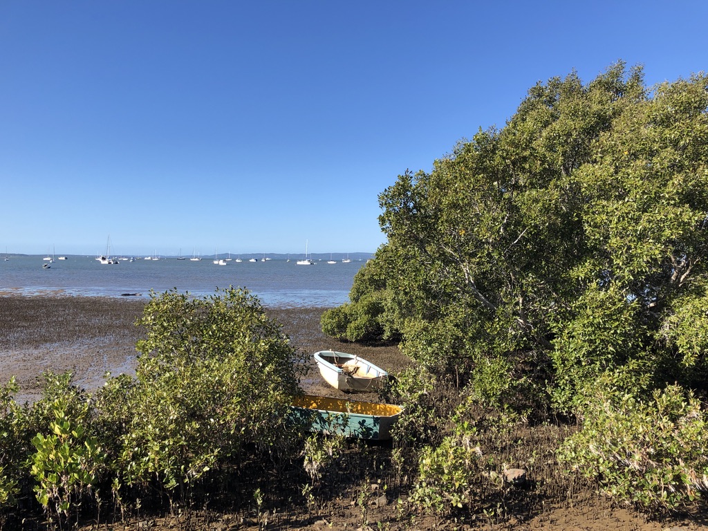
There are still mangrove forests around Moreton Bay – seven species of them, reportedly, along the coast and the islands, and up the rivers, in spite of development and climate change.

Moreton Bay mangroves, Victoria Point

Our Lizzie has been a beach lover all her life. When she was little, we’d often visit the beaches of Maroochydore, or Townsville, or Etty Bay, making sandcastles and decorating them with shells and seaweed and pumice. We’d draw in the sand with mangrove pencils and make patterns with mangrove flowers. Lizzie is now an environmental engineer, and last month, during one of her regular scientific field trips to Stradbroke Island, she found a mangrove pencil on the sand.

She drew me a picture, and sent me the photo. That’s one to keep.

Sweet Potato

At lunch time, behind the school, Con and his mates used to dig up sweet potatoes.

“We gave the big ones to the nuns, but us kids would eat the small ones, raw. They were sweet and juicy.”

Con went to the Good Counsel Convent school in Innisfail, run by the Good Samaritan Sisters (the Good Sammies, as they were affectionately known.) The red volcanic soil of Innisfail is ideal for growing sweet potatoes, but they’ll grow happily anywhere in Queensland, if there’s warmth, soft soil and good rain. They’re a staple across the South Pacific. They flourished in Nambour, too: in my family’s backyard.

Our yard, on a then new sub-division on Mapleton Road, sloped down towards a farm with a bull paddock. The fence was flimsy. Once, when plumbers were working on our septic tank, they occupied their smoko time with teasing the bull. My mother watched out the bedroom window, expecting the bull to break through the fence at any moment and chase the plumbers up the slope. She was disappointed when it didn’t happen.

“I’d have liked to see them trying to run up that slope, catching their feet in the sweet potato vines,” she said.

In Con’s tropical Innisfail yard there were banana plants, papaws, mangoes, passionfruit vines and citrus trees. It’s still the same in the North.

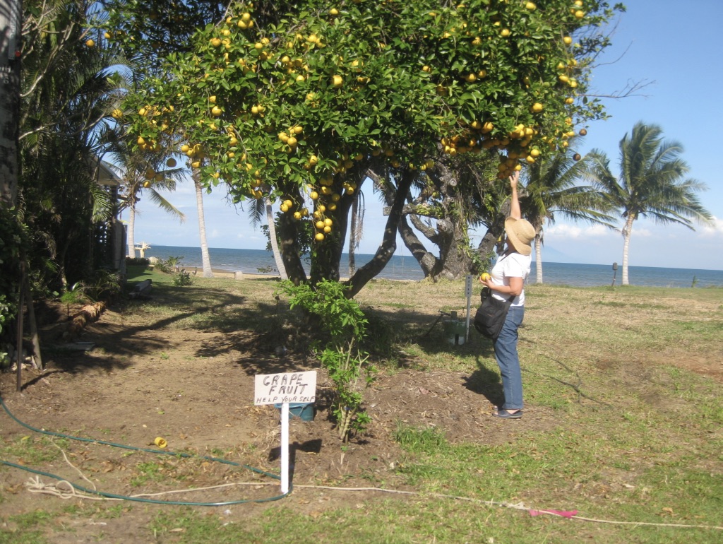
Citrus growing by the beach, Tully Heads
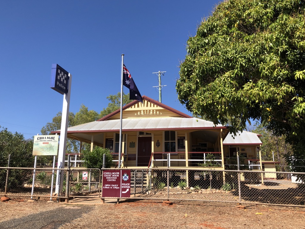
Loaded mango tree outside the police station in Chillagoe, west of Cairns

Our garden in Nambour, a 1500 km drive south and officially in the sub-tropics, had bananas and papaws, too, and also loquats, guavas, rosella plants, a mulberry bush and a big mango tree, left over from farm days. Across the state, a group of fine old mango trees, Moreton Bay figs and hoop pines often indicates that a farmhouse once stood there.

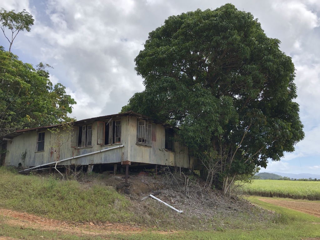
Mango tree flourishing beside a derelict farmhouse, Babinda

In Nambour, we never got to eat our guavas, because we would forget about them until we could smell the fruit. By then, it was too late – they’d be full of fruit fly grubs.

There was a flourishing choko vine on our fence. I haven’t eaten chokos since Mum used to cook them, serving them in white sauce to give them some flavour.

In these days of supply chain problems, we should all have a choko vine along the fence, along with all the other fruits and veggies that grow so well in Queensland.

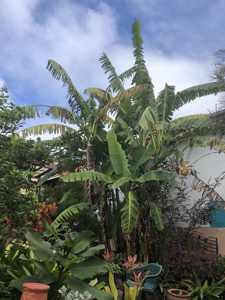
Bananas growing beside a West End house

Sadly, in old migrant suburbs like West End, because of high property values and the move towards denser housing, many fine backyard fruit and vegetable gardens are disappearing.

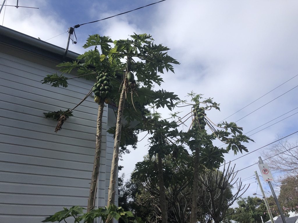
Papaws, West End

The Sunshine Coast hinterland north of Brisbane is perfect for growing tropical fruits and citrus in the backyard. In our Woodford yard, as well as an old mango tree there were macadamias, lemons, bananas, and a large custard apple tree of the bullock heart variety.

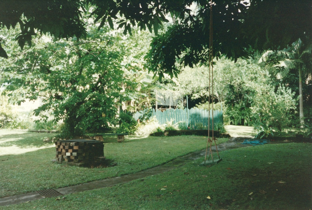
Looking from under our Woodford mango tree towards the custard apple tree. In the background are macadamias and bananas

Huge productive avocado trees grow almost wild in Maleny backyards.

Dragon fruit vines smother Brisbane gum trees and loaded passionfruit vines festoon suburban fences; but the biggest passionfruit vine I ever saw was growing over the toilet block in the yard of the Silkwood Hotel, north of Tully. It provided shade over people enjoying a drink in the beer garden, and masses of fruit; possibly nourished by the septic tank.

In the beer garden of the Silkwood Hotel, under that enormous passionfruit vine

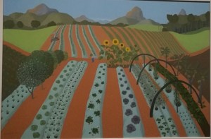
We tend to take all this splendid bounty for granted, since it grows in spite of us and requires no care. Fruits that are rarities in cold climate countries are part of our everyday environment in much of Queensland, and visitors are amazed by them. When taking a drive around the Glasshouse Mountains with overseas visitors we stopped beside a pineapple farm with its neat rows of plants and young, green pineapples. Pines, as we used to call them. Our German friend looked at them in amazement. “So that’s how they grow!” he said.

“Mixed Farm with Sunflowers, Glasshouse Mountains”, painted by Anne Marie Graham

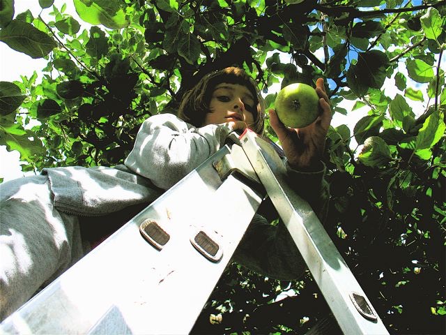
I feel the same amazement when I visit Europe and see apple trees in fruit, hanging over people’s garden walls, or when I look at photos of my granddaughter picking apples in her Opa’s Berlin garden.

Picking apples in a Berlin garden

In York, U.K., in my friend’s wintery garden there was an enormous pear tree. It had one yellow pear still hanging on it on, metres above the ground. I’d had no idea that pear trees grew so big, and that you could just grow them in your back yard.

That big Nambour mango tree is long gone now, making way for brick and concrete; and in the old bull paddock there is a sprawl of houses. I’d be willing to bet sweet potato vines are still flourishing somewhere nearby, though.

When I first had a meal at my future mother-in-law Min’s house in Innisfail she said, “Do you like sweet potato?”

I didn’t, but of course I said yes. From then on, it was always on the menu when we ate there.

Years later when we visited, Min, now elderly, looked exhausted.

“What have you been doing, Mum?” Con asked.

“Well, I didn’t have any sweet potato, and I know Rose loves it, so I walked into town to buy some,” she replied.

A kilometre each way in the tropical heat.

It wasn’t the right time to tell her the truth. That time never came.

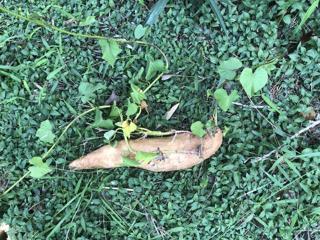
Every now and then I buy sweet potatoes, in Min’s memory, and put them in the potato basket and forget about them. By the time I notice them again they have sprouted, so I throw them out in the garden to rot away and nourish the soil.

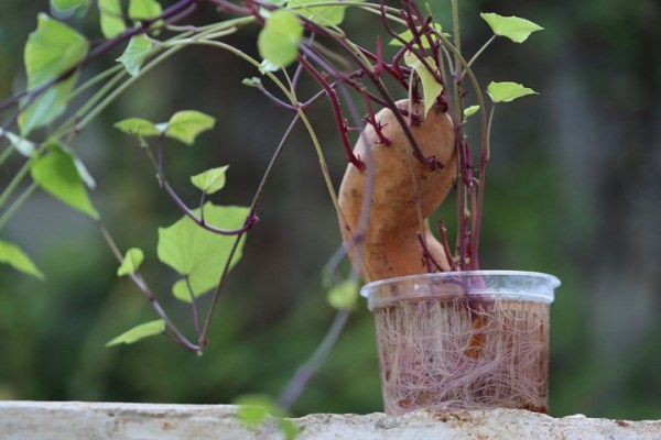
Thrown-out sweet potato that won’t die

They don’t rot, though; they keep growing until I trip over the vines.

Passionfruit vine growing over a telephone booth, Bingil Bay

The Mabo Decision 30 years on… the legacy lives on

A fine Queensland story. We lived in Townsville around the time the Mabo Native Title case began to be formulated, and one evening we had the experience of meeting Eddie Koiki Mabo, when he worked as groundsman at JCU.

qldmuseum's avatarBlog

By Leitha Assan, Senior Curator, Indigenous Cultures

From its inception in Townsville in 1981 to the High Court victory on 3 June 1992, 2022 marks 30 years since the historical landmark Mabo decision was handed down by the High Court of Australia.The High Court ruled that the Meriam people were entitled to possession, occupation, use and enjoyment of their Islands, effectively recognising their Native Title. Native Title is the recognition by Australian law of Torres Strait Islander and Aboriginal people’s traditional laws and customs that are connected to lands and waters.

More than 100 years after European settlement, a group of Islanders – namely Reverend Dave Passi, Deacon Sam Passi Snr, James Rice, one Meriam woman, Celuia Mapo Salee and led by Eddie Koiki Mabo – won a landmark legal battle against the Queensland and Australian governments. They proved that Islanders are the customary owners of land on Mer, Waier…

View original post 662 more words

Breached! — The Eternal Traveller

Interesting times along Pumicestone Passage, as local blogger The Eternal Traveller tells us. Queensland’s shifting sand islands are always on the move.

https://www.google.com/maps/embed?pb=%211m18%211m12%211m3%211d227603.82078583835%212d153.00129156397605%213d-26.957090214481568%212m3%211f0%212f0%213f0%213m2%211i1024%212i768%214f13.1%213m3%211m2%211s0x6b93969ba2f07c5b%3A0x2f2634a069ccf88a%212sBribie+Island%215e0%213m2%211sen%212sau%214v1653699601414%215m2%211sen%212sau

Bribie Island, Queensland The calm waters of Pumicestone Passage separate the quiet coastal suburb of Golden Beach from the narrow strip of land just offshore that is Bribie Island. The island hugs the coast from the northern end of Brisbane to Caloundra, creating a barrier between the open ocean of Moreton Bay and Pumicestone Passage. […]

Breached! — The Eternal Traveller

Blog at WordPress.com.

Up ↑