Innisfail

The air feels different here in the Wet Tropics. The sun is hotter, it’s more humid, and in the wet season mould grows on everything.

The hilly town of Innisfail, ninety kilometres south of Cairns, is situated at the junction of two beautiful rivers: the North Johnstone and the South Johnstone. No one swims in them. This is the home of the Johnstone River crocodile, otherwise known as the freshwater crocodile or freshie, which doesn’t eat people; but the saltie, or saltwater crocodile, does eat people – and it also inhabits these rivers.

innisfail riverfront
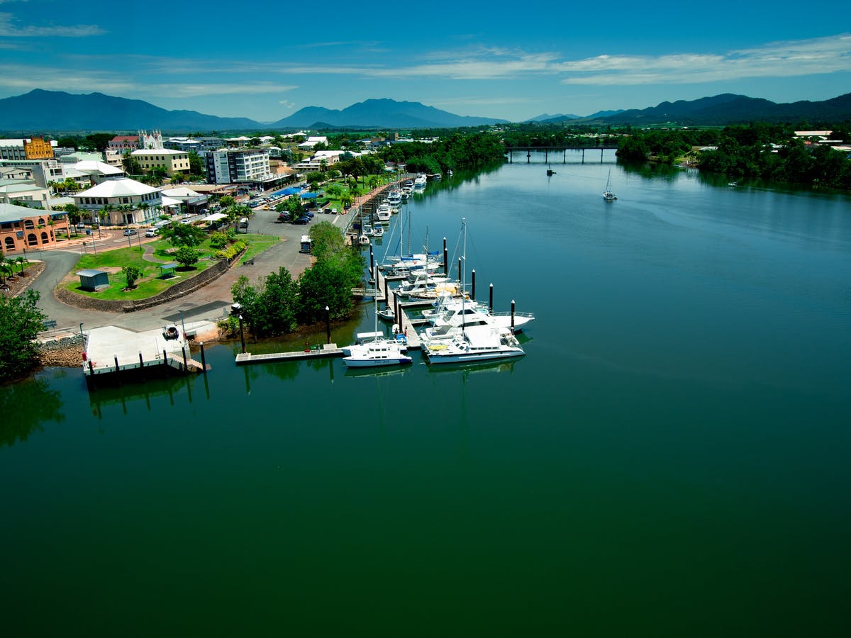
Innisfail waterfront at the junction of the North and South Johnstone Rivers queensland.com

The first time I visited Innisfail, I came up from Brisbane on a Greyhound bus. Con and I were engaged, and we were travelling north together so I could meet his family. It took us over thirty hours to get here.

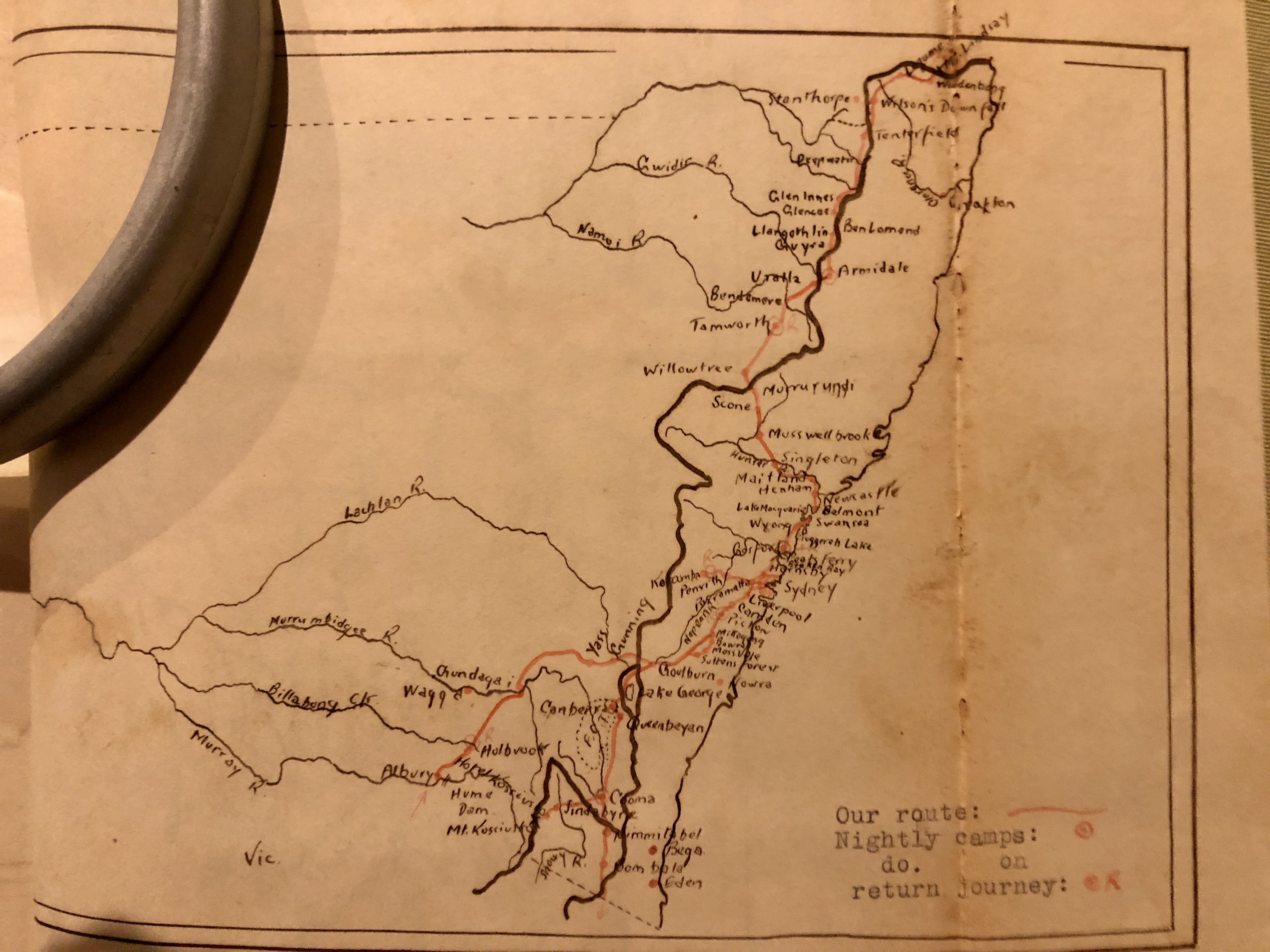
With roads much improved now – motorways, passing lanes, highway redirection – you can (in theory) drive here in eighteen hours, but the bus still detours to drop off and pick up passengers at tourist spots – Noosa, Hervey Bay, Proserpine, Mission Beach – so it still takes a long time. The train takes about twenty-four hours, and if you pay the rather enormous cost of a railbed you can sleep for eight hours of that. We usually drive, stopping for one or two nights on the way, perhaps at Rockhampton and Ayr, or at Sarina, south of Mackay.

Con grew up in Innisfail but left long ago. We’ve been back many times to visit, and each time he gives me a guided tour of his special places. Including pubs.

“Dad’s Shell fuel depot was over there, near the Goondi Hill Hotel.

5 - con, jim and colin. innisfail 1940
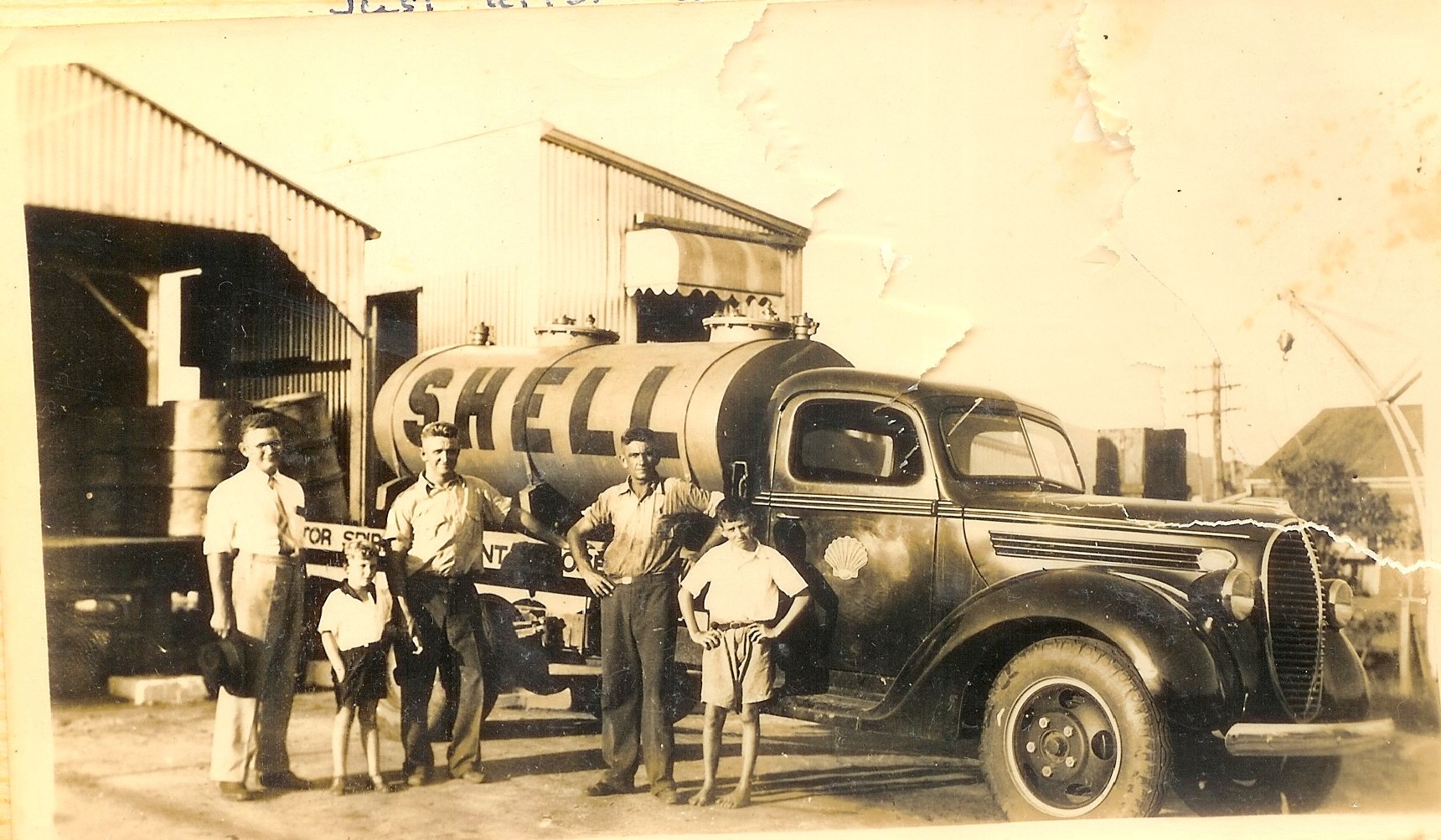
Con Snr (centre) at his Shell fuel depot, Innisfail 1940

“There were lots of hotels back then. As well as the Goondi, there were the Commonwealth, Innisfail, Crown, White Horse (we called that the Blonde Donk), Grand Central (that’s an arcade now), Riverview, Exchange (that’s near the canecutter statue), Federal, Imperial and Queens hotels. It was a lively town.”

The white marble Canecutters Memorial was erected beside the river in 1959 by Innisfail’s Italian community, to celebrate Queensland’s centenary.

innisfail Canecutters_Memorial,_1999
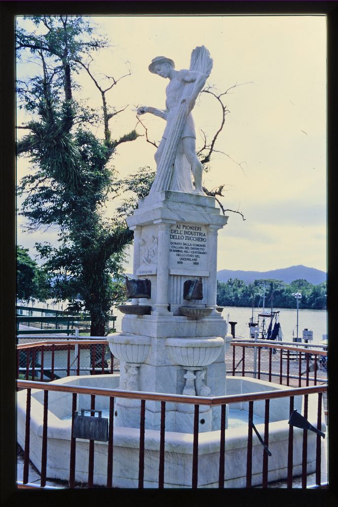
Canecutters Memorial      en.wikipedia.org

Many of Innisfail’s hotels are gone now, either closed down, or blown down by a cyclone. 

We drive twenty-four kilometres to Paronella Park, where Con went to dances as a young man. “It had a mirror ball in the ballroom. It was great!”

He took me there on that first visit, borrowing his mum’s little Datsun. Built by Spanish immigrant Jose Paronella, the Park, with its fantastic castle, walkways, staircases and bridges gently rotting away in the rainforest beside Mena Creek’s waterfall, was first opened in 1925 as pleasure gardens. It even had its own hydroelectric system, using the force of the nearby falls.

Damaged by floods and cyclones, picturesque Paronella Park has been listed with the National Trust, and it has now been developed for modern tourism, its hydro system restored. Chosen as the setting for a recent feature movie, “Celeste”, it’s unique and authentic, a FNQ treasure. Nowadays we go there with our grandchildren.

1E2910EC-1434-4A5D-A16E-4C8D9928AD86_1_201_a
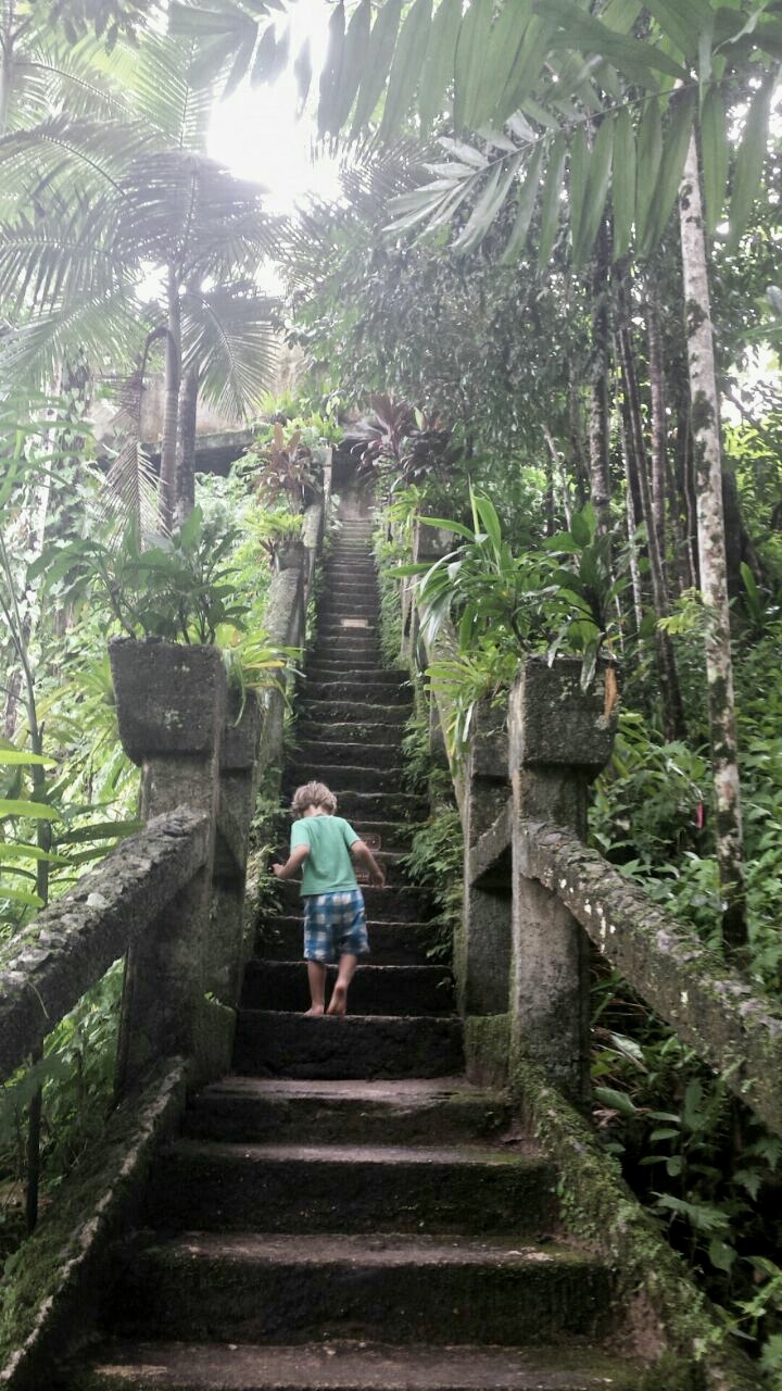
Climbing the stairs at Paronella Park

We drive out to Etty Bay, sixteen kilometres from Innisfail, one of Australia’s prettiest beaches, where rainforest and coconut palms shade the coral sand, and cassowaries wander.

Sometimes we spend a night in the caravan park and eat a fish and chips dinner at the kiosk.

Innisfail etty
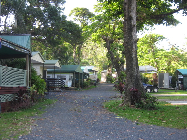
A cassowary wanders through the Etty Bay Caravan Park

Con is sentimental about Etty Bay.

“There’s another little beach up here,” he says, climbing over the oyster shell strewn rocks at the northern end of the beach. “We used to call it Second Beach.

“And look – here’s another beach! It’s tiny, but it’s a beach all right! We called it Third Beach!!

Innisfail etty 2
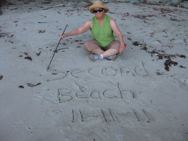
Celebrating Second Beach

“We opened the oysters with a screwdriver. They were small, but they were the best oysters I ever ate!”
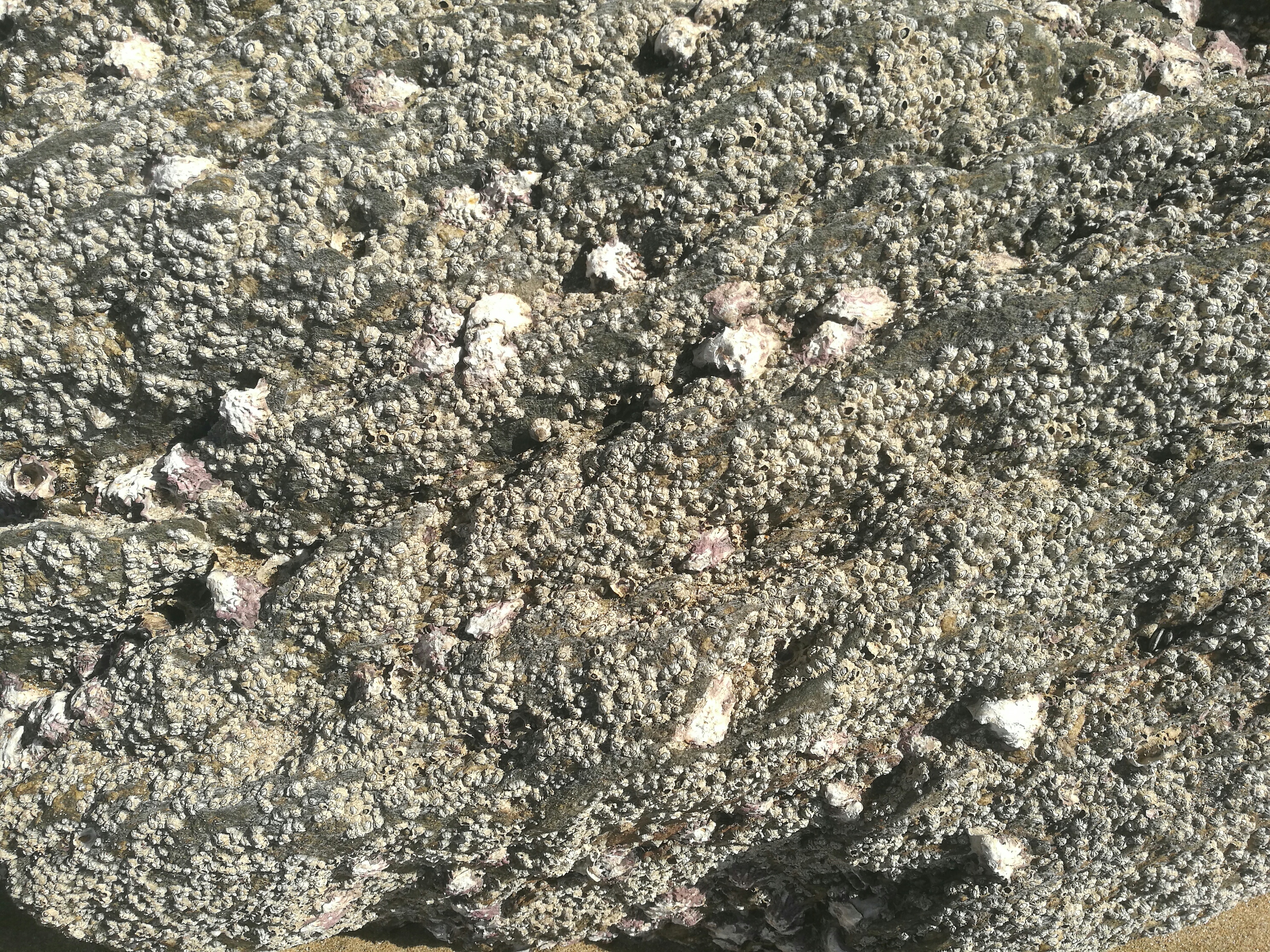
DE282A87-50C6-472B-94CE-DCE25BE549D3
Etty Bay oysters

Innisfail is a pretty town. The Johnstone Shire Hall, built in the 1930s on the side of a hill, has a top-floor ball room and concert hall. Con takes me up the steep stairs to take a look. People are setting up for a concert, and the double door at the back of the stage is open.

There is a lift platform outside the door, suspended far above the ground, for winching equipment, pianos and sound systems up to the stage. “Workplace Health and Safety was never much of a consideration when I was in shows here,” Con tells me.

innisfail shire hall abc.net
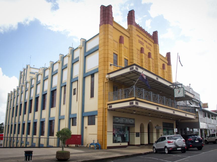
Johnstone Shire Hall abc.net.au

We visit Con’s old school, and the Catholic church, a spectacular building at the top of the town, dressed with Italian marble, with an altar constructed by Irish Trappist monks. Innisfail is an old name for Ireland, and lots of Irish migrated to this green countryside. Italians came, too, to cut cane and take up farming. Innisfail has the lively and well-stocked  Oliveri’s Italian delicatessen, where old families meet up on a Sunday morning for coffee and chat.

743EE5A9-1777-4AB4-9AA1-FC11FBB23C95
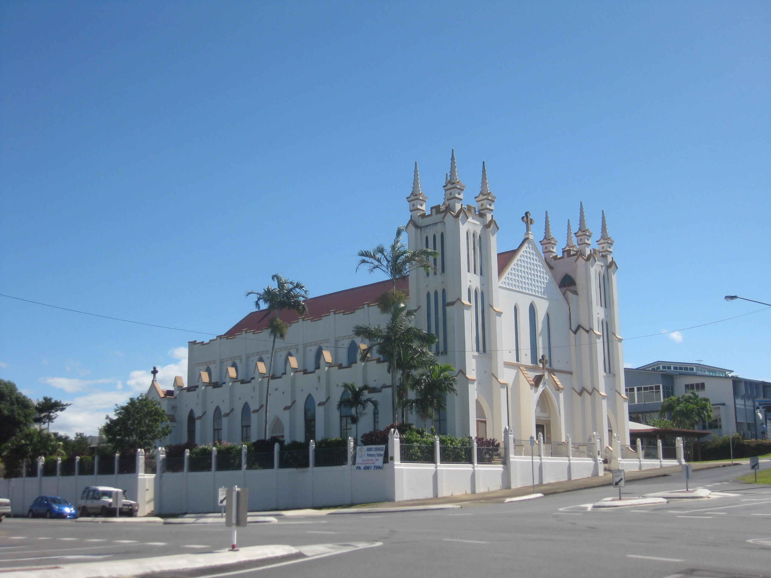
Mother of Good Council Catholic Church, Innisfail

Chinese immigrants came here, too, working in the cane and the bananas, and going into business. The Innisfail Temple, also known as the Joss House, is still the spiritual home of the Chinese community here. Taam Sze Pui (Tom See Poy) came from southern China in the 1880s and set up one of North Queensland’s largest and most successful department stores, See Poy and Sons. Tom See Poy named his sons after North Queensland rivers – Johnstone, Gilbert and Herbert.

Con tells me about the time he worked in Men’s Wear at See Poy’s one Christmas holidays, as well as singing carols in the shop and changing into a Santa Claus suit to ask children what they wanted for Christmas.
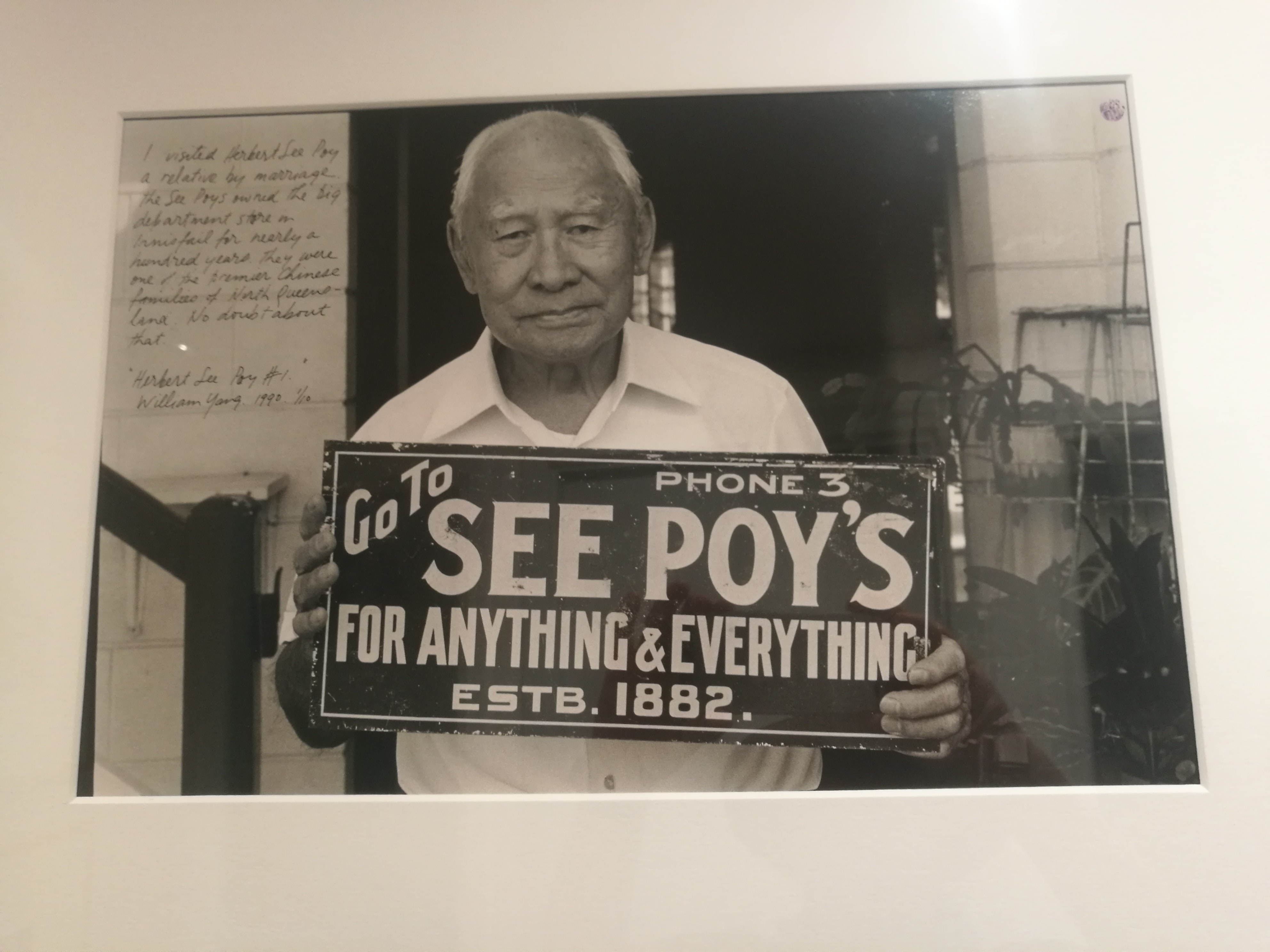
cof
Mr Tom See Poy

The fine old department store is gone. Now Woolworths, Coles and Bunnings supply the town. Roadside stalls sell fresh, seasonal produce along the highway, and in March, the Innisfail Feast of the Senses Festival celebrates the local tropical fruit.

In regional areas like this, improved roads and large operators have undermined some local businesses. It’s easy to drive to Cairns for clothes and household goods, or a show or movie. Both of Innisfail’s two movie theatres are gone. Mechanical harvesters cut the cane; and backpackers pick the fruit.

Ironically, though, disasters have brought money into Innisfail. Since Cyclone Larry in 2006 and Cyclone Yasi in 2011, there are new, shiny roofs, new parkland and a walkway along the river. The old art deco buildings in the centre of town and the water tower on the hill have been painted in bright colours.

cof
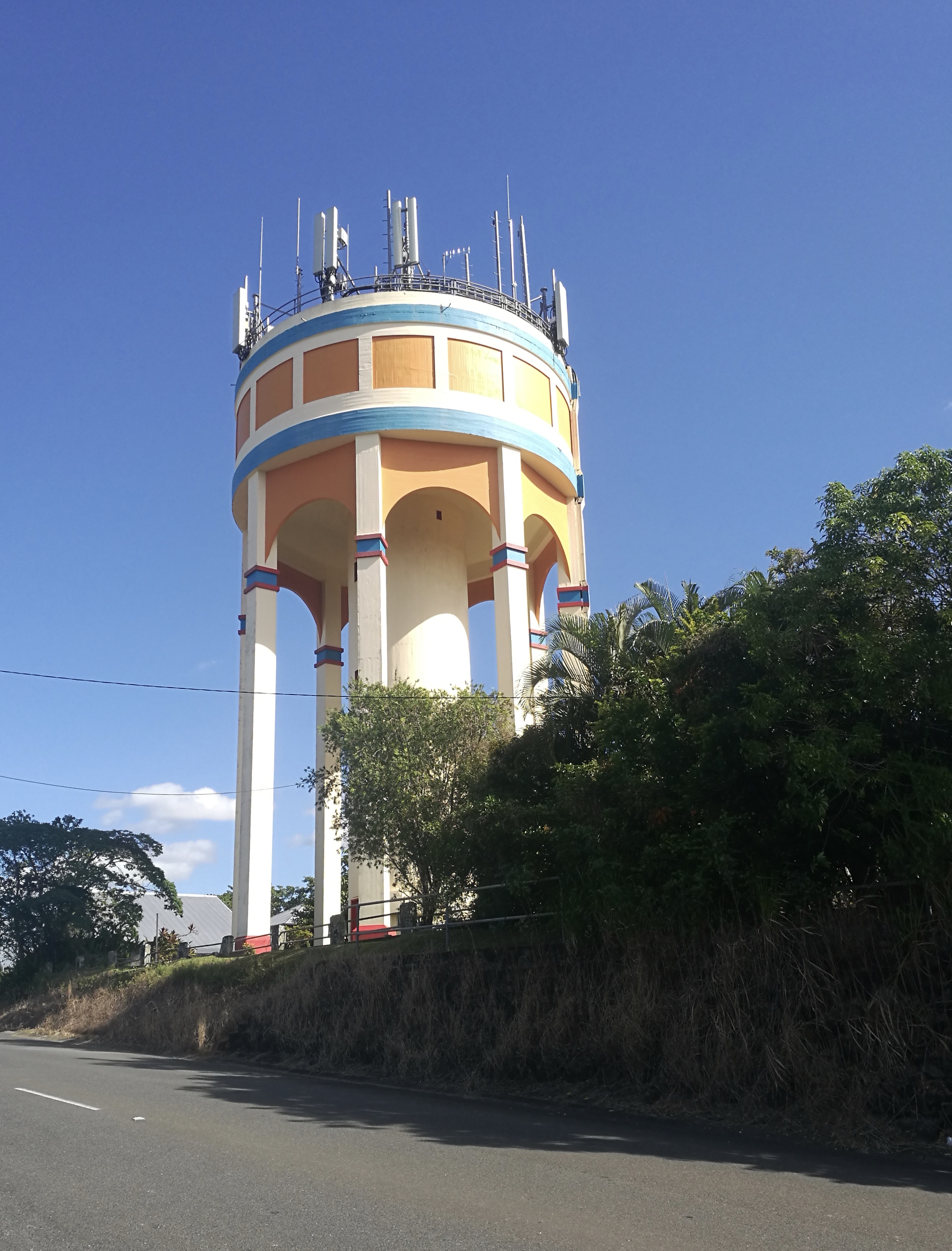
Innisfail water tower

The bridge where the rivers join has been rebuilt in art deco style. There is now a Tropical Art Deco Festival in Innisfail. Who knew that these old buildings, always taken for granted, had such potential for charm?

1DD08937-1287-49AC-9DB4-92FA41CF288B
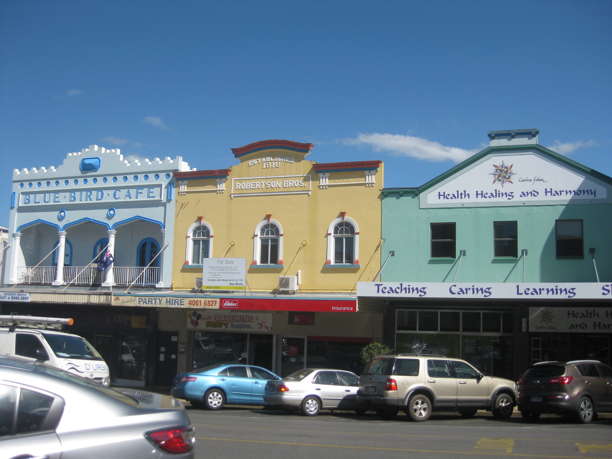
Rankin Street shop fronts

We drive down Coronation Avenue, beside the river, where Con’s family lived. All is green and lush, and the air is so humid it’s like being in a cloud – only hot. At the end of the street is Con O’Brien Park, named after his father, old Con. I take his photo with the sign; then we get back in the car and head south, before the rain begins.
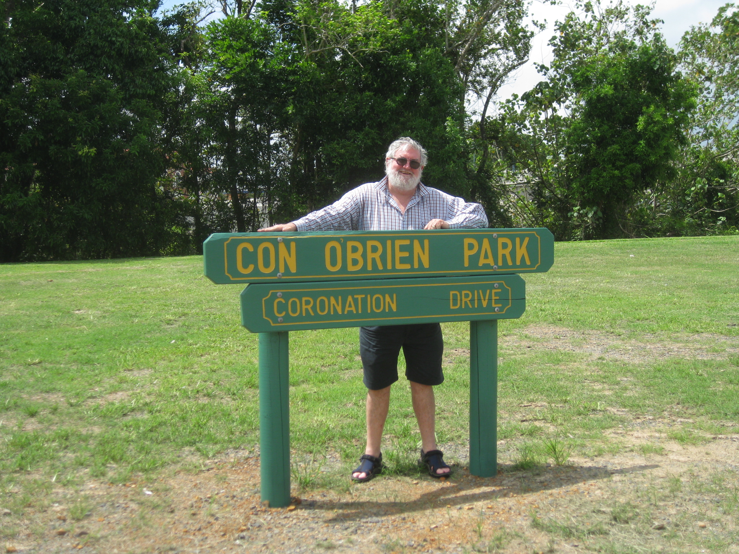
D0607A5E-3CF2-4FA9-8C44-7D8D7661138B
Enter a caption

Glimpsing Bradman

On Boxing Day, 1936, in a soft-topped Essex motorcar and towing a trailer full of camping gear, my father Maurice, his two younger brothers, his father, E.B., and his grandfather C.B. left Nambour to drive to Melbourne. The Third Test was due to begin in January 1937, at the Melbourne Cricket Ground, and they wanted to see Don Bradman bat.

It was to be a two-week road trip – touring, as they called it then – through New South Wales and Victoria. The family often went touring. They didn’t know this would be their last long trip together.

My Dad, Maurice, then an eighteen-year-old, kept a trip journal, full of details that seem quaint to travellers in the twenty-first century: border crossings, road conditions, camping, communications, access to funds along the way.

ED3897E1-9074-485A-8167-1C19EF181C99 Maurice’s trip journal 1936-1937

Now, in June 2020, the year of COVID-19, southerners are stopped at the border, not allowed to cross into Queensland without a special permit.

bradman covid closure guardian “Long delays as Queensland-NSW border closed for first time since Spanish flu in 1919” The Guardian, 26 Mar 2020

In 1936, cars and trucks going from Queensland to New South Wales were stopped and inspected at border gates. New South Wales didn’t want Queenslanders bringing cattle ticks south with them to infest stock. They still don’t.

Queensland has always been seen by southerners as a wild, bizarre place, a frontier region with its own quirky rules. We are the state of cyclones, cane toads, crocodiles, cattle ticks and mad politicians, and we’re oddly proud of that.

In normal times in the twenty-first century, cars drive straight across the borders without a pause; but still, when I cross into New South Wales on the Pacific Motorway, speeding past the big red border sculpture along the Tugun Bypass, or down through the rugged border mountains near Mount Lindesay, or at Wallangarra on the New England Highway, or Goondiwindi on the Newell, it feels like an event, with a little sense of visiting a foreign country; and crossing back into Queensland feels like coming home.

bradman red border sculpture Qld-N.S.W Border, Tugun goldcoastbulletin.com.au

In 1936, Queensland travellers were advised to obtain an Interstate Motorists Permit before travelling south. Dad’s family crossed the border at Mount Lindesay, and in Armidale, their first stop in New South Wales, according to Maurice’s journal they sought the cop-shop, where a policeman was persuaded to come out and search for engine-numbers, chassis-numbers etc., and to give us an interstate pass and windscreen sticker.

bradmanborder gate The Border Gate at Mt Lindesay Frank Hurley, c.1961

They slept that night on the floor of a fruit packing shed outside Armidale, on the property of a family friend. From then on, nights were spent in their tent in what were called Tourist Camping Parks, or at likely spots beside the road wherever it suited them, as you could do in those less regulated days.

In 1936, the population of Australia was less than six million. Now, over twenty million people call Australia home, driving nearly twenty million vehicles, and so we can’t just set up camp wherever we want to anymore.

Roads were narrow and often steep and winding. Even major roads were rough and unsealed in places. There were many railway level crossings on the New England Highway; and instead of speeding high over the Hawkesbury River on the M1 as we do now, travellers crossed by Peat’s Ferry. It nine years later when the river was bridged at that point.

bradman peat's ferry 1930 NSW state archives Launch of the new Peat’s Ferry, 1930 records.nsw.gov.au

Thirty-seven other cars went on the ferry with the family’s Essex, and as they waited in line to board, Maurice and his brothers ate a bottle of local oysters, sold to waiting travellers by enterprising boys. Hawkesbury River oysters. That hasn’t changed.

bradman 1931 essex Essex Super Six Model E, 1931 – probably the model used on this road trip commons.wikipedia.org

Road trip communications are different now, in ways that were unimaginable then. We use our phones to check directions and distances, traffic conditions and weather; to book accommodation, and listen to music, talking books and podcasts; all while travelling. To check weather conditions before heading to Mount Kosciusko, E.B. booked a trunk call to the weather bureau from Canberra Post Office, and to communicate with home they sent telegrams.

We’ve done over 100,000 kilometres in our Forester, with one puncture. We have it serviced every 12,000 kilometres or so. On highways, cruise control is set at 100 or 110 kph. Maurice and his family, on their 1936-37 trip of 3397 miles (5467 kilometres), changed three tyres because of punctures, stopped three times for grease-ups and oil changes, broke a spring, had the steering adjusted and repairs done to the trailer, and were pleased when on one straight road in Victoria they reached fifty miles (eighty kilometres) an hour.

As we all had to before the arrival of Bank Cards in the late 1970s, they’d sent specimen signatures ahead from their home branch of the Commonwealth Bank so they could withdraw money along the way. No ATMs or plastic cards then.

On 4 January 1937, Maurice and his group at last got to the M.C.G. to see Bradman. They arrived late. As Maurice put it, We went there on the day on which the world’s record cricket crowd – 87,000 – was present. We were among the 17,000 for which there was no room. We caught glimpses of the play – sometimes three quarters of a wicket keeper, or a single fieldsman and a patch of grass. One of the batsmen we could sometimes glimpse was Bradman.     

bradman Guardian Bradman at the crease, Third Test, second innings, Melbourne January 1937 20 Great Ashes Moments No. 4, The Guardian, 9 May 2013

Next day they had to leave for home. With no car radio, they stopped along the way to hear the progress of the Test: in a café in Wangaratta, and again in a park at Albury, where people lay on the bank of the Murray in bathers, listening to the broadcast description of Bradman’s and Fingleton’s fine stand blaring forth from a speaker hung in a tree in the park.

bradman albury park The Murray River near Albury, 1930s. flickr.com

Next day, at a loudspeaker at a small refreshment stall at Hume Dam, we heard Bradman score the single which took his score to two hundred.

Bradman ended up scoring 270 runs – a record for a number seven batsman; and England lost the Test.

Sixteen days after leaving Nambour, Maurice and the family arrived back home. Maurice typed up the story, added maps and illustrations and had the journal sturdily bound.

20F2E6FF-1839-4DEF-98BB-D370417D242C_1_201_a Maurice’s hand-drawn map of the journey through N.S.W.

A month later, he started university. Three years later, he joined the 2/26th infantry battalion. He shipped out of Melbourne in 1941, bound for Singapore, part of the troop build-up in the face of the threat of invasion by Japan.

The following February, Singapore surrendered to the Japanese Imperial Army, and in 1943 Maurice was among the thousands of prisoners of war who were packed into rice wagons and taken north by train to work as slaves, building the infamous Thai-Burma railway.

In October 1945, twenty-seven years old, thin, jaundiced and exhausted, Maurice came home again to Nambour, to Mum, and to their little son.

At once, he bought a new car; and within two years, he and Mum were off on another road trip – the first of a new generation. My earliest memory is standing in the back seat of that little car, as kids did in those less regulated days, looking between my parents’ shoulders at a long, narrow road leading off into the distance.

My Dad got me addicted to road trips early. I’ve never gotten over it.

Blog at WordPress.com.

Up ↑