Captain Logan and Queen’s Wharf

“The settlement,” Cowper had told Clunie on the Isabella, “is mostly on one point of land. Penis-shaped, we shall say, backed by a high ridge we shall call the Line of Bollocks.”[1]

Jessica Anderson wrote a wise and interesting novel of convict Brisbane, “The Commandant”, published in 1975. It includes this pungent description of the site of the Moreton Bay Convict Station, in the words of the notoriously bitter, badly-behaved drunk, Henry Cowper, the convict station’s first medical officer. The site of the Moreton Bay Convict Settlement, established in 1826, runs along the ridge where William and George Streets run now.

Queensland’s government buildings still occupy this “penis-shaped” piece of high ground along the river.  

Henry Cowper was the medical officer for the Settlement from 1826 to 1832. He worked in primitive conditions in this isolated, under-funded and under-supplied outpost of the British Empire. Captain Patrick Logan was the commandant.

Captain Patrick Logan, 57th Foot Regiment, Commandant of Moreton Bay Convict Station 1826-1830 State Library of New South Wales

Jessica Anderson’s excellent novel was thoroughly researched, and conditions in the settlement, and many of the characters, are based on records of the time. The novel culminates in the sombre discovery and retrieval of the body of Captain Logan.

Captain Patrick Logan of the 57th Foot Regiment, a veteran of the Peninsula War against Napoleon, was commandant of the settlement from 1826 until his murder in 1830 at the age of just thirty-nine.

Many men who came to Australia in the early years of European occupation, to supervise convict stations and run governments, were veterans of the European wars of the early nineteenth century. Violence and flogging were not new to them. Logan was a notoriously harsh disciplinarian who followed the rules without mercy. The floggings Logan ordered for convicts would have provided Cowper with a stream of grievously injured patients.

Constant complaints about the treatment of Moreton Bay convicts were made to the government in Sydney. The famous old song “Moreton Bay” has a convict describe it:  

For three long years I was beastly treated 
And heavy irons on my legs I wore
My back from flogging was lacerated
And oft times painted with my crimson gore
And many a man from downright starvation
Lies mouldering now underneath the clay
And Captain Logan he had us mangled
All at the triangles of Moreton Bay

Like the Egyptians and ancient Hebrews
We were oppressed under Logan’s yoke
Till a native black lying there in ambush
Did deal this tyrant his mortal stroke
My fellow prisoners be exhilarated
That all such monsters such a death may find
And when from bondage we are liberated
Our former sufferings will fade from mind[2]

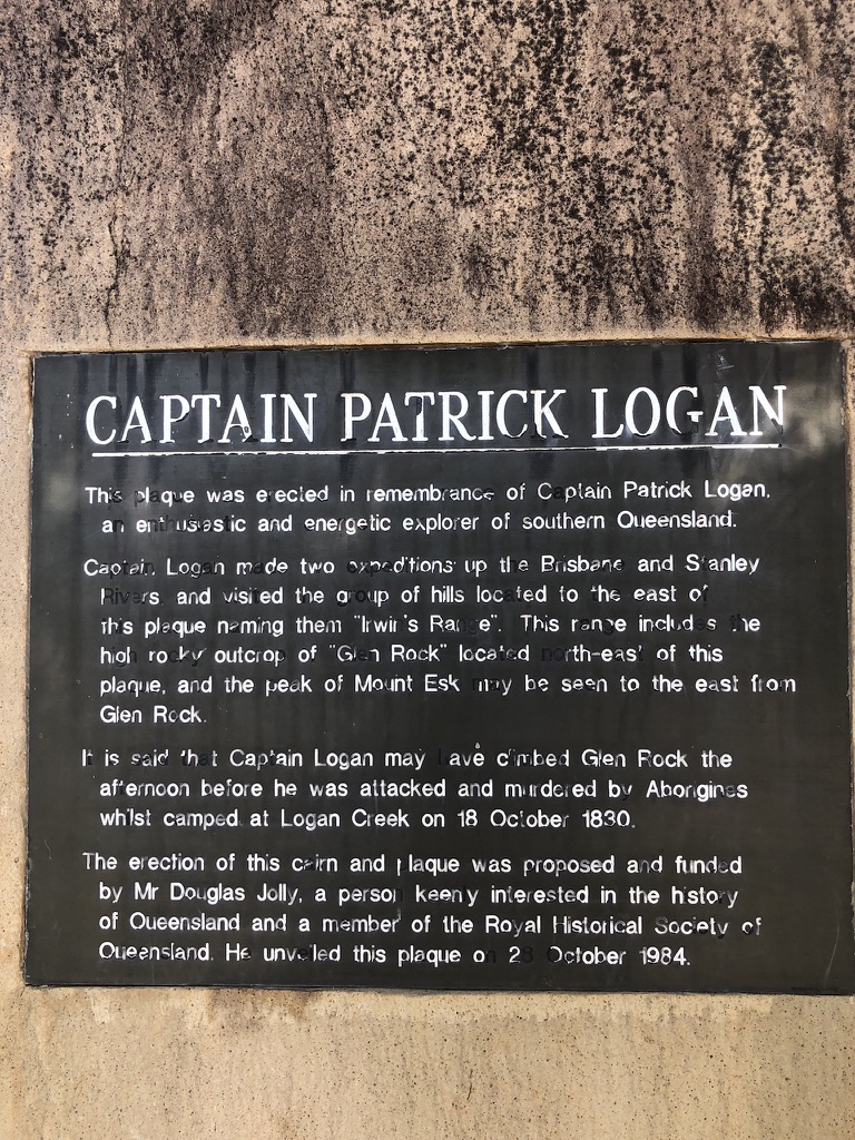
In Esk, in the Brisbane Valley, the Memorial Park has shady trees and picnic tables. We stopped there for lunch one day. Sandwich in hand, I wandered around the park, and found a rock with a plaque attached. The plaque describes Patrick Logan as “an enthusiastic and energetic explorer of Southern Queensland’, and provides the information that it was near here, on 18 October 1830, on his last exploratory trip before his term as commandant was over, that he was killed by an Aboriginal group.

Plaque on the monument in Esk Memorial Park

It may be true that escaped convicts were also involved in Logan’s murder; but there is always going to be violence when one group invades another’s traditional homelands and takes them for their own.

Patrick Logan made frequent exploratory expeditions and is credited with many “discoveries” in south-east Queensland. His name is on lookouts at Rathdowney and Mount French in the Scenic Rim. He is credited with discovering the Logan River, Dugulumbah to Yugumbeh people who had known it for thousands of years. Logan Road, the City of Logan, and many other plaques, streets and suburbs carry his name.

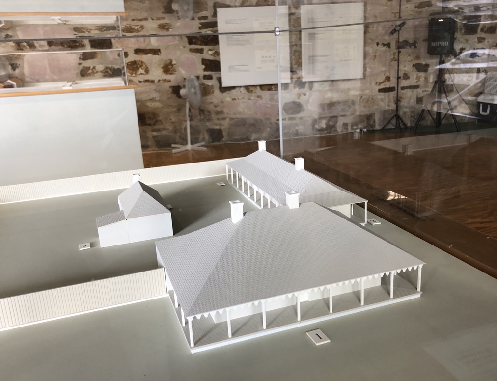
During Logan’s time as commandant, the first permanent buildings in what was to become Brisbane were erected. Two of them still stand: the windmill up on Wickham Terrace (on Cowper’s “Line of Bollocks”, in fact) and the Commissariat Store in William Street, the oldest inhabited building in Brisbane. The Commissariat Store building is now the Convict Museum and the headquarters of the Royal Historical Society of Queensland, and on its lower floor can be seen models of the Convict Station the way it looked at the time of Logan’s death.
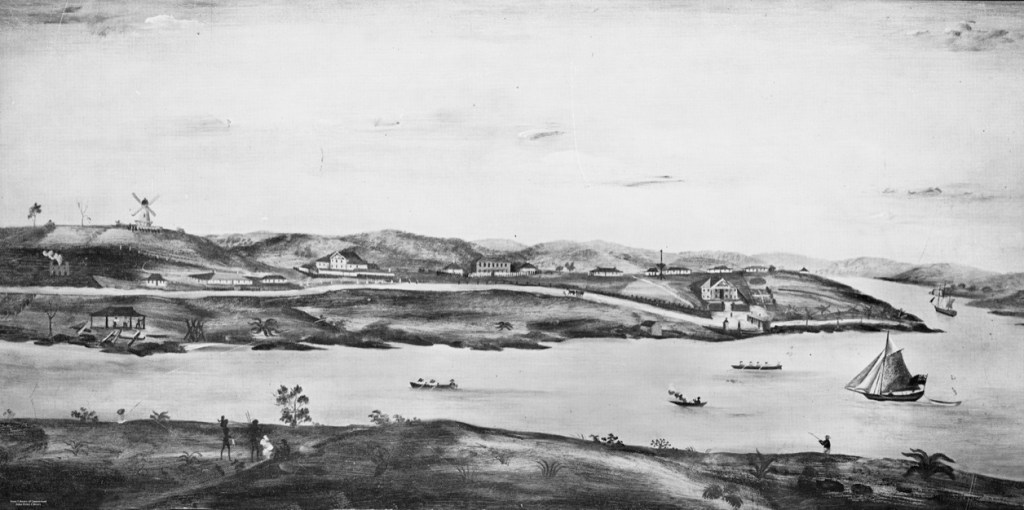
The Commissariat Store, in its original two story form, can be seen above the wharf towards the end of the point of land. The Commandant’s house is the last one on the right above the Store. The wharf was not called “Queen’s Wharf” in those days. George IV had recently died, and William IV was king. Queen Victoria did not gain the English throne until 1837. “Image of early Brisbane Town in convict days, ca. 1831. From a painting by Cedric Fowler.” collections.slq.gov.au

These include a model of the Commandant’s house, with a verandah in front.

Model of the Commandant’s house, in the Convict Museum, William Street, Brisbane

A museum volunteer tells me that the house, which features in Jessica Anderson’s novel, looked across William Street to the river, near the site where huge casino and hotel buildings are currently rising: the Queen’s Wharf Development Project.

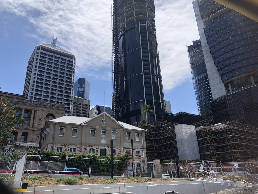
The roof and top floor of the Commissariat Store, now headquarters of the Royal Historical Society of Queensland, William Street. Queen’s Wharf Development site in the background

According to the website, the finished Queen’s Wharf development will include a Sky Deck 100 metres above William Street, and fifty restaurants, bars and cafes.

This whole area is a massive construction site; and in the midst of it sits, incongruously, the Commissariat Store.

Commissariat Store in the midst of construction site

I’m told the developers wanted to take over the convict-built Commissariat Store. It would have made a fine site for a restaurant and bar, this old stone building opening out on to the riverbank. But somehow the RHSQ managed to keep it.
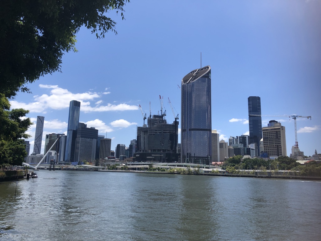
The white peaked roof of the Commissariat Store can just be seen behind the freeway overpass. The Commandant’s house would have been behind the building with the cranes

Other historical buildings within the William and George Street precinct are being protected and preserved, but it’s difficult now to imagine the environment of simple wooden buildings, dirt pathways and gardens that occupied this stretch of land two hundred years ago.

Today there’s a huge, powerful white snake rearing out of the Brisbane River, looking as if it’s about to strike.

Neville Bonner Bridge under construction

It’s the new Neville Bonner Bridge, startling in its design but destined to become a Brisbane icon. The last sections have been craned into place, and soon pedestrians will be able to cross from Southbank Parklands to take part in the promised glories of the new development.

The ridge above the river will never be the same again. Patrick Logan would not recognise it.

It’s to be hoped that enough well-off tourists come to spend their money there to pay for it all.


[1] “The Commandant”, Jessica Anderson. First published 1975. This edition: The Text Publishing Company, Australia. 2012. P. 74.

[2] folkstream.com
Horror Stretch

Murder.

Travellers shot in their cars or sleeping bags.

Frightening reports in the papers.

In the 1960s and 1970s, Central Queensland place names Funnel Creek, Lotus Creek and Connors River held a weight of menace. Across that decade, several travellers were murdered by strangers when pulled up alongside the Bruce Highway between Marlborough and Sarina. The Marlborough Stretch became known as the Horror Stretch.

In his 2002 book “Seven Versions of an Australian Badland”, historian Ross Gibson writes in detail about those random murders and the other violent acts that occurred in this region over the previous century.

He writes, “This stretch of country is an immense, historical crime scene.”

Gibson also describes its cyclones and floods; and it was because of floods that Con and I once found ourselves stranded here with our children.

In the early January of 1974, on our way north to Cairns, we drove the Horror Stretch, as we had done before; but this year was different. This year was very wet indeed. Later that month, Australia Day weekend, record floods would inundate Brisbane.

From our home in Burketown, we had driven down to Brisbane for Christmas – 2200 kilometres of bitumen and gravel, with two young children and no car air-conditioning. But we were young, and we were used to it.

In those days, the Burketown water supply was untreated. We had a rainwater tank for drinking, but our bath water came from a lagoon where the local kids swam. It is not surprising that when, over Christmas, I began to feel ill, a doctor diagnosed hepatitis A.

There was nowhere for us in Brisbane, with me suffering from an infectious disease.

“I could have you taken into custody,” said the doctor. “If you don’t undertake to keep yourself away from people, that’s what I’ll do!”

We had a holiday apartment waiting for us in Cairns, and so we set out on the three-day journey north, in spite of warnings of flood rains along the way.

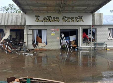
We crossed Lotus Creek on our second day on the road, 120 kilometres north of Marlborough and driving through rain, dipping down on to the narrow, single-lane bridge, with swirling, brown waters close beneath its decking, then up past the roadhouse on the north bank.

lotus creek roadhouse
Lotus Creek Service Station after Cyclone Debbie, March 2017. Rockhampton Morning Bulletin

Twenty kilometres further on we crossed the Connors River, with even higher water; but when we reached Funnel Creek, we were stopped. Water was racing over the bridge and halfway up the flood marker.

“We’re going back,” called out one of the other travellers pulled up at the flooded bridge. “Connors River is coming up. If it goes over the bridge there, we’ll be stranded.”

Worried, we turned back too, crossed Connors River safely and spent that night in the car, parked beside the road, just south of the river. The rain poured down, so we had to close the windows, except for a crack. It was hot, and there were mosquitoes.

We locked the car doors and tried not to think of how many people had been murdered along this road. Fourteen months later, skydiving couple Noel and Sophie Weckert would be shot by strangers here at Connors River.

noel weckert
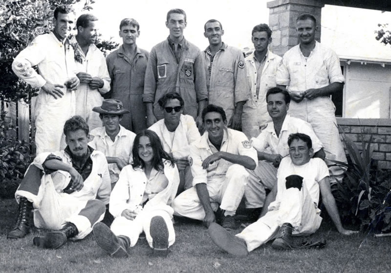
Back row, 4th from left – skydiver Noel Weckert. South Australian Skydivers

Next morning, we drove further south, hoping to get back to Marlborough; but now the water was over the bridge at Lotus Creek. We were marooned.

There were a dozen carloads of people caught there, congregated at the Lotus Creek Roadhouse. The manager let us have an old caravan out the back for that night. It was broken-down and dusty, with grimy mattresses and no bedding, but it was more comfortable than the car. And it felt safer.

There wasn’t much food at the roadhouse, but we had our own supplies – including the only bread available for breakfast next morning. We shared it with other travellers, but the manager charged us for toasting it.

After breakfast, we drove north again and joined the queue waiting at the Connors River for the water to go down. It was a long, hot wait. People shared stories about floods, snakes and breakdowns. Some dozed in their cars. Our small children squatted in the gutter beside the car, playing with a toy truck.

The water was still over the bridge when cars began to cross. We took our turn, with a towel draped across the grill to minimize the wet coming in over the engine. As we drove up the slope on the other side, I bailed water out the window with an icecream container.

We did stupid things as young parents.

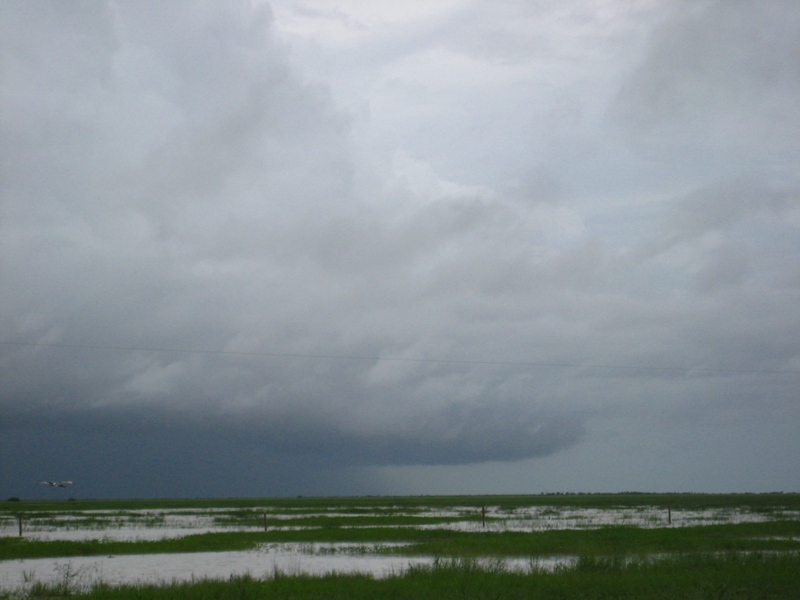
Having made it through to Cairns, a couple of weeks later we flew back to Burketown. The day Brisbane flooded, we were flying over the Gulf Country, across a sea of floodwater, the winding Carpentaria rivers marked only by the tops of trees along their banks. Our final leg home from the airstrip was in a tinnie.

IMG_7928
Gulf Country under floods

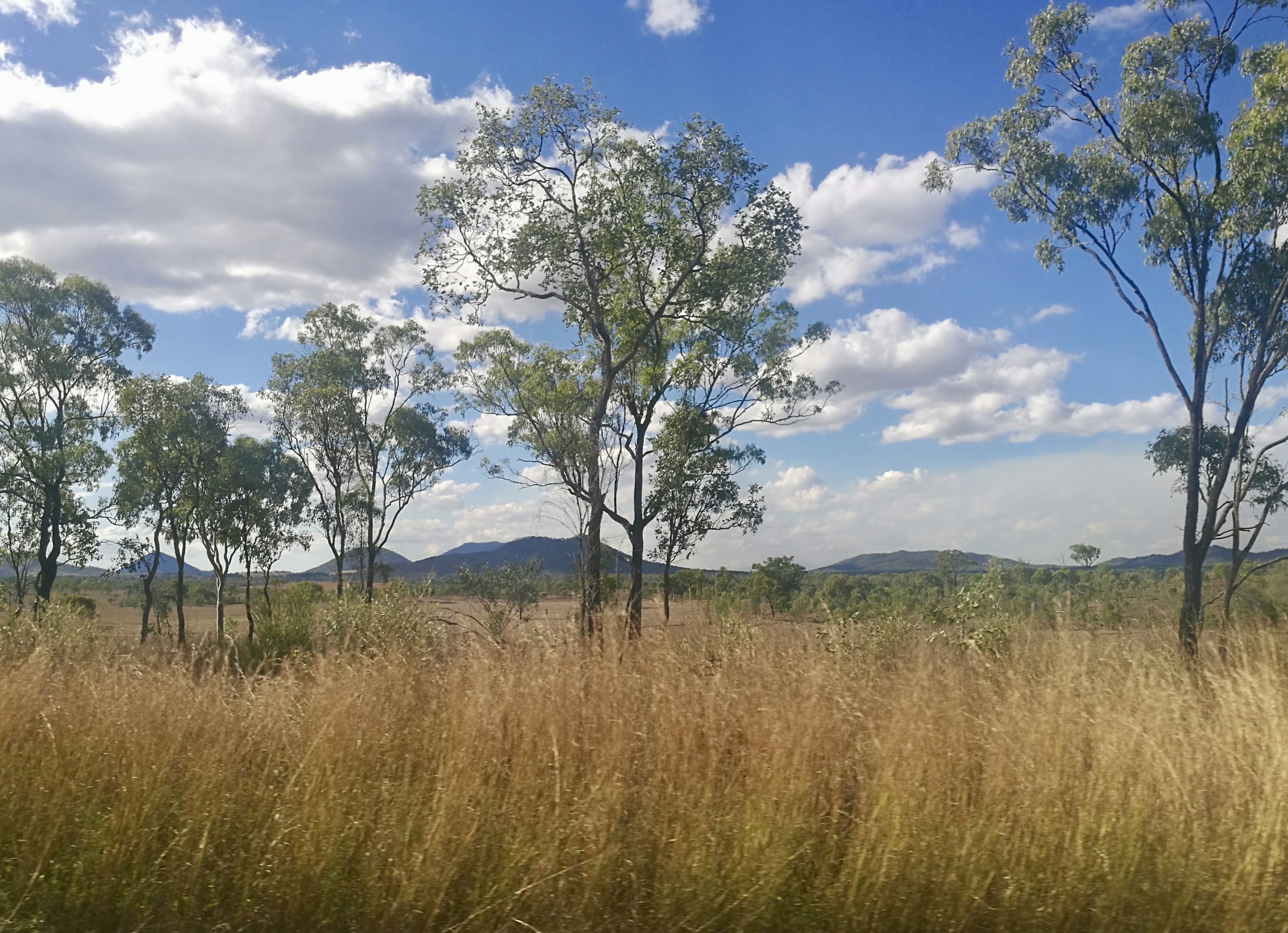
The highway doesn’t follow the Horror Stretch now – it takes a shorter, more easterly route past Saint Lawrence, and it’s a wide, well-made road and a pleasant, high-speed drive, with pasture and bush land, spectacular ranges in the background and station homesteads out of sight up dirt tracks and behind gates and grids. In a good season, tall grass stands golden along the road edges, bright against the blue mountain ranges.

fullsizeoutput_3ef3

Many still remember the murders of the Horror Stretch, though; and there have been even more frightening outback murders in the fifty-odd years since. There’s horror in the idea of a madman emerging from the dark lonely bush to murder a stranger.

That said, more travellers have died when driving voluntarily through floodwaters. Crossing flooded Connors River with young children in the car is the memory that gives me nightmares.

Blog at WordPress.com.

Up ↑