Cooktown, 250 Years after Cook

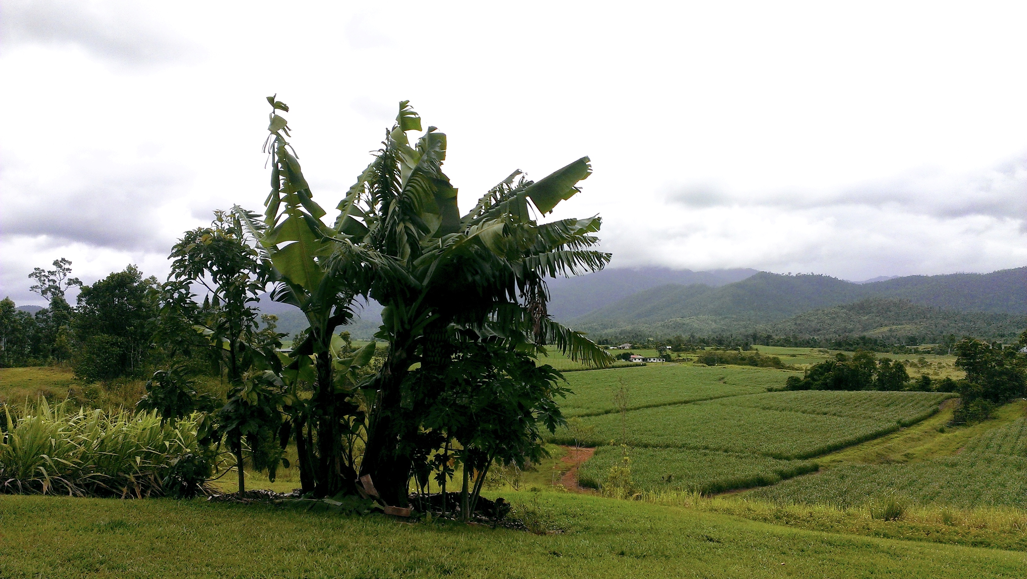
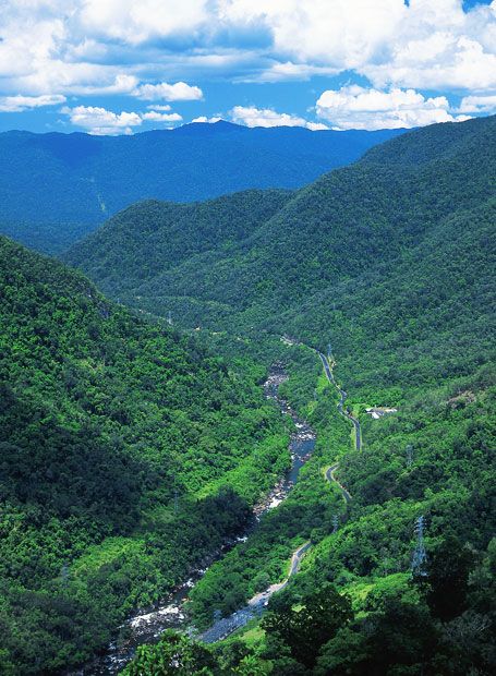
Cooktown is a small town a long way from anywhere: 328 kilometres north of Cairns, at the end of the bitumen. When we visited it hadn’t occurred to me that it has a Botanic Gardens; but does, and it’s a beauty. Old, too. Planting first began there in 1868, and it was made official in 1878.

cooktown-botanic-gardens-cooktown-1
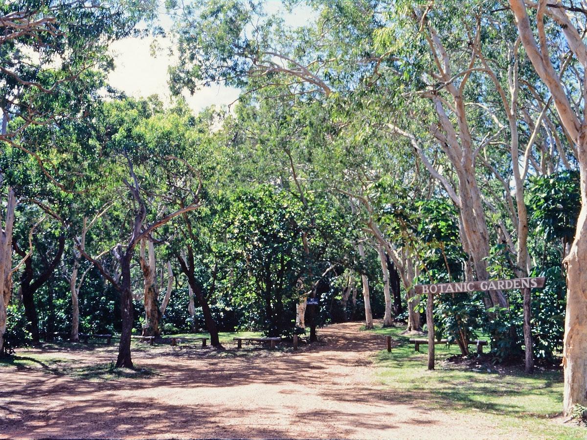
Cooktown Botanic gardens and Gallery queensland.com

The Cooktown Botanic Gardens has an art gallery, café and information centre, and as always for a Botanic Gardens, its plantings are based on scientific, cultural and historical principles. It includes local species used throughout the centuries by the local Indigenous people, as well as threatened species.

It also includes examples of the plants collected in 1770 by the botanists Joseph Banks and Daniel Solander on Captain James Cook’s visit on HMB Endeavour, and drawn by botanist and natural history artist Sydney Parkinson. Some of these specimens, pressed, are in the collection of the Queensland Herbarium, at Mt Coot-tha Botanic Gardens in Brisbane.

cook banks-specimen
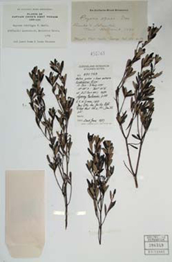
“Specimen collected by Banks and Solander from the Endeavour River, Queensland, Cook’s Voyage 1770” Qld Herbarium http://www.qld.gov.au

We visited Cooktown in mid-November, in the build-up to the wet season. Not surprisingly, it was hot in the Gardens.

Our motel overlooked the Endeavour River, named by Captain Cook, and I couldn’t help thinking about the history of this place that we’ve heard about all our lives. The Endeavour was beached for repairs just below us, and behind us was the granite hill that Cook and his companions climbed to look out over the sea and its treacherous reefs their wounded ship had picked its way through to reach this small harbour and would have to thread through again on its way out.

4AB37D87-01C8-42FD-AB67-D1A09A2A95B0
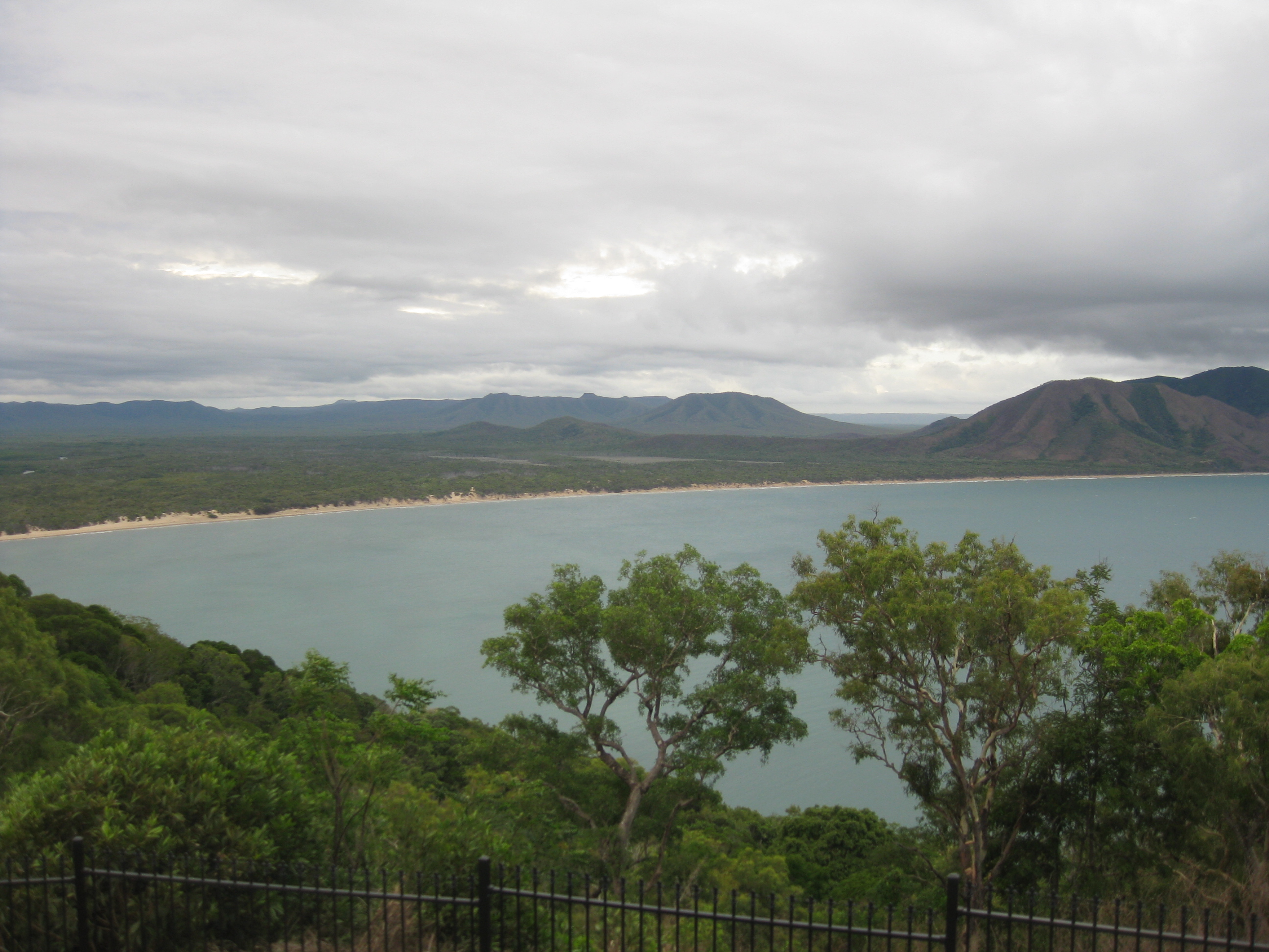
View from Grassy Hill, Cooktown

Captain Cook’s expedition (we call him Captain because he was captain of the Endeavour, but his naval rank was Lieutenant) arrived in mid-June and stayed throughout July, when the weather in the tropics is perfect. They spent nearly seven weeks here, on Cook’s first voyage to the South Pacific, 250 years ago this month. When I read these sections of Cook’s journal, I realised for the first time just what an extraordinary episode this was, an encounter between two cultures entirely unknown to each other. The party of eighty-seven Europeans – explorers, astronomers, botanists, officers and crew – knew nothing of the Indigenous culture or language, and the local Guugu Yimithirr of the area had no idea what these strange intruders were doing here.

Cook was an extraordinary seaman, navigator and cartographer. His orders from the British government for this three-year voyage of discovery were both scientific and strategic: to carry out astronomical observations, and to investigate and take possession of the rumoured Great Southern Lands for Britain.

A plan of the entrance of Endeavour River, New South Wales: lati
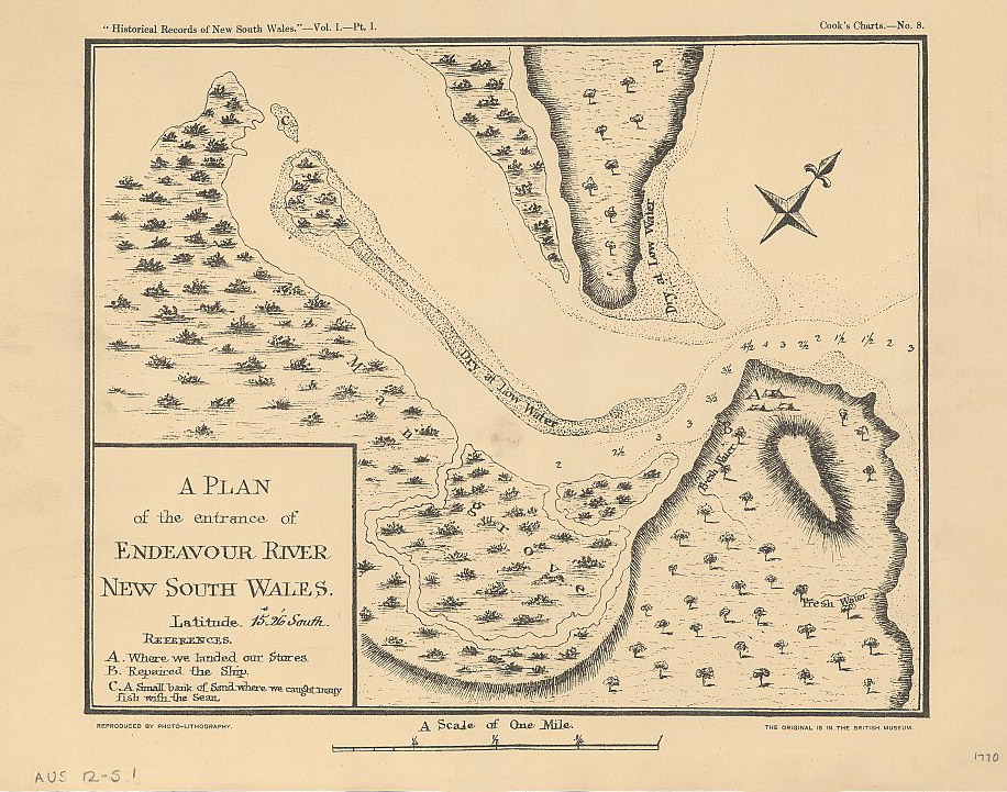
“A plan of the entrance of the Endeavour River, New South Wales, 1770” Cook’s Charts, National Library of Australia collection

All the way up the east coast of Australia, Banks and Solander had been desperate to do some serious study of the wealth of plants and animals that Europeans had never seen before. In what is now Cooktown they finally got their chance, although they and everyone else on Endeavour nearly died getting there.

According to the captain’s journal it was a clear, moonlight night when on 10 June 1770, the Endeavour, surrounded by coral reefs, struck a reef and stuck fast. Cook’s journal entry for 11 June, written in the utmost haste, shows how desperate the situation was.

The crew threw overboard the ship’s cannons, ballast, and anything else that could be spared to reduce weight, and manned the pumps desperately for twenty-four hours before the ship could be floated and dragged off the reef. A fothering sail was prepared, packed with wool and oakum, and dragged under the hull to be lashed over the hole.[1]

Too far from shore to swim, on a small ship alone in unknown waters and utterly beyond help, it was equivalent to a dangerous situation on a space craft.

The ship picked its way through further reefs, taking water all the time, until they found the mouth of what Cook named the Endeavour River, and moored the ship alongside a steep beach on the southern side of the river.

cooktown botanic view of endeavour river nat Mari museum
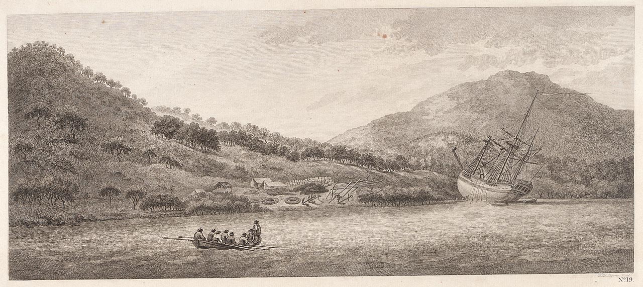
“A view of Endeavour River” collections.rmg.co.uk/collections

When they looked at the damage to the hull it was discovered that a piece of coral had broken off and blocked the hole, probably saving them.

The Endeavour and its company stayed at the Endeavour River until repairs were completed. Banks and Solander collected plant specimens; and the Europeans saw their first kangaroo.

The local Guugu Yimithirr people did not make them welcome. It’s a perilous business, going uninvited into a foreign land and helping yourself to whatever you need. Eight years later, in Hawaii, it was probably taking advantage of local hospitality without any awareness of local customs and sensitivities that led to Cook’s death. There were misunderstandings and clashes on the Endeavour River, too.

cooktown kangourou parkinson
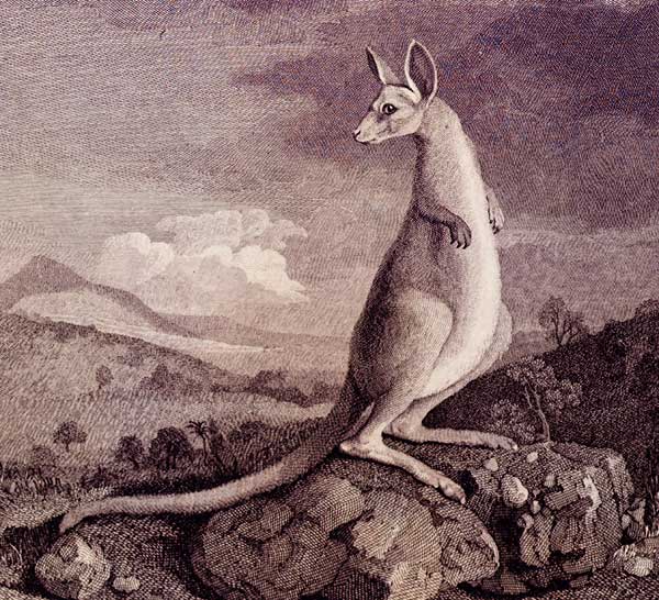
“Kangourou – seen Endeavour River” Sydney Parkinson. Engraving by William Byrne en.wikipedia.org

The locals especially resented Cook’s party catching and eating turtles, which were of course a traditional local food with rituals around their capture, preparation and sharing. They probably thought of it as stealing. They showed their displeasure, and Cook’s party retaliated.

19 July: …those that came on board were very desirous of having some of our turtle and took the liberty to haul two to the gang way to put over the side… being disappointed in this they grew a little troublesome, and were for throwing everything overboard they could lay their hands upon; I offer’d them some bread to eat, which they rejected with scorn as I believe they would have done anything else excepting turtle – soon after this they all went ashore. Mr Banks, myself and five or six more of our people being ashore at the same time, immediately upon their landing one of them took a handful of dry grass and lighted it at a fire we had ashore and before we well know’d what he was going about he made a large circuit round about us and set fire to the grass, and in an Instant the whole place was in flames… they went to a place… where all our nets and a good deal of linnen were laid out to dry, here they again set fire to the grass… I was obliged to fire a musquet loaded with small shott at one of the ring leaders which sent them off. Notwithstanding my firing in which one must have been a little hurt because we saw some a few drops of blood on some of the linnen he had gone over, they did not go far for we soon after heard their voices in the woods…[2]

On 22 August 1770, on a small island he named Possession Island at the tip of Cape York, Captain Cook took possession of the whole eastern coast of what is now Australia on behalf of the British Government. Cook noted in his journal:

 … I now once more hoisted English Coulers and in the Name of His Majesty King George the Third took possession of the whole Eastern Coast from the above Latitude down to this place by the Name of New South Wales together with all the Bays, Harbours Rivers and Islands situate upon the said coast after which we fired three Volleys of small Arms which were answerd by the like number from the Ship.[3]

 After Cook’s return to England the British government decided that this land belonged to no one – terra nullius – and therefore was free for them to use without treaty or reparation. It’s suggested that it was Banks, by all accounts both arrogant and influential, who gave them that impression.[4]

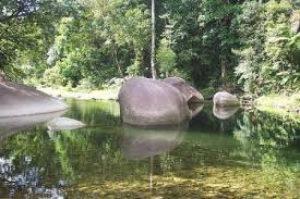
We visited the James Cook Museum, occupying a spectacular old nineteenth century Sisters of Mercy Convent building, and looked at the displays telling the stories of this place where such an extraordinary clash of cultures occurred two hundred and fifty years ago. We visited Finch Bay, with its granite boulders like whales and a backpacker standing naked in the creek, braving the crocodiles as she washed her clothes; we watched another sunset over the Endeavour River, and next morning drove away back to Cairns.

Cooktown rock
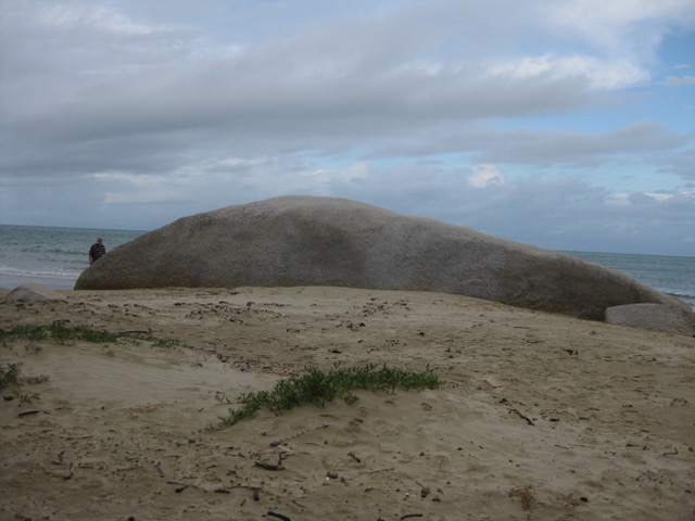
Granite boulder, Finch Bay

The English knew what it was to have foreigners arrive in ships. Romans, Anglo-Saxons, Vikings, Normans: they were all invaders who took land and goods, killed any who opposed them, and disrupted local culture, language and spirituality. Britain did the same to Ireland; and the Guugu Yimithirr people were to be left in peace for only a few more generations before the same disaster happened to them.
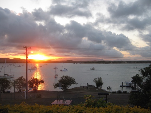
Cooktown sunset
Cooktown sunset

[1] http://southseas.nla.gov.au/journals/cook/17700611.html Cook’s Journal Daily Entries 11 June 1770.

[2] http://southseas.nla.gov.au/journals/cook/17700611.html Cook’s Journal Daily Entries 19 July 1770.

[3] http://southseas.nla.gov.au/journals/cook/17700822.html Cook’s Journal Daily Entries 22 August 1770

[4] https://theconversation.com/henry-reynolds-australia-was-founded-on-a-hypocrisy-that-haunts-us-to-this-day-101679

Golden Gumboot

It’s December in the Wet Tropics of Queensland, and the chimneys of Tully Sugar Mill are quiet. Crushing has finished for the year. Behind the town, the rainforests of Mount Tyson are cloaked in rain.

06FF0145-4C62-4F82-A470-A090615A3B76_1_201_a
Wet Tropics

This is Golden Gumboot country. The Golden Gumboot is an unofficial, hotly contested yearly competition for the highest rainfall, between the Far North Queensland towns of Tully and Babinda.

Tully, 140 kilometres south of Cairns, has at the start of its main street a concrete gumboot 7.9 metres high with a frog crawling up it. Having survived two fierce cyclones, the boot was recently refurbished by means of a state government grant and given a spectacular coat of gold paint. There is a staircase to the top, and a viewing platform. 7.9 metres is the amount of rain that fell here in 1950: the highest annual rainfall ever recorded in a populated area of Australia. Tully’s average annual rainfall, according to the Bureau of Meteorology, is 4 metres.

golden gumboot new
Tully’s Golden Gumboot with renewed gold

Tully has a Golden Gumboot Festival each year whatever the totals are; but in recent decades Babinda, 80 kilometres further north, has had the higher rainfall, averaging 4.28 metres annually, compared to Tully’s 4.09 metres. It’s Babinda that has the Golden Gumboot bragging rights.

To give an idea of what these numbers signify, Brisbane has an average rainfall of just over one metre a year.

Babinda nestles close to the rainforest-covered slopes of Mount Bartle Frere, Queensland’s highest mountain. If you can see the top of Mount Bartle Frere, so locals say, it’s going to rain. If you can’t, it is raining.

FA23E2EE-F506-45C2-B4E3-089F01CB3ED6_1_201_a
Towards Mount Bartle Frere, Queensland’s highest

People in these northern towns and farms face a challenging climate, economic threats and agricultural tribulations. Bananas and papaws are major industries around here, but the focus of Tully’s economy is its sugar mill. Chinese-owned, it is the economic heart of this working town. Tully Mill crushes the second highest tonnage of any in the country.

Banana crops, papaw trees and sugar cane are vulnerable to disease, and all are at the mercy of the market – and the weather. Because the rainfall in this region is so reliable, farmers don’t irrigate.

The locals are down-to-earth and practical. They drive twin-cab utes, often with a pig dog cage on the back, and there are boats parked in many back yards. Men dress in boots, work shorts, polo shirts and hi-vis. Women favour denim shorts, black singlet tops and rubber thongs.

The locals relish an earthy form of humour. For instance, a visitor to Tully might talk about driving up the main street, Butler Street; but to a local, it’s “going up the Butt.”

golden gumboot butler st
Up Butler Street, Tully, towards Mount Tyson

Both Babinda and Tully have spectacular tourist draw cards nearby. The famous Tully Gorge, where white-water rafting tours ride the outpour of water from the Kareeya hydro-electricity plant, runs right up against the ranges of the Atherton Tableland and the three hundred metre drop of Tully Falls. The falls lie directly below Tully Falls Lookout on the map, but the distance between the two by road is over two hundred kilometres.

golden gumboot tully gorgr
Tully Gorge seen from Tully Falls Lookout, 200km away by road

Electric-blue Ulysses butterflies flit through the forests along the gorge.

Babinda has The Boulders, a famous swimming hole and granite boulder-strewn creek of matchless beauty. We called in there for a swim a few years ago, floating in that clear pool in the rain as if in a cool, green heaven.

“We used to come to The Boulders for picnics,” Con told me, kicking against the gentle flow of the water. Con grew up in Innisfail, which lies between Tully and Babinda, looking out towards Mount Bartle Frere. Innisfail, famous for its papaws, averages a mere 3.4 metres of rainfall annually.

golden gumboot bananas
Innisfail banana farm

“Downstream from the main swimming hole there’s a place we called the Chute, which was like a fast water slide. It was great. And the Devil’s Pool – you’d have to be crazy to jump in there, but people did.”

This is a dangerous place for people who venture too close to where the creek is sucked down among huge granite boulders. Adventurous young men have died here.

“When I played for Innisfail Brothers League team and we had a game in Babinda, we’d come to The Boulders afterwards for a swim. We played at the Babinda showgrounds, and there was no such luxury as showers there.”

I first visited The Boulders with my family during a road trip from the south. My dad climbed up on a large boulder and swung out on a rope swing before performing a cartwheeling belly flop into the creek. He swam ashore with his chest scarlet from hitting the water. We were laughing; he didn’t see the funny side.

golden gumboot boulders
The Boulders, Babinda

In 2011, Cyclone Yasi brought disaster to a thousand kilometres of  Queensland coast, its eye crossing the coast at Mission Beach, the closest coastal town to Tully.

golden gumboot yasi bom
Cyclone Yasi crossing the coast

Yasi’s devastation still shows in an occasional roofless building and in the thinned rainforest on the hillsides. Mission Beach people were isolated for days. A couple of years after Yasi I spoke to a young Frenchwoman living there. I asked her how she had fared.

“During the cyclone, I got a call from my family in Paris,” she told me. “My mother had died. I wanted to get out, to get to the airport in Cairns and fly home. The roads were blocked with debris. The army was clearing them with chainsaws, but no one was allowed in or out.

“I finally managed to get a ride out to the highway with the police, and a bus to Cairns, but the funeral was over long before I reached home.”

We visited friends at South Mission Beach in their beautiful timber house on the hill, and stood on their verandah looking down through greenery towards the tranquil beach where Yasi made landfall.

“Did you leave, when Yasi was coming?” I asked.

“No, we stayed here. We bunkered down in the bathroom, but it was scary. The noise was incredible. The glass doors at the back blew out, and the garden was a mess of shredded trees and debris. We couldn’t get down the road for smashed branches and tree trunks.”

golden gumboot yasi 2
A local’s comment on Cyclone Yasi

In the Tully branch of Cassowary Coast Libraries there is a display of local historical photographs. Looking at them and seeing the difficulties involved in land clearing, timber felling, road building and transport in the old days, and considering the difficulties they still face today from the weather and the markets, it’s easy to see why the locals need to be tough.

2019 has been drier than usual, even here in the Wet Tropics. The Cassowary Coast Council, which includes Tully and Innisfail, has announced Level 3 water restrictions. The beautiful creek at The Boulders is at its lowest level for years. Babinda and Tully have both recorded much less than their average rainfalls, and little rain is forecast for the rest of the year.

The Wet Tropics is still the greenest place in the state. Sugar, banana and pawpaw farmers are watching the forecasts, though. They must wonder what the future will bring.

golden gumboot Australian_Butterfly_Sanctuary_Ulysses-8-1024x685
Ulysses butterflies

Apple and Grape

“What if you go into labour? I’ll be on the back of the truck – I won’t be able to help you!”

It was 1970, and my husband Con was Master of Ceremonies at the Stanthorpe Apple and Grape Harvest Street Festival. He stood at the microphone on top of a semi-trailer in Maryland Street, describing events and announcing winners, with thousands of people partying around him. No place for a woman soon to give birth.

In the end I watched events from the verandah of the Country Club Hotel.

stanthorpe country club hotel

Con remembers lots of things about that day, such as the hotly-contested Packing Case Relay.

“There was a team of back-packers from one of the big orchards, all in matching t-shirts,” he says. “They were pretty sure of themselves. They’d even trained for it, carrying the packing cases on their shoulders in the approved style.

“They were beaten by a team of local lads wearing work boots and carrying the cases any way they liked! It was a great win.”

He remembers the facial hair competitions.

“Your father entered in the Best Side Levers competition.”

“No! My dad had competition-grade side levers? I don’t remember that!”

“Your dad didn’t win – Jimmy Esplin won. There was a Best Beard competition, too. They made me one of the judges. I was about the only man in town with a beard, which made me the expert!”

“Which horse won the Melbourne Cup that year?”

“Baghdad Note. Why?”

Con remembers, with advantages, every good joke he’s ever heard, and every Melbourne Cup winner by year, and he can tell me who won the Best Side Levers competition at the 1970 Apple and Grape Harvest Festival; but he can’t remember that we agreed to baby-sit the grandchildren next Saturday night or that the wattle tree out the front needs pruning. We’ve been debating for years over which of us has the worse memory.

“I remember Dad’s whiskers,” says my brother Mike. “He grew them especially for the competition. Don’t remember much else though, because I was busy on the High School fundraiser down the street – Bash a Bomb. We’d dragged in a broken-down car, and we charged people for the chance to bash it with sledge hammers. It was very popular! Don’t think it would go down so well these days.”

Con’s reminiscences continue.

“One float in the procession had a girl on top of a Mini-Minor, sitting on a swing. The driver kept lagging behind, then accelerating, then braking again. Every time he braked, the girl nearly flew out of the swing.

“Her boyfriend got sick of it. He opened the door of the Mini, told the driver to get out, and drove it himself for the rest of the parade.”

Matt was born a week after the Festival, and in the winter that followed our hot water pipes froze and burst, and the nappies iced up while soaking in the laundry tubs and hung stiff and frozen on the clothesline.

Frosty Stanthorpe weather is beautiful, and by nine in the morning, I could put the baby out on the verandah, naked, to soak up the sun.

Stanthorpe is an attractive town, unique in the State, with its granite boulders, wild flowers and autumn colours. The houses have the snug architecture of a cold climate, and the sweet smell of wood smoke hangs over the town for months of the year. Locals are proud of living in Queensland’s coldest town.

IMG_3331
Wild flowers and boulders

The Apple and Grape Harvest Festival still draws a crowd, every second year in early autumn when the harvesting season begins. The next Festival will be in 2020, from 28 February until 8 March. There will be a Wine Fiesta, Gala Ball, Fun Run, Grand Parade, Grape Crushing and fireworks, the National Busking Championships, and according to the website, lots more.stanthorpe apple and grape logo

There’s no mention on the website of Bomb Bashing or Side Levers, though, so I don’t know how successful it will be.

Rail Trails

“We power on, trying to sense the walls beside us, ears and eyes straining for anyone coming from the other direction. It’s like holding your breath with your eyes.”

Cycling through a tunnel on the rail trail near Matarraña, Spain. Scary, but exciting, according to Con O’Brien, author of The Ebro Drift blog.

The Matarraña trail is just one of thousands of rail trails all over the world. Rail tracks no longer in use are pulled up, railbeds resurfaced, bridges and tunnels checked for safety. In some places old station buildings are converted to cafes or guesthouses. Railway gradient is perfect for cyclists and walkers, the countryside is interesting, and whether for long journeys or short sections, the trails provide great opportunities to exercise and travel at the same time.

Rail trails are international tourism magnets.

IMG_1996
Railway track just visible through the wildflowers on The High Line, NYC

In New York City, I walked on the High Line, a disused elevated freight railway line converted to almost two and a half spectacular kilometres of wildflower parkland, walkway and art space, stretching above west Manhattan. The line came very close to demolition before concerted pressure by far-seeing activists and the public saved it. Now, ten years later, the High Line is a much-loved public amenity and major tourist attraction.

IMG_1692
The “Rec Trail” through Cannery Row, past bust of Ed Ricketts

In California I visited Monterey’s Cannery Row, the setting for John Steinbeck’s classic novel of off-beat characters living there in the 1940s. The Southern Pacific Railway ran through here, but since the 1980s its track has become the “Rec Trail”, an eighteen-mile-long recreation trail for walkers and cyclists. The Cannery Row section passes depictions of scenes from the famous book, old carriages, items of railway equipment, and the Monterey Aquarium. Beside a road crossing stands a bronze bust of Steinbeck’s friend and collaborator, marine biologist Ed Ricketts, “Doc” in the novel, who was killed by a train on this spot.

There are plenty of rail trails in Australia, and more are appearing all the time. The Rail Trails Australia web site shows, state by state, just how many trails are either in development or in use throughout the country. They range from rough gravel tracks to smooth bitumen with a white line down the middle, from short urban paths to trails hundreds of kilometres long. Many of them have tunnels. In Queensland, Boyne Burnett Inland Rail Trail aims to connect Monto, Eidsvold, Mundubbera and Gayndah and more, and includes heritage listed bridges and numerous tunnels.

Boyne Burnett Inland Rail Trail fb
Tunnel on the proposed Boyne Burnett Inland Rail Trail

The hundred-and-sixty-kilometre Brisbane Valley Rail Trail has been popular with cyclists, walkers and horse riders for years. It connects Ipswich and Yarraman, passing through small towns along the way, with their coffee shops, bakeries and quaint country pubs. Watch out for magpies, though. They can be ferocious enough to ruin a cyclist’s helmet.

OLYMPUS DIGITAL CAMERA
Walkers in an old fettlers’ hut on the Brisbane Valley Rail Trail

At the Gold Coast, traces can still be found of the old branch line through Southport to Tweed Heads. The footbridge at Currumbin Creek was once the rail bridge, and Coolangatta’s Lanham Street walking path runs up though a cutting and past the Police Station on a curve that once approached the railway station on Chalk Street.

The trail that interests me most, and which has lots of tourist potential, is the one, currently under consideration, which would link Wallangarra, on the Queensland and New South Wales border, with the fine old city of Armidale, two hundred and ten kilometres to the south. While on the Queensland side the line is still functioning, if only for heritage steam train trips, south of Wallangarra it lies derelict, its standard gauge tracks and infrastructure still in place.

fullsizeoutput_4065
Wallangarra Station, looking north. Disused NSW tracks on the right hand side

This is heroic country, with steep hills, wide blue vistas, granite boulders piled up and bulging out of hillsides, with an heroic climate to match, ranging from winters of sleet, snow and frost to oven-like summer temperatures. There are golden brown paddocks, kangaroos, sheep, and gum trees.

The railway line follows the New England Highway, over it, under it and alongside, almost all the way. There are villages and towns along the line, bridges and culverts and old railway stations, some of them heritage listed and lovingly preserved by local groups.

Ready for the stream of travellers a rail trail would bring, year-round.

IMG_6839
Old rail bridge beside the New England Highway, north of Tenterfield

Every time I drive the New England Highway, admiring its gorgeous, so-Australian scenery, its old towns and quaint buildings, I’m torn between wishing the railway line (the first to connect Brisbane and Sydney) was still running, and hoping it can be transformed into a new, money-making concern for the future. Some locals are doubtful. “We don’t want the track pulled up. Maybe they’ll bring the trains back some day.”

That’s not going to happen.

Many others are eager for the New England Rail Trail to be established, bringing jobs and tourism dollars to the towns along the way. They lobby the state government, and they have a Facebook page with an engaging title – NERT Inc.

The trail is listed on the Australian Rail Trail web page as “Possible”.

I say good luck to all of the Rail Trail lobbyists, opening up our landscapes to the world.

nert
From Rail Trails Australia – a cutting on the proposed New England Rail Trail

IMG_6861

Blog at WordPress.com.

Up ↑