Where the Bruce meets the Sea

The first glimpse of the sea is always exciting. Suddenly there it is, spread out blue in the sun, with light glinting off the wave crests.

I feel calmer and happier near the sea. Perhaps it’s the clean, salty breeze. Coastal air seems more charged with oxygen than inland air. Perhaps it’s the peaceful sleep that comes with the sound of the waves all night long.

We think of Queensland’s Bruce Highway, in its magnificent 1679 kilometres from Brisbane to Cairns, as a coastal highway. The irony of it is that in all that length there are only four spots where can you actually see the sea. And you have to earn those views.

First sight of the sea comes 840 kms up the Bruce from Brisbane: well into the Tropics, passing the beaches of Noosa and Rainbow Beach, of Hervey Bay and Yeppoon, without a glimpse.

After eight hours or so of hinterland driving to Rockhampton and another couple of hours through the beautiful but dry cattle country further north, suddenly, below a curving hillside, across the railway line that skirts the highway, the sea appears. On a narrow strip of land beside the water is the tiny fishing village of Clairview.

Less than a minute’s drive later, it’s gone, and the dry forested hills are back.

“That looked beautiful,” you say. “We must stop there some time!”

A few weeks ago when driving to Cairns, we did stop at Clairview, spending the night in a cabin at the peaceful BarraCrab Caravan Park.

BarraCrab Caravan Park Clairview Photo: thetimes.com.au

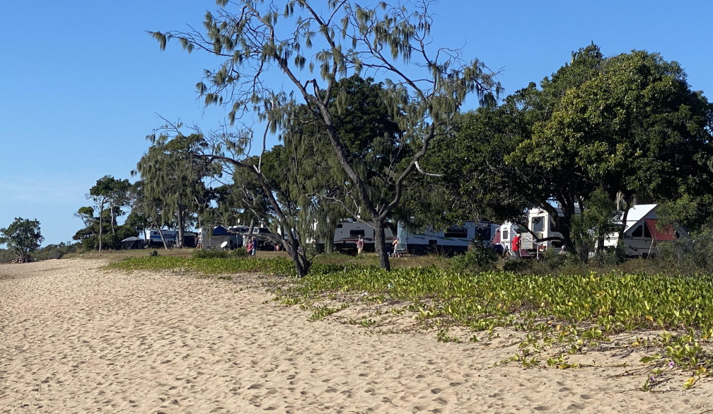
We ate fish and chips (neither barramundi nor crab was on the menu) with a beer at the casual licensed restaurant, looking across the coconut palm lined beach to the peaceful evening sky and sea, where people were strolling or fishing.

Evening at Clairview

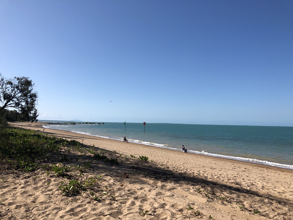
Workers commute up and down the Bruce Highway all year round, often spending the night in motels and caravan parks, and here at Clairview a tradie was standing relaxed on the beach, looking at the water, work done for the day, in hi-vis and thongs with a Fourex Gold beer can in his pocket.

At Clairview, after work

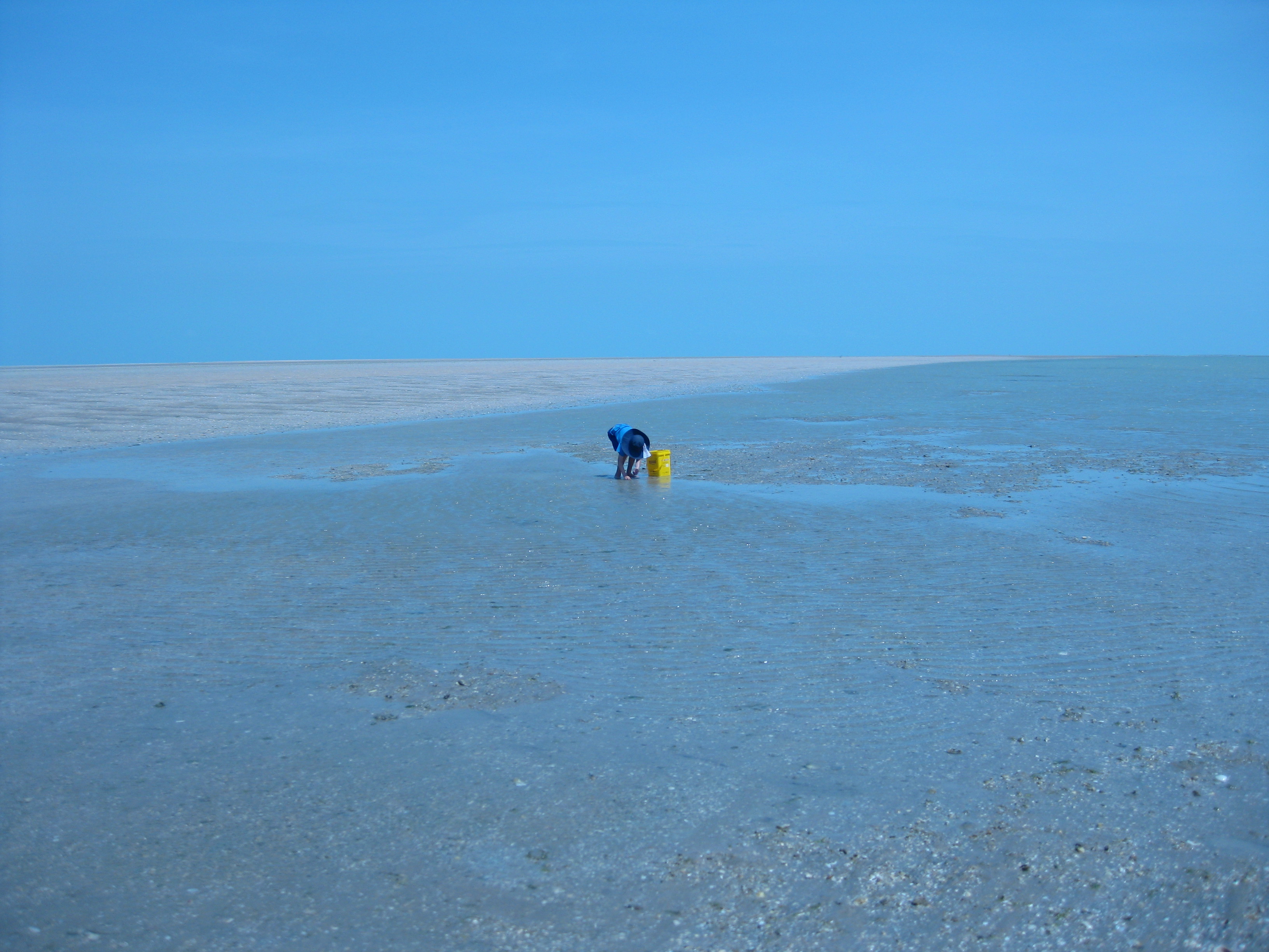
We weren’t tempted to swim. Stingers and crocodiles are always a threat in these waters, and like all northern beaches in the shelter of the Great Barrier Reef, the waves are little more than ripples.

Onwards up the Bruce.

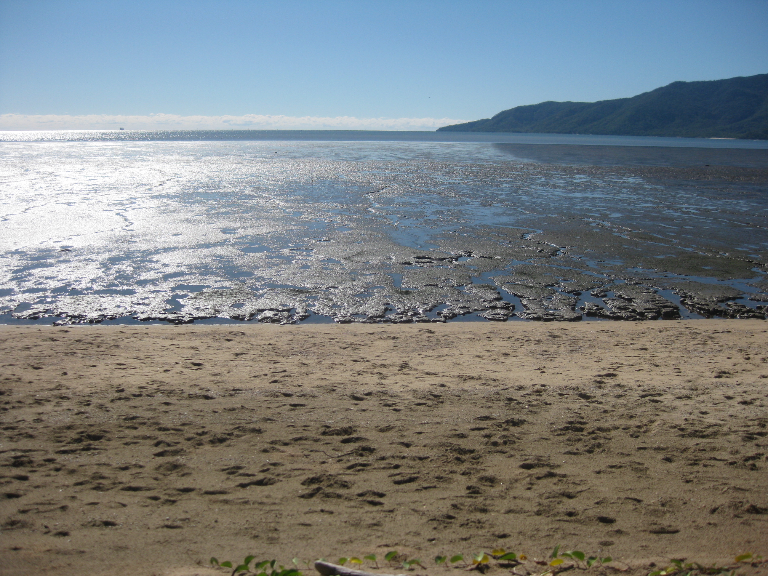
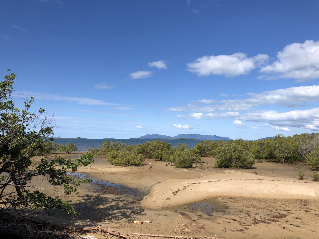
Three and a half hours north of Clairview, just south of Bowen and across the road from the Big Mango, you glimpse the sea again. The tide is out, revealing the roots of mangroves and millions of tiny mud dwelling creatures; but beyond them the water is bright blue. Looming to the east are the hazy purple hills of Gloucester Island and the Whitsundays.

Low tide, south of Bowen

Nearby, above the highway and looking out across Nelly Bay, is the Ocean View Motel, and it’s a pleasure to sit outside a unit there, under the frangipanis, and enjoy the evening view across the water to the lights of Bowen.

Bruce Highway where it meets the sea, south of Bowen, near the Big Mango Photo: petfriendly.com.au

This is one of the rare Bruce Highway motels with a view of the sea. You’ll need to drive north for another four hundred kilometres or so to find another.

An hour and a half north of Townsville comes the next ocean view. On a stretch of the these-days divided highway that crosses the Cardwell Range nineteen kilometres north of Ingham, you can glimpse the sea through roadside vegetation. For the full sea view, away from the fast-moving traffic, take the slip road at the top of the range and walk five minutes to Panjoo Hinchinbrook Lookout for a breathtaking outlook over the channel and Hinchinbrook Island (Munamudanamy) to the ocean.

View from Panjoo Lookout across Hinchinbrook Passage and Island (Munamudanamy)

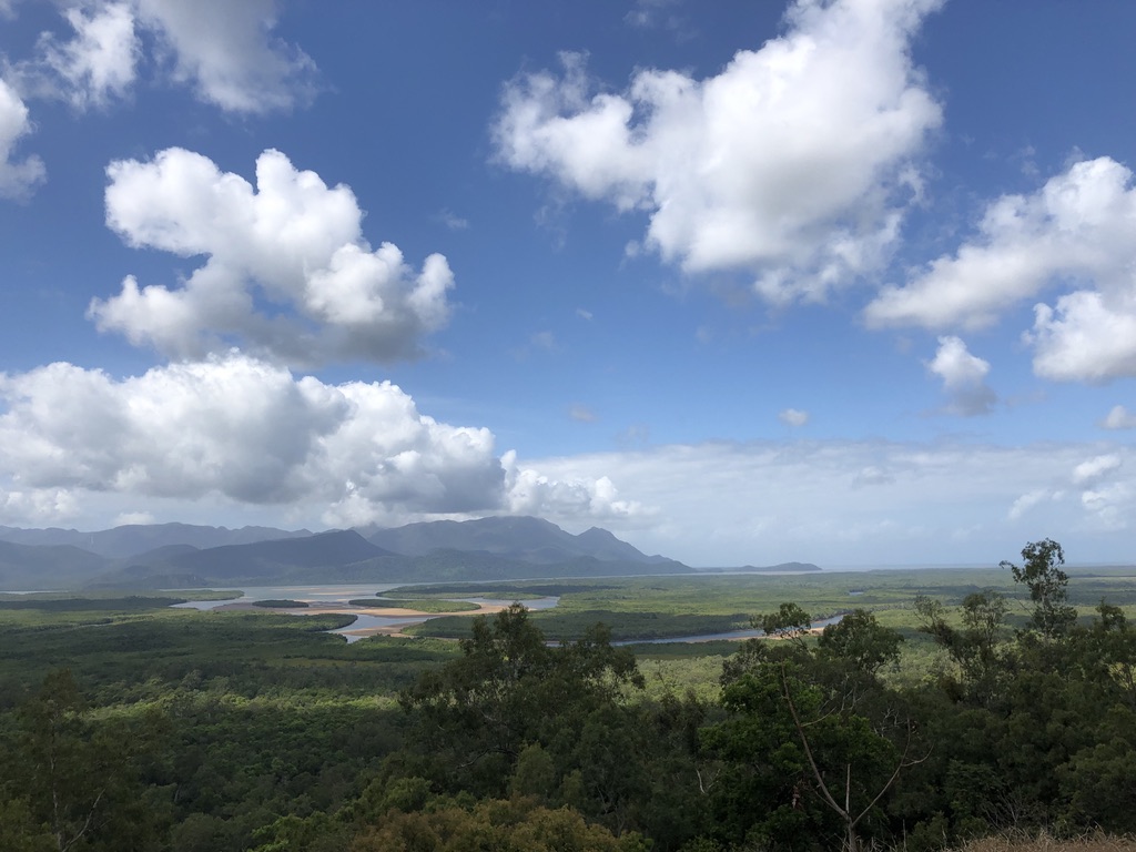
The Banjin People are traditional owners of this large, undeveloped, beautiful island, which is part of the Girringun Indigenous Protected Area.

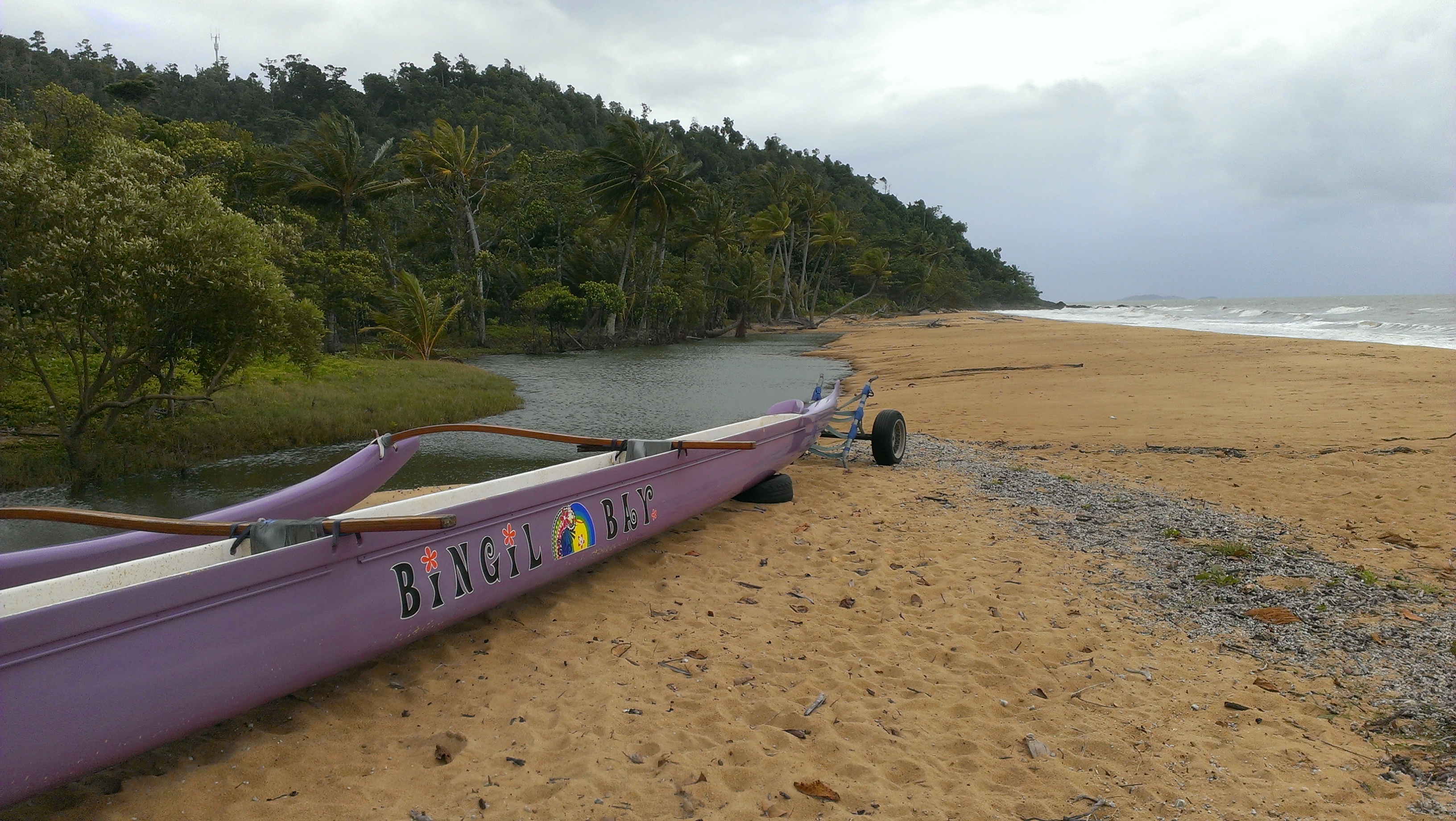
At Cardwell, thirty-eight kilometres north of Panjoo Lookout, the Bruce Highway at last spends time near the sea – the Coral Sea. Here, for over a kilometre, the highway follows the shoreline. A walkway leads past big old calophyllum inophyllum trees, otherwise known as ballnut trees, on the edge of the beach.

Protected since 1865, a Calyphyllum inophyllum at Cardwell

Governor Bowen, travelling in the ship “Platypus”, visited this area in 1865, only a year after the town was formed and the local Girringun people had been violently “dispersed” from their ancient lands. The Queensland Government wanted Cardwell for a port.

Governor Bowen was impressed by the calophyllum trees, hundreds of years old even then. Since 1866 they’ve been protected by law; and they weathered Cyclone Yasi better than most.

A postcard from c.1885 shows the dark-leaved calyphyllum trees, old even then, on the shoreline of Cardwell Photo: northqueenslandhistory.blogspot.com

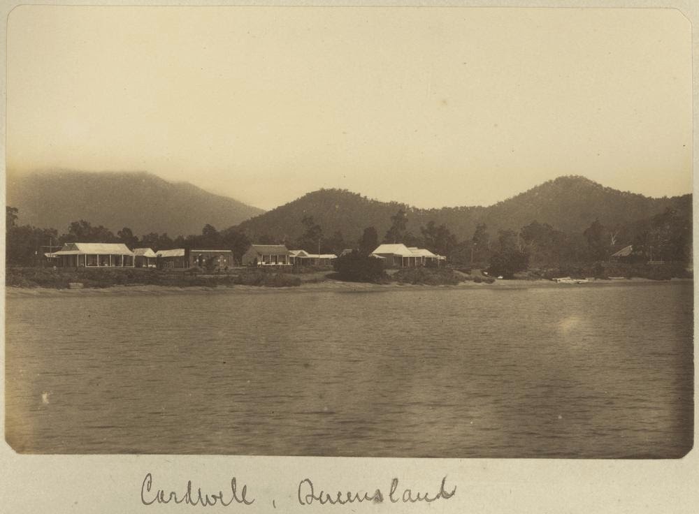
In 2011, Cardwell was devastated by Yasi, with sand and water blown across the highway, the bitumen ripped up and houses destroyed; but now, eleven years, later, it has never looked better.

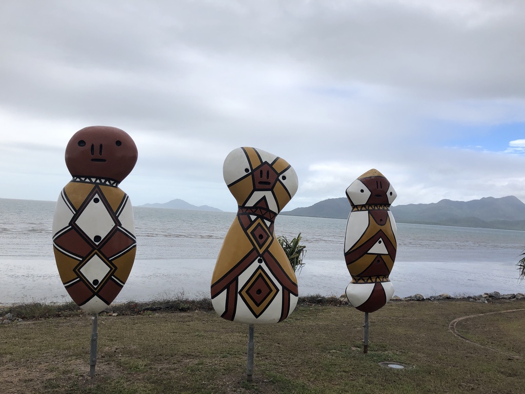
Girringun Bagu sculptures, based on the design of firesticks, by local artists Eileen Tep and Charlotte Beeron, stand enigmatically on the shoreline. They watch the tourists who stop here for the scenery, the information centre, playground, petrol and food.

Bagu sculptures at Cardwell

There are motels and pubs, the popular Yasi Bar, and a charging station for electric vehicles. And the calophyllum trees.

Best not go for a swim, though. Crocodiles and stingers are common here, so close to the mangroves and muddy water of Hinchinbrook Channel.

That’s it for sea views from the Bruce Highway.

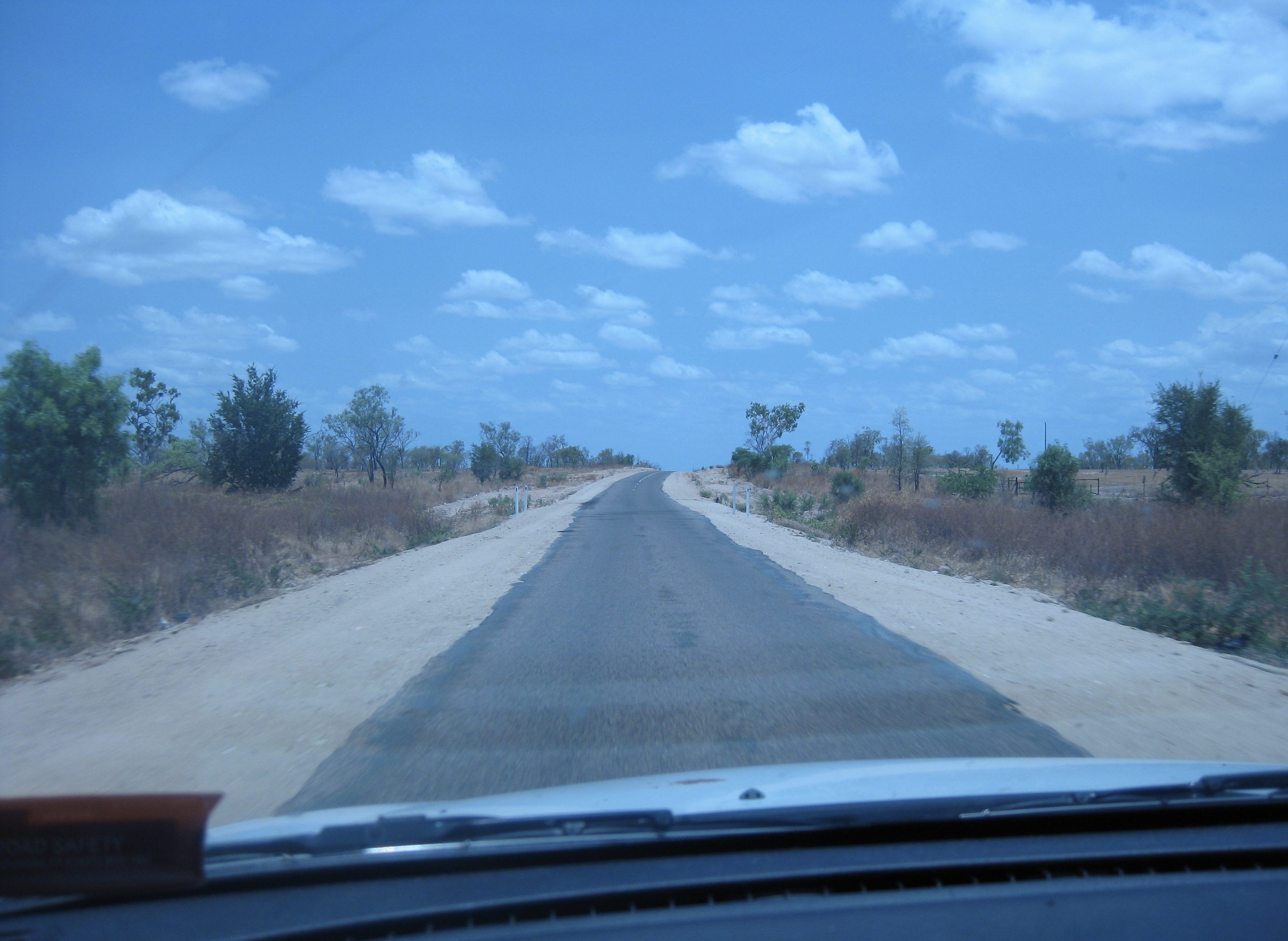
Named in the 1940s after a North Queensland Labor politician and Minister for Works, Harry Bruce, this highway deserves a more romantic, evocative title. Many travellers have called it derogatory names over the years, one favourite being Goat Track. That’s unfair. This is a long road, covering difficult terrain in an extreme climate, with a comparatively small population to pay for it.

I’ve been travelling the Bruce for over fifty years, in drought and in flood. I’ve crossed the old Marlborough Stretch, been stopped at its one-way bridges, experienced flat tyres and breakdowns and dodgy motels. I’ve crawled around the hills south of Gympie, stuck behind caravans on the old narrow, curving road that has now been replaced by a motorway. I’ve suffered the bumps and potholes in the flood-prone roads around Bowen and Proserpine. But to me the Bruce Highway is a beautiful road, and I’ve seen great improvements to it over the years, making it far safer and more pleasant to drive on; and upgrades are happening all the time.

However, if it’s sea views you want, you’d be better to take the Captain Cook Highway from Cairns to Port Douglas.

Captain Cook Highway Photo: australiangeographic.com.au

There are many spectacular sea views to enjoy in Queensland; but you’ll have to leave the Bruce to find them.


[1] https://www.theguardian.com/lifeandstyle/2019/nov/03/blue-space-living-near-water-good-secret-of-happiness

Cairns

I’m walking along the Cairns Esplanade, past the hospital. It’s a classic tropical scene with coconut palms, figs trees and lush plantings. The tide is out, and beyond a narrow strip of sand, mud stretches two hundred metres out to the waterline. Sea birds stalk on their long legs and webbed feet, pecking for worms and crabs. A blue sky is reflected in patterns of mud and water, and the calm sea behind gleams like pewter, right across Trinity Bay to the forests of the Yarrabah Range.

D39C46BE-AFC8-41F4-A8A7-DE5B186AF171
Trinity Bay, Cairns, from the Esplanade

Opposite the hospital, a man in a yellow work vest stops me. “There’s a helicopter coming in,” he says. “It won’t take long, but we need to keep people away from the helipad for a few minutes.”

I stand with other walkers and watch. I hadn’t noticed before, but there is a helipad set into the broad grassy parkland across the road from the hospital buildings. “That’s strange,” I say to the man in the yellow vest. “Usually hospital helipads are on the roof of the hospital.”

“They can’t do that here,” he replies. “It’s too close to the flight path from the airport.”

Guards have stopped cyclists on the bike track, too. Across the road, in the hospital entrance, another uniformed man, wearing earmuffs, waits beside a wheeled stretcher. I hear a helicopter coming in from the west, and soon it lowers itself on to the helipad. It’s a large Queensland Government Air rescue helicopter.

cairns helicopter 3
The Queensland Government Air Rescue Helicopter ready to evacuate a patient from a remote property to Cairns Hospital

Crew in navy blue uniforms climb out of the helicopter as the traffic is stopped and the stretcher is brought across the road from the hospital. A middle-aged man in a high-vis work shirt and straggly goatee beard is loaded on, sitting propped up as he is wheeled back to the hospital.

The helicopter takes off, the men in yellow vests disappear, and we all continue our walking, jogging or cycling along the Esplanade as if nothing had happened.

cairns hospital
Jogger passing Cairns Hospital helicopter pad

Cairns Hospital services a huge geographical area, most of it wild and sparsely populated. Patients are transported here from as far away as Croydon, over five hundred kilometres to the west, from Thursday Island, eight hundred kilometres to the north, and even further. From here, patients requiring the most complex care are transferred to Brisbane, eighteen hundred kilometres south. The hospital can provide up to five hundred beds, making it a major regional facility. And its windows offer a view of palm trees and the Coral Sea.

I’ve been a patient here myself. Years ago, Con and I lived at Yarrabah Aboriginal Community, as it was known then, a forty-five-minute drive from Cairns. I’d worked hard one day hacking at the guinea grass and weeds that grew along the creek running by our house, and went to bed as usual that evening; but by next morning I was unconscious, and Con drove me urgently to the emergency department here at Cairns. At four o’clock that afternoon I woke up in the Intensive Care ward, startled by the sight in the next bed of a man wrapped completely in plaster and bandages, his limbs in hoists. He’d been in a plane crash.

While I’d been unconscious, I’d had an encephalogram and a lumbar puncture. The doctors concluded that I’d been bitten by some unknown tropical insect and had had a nasty response.

For the following twelve months I suffered debilitating attacks of vertigo, and it still troubles me from time to time. In North Queensland, it’s not just obvious things like crocodile attacks and jellyfish stings that can hurt you.

Con is a North Queenslander by birth. A tropical plant, as I tell him. He was born in Innisfail, an hour’s drive south of Cairns.

“Did you come to Cairns much when you were a kid?” I ask him.

“Sometimes. We’d come up here in the old man’s Ford ute, to rugby league games.”

“I didn’t know your dad was involved with rugby league.”

“Yes, he was president of Innisfail Rugby League Club for a while. League was strong there.”

Rugby league is strong everywhere in Queensland, but in regional areas there’s a special enthusiasm. In Townsville, in recent mayoral elections, an informal vote had an extra name pencilled on to the voting slip, with a “1” in the box and next to it, “Johnathan Thurston”, then star of the North Queensland Cowboys.

cairns thurston
Ballot paper, Townsville mayoral elections

cairns thurston 2
Johnathan Thurston, North Queensland Cowboys

Cairns has always been a lively place, both busy regional centre and tourist hotspot, the best-known place to come if you want to visit the Great Barrier Reef. As an American woman said to me at Uluru, “I went to Cairns first, then here. The Reef and the Rock – that’s all I want to see in Australia. I’m off home now.”

We’ve stayed in many parts of Cairns over the years, but the north-western stretch of the Esplanade (the ‘Nade to locals) is my favourite – beyond the tourist restaurants and biggest hotels, across the road from the seaside parklands and within walking distance of the centre of town. Towards Trinity Inlet and the cruise boat terminals is the spectacular swimming lagoon, built to relieve the frustrations of locals and tourists who find themselves beside the sea on a hot day, but unable to swim in it because of the mud – and the crocodiles.

cairns lagoon
Cairns Esplanade Lagoon

The tropical plantings along Shield Street and Abbott Street are lush and beautiful, and it’s a treat to wander through Rusty’s Bazaar markets, with its tropical produce and hippy vibe; but I avoid the cheerless souvenir shops selling nothing made in Cairns, or even in Australia.

cairns_rustys-markets_own
Rusty’s Bazaar

More interesting are the renowned Cairns Botanic Gardens at Edge Hill, the Tanks Arts Centre now occupying the old fuel tanks tucked in behind the hill during the war, and Centenary Lakes, with its boardwalks and walking tracks and a wonderful, wild Nature Playground.

cairns tanks
Tanks Arts Centre

Joe, like his father, is a tropical plant, born in Townsville and just ten days old when we moved to Yarrabah. I’ll never forget the day we first drove over the range and down the steep descent into the town, stopping at the lookout to admire the view over Mission Bay to Fitzroy Island. The Yarrabah Range is covered in rainforest. It is beautiful, and the road is steep. Here and there beside the road are large stones, known as handbrakes, which can be used to put behind the wheels of your car if you break down halfway up the hill. Occasionally a cassowary strolls out of the forest and across the road.

In Yarrabah, we lived in a Queensland government residence, with a view out to sea, the steep, forested hillside behind us, and the sound of a waterfall close by. It was a tropical paradise; although for the local people life was, and is, often hard. I would drive to Cairns once a fortnight, to do the banking and grocery shopping, and I always took little Joe with me, to visit Rusty’s Bazaar and eat icecream on the Esplanade. Now Joe lives in the north, and he takes his own children to Cairns, to play in the waterpark and watch the birds on the mudflats.

It’s amazing what a pull this place has, with its brooding greenery and humid tropical air, its rain-forested hillsides and calm sea. If you were born a local, or even spend a few years here, it has the atmosphere of home.

I can recommend the hospital, too.

cairns cent lakes
Boardwalk, Centenary Lakes, Cairns

Counting Prawns

The bitumen is too narrow for two vehicles. One of them at least will need to go on to the sloping, gravel shoulder.

fullsizeoutput_32ac
The Savannah Way

I’m with Joe, in the front passenger seat of his ageing Commodore, driving from Cairns to Karumba, a distance of over seven hundred and fifty kilometres. We’re driving through a plague of grasshoppers.

IMG_1313
Grasshoppers

West of Mount Surprise the Gulf Development Road narrows to a single strip of bitumen.

Joe has never driven on a road like this.

“When we meet on-coming traffic, what should I do?” he asks.

Joe’s driving has all been on motorways and city streets, and he is expert at changing lanes and reverse parking. Now he needs to learn another skill.

“When you see an oncoming vehicle, put two wheels off the bitumen,” I tell him. “Give them lots of room.”

Out of the mirage ahead of us a Toyota ute appears, heading our way, at speed. At one hundred kilometres an hour, Joe puts two wheels on to the shoulder and we fly along the gravel, past the Toyota, and back on to the bitumen.

“Maybe, next time, you should reduce speed before you do that,” I suggest to Joe.

“Good idea,” he says, drily.

Con and Joe and I going to visit our daughter Lizzie and her family. They’re living in Karumba, a small town on the mud banks of the Norman River, close to where it flows into the south-eastern Gulf of Carpentaria. Russ, a scientific assistant, spends his days sitting in a shed overlooking the river, with a microscope and tweezers, counting juvenile prawns by species: banana, king, tiger.

This is crocodile country, so no one swims in the river or in the Gulf. There are box jellyfish in these waters too. On Google Earth, the Norman River and its tributaries look like twisting tree branches or a beautiful abstract painting. Up close, it looks dangerous.

Karumba exists because of prawning and fishing. Prawns and barramundi come off the trawlers already frozen and go straight into freezer trucks destined for the southern markets.

In the winter months retirees come from the south for the fishing. That’s what Karumba is about. Prawns and fishing.

Con and I last came this way in the 1970s, on the way west to Burketown, driving our old Holden sedan. When we’d passed through Croydon, over five hundred kilometres into the trip, the sun was low and shone directly into our eyes.

The road had once been sealed, but the bitumen had worn away to sharp-edged tracks running through bull-dust. Half-blinded by the sun, Con bogged the car half off the road, and we had to wait with our young children for a tow.

Today this road is part of the Savannah Way, stretching three thousand, seven hundred kilometres from Cairns to Broome, in Western Australia, and although still narrow it is well maintained.

We’re following the line of the Gulflander, the rail motor that connects Croydon and Normanton with a once a week service. Built in the late 1880s to service the Croydon gold rush, now it’s a tourist attraction, a welcome sight to travellers on this lonely road as it goes rocking slowly on its way.

Mid-afternoon we meet the Burke Development Road and turn north towards Normanton. Karumba is seventy kilometres further north again, and just on dusk we pull in at Lizzie’s place, a cabin behind the motel in the shade of a poinciana tree. The front of the car is plastered with dead grasshoppers.

We spend a week in Karumba, visiting the barramundi farm and going up-river with Russ to glimpse the low scrub on the barren river flats, crocodile slides showing clearly in the muddy banks. We collect hermit crabs at low tide with our grandsons, visit the tavern, admire the town brolga and swim in the motel pool before heading back to Cairns.

IMG_1235
Collecting hermit crabs, low tide, Gulf of Carpentaria

Lizzie and her family are enjoying their few months here, but she worries about cyclones. “There’s nowhere to go,” she says. “No hill, no safe building. A tidal surge would go right over the town and wipe it out.”

IMG_1196
The Norman River at Karumba

A few weeks later, in the middle of the night, Tropical Cyclone Charlotte crosses the coast at Karumba. Only one building is damaged. While Lizzie, Russ and the boys shelter in the bathroom, that poinciana tree falls and crushes their cabin. No one is hurt, so they put it down as just another Gulf Country adventure.

poinciana
Before the cyclone: that Karumba poinciana

Crocodile Watch

Rollingstone Creek is deep and clear, with a sandy bottom. The water is blessedly cool on this tropical summer’s morning.

My sister-in-law Margaret is sitting on a folding chair in the shade, watching for crocodiles.

This swimming hole, so innocent-looking, is a few hundred metres upstream from an estuary where crocs are known to lurk. We wallow in the shallows, close to the bank, and Margaret watches the water.

It’s mid-January, and hot. So hot. That’s why we’re risking the crocodiles.

Balgal Beach, where we’re staying, is a quiet spot north of Townsville. Like the other Queensland beaches sheltered by the Great Barrier Reef, it has no surf. Not many people swim at northern beaches in summer, in spite of the heat and the picture postcard beauty of places like Balgal, Bingil Bay and Etty Bay. From October to March, stinger nets are set up on popular beaches. Swimming outside of them you risk being killed by a box jellyfish.

IMAG0820_BURST002_COVER

Occasionally the television news shows a crocodile in one of the stinger nets, making people a little nervous – especially tourists. No much fazes the hardy locals.

The quiet northern beach towns are ideal for early-morning walks, fishing, bird watching, or a peaceful retirement; and in the caravan park at Balgal Beach contented campers and caravaners with interstate number plates sit reading in the shade of the trees.

Perhaps they’ll buy fish and chips for dinner and eat looking out over the water towards Palm Island, while gangs of red-tailed black cockatoos screech and quarrel in the fig trees above.

IMAG1007

There are many gorgeous swimming spots in North Queensland, year-round, where even in July daytime temperatures rarely drop below twenty-five degrees. They’re in creeks running through rainforest, tumbling over granite boulders and falling into clear pools. Famous places like The Boulders at Babinda, or hidden creeks only locals know about. You just have to find a spot above the range of the crocodiles.

babinda


North of Tully there’s a swimming hole called Alligator’s Nest, at the junction of two clear creeks, in spite of its name beyond the reach of crocs. It was a cool and drizzling July day when we went there, and the creek was deserted. I had no swimmers, but I went in anyway, in my skin. It was a perfect swim.

I’ve enjoyed many perfect swims. One was at Wineglass Bay, on the Freycinet Peninsula in Tasmania. Con and I climbed the steep track to the famous look-out spot, then down the other side to the bay. It took us an hour and a half, and when we came out of the scrub on to the beach, the only sign of human life was a yacht moored in a little hook of the bay, off to the south. The clear water looked wonderfully inviting. Again, I went in in my skin. It was cold –  but perfect.

fern pool, karajini nat pk

The clear pools and red gorges of Karijini National Park, in Western Australia’s iron ore country, have many perfect swimming spots, although they’re much too popular for skinny dipping; but the place I love the most, even more than the creeks of North Queensland, is Greens Pool, on the southern coast of WA.

Greens Pool is a wide stretch of calm water sheltered from the Southern Ocean by a string of granite boulders. Other boulders, the famous Elephant Rocks, stand in a group in the middle of the Pool, bigger than elephants, and you can leap off them into the deep, clear, salty water. Breakers send up spray over the protective rocks beyond the Pool. The water is cold, but the initial shock is soon forgotten in the pleasure of it all.

In South Queensland, the water is warm. I remember a perfect day in the surf at Alexandra Headland, when I was twelve. The waves were smooth, no dumpers, a gorgeous green. I lay on my back, and each wave lifted me gently to its crest then glided me down the other side. The sun shone through the water, dappling the sand below.

Across the road from my childhood holiday house at Maroochydore was a small beach we kids considered our own, with a jetty at one end. At high tide, the river would reach up close under the jetty, and my brothers and I would bomb-dive off it with delight.

I grew up on beaches. I love the water.

scan


That day in Rollingstone Creek, though, it was a comfort to have Margaret watching for crocs.

Photos: Bingil Bay; Balgal Beach; a North Qld creek; Weano Gorge, Karajini NP; Alexandra Headlands.

Blog at WordPress.com.

Up ↑