Driving from Brisbane and heading for Cairns a year or so ago we turned off the Bruce Highway at Childers to visit some relations in Bundaberg, planning to spend the night in a motel in the centre of the city. After waving goodbye to Con’s cousin I tapped the motel’s name into my phone. The sat nav directed us through the suburbs as I expected it to; but then it sent us north across the Burnett River.
I know the Bundaberg CBD is on the south bank of the river. Just as the CBDs are in those other two major Queensland river cities, Rockhampton and Mackay.
Putting on my glasses I had a closer look at the phone. Distance to the motel: 620 kilometres.
I’d accidentally booked a motel in Mackay.
All the Bundaberg motels had No Vacancy signs, and we ended up driving back to Childers for the night.
On another trip I booked a place in Gayndah when I meant to book one in Gin Gin. There are so many Colonial Motels, Country Comfort Motels, Seaview and Ocean View, Heritage and Midtown Motels across the country, it’s easy to get confused.
That Bundaberg motel mistake happened a few years ago, and last year we took a more leisurely trip north and decided to visit Bundaberg to stay for a few days. I booked a room in the Matilda Motel, making sure it was the one in Bundaberg, not the Matilda Motel in Winton or the one in Dubbo…
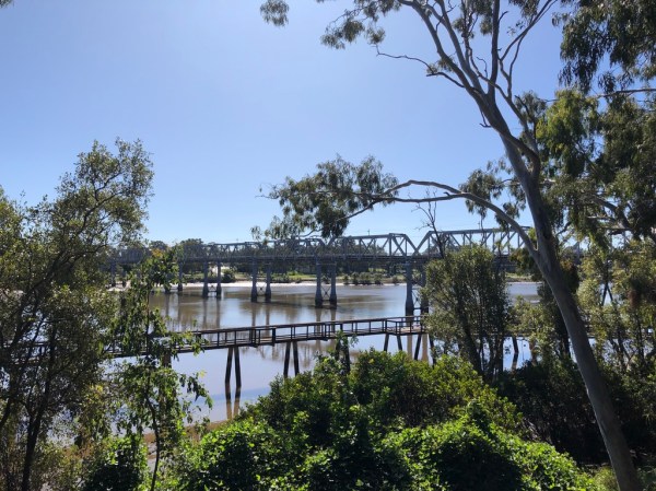
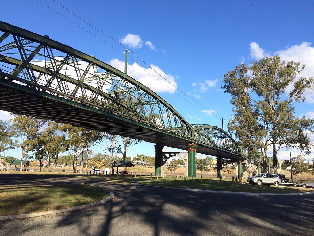
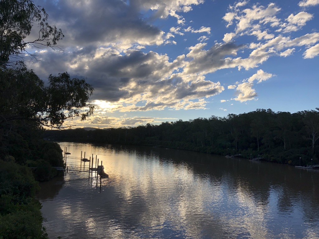
The fine old sugar town of Bundaberg is known for its ginger beer, but it’s Bundaberg Rum the town promotes itself by. Once a thriving port, it has some beautiful civic buildings, banks and hotels, and heritage listed bridges.
Burnett Bridge, Bundaberg, built in 1900, heritage listed Photo:en.wikipedia.org
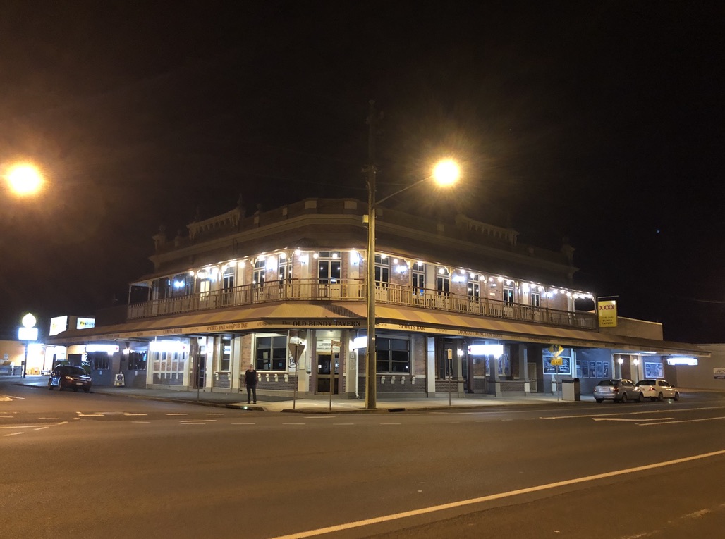
We took in dinner and the Trivia Night at the Old Bundy Tavern, overlooking the river. This elegant brick hotel with its verandahs and stained glass windows was built in 1917 as the Hotel Bundaberg.
The Old Bundy Tavern, previously The Hotel Bundaberg
Best of all for me, as a fan of old infrastructure, is a wonderful 1902 brick water tower in East Bundaberg, heritage listed and still in use.
East Bundaberg water tower, still in use
Across the river in North Bundaberg are the Bundaberg Botanic Gardens, with the striking-looking Hinkler Museum celebrating Bert Hinkler, aviator, one of Bundy’s most famous sons.
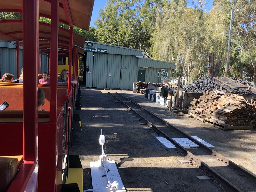
There’s a sugar industry museum in beautiful old Fairymead House; and you can take a ride on a cane train. I love a train ride.
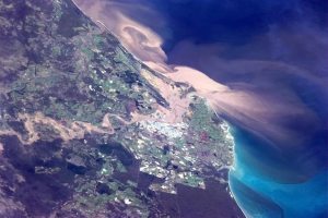
All of Queensland’s old river port cities, Mackay, Rockhampton, Bundaberg, Maryborough and Brisbane itself, are built on flood plains. The Burnett River has a catchment area of some 33,000 square kilometres, including Gayndah and Monto, and it all flows down to Bundaberg. The city has been flooded many times. The worst happened in January 2013, and it was apocalyptic. The CBD flooded and an estimated 600 businesses were inundated, as well as many houses.
Bundaberg with the Burnett River in flood, January 29, 2013, as seen from space Photo: Canadian astronaut Chris Hadfield
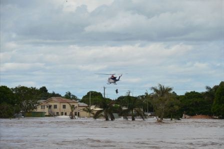
People living in North Bundaberg were told to leave their homes. Evacuation was mandatory, but many people said, “They don’t know what they’re talking about. North Bundaberg never floods.”
This flood was different, and higher, and in the end hundreds had to be rescued by helicopter.
In 2014, the year after the flood, we drove through Gayndah and visited the small museum there and heard how that same Burnett River flood ripped trees out of the riverbanks, filled the museum with mud and flowed through the shed full of prized old agricultural machinery. “Backpackers helped us clean up. We couldn’t have done it without them,” the museum staff told us.
Burnett River, Gayndah, in normal times. Height of bridge is an indication of flood heights here
Last year it was Maryborough’s turn to go under. Twice, within six weeks. These old regional river cities are beautiful, but beware the floods.
Mary River flood, Maryborough, 2022: second flood within six weeks Photo: good-news-fraser-coast.com
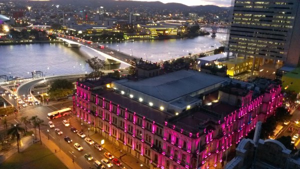
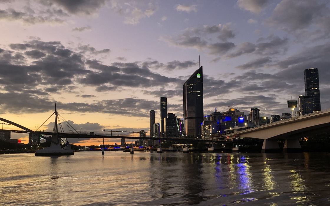
As evening comes down over the river, I’m standing with my grandson Angus on a CityCat ferry. We’re heading downstream from UQ to photograph the bridges of central Brisbane. The muddy old Brisbane River, MAIWAR in Turrball language, is at its most beautiful.
High above us as we waited at the ferry wharf was the Eleanor Schonell Bridge, opened in 2006 to link Yeronga to the University of Queensland. Carrying only buses, cyclists and pedestrians and known to everyone as the Green Bridge, its four tall towers are visible from kilometres away.
Eleanor Schonell (Green) Bridge
On board the CityCat we’ve moved through the cabin to the bow, holding the rail as its powerful engines send the boat surging down the river and round its slow curves, past the university sports fields and old, timber houses high on the opposite banks.
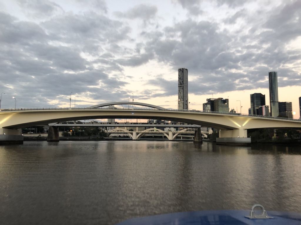
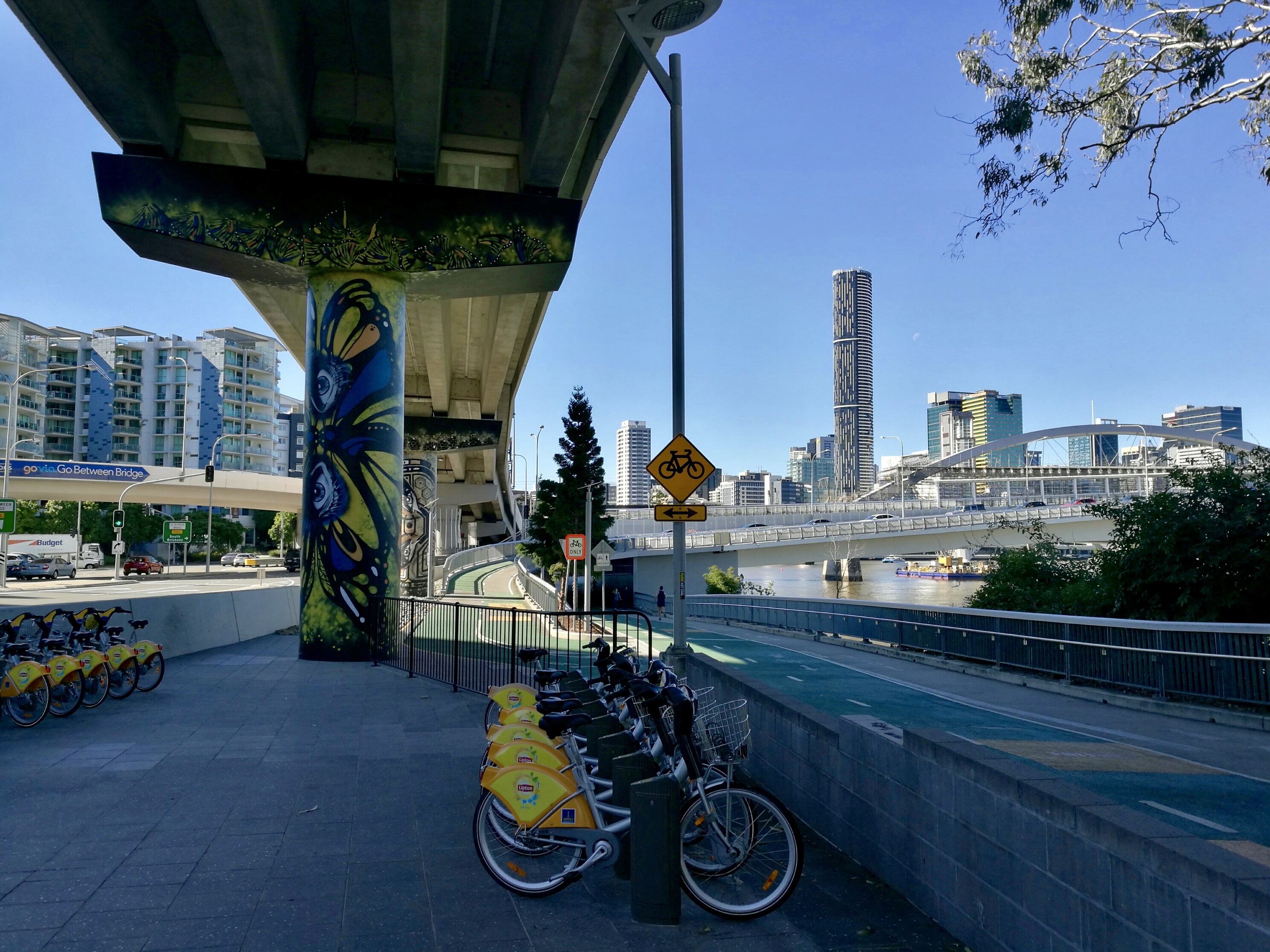
Go-Between, Merivale and William Jolly Bridges, looking downstream
Coming down the Milton Reach towards the CBD, the wind in our hair, we can see three bridges at once.
Closest to us is the graceful white span of the Go-Between Bridge, opened in 2010 to connect West End to the Inner-City Bypass at Milton.
Approaches to the Go-Between Bridge from under the Coronation Drive overpass
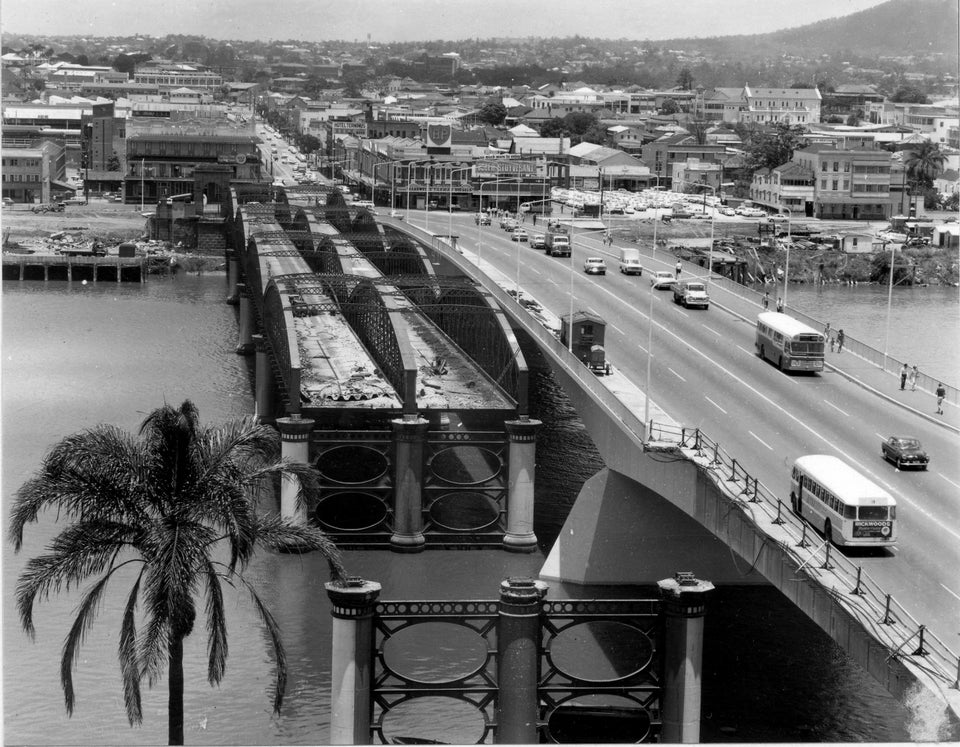
Beyond the Go-Between Bridge is the coat-hanger arch of the Merivale Bridge, the railway bridge which connects South Brisbane Station to the north side of the river, crossing Melbourne Street behind the old Hotel Terminus, where you might once have spent the night after getting off the Sydney train at South Brisbane Station. Until the bridge opened in 1978, to catch a train onwards to Cairns or Cunnamulla or Longreach, you’d have needed take a taxi across the river to Roma Street Station, probably via the William Jolly road bridge, known to most as Grey Street Bridge.
Opening in 1932 to link South Brisbane to the CBD at Roma Street, Grey Street Bridge, with its graceful cream art deco arches, is one of Brisbane’s best-loved bridges and the most celebrated by artists.
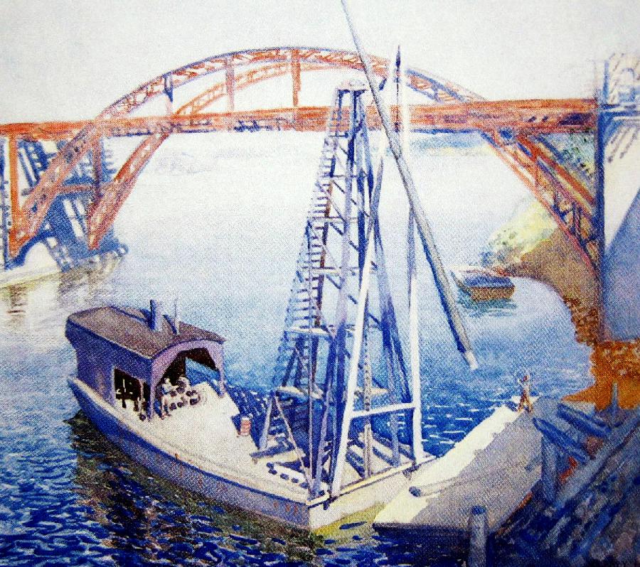
The Grey Street Bridge, Vida Lahey. Bridge under construction. artrecord.com
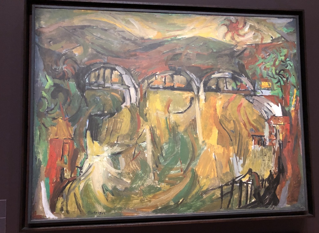
Grey Street arrangement Jon Molvig. Museum of Brisbane
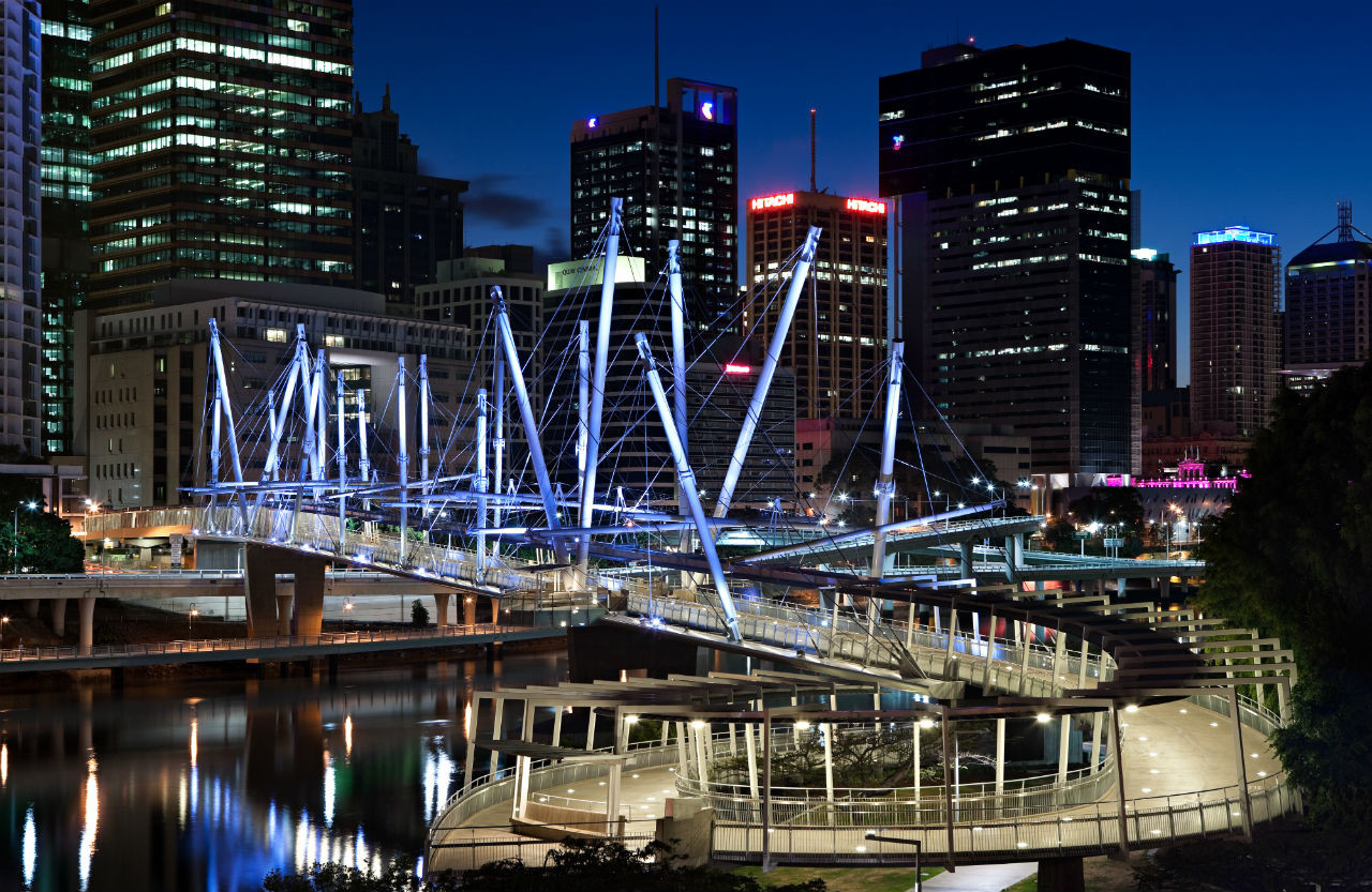
From under the Grey Street Bridge, around the bend of the river at Kurilpa Point, the spectacular Kurilpa pedestrian bridge comes into view, with its many white masts like drinking straws or a sailing ship’s spars.
Kurilpa Bridge, from under Grey Street Bridge
Opened in 2009, it joins Kurilpa Point (from the Turrball word for place of the water rats) to the CBD at Tank Street.
Kurilpa Bridge. australiandesignreview.com
Now we’re approaching the slim, elegant span of Victoria Bridge, opened in 1969.
Victoria Bridge
As a teenager, I used to cross the old Victoria Bridge by tram, and it made me nervous to see the sign limiting the number of trams per span of the bridge. Instead of two or three, there were often five or six going each way.
“Out with the old, in with the new… The Victoria Bridges in December 1969”. reddit.com
Now Victoria Bridge carries only buses, cycles and pedestrians across the river between South Brisbane and the top of Queen Street. It’s beautiful this evening, lit up with colours that are reflected in the timeless ripples and eddies of the river.
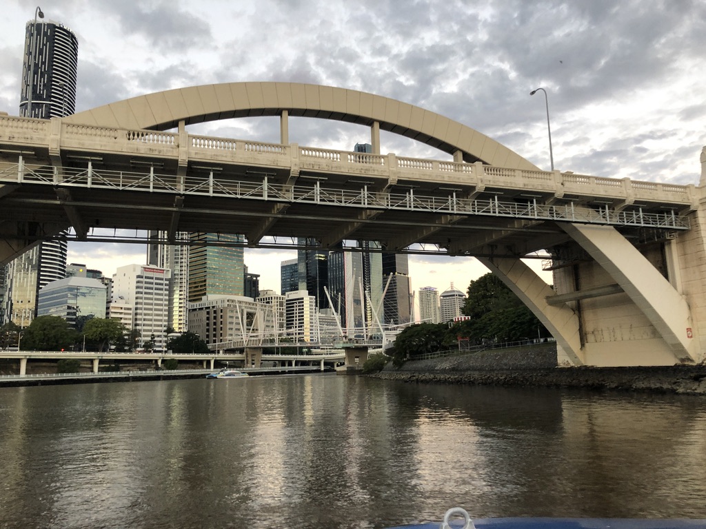
Downstream from Victoria Bridge our CityCat negotiates an obstacle course of construction barges. A spectacular footbridge, the Neville Bonner Bridge, is due for completion in 2022, linking South Bank Parklands to the ambitious Queens Wharf development with its hotel and apartments, casino, shops and parks. Let’s hope tourism dollars will return to Brisbane soon to pay for it.
Image of how the Neville Bonner Bridge and the new Queens Wharf development are expected to look. queenswharfbrisbane.com.au
The Goodwill Bridge, opened in 2001 to carry cyclists and pedestrians from South Bank to Gardens Point, is next, with a stylish design and a little coffee bar on one of its viewing platforms.
Goodwill Bridge, with the Captain Cook Bridge in the background.
I love how it looks in the evening light, looking back to the CBD buildings and the lights of Victoria Bridge.
Goodwill Bridge, looking upstream.
At Gardens Point the clean line of Captain Cook Bridge links the Pacific Motorway to the Riverside Expressway. Opened in 1973, in the time of Premier Joh Bjelke-Petersen, when modernisation was everything and cars were king, the bridge has no pedestrian or cycle access. We travel under it and watch joggers and evening pedestrians in the riverside parkland, and climbers spread-eagled under the lights on Kangaroo Point Cliffs.
A CityCat coming towards the Captain Cook Bridge, with the Kangaroo Point Cliffs in the background.
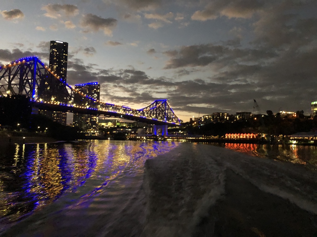
Ahead the tall, lit-up buildings of Petrie Bight come into view, and on the next bend the Story Bridge.
Petrie Bight buildings and the Story Bridge
The heritage-listed Story Bridge is the most iconic of Brisbane bridges. A massive steel structure, it was built as part of public works programs during the Great Depression and opened in 1940. (See my story Brisbane Icons: Fig Trees and the Story Bridge.)
Sunset fades from the sky and the lights of the bridge and high-rises shine on the water. Howard Smith Wharves, with bright and noisy hotel, restaurants and bars, slide by.
Under the Story Bridge. On the roof of a hotel at Howard Smith Wharves, people relax beside a pool.
The bridge is high above us as we steady our cameras against the movement of the speeding ferry.
Under the bridge at evening
The Story Bridge looks magnificent reflected in our wake.
Looking back at the Story Bridge and the lights of Howard Smith Wharves
At the next CityCat stop, Mowbray Park, we disembark to catch another ferry back upstream.
To see more of Brisbane’s bridges, Angus and I might take a cruise upriver one day, under the bridges at Indooroopilly and Jindalee.
The utilitarian-designed Centenary Bridge, opened in 1964, carries the busy Centenary Highway between Fig Tree Pocket and Jindalee.
Centenary Bridge, looking from Jindalee to Fig Tree Pocket
From under the bridge, shady walkways lead downstream past mighty riverside eucalypts and fig trees, the treasures of Brisbane’s riverside parks.
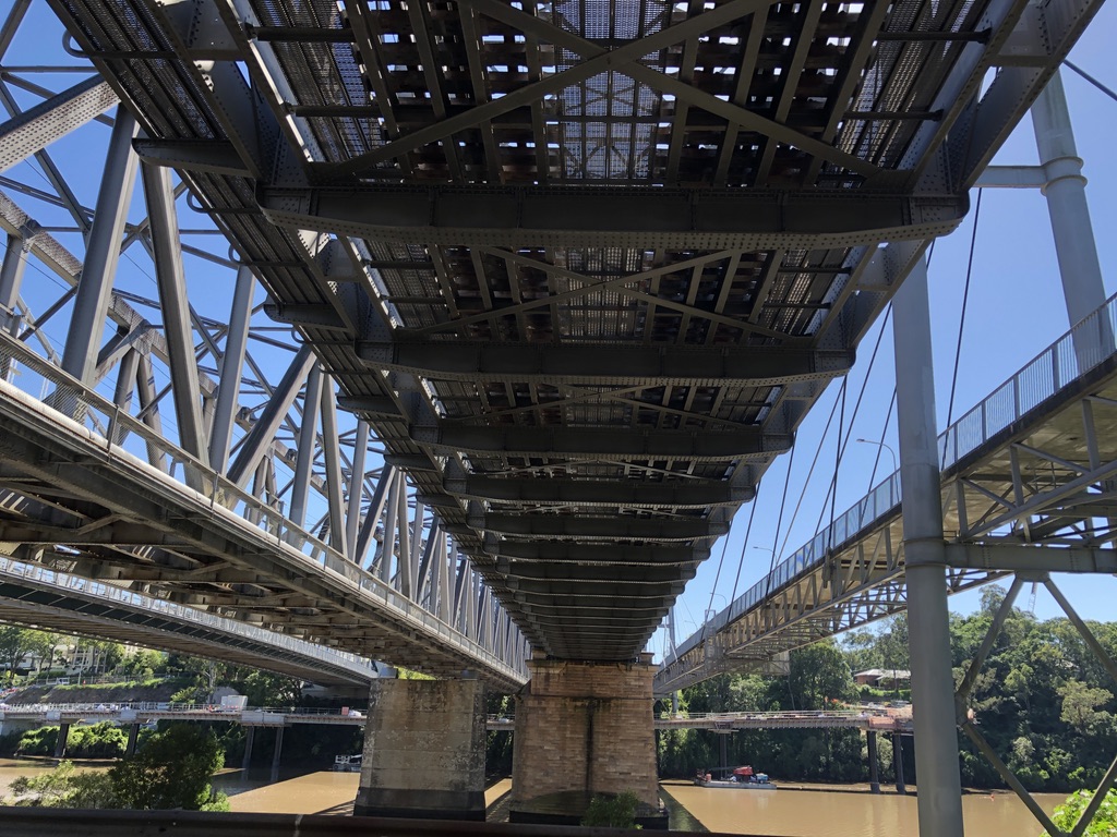
At Indooroopilly, on a deep bend of the river, there are four bridges: the road bridge, two rail bridges and a cycle and pedestrian bridge.
Under the Indooroopilly bridges
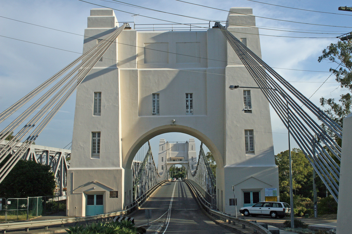
I lived at Indooroopilly with my family (see my story Gully of Leeches) when there were just two bridges. I used to ride my bike to school across the white, art deco Walter Taylor road bridge, under its towers and past the tollbooth. The northern tower of the bridge famously included an apartment, where washing was sometimes strung to dry high above the traffic.
Walter Taylor Bridge, commonly known as the Indooroopilly Bridge. queenslanddecoproject,com
Until it opened in 1936, the only bridge at Indooroopilly was the Albert Railway Bridge carrying the Ipswich Line. Another rail bridge was opened in 1957, and in 1998 a pedestrian and cycle bridge on the downstream side.
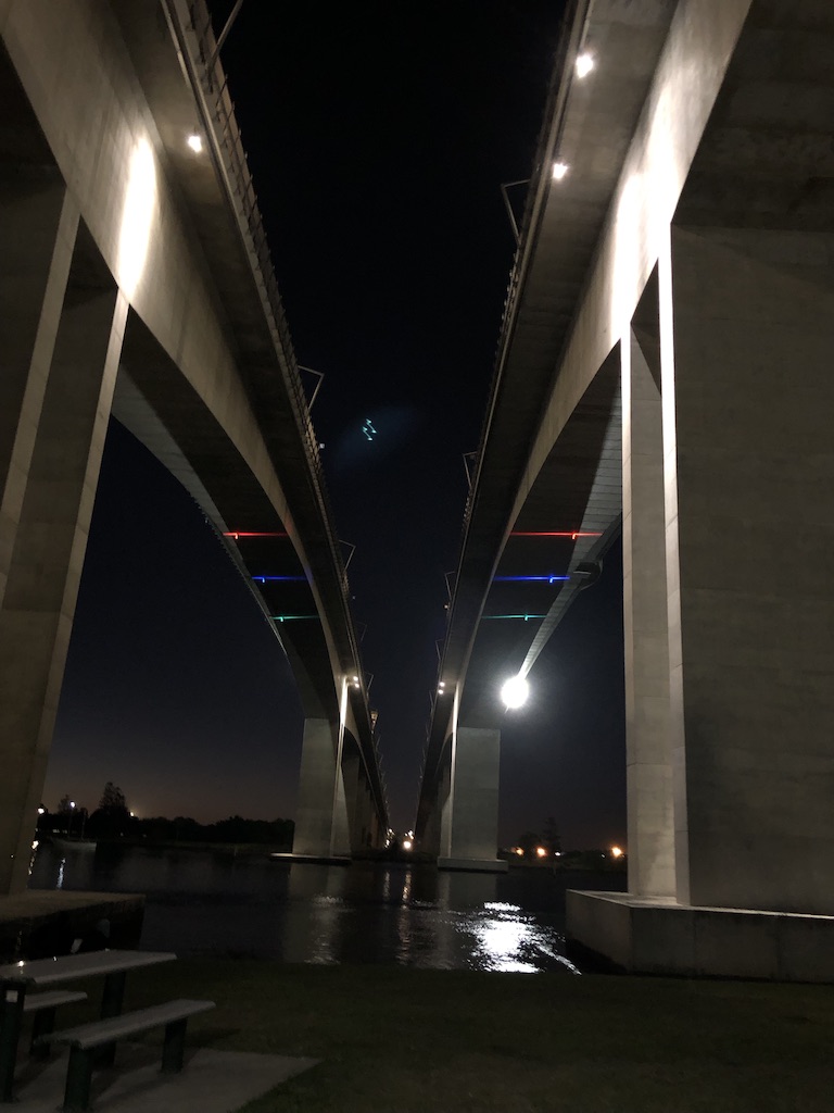
If we’d stayed on the downstream CityCat, Angus and I would have come within sight of the twin Gateway Bridges, officially named after Sir Leo Hielscher, lit up dramatically and arching high above the river.
Fishing, upstream from the Gateway Bridges
Opened in 1986 and 2010, the upstream bridge takes northbound traffic, while the downstream one carries southbound traffic as well as a cycle and pedestrian path.
Under the Gateway Bridges
Con and I walked one winter’s day from beneath the southern end of the bridge, up to the top. From the viewing platform there, we could see down to the river mouth and Moreton Bay. It was a long slog to the top of the bridge, but not too steep, as it was built to carry heavily laden semi-trailers.
Other cycle and pedestrian bridges are in the planning stages, to link Saint Lucia and Toowong to West End, and Kangaroo Point to the City Botanic Gardens.
I can remember when old Maiwar was treated with little respect, as a flood-prone dumping-ground that people crossed in a hurry in cars, buses and trams. Now it has been reclaimed for pedestrians, cyclists and ferries, and its banks and its bridges are sources of pleasure and pride for Brisbanites.
How would you like to be
Down by the Seine with me
Oh what I’d give for a moment or two
Under the bridges of Paris with you…
(Eartha Kitt 1953)
The Seine in Paris has 37 bridges, but crossing approximately thirty-five kilometres of the river in Brisbane there are just sixteen. The Brisbane River is wider than the Seine, and not as easily bridged, or tamed; and the bridges of Brisbane are not as classically elegant as the bridges of Paris, made famous by Eartha Kitt in her sexy version of this famous song.
But I love our Brisbane bridges.
All are spectacular; some are iconic; and old Maiwar flowing beneath them is beautiful.
For Brisbane children, gullies are places of adventure. I grew up next to one myself, off Priory Street, Indooroopilly; and I loved it.
Indooroopilly translates from the local Yugara language as Gully of Leeches. The Priory Street gully is the one the name refers to.
Mural with leeches, Indooroopilly Station brisbanetimes.com.au
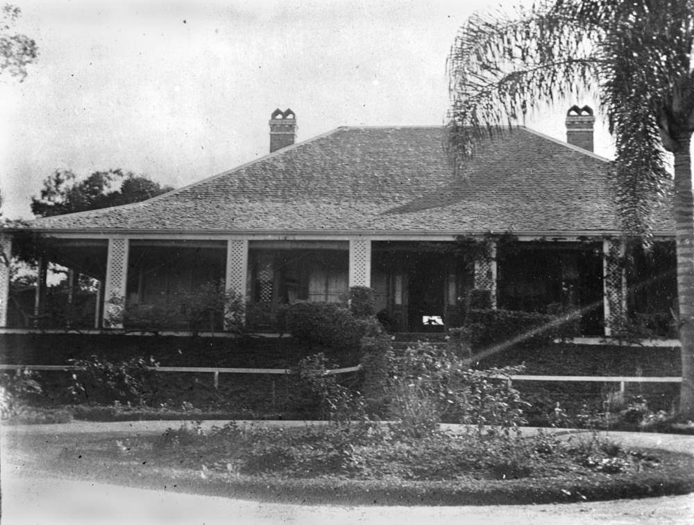
The Priory is an elegant nineteenth-century house on a hill in Indooroopilly, looking down over the four bridges that cross the Brisbane River here: the road bridge, two rail bridges and a cycle and pedestrian bridge.
The Priory House, Indooroopilly Vintage Queensland/Facebook
The house was built in the 1880s, on a large piece of land which included a deep, scrubby, rain-forested gully running down to the river. The first railway bridge had already been built here, linking Brisbane to Ipswich and beyond, and opening up all the land along the line to development, and to the building of expensive riverside residences.
The back driveway of The Priory crossed the gully on a wooden bridge and curved up to join Priory Street. When part of the Priory land was subdivided and sold off, my parents built a house here – a small brick house built looking down on the gully, on what had been the end of that old back driveway.
Our house at 12 Priory St, Indooroopilly
For my two younger brothers and me – especially my brothers – our gully was an endless source of amusement. Last week, as we enjoyed a social distancing takeaway coffee in a Tarragindi park, they reminded me of the things they got up to there as boys.
There’s a special time of fun for children, once they are old enough to go out and play alone, and before the start of high school and puberty: between about eight and twelve. I still remember the fine games we played then: Cowboys and Indians, Cops and Robbers, exploring, trolley (aka billycart) riding down our then-gravel street, and a game we invented, called coffee tin and walking stick. It was a lawless kind of hockey, played with an International Roast tin and a couple of old walking sticks, in the front yard of that little brick house. No wonder the neighbours complained to our harassed mother about our noise.
After talking to my brothers, I went back last week to see the gully. It hasn’t changed much, except there’s more rubbish in it. It has a darker, more menacing air now.
The gully today
It’s still deep, and clogged with vegetation – bamboo, palms, trees draped with cat’s claw creepers. A smelly creek runs down it. It was always a bit smelly, with run-off from storm water and the greywater sullage that seeped through our back yards in those pre-sewerage days, but as kids we didn’t care.
At the upstream end of the gully there is a large storm water pipe coming from the darkness under the Rankin Street Park. One day we kids screamed “Help!” into it, just to hear the reverberation. All the neighbours heard it and rushed out to investigate. I tested it, and I was pleased to discover it still echoes.
At its lower end, the gully flows under the road in more large pipes. They were big enough for us kids to crawl through, but it was dangerous. They opened out on to a slimy concrete slab hanging above the river, and if we’d slipped, depending on the tide level we’d have gone either straight into the river or on to the rocks below.
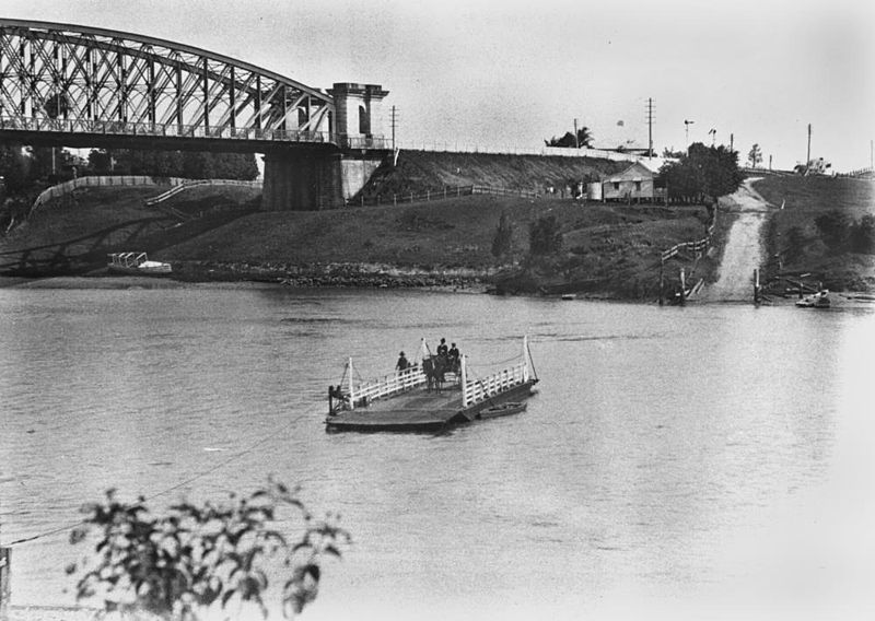
Just downstream from the gully outflow was an old boat ramp, in our time used by a water-ski club, but possibly built for the ferry that crossed the river here before 1936, when the Indooroopilly Toll Bridge with its distinctive white towers was opened. Now there’s major construction underway round this curve of the river: an impressive new river walk way and bike path.
Indooroopilly ferry crossing the Brisbane River, 1906 State Library of Queensland
My brothers knew every inch of the gully, and of the surrounding streets and parks. They knew the overhang where some older kid had left cigarettes and matches and a Playboy magazine; where to find stinking roger weed to make arrows for their home-made bows; where to stand to throw rocks on the roof of the water ski clubhouse; how to pull loose boards from the base of the bridge cables and climb in among them, those huge steel cables left over from the building of the Sydney Harbour Bridge. They could light a double bunger in one of those useful coffee tins, jam the lid on and throw it so it would explode just before it hit the river. That takes careful timing.
In a hilly place like Brisbane, there are gullies everywhere, and most kids have access to a bushland reserve, rainforest gully or rocky creek bed not too far from where they live.
Rope swing on an old camphor laurel, Greenslopes
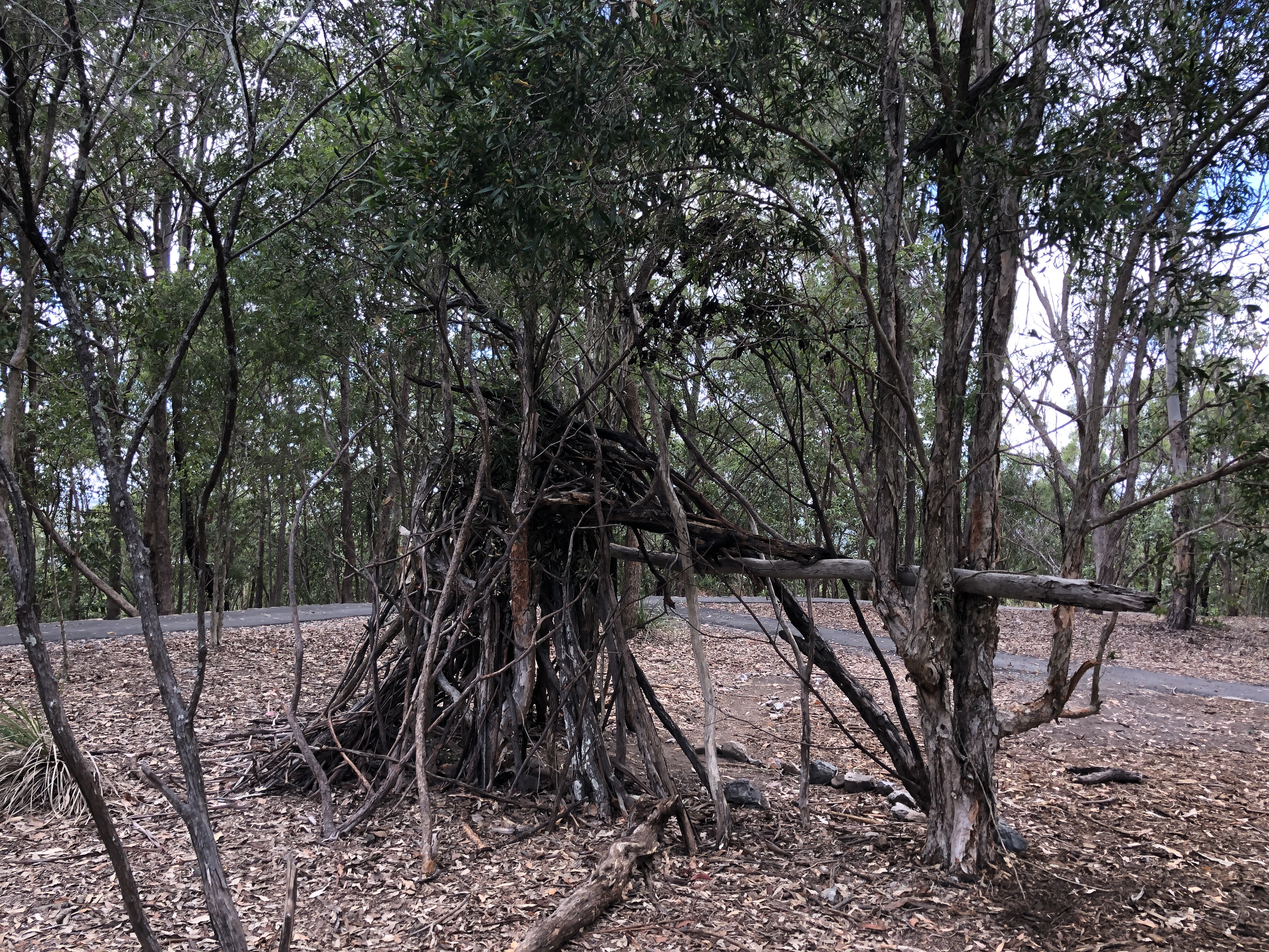
In nearly every wild spot there are signs of children having fun: cubby houses, rope swings, hand-made mountain bike jumps, rocks piled up to dam the creeks, boards and branches laid across them to make bridges.
Cubby, Whites Hill Reserve
Some gullies are dry, many are built over, and others have small, permanent creeks in them, fed by rain and by storm water drains carrying run-off from people’s roofs and gardens. Many gullies and areas of bushland are cared for by enthusiastic volunteer bush care groups, supported by the City Council.
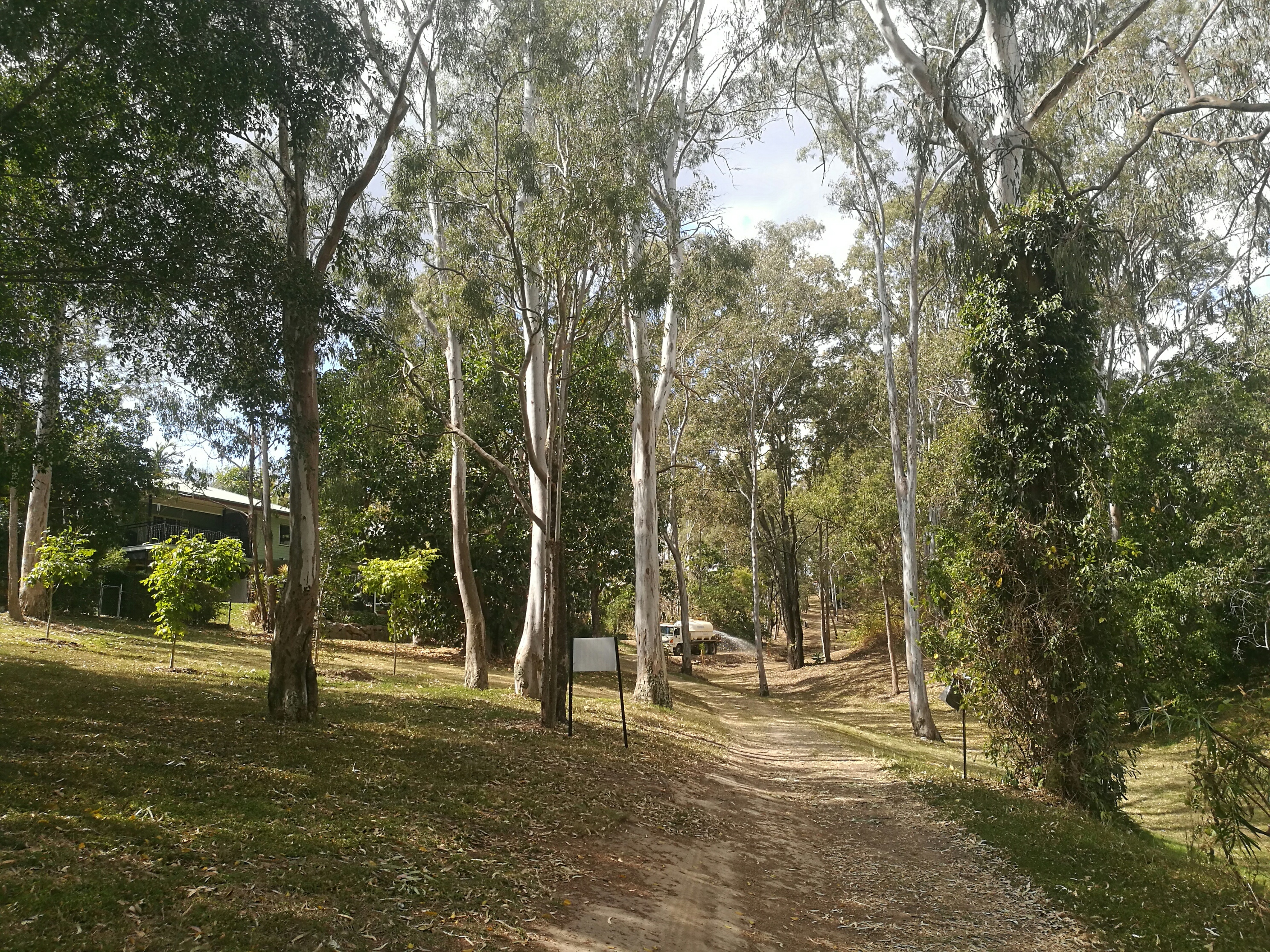
A Brisbane City Council water tanker watering bushcare plantings in a Coorparoo Finger Gully
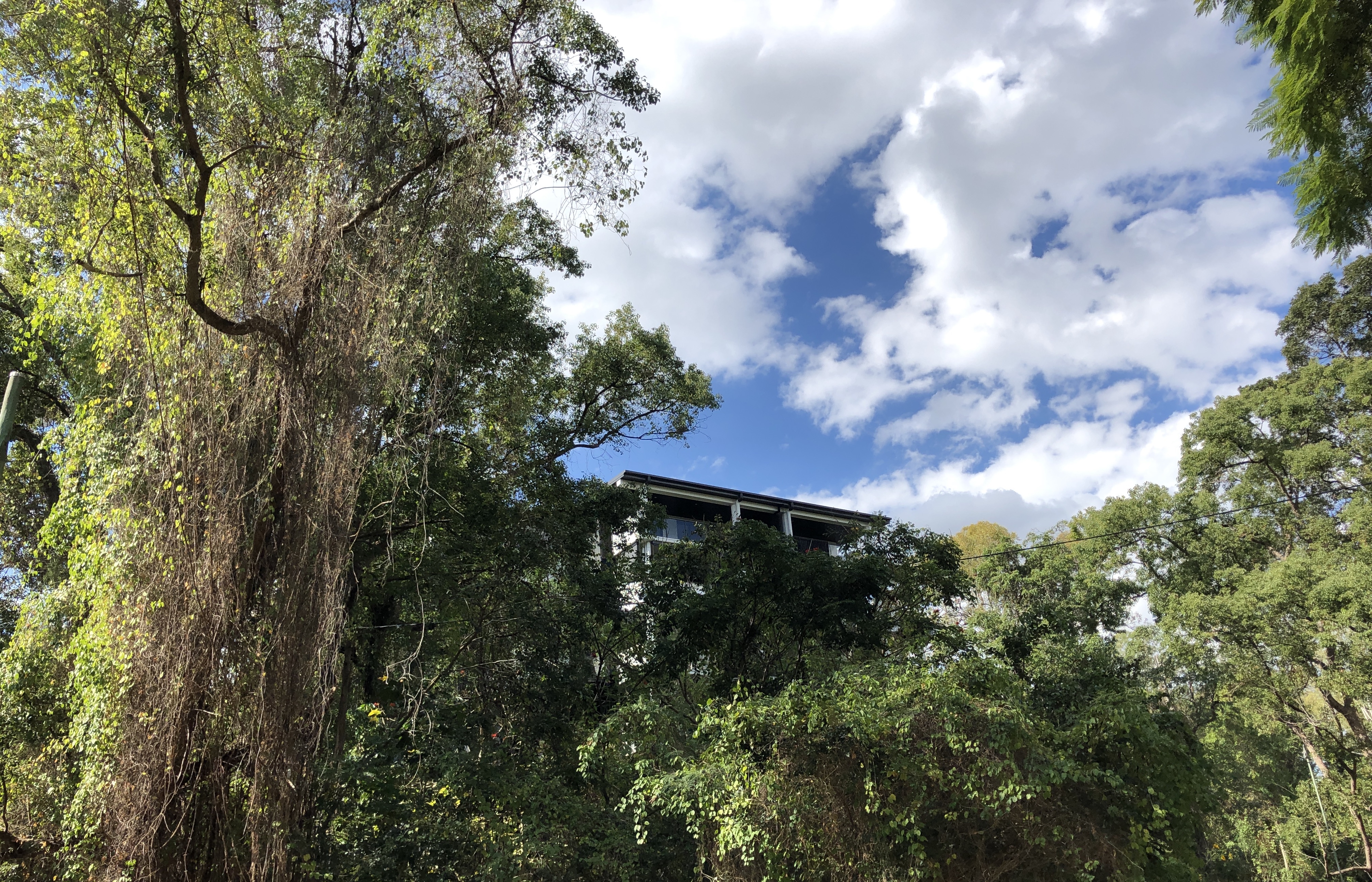
That hasn’t happened in the old gully that gave Indooroopilly its name. This hilly suburb is a wonderful mix of old timber houses both fine and humble, restored to splendour or resting quietly under their gnarled frangipanis and poinsettias; but it is also being subjected to the rampant building of apartment blocks – even, it seems, around the beautiful old Priory. Priory Street itself is full of them, and where our little house once stood there are two modern houses now. Perhaps the apartment dwellers are busy professional people, or the elderly, or students – not people interested in restoring bushland. The cat’s claw creeper that infested the gully when we were kids is taking over on every side now.
New apartments in Priory Street overlooking the old gully
I live on the side of a Brisbane gully that is now a street, a rat-run between two busy roads, and the sound of the television is sometimes drowned out by the roar of a speeding car or motorbike. Every so often, though, after heavy rain, the creek that once ran here re-asserts itself, flowing down from the hillsides and up from the stormwater drains, draining other, smaller gullies to flood the road. My street still wants to be a Brisbane bushland gully of ferns and fig-trees, eucalypts and wattles; but on this dry side of town, I doubt if it was ever a gully of leeches.
Looking downstream towards the Indooroopilly bridges and the construction of a new river walk way